Cwm yr Wnin

Valley in Merionethshire

Wales

Cwm yr Wnin

A470 near Coed y Brenin
A470 near Coed y Brenin Credit: Steven Brown

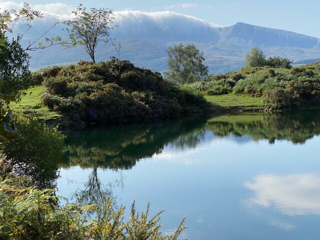
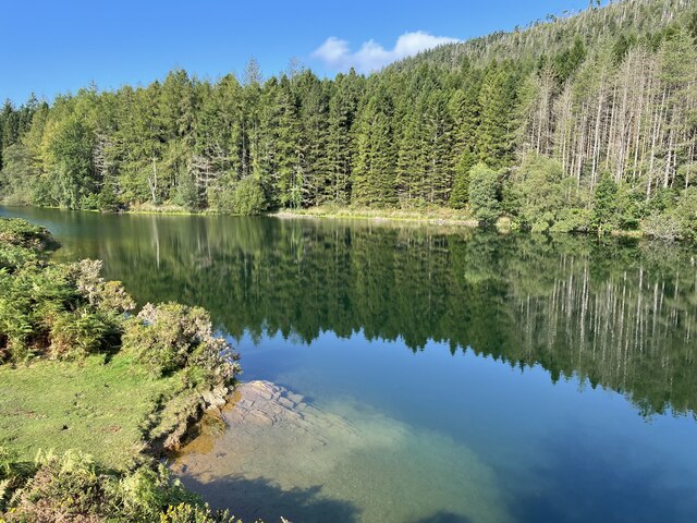
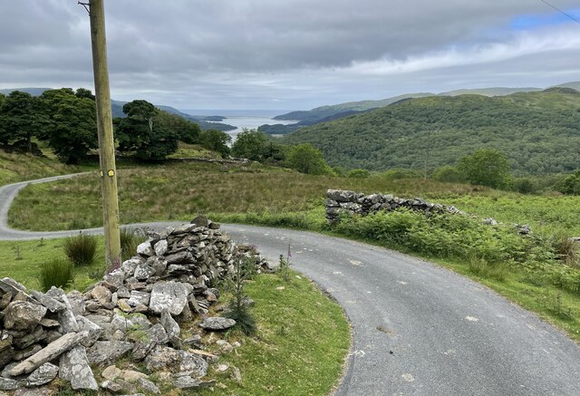
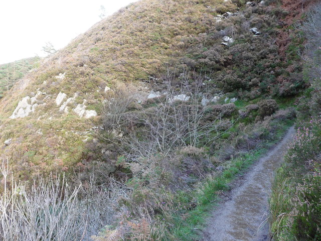
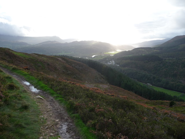
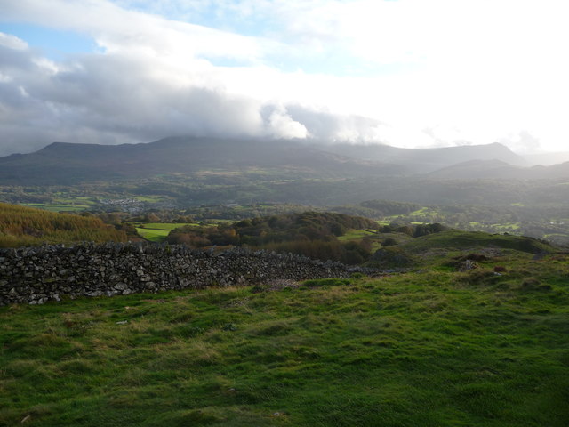
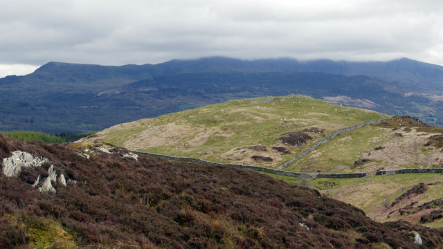
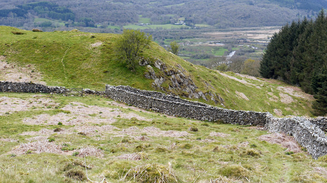
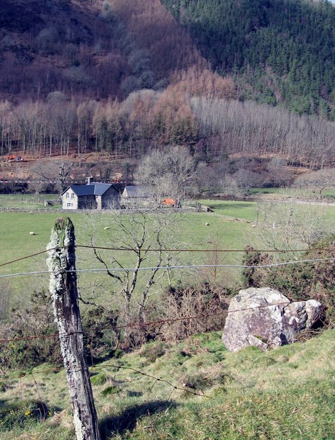
Cwm yr Wnin is a picturesque valley located in the historic county of Merionethshire in Wales. Situated in the southern part of Snowdonia National Park, the valley is surrounded by stunning natural landscapes and offers breathtaking views of the surrounding mountains and lush greenery.

The name "Cwm yr Wnin" translates to "Valley of the Gwyn" in English, referring to the nearby River Gwyn that runs through the valley. The river, along with several smaller streams, adds to the beauty of the area and provides a serene atmosphere.

The valley is known for its rich history and is dotted with remnants of ancient settlements, including stone circles and burial sites. These archaeological sites offer a glimpse into the lives of the people who inhabited the valley centuries ago.

Cwm yr Wnin is a haven for outdoor enthusiasts, offering a range of activities such as hiking, mountain biking, and wildlife watching. The valley boasts numerous walking trails, allowing visitors to explore the area's natural wonders at their leisure. The diverse flora and fauna of the valley make it an excellent destination for nature lovers, with a variety of bird species and wildlife to spot.

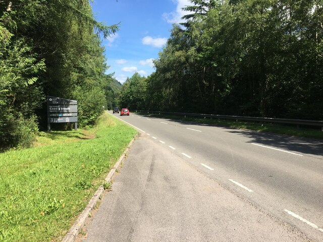
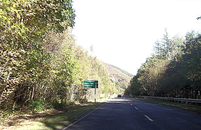
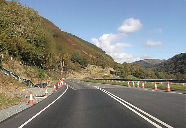
The valley is also home to a small, close-knit community that takes pride in preserving the area's natural beauty and heritage. Despite its remote location, Cwm yr Wnin is easily accessible by road, making it a popular destination for tourists seeking tranquility and a retreat from the hustle and bustle of city life.

If you have any feedback on the listing, please let us know in the comments section below.
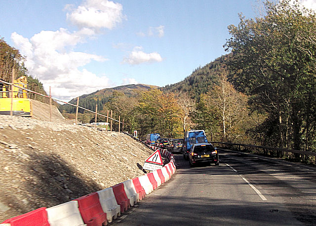
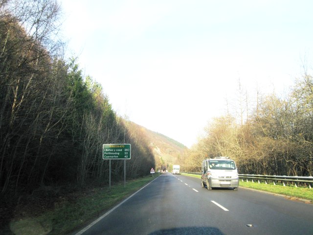
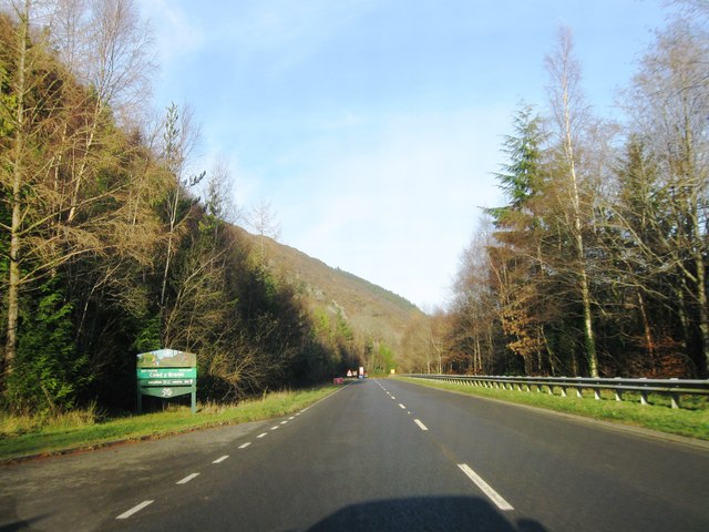
Cwm yr Wnin Images

Images are sourced within 2km of 52.770165/-3.9058829 or Grid Reference SH7120. Thanks to Geograph Open Source API. All images are credited.

A470 near Coed y Brenin
Llyn Tan-y-Graig A spectacular September morning shows the lake off at its very best.
Llyn Tan-y-Graig
A spectacular September morning shows the lake off at its very best.
Cadair Idris a Llyn Tan-y-Graig The morning mist and cloud is fast burning off the summits of Cadair Idris, as the sun takes hold on a beautifully warm early September morning.
Cadair Idris a Llyn Tan-y-Graig
The morning mist and cloud is fast burning off the summits of Cadair Idris, as the sun takes hold on a beautifully warm early September morning.
Dying larches, Llyn Tan-y-Graig Unfortunately, many of the larch trees in these forests are dying or already dead, thanks to the rapid spread of the Phytophthora ramorum fungus. There will be major felling over the winter, and this view will soon be gone.
Dying larches, Llyn Tan-y-Graig
Unfortunately, many of the larch trees in these forests are dying or already dead, thanks to the rapid spread of the Phytophthora ramorum fungus. There will be major felling over the winter, and this view will soon be gone.
Track at Foel-Ispri-uchaf The track leads away from the New Precipice Walk and at this point affords views down towards Barmouth Bay.
Track at Foel-Ispri-uchaf
The track leads away from the New Precipice Walk and at this point affords views down towards Barmouth Bay.
The south-west slopes of Foel Faner Looking to the Afon Mawddach estuary.
The south-west slopes of Foel Faner
Looking to the Afon Mawddach estuary.
Part of the Precipice Walk The walk has good views down into the valley below and is fast and fun to walk.
Part of the Precipice Walk
The walk has good views down into the valley below and is fast and fun to walk.
Little re-entrant on the Precipice Walk An amusing little feature on the walk.
Little re-entrant on the Precipice Walk
An amusing little feature on the walk.
Part of the Precipice Walk above Dolgellau The walk offers great views westards in late afternoon or evening, depending on the season, and the weather.
Part of the Precipice Walk above Dolgellau
The walk offers great views westards in late afternoon or evening, depending on the season, and the weather.
Cadair Idris from the Precipice Walk Majestic, beautiful, inspiring - this view has it all. Though it's not quite as good as the view from that ridgeline...
Cadair Idris from the Precipice Walk
Majestic, beautiful, inspiring - this view has it all. Though it's not quite as good as the view from that ridgeline...
Foel Faner Foel Faner is a lesser top of the hill, Foel Cynwch and is seen from the ridge south of the summit of that hill. The cloud-shadowed and misted mountain range in the distance is Cadair Idris.
Foel Faner
Foel Faner is a lesser top of the hill, Foel Cynwch and is seen from the ridge south of the summit of that hill. The cloud-shadowed and misted mountain range in the distance is Cadair Idris.
Walls beside Coed Dol-fawr The declining south-west ridge of Foel Cynwch has a tapering finger of moorland that eventually gives way to farmland and woods. The walls seen here are adjacent to one of those woods.
Walls beside Coed Dol-fawr
The declining south-west ridge of Foel Cynwch has a tapering finger of moorland that eventually gives way to farmland and woods. The walls seen here are adjacent to one of those woods.
Dol-y-clochydd
Dol-y-clochydd
A470 north from Llanelltyd
A470 near Maes Mawr
A470 near Maes Mawr
A470 road works near Pont Careg -arw
A470 northbound
A470 northbound
A470 northbound
A470 northbound
Show me another place!

Cwm yr Wnin is located at Grid Ref: SH7120 (Lat: 52.770165, Lng: -3.9058829)

Unitary Authority: Gwynedd

Police Authority: North Wales

What 3 Words

///pumps.thickened.sample. Near Dolgellau, Gwynedd

Related Wikis

Llanelltyd

Llanelltyd (Welsh: Llanelltyd) is a small village and community in Gwynedd, to the northwest of Dolgellau. The community population taken at the 2011 Census...

Cymer Abbey

Cymer Abbey (Welsh: Abaty Cymer) is a ruined Cistercian abbey near the village of Llanelltyd, just north of Dolgellau, Gwynedd, in north-west Wales, United...

River Wnion

The River Wnion is a river in the southeast of Gwynedd, Wales. It begins high on the slopes of Aran Benllyn about five miles south of Lanuwchllyn and...

Hengwrt

Hengwrt (English: Old Court) was a mansion near Dolgellau in Meirionnydd, Gwynedd. It lay in the parish of Llanelltyd near the confluence of the River...

Nearby Amenities

Located within 500m of 52.770165,-3.9058829
Barrier: cattle_grid
Source: OS_OpenData_StreetView
Lat/Long: 52.7728855/-3.9060266
Man Made: adit
Lat/Long: 52.7741725/-3.9076605
Power: pole
Lat/Long: 52.7664161/-3.9028706
Power: pole
Lat/Long: 52.7668188/-3.9038653
Power: pole
Lat/Long: 52.7672129/-3.90433
Power: pole
Lat/Long: 52.7737138/-3.909552
Power: pole
Lat/Long: 52.7733876/-3.9089994
Power: pole
Lat/Long: 52.7727487/-3.9087667
Power: pole
Lat/Long: 52.7721464/-3.9086526
Power: pole
Lat/Long: 52.7714331/-3.9082567
Power: pole
Lat/Long: 52.770575/-3.9079233
Power: pole
Lat/Long: 52.7700065/-3.9076996
Power: pole
Lat/Long: 52.7693676/-3.9074669
Power: pole
Lat/Long: 52.7689899/-3.9067308
Power: pole
Lat/Long: 52.7686353/-3.9060776
Power: pole
Lat/Long: 52.768282/-3.9054757
Power: pole
Lat/Long: 52.7677753/-3.9049495
Crossing
Lat/Long: 52.76832/-3.9052325
The data included in this document is from www.openstreetmap.org. The data is made available under ODbL.

Have you been to Cwm yr Wnin?

Leave your review of Cwm yr Wnin below (or comments, questions and feedback).