Allt y Fedw

Wood, Forest in Carmarthenshire

Wales

Allt y Fedw

Llwybr Cwm Llynfe Uchaf / Cwm Llynfe Uchaf path Heol ffarm a llwybr cyhoeddus yn mynd i gyfeiriad anhedd-dy o'r enw Cwm Llynfe Uchaf.

Access road and public footpath heading in the direction of a property known as Cwm Llynfe Uchaf. (trans. Llynfe stream valley upper farm).
Llwybr Cwm Llynfe Uchaf / Cwm Llynfe Uchaf path Credit: Alan Richards

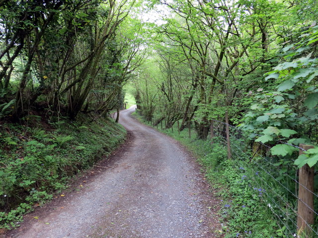
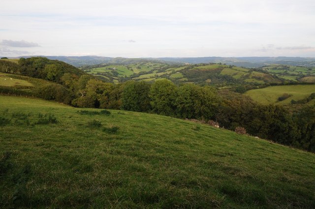
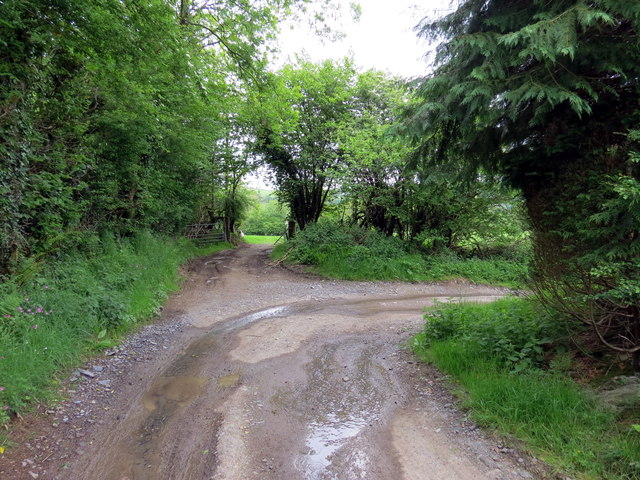
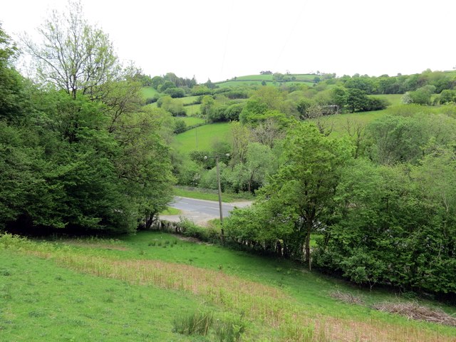
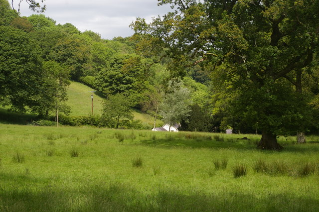
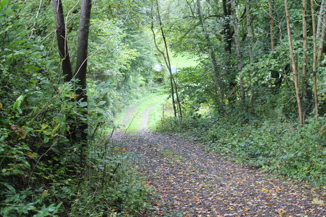
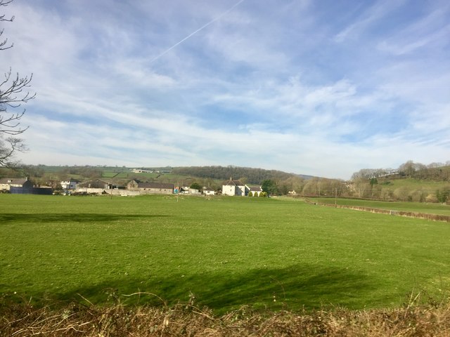
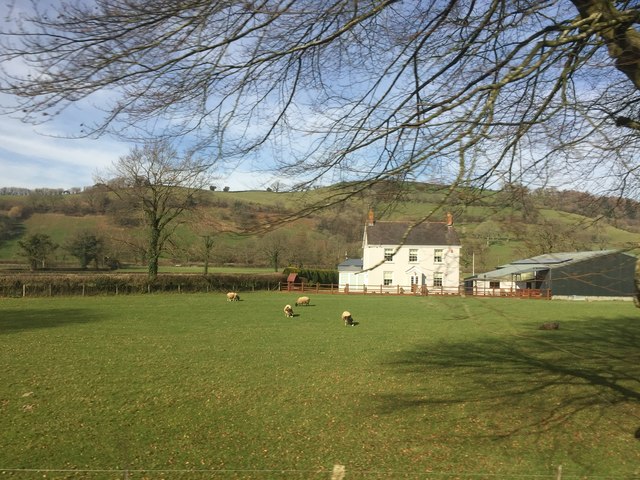
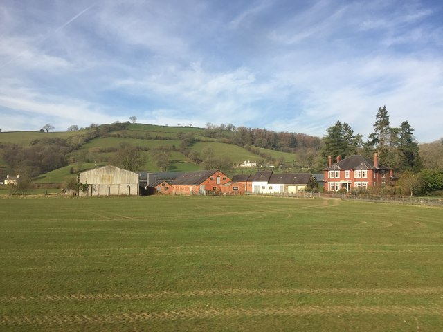
Allt y Fedw, located in Carmarthenshire, Wales, is a picturesque wood or forest that offers a serene and natural escape for visitors. Situated on the western side of the Brecon Beacons National Park, it spans over an area of approximately 100 hectares.

The wood is characterized by a diverse range of trees and vegetation, including oak, beech, birch, and coniferous species. This variety creates a rich and vibrant ecosystem, supporting a wide array of wildlife. Visitors to Allt y Fedw can expect to encounter various bird species, such as woodpeckers and owls, as well as mammals like badgers and foxes.

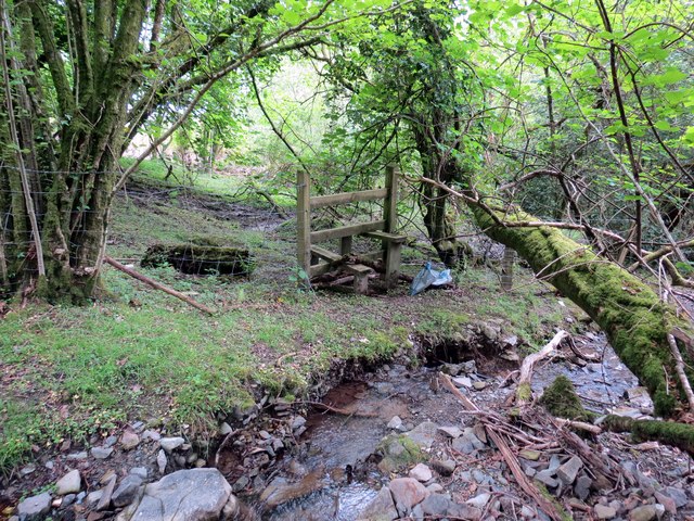
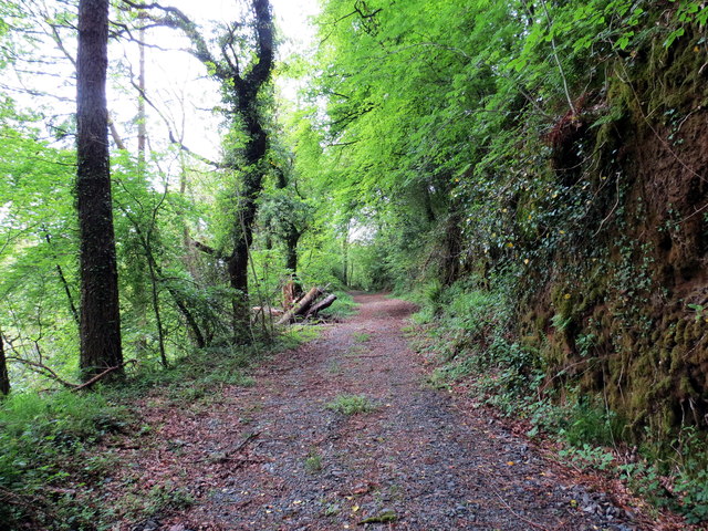
Tranquil walking trails wind through the wood, providing visitors with the opportunity to explore the natural beauty of the area. The paths are well-maintained and suitable for all ages and fitness levels. Along the way, there are benches strategically placed, allowing visitors to rest and take in the scenic surroundings.

Allt y Fedw is also home to a small stream that meanders through the woodland, adding to the charm and tranquility of the setting. The sound of running water further enhances the peaceful atmosphere of the wood.

The wood is open to the public throughout the year, and there is no entrance fee. However, visitors are encouraged to respect the natural environment and adhere to any signage or guidelines provided. Allt y Fedw is a true haven for nature lovers, offering a peaceful retreat from the hustle and bustle of everyday life.

If you have any feedback on the listing, please let us know in the comments section below.

Allt y Fedw Images

Images are sourced within 2km of 51.981701/-3.8779461 or Grid Reference SN7133. Thanks to Geograph Open Source API. All images are credited.
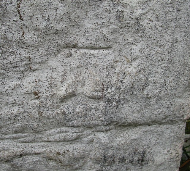
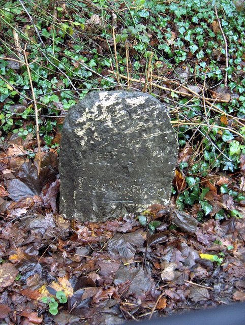
Llwybr Cwm Llynfe Uchaf / Cwm Llynfe Uchaf path Heol ffarm a llwybr cyhoeddus yn mynd i gyfeiriad anhedd-dy o'r enw Cwm Llynfe Uchaf.

Access road and public footpath heading in the direction of a property known as Cwm Llynfe Uchaf. (trans. Llynfe stream valley upper farm).
Llwybr Cwm Llynfe Uchaf / Cwm Llynfe Uchaf path
Heol ffarm a llwybr cyhoeddus yn mynd i gyfeiriad anhedd-dy o'r enw Cwm Llynfe Uchaf. Access road and public footpath heading in the direction of a property known as Cwm Llynfe Uchaf. (trans. Llynfe stream valley upper farm).
Sticil Cwm Llynfe Isaf Stile Sticil ar lan nant fach (Llynfe?) ger Ffarm Cwm Llynfe Isaf.

A stile on the banks of a stream ( Llynfe?) near Cwm Llynfe Isaf Farm (trans. lower Llynfe valley farm)
Sticil Cwm Llynfe Isaf Stile
Sticil ar lan nant fach (Llynfe?) ger Ffarm Cwm Llynfe Isaf. A stile on the banks of a stream ( Llynfe?) near Cwm Llynfe Isaf Farm (trans. lower Llynfe valley farm)
Ordnance Survey Cut Mark This OS cut mark can be found on the milk stand at Bryn-Dyfan Farm. It marks a point 162.035m above mean sea level.
Ordnance Survey Cut Mark
This OS cut mark can be found on the milk stand at Bryn-Dyfan Farm. It marks a point 162.035m above mean sea level.
Rolling Carmarthenshire countryside Rolling Carmarthenshire countryside to the south of Porthrhyd.
Rolling Carmarthenshire countryside
Rolling Carmarthenshire countryside to the south of Porthrhyd.
Llwybr Cwm Llynfe Isaf Path Mae llwybr cyhoeddus yn mynd  syth ymlaen wrth i drac y ffarm droi yn siarp i'r dde.

The public footpath goes straight on where the farm access road turns sharply right.
Llwybr Cwm Llynfe Isaf Path
Mae llwybr cyhoeddus yn mynd syth ymlaen wrth i drac y ffarm droi yn siarp i'r dde. The public footpath goes straight on where the farm access road turns sharply right.
Llwybr Cwm Llynfe Isaf Path Llwybr cyhoeddus yn agosau at yr A482 ym Mhont Cwm Llynfe

A public footpath approaching the A482 at Pont Cwm Llynfe (trans. Llynfe valley bridge).
Llwybr Cwm Llynfe Isaf Path
Llwybr cyhoeddus yn agosau at yr A482 ym Mhont Cwm Llynfe A public footpath approaching the A482 at Pont Cwm Llynfe (trans. Llynfe valley bridge).
Llwybr Gilfach Path Llwybr cyhoeddus yn agosau at yr A482 ym Mhont Gilfach.

A public footpath approaching the A482 at Pont Gilfach (trans. nook [farm] bridge).
Llwybr Gilfach Path
Llwybr cyhoeddus yn agosau at yr A482 ym Mhont Gilfach. A public footpath approaching the A482 at Pont Gilfach (trans. nook [farm] bridge).
Llwybr Gilfach / Gilfach path Llwybr cyhoeddus yn mynd i gyfeiriad Ffarm y Gilfach. 

A public footpath heading in the direction of Gilfach Farm (trans. nook).
Llwybr Gilfach / Gilfach path
Llwybr cyhoeddus yn mynd i gyfeiriad Ffarm y Gilfach. A public footpath heading in the direction of Gilfach Farm (trans. nook).
Milestone - Llandovery 6 There is an Ordnance Survey cut mark on the front of the milestone. It marks a point 338.1ft above mean sea level.
Milestone - Llandovery 6
There is an Ordnance Survey cut mark on the front of the milestone. It marks a point 338.1ft above mean sea level.
Ordnance Survey Cut Mark This OS cut mark can be found on the front of The Feathers Inn. It marks a point 101.160m above mean sea level.
Ordnance Survey Cut Mark
This OS cut mark can be found on the front of The Feathers Inn. It marks a point 101.160m above mean sea level.
View over the fields towards Alltycloriau
Track from A482, Llanwrda Track from lay-by down to field and river.
Track from A482, Llanwrda
Track from lay-by down to field and river.
Northern approach to Llanwrda The A482 heads south into Llanwrda past various signs for vehicles to slow.
Northern approach to Llanwrda
The A482 heads south into Llanwrda past various signs for vehicles to slow.
Old Milestone By the A482, in parish of Llanwrda (Carmarthenshire District), South of Pont Cwm-marchon, East side of road.

Inscription reads:- : 6 / Miles to / Llandovery :
Carved bench mark lower face.

Surveyed

Milestone Society National ID: CAM_LDLP06
Old Milestone
By the A482, in parish of Llanwrda (Carmarthenshire District), South of Pont Cwm-marchon, East side of road. Inscription reads:- : 6 / Miles to / Llandovery : Carved bench mark lower face. Surveyed Milestone Society National ID: CAM_LDLP06
Pentremeurig farm Farmland on the outskirts of Llanwrda.
Pentremeurig farm
Farmland on the outskirts of Llanwrda.
Island Cottage Island Cottage in the Tywi valley.
Island Cottage
Island Cottage in the Tywi valley.
Tir Allen Farm buildings in the Tywi valley.
Tir Allen
Farm buildings in the Tywi valley.
Borezell - Former Royal Oak Inn, Llanwrda Built around 1900 for the Bishop family of Dolgarreg, Myddfai the former Royal Oak Inn served the community in Llanwrda until shortly after the Second World War when it closed and became a private house - Borezell. Unusually for rural Wales in this locale it was built to an Arts and Crafts style which has earned it a Grade II listing by Cadw in 1999.
Borezell - Former Royal Oak Inn, Llanwrda
Built around 1900 for the Bishop family of Dolgarreg, Myddfai the former Royal Oak Inn served the community in Llanwrda until shortly after the Second World War when it closed and became a private house - Borezell. Unusually for rural Wales in this locale it was built to an Arts and Crafts style which has earned it a Grade II listing by Cadw in 1999.
Show me another place!

Allt y Fedw is located at Grid Ref: SN7133 (Lat: 51.981701, Lng: -3.8779461)

Unitary Authority: Carmarthenshire

Police Authority: Dyfed Powys

What 3 Words

///speech.mice.squaring. Near Llansadwrn, Carmarthenshire

Nearby Locations

Allt Fawr Allt y Fedw

Related Wikis

Llanwrda

Llanwrda ([ɬanʊrˈda] ) is a village and community in Carmarthenshire, Wales, 4 miles (6.4 km) southwest of Llandovery. It lies on the River Towy. The population...

Llanwrda railway station

Llanwrda railway station serves the village of Llanwrda near Llandovery, Carmarthenshire. Opened by the Vale of Towy Railway in 1858, the station is on...

Llansadwrn

Llansadwrn (; Welsh: [ɬanˈsadʊn]; ) is a small village and community in Carmarthenshire, Wales. It is located in the countryside above the valley of the...

Afon Brân

The Afon Brân is a tributary of the River Towy (or Welsh Afon Tywi) in mid Wales. Its headwaters rise in Irfon Forest in the northeastern corner of Carmarthenshire...

Llangadog railway station

Llangadog railway station serves the village of Llangadog near Llandeilo, Carmarthenshire. The station is on the Heart of Wales Line 36+1⁄2 miles (59 km...

Llangadog

Llangadog () is a village and community in Carmarthenshire, Wales, which also includes the villages of Bethlehem and Capel Gwynfe. A notable local landscape...

Llandovery railway station

Llandovery railway station serves the market town of Llandovery, Carmarthenshire, Wales. The station is on the Heart of Wales Line 42 miles (68 km) north...

Llandingat House

Llandingat House is a late Georgian detached town house in the town of Llandovery, Carmarthenshire, Wales. The house was built in the early nineteenth...

Nearby Amenities

Located within 500m of 51.981701,-3.8779461
Direction: ESE
Generator Method: photovoltaic
Generator Output Electricity: yes
Generator Solar Modules: 8
Generator Source: solar
Generator Type: solar_photovoltaic_panel
Location: roof
Power: generator
Lat/Long: 51.9781432/-3.8806106
Direction: ESE
Generator Method: photovoltaic
Generator Output Electricity: yes
Generator Solar Modules: 8
Generator Source: solar
Generator Type: solar_photovoltaic_panel
Location: roof
Power: generator
Lat/Long: 51.9781564/-3.8806495
The data included in this document is from www.openstreetmap.org. The data is made available under ODbL.

Have you been to Allt y Fedw?

Leave your review of Allt y Fedw below (or comments, questions and feedback).