Allt Fawr

Wood, Forest in Carmarthenshire

Wales

Allt Fawr

Sticil Cwm Llynfe Isaf Stile Sticil ar lan nant fach (Llynfe?) ger Ffarm Cwm Llynfe Isaf.

A stile on the banks of a stream ( Llynfe?) near Cwm Llynfe Isaf Farm (trans. lower Llynfe valley farm)
Sticil Cwm Llynfe Isaf Stile Credit: Alan Richards

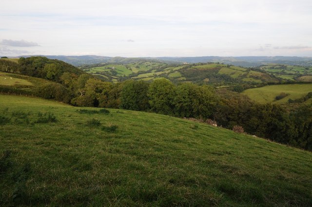
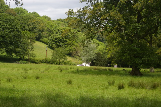
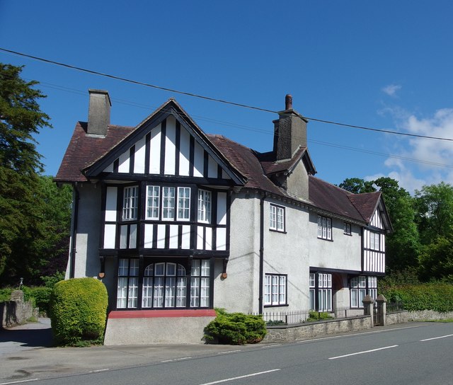
Allt Fawr is a picturesque woodland located in the county of Carmarthenshire, Wales. Spanning over a vast area, it is a haven for nature enthusiasts and offers a tranquil escape from the hustle and bustle of everyday life.

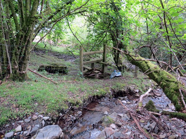
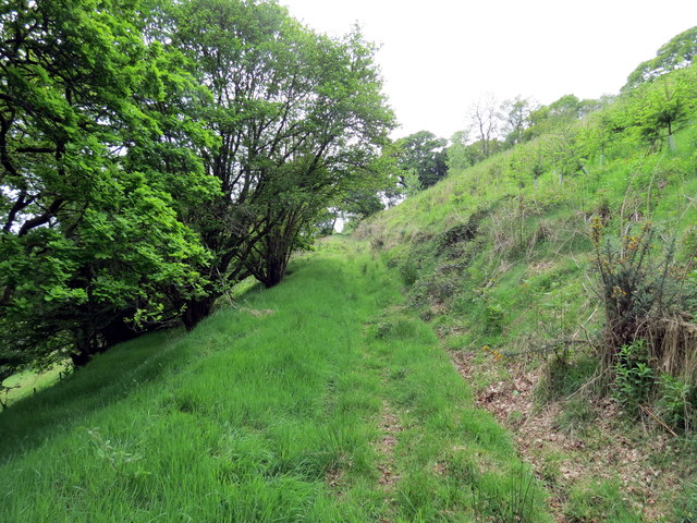
The woodland is characterized by its diverse range of tree species, including oak, ash, beech, and birch. These towering trees create a dense canopy, allowing only dappled sunlight to filter through, creating a magical atmosphere. The forest floor is adorned with a rich carpet of ferns, wildflowers, and moss, adding to the enchanting beauty of the surroundings.

The Allt Fawr woodland is home to a variety of wildlife, including deer, badgers, foxes, and numerous bird species. Birdwatchers can spot woodpeckers, owls, and thrushes amongst the leafy branches. The area is also known for its population of red kites, which can often be seen soaring gracefully overhead.

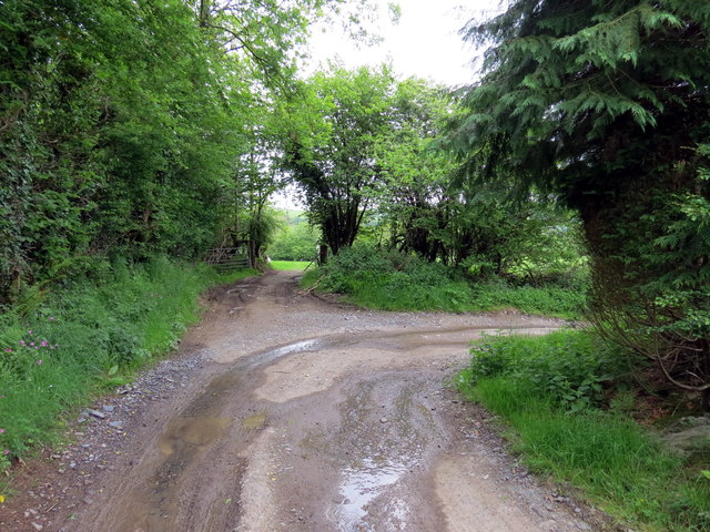
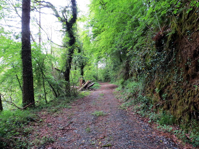
Visitors to Allt Fawr can enjoy a range of activities such as walking, hiking, and picnicking. There are well-maintained trails that meander through the woodland, offering breathtaking views of the surrounding countryside. The peacefulness of the location makes it the perfect spot for a leisurely stroll or a family outing.

Allt Fawr is easily accessible, with ample parking available nearby. It is a popular destination for nature lovers, photographers, and those seeking a moment of serenity amidst the beauty of nature. Whether it's exploring the ancient woodland or simply appreciating the tranquility, Allt Fawr is a must-visit destination in Carmarthenshire.

If you have any feedback on the listing, please let us know in the comments section below.

Allt Fawr Images

Images are sourced within 2km of 51.984853/-3.8764761 or Grid Reference SN7133. Thanks to Geograph Open Source API. All images are credited.
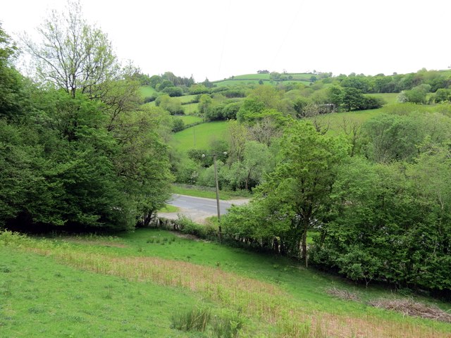
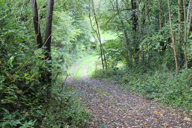
Sticil Cwm Llynfe Isaf Stile Sticil ar lan nant fach (Llynfe?) ger Ffarm Cwm Llynfe Isaf.

A stile on the banks of a stream ( Llynfe?) near Cwm Llynfe Isaf Farm (trans. lower Llynfe valley farm)
Sticil Cwm Llynfe Isaf Stile
Sticil ar lan nant fach (Llynfe?) ger Ffarm Cwm Llynfe Isaf. A stile on the banks of a stream ( Llynfe?) near Cwm Llynfe Isaf Farm (trans. lower Llynfe valley farm)
Llwybr Tir y Graig / Tir y Graig path Llwybr cyhoeddus yn dringo'r bryn uwchben anhedd-dy o'r enw Tir y Graig. 

A public footpath ascending the hill above a property known as Tir y Graig (trans. land of the hill).
Llwybr Tir y Graig / Tir y Graig path
Llwybr cyhoeddus yn dringo'r bryn uwchben anhedd-dy o'r enw Tir y Graig. A public footpath ascending the hill above a property known as Tir y Graig (trans. land of the hill).
Rolling Carmarthenshire countryside Rolling Carmarthenshire countryside to the south of Porthrhyd.
Rolling Carmarthenshire countryside
Rolling Carmarthenshire countryside to the south of Porthrhyd.
Llwybr Cwm Llynfe Isaf Path Mae llwybr cyhoeddus yn mynd  syth ymlaen wrth i drac y ffarm droi yn siarp i'r dde.

The public footpath goes straight on where the farm access road turns sharply right.
Llwybr Cwm Llynfe Isaf Path
Mae llwybr cyhoeddus yn mynd syth ymlaen wrth i drac y ffarm droi yn siarp i'r dde. The public footpath goes straight on where the farm access road turns sharply right.
Llwybr Cwm Llynfe Isaf Path Llwybr cyhoeddus yn agosau at yr A482 ym Mhont Cwm Llynfe

A public footpath approaching the A482 at Pont Cwm Llynfe (trans. Llynfe valley bridge).
Llwybr Cwm Llynfe Isaf Path
Llwybr cyhoeddus yn agosau at yr A482 ym Mhont Cwm Llynfe A public footpath approaching the A482 at Pont Cwm Llynfe (trans. Llynfe valley bridge).
Llwybr Gilfach Path Llwybr cyhoeddus yn agosau at yr A482 ym Mhont Gilfach.

A public footpath approaching the A482 at Pont Gilfach (trans. nook [farm] bridge).
Llwybr Gilfach Path
Llwybr cyhoeddus yn agosau at yr A482 ym Mhont Gilfach. A public footpath approaching the A482 at Pont Gilfach (trans. nook [farm] bridge).
Llwybr Gilfach / Gilfach path Llwybr cyhoeddus yn mynd i gyfeiriad Ffarm y Gilfach. 

A public footpath heading in the direction of Gilfach Farm (trans. nook).
Llwybr Gilfach / Gilfach path
Llwybr cyhoeddus yn mynd i gyfeiriad Ffarm y Gilfach. A public footpath heading in the direction of Gilfach Farm (trans. nook).
Milestone - Llandovery 6 There is an Ordnance Survey cut mark on the front of the milestone. It marks a point 338.1ft above mean sea level.
Milestone - Llandovery 6
There is an Ordnance Survey cut mark on the front of the milestone. It marks a point 338.1ft above mean sea level.
Ordnance Survey Cut Mark This OS cut mark can be found on the front of The Feathers Inn. It marks a point 101.160m above mean sea level.
Ordnance Survey Cut Mark
This OS cut mark can be found on the front of The Feathers Inn. It marks a point 101.160m above mean sea level.
View over the fields towards Alltycloriau
Track from A482, Llanwrda Track from lay-by down to field and river.
Track from A482, Llanwrda
Track from lay-by down to field and river.
Northern approach to Llanwrda The A482 heads south into Llanwrda past various signs for vehicles to slow.
Northern approach to Llanwrda
The A482 heads south into Llanwrda past various signs for vehicles to slow.
Old Milestone By the A482, in parish of Llanwrda (Carmarthenshire District), South of Pont Cwm-marchon, East side of road.

Inscription reads:- : 6 / Miles to / Llandovery :
Carved bench mark lower face.

Surveyed

Milestone Society National ID: CAM_LDLP06
Old Milestone
By the A482, in parish of Llanwrda (Carmarthenshire District), South of Pont Cwm-marchon, East side of road. Inscription reads:- : 6 / Miles to / Llandovery : Carved bench mark lower face. Surveyed Milestone Society National ID: CAM_LDLP06
Borezell - Former Royal Oak Inn, Llanwrda Built around 1900 for the Bishop family of Dolgarreg, Myddfai the former Royal Oak Inn served the community in Llanwrda until shortly after the Second World War when it closed and became a private house - Borezell. Unusually for rural Wales in this locale it was built to an Arts and Crafts style which has earned it a Grade II listing by Cadw in 1999.
Borezell - Former Royal Oak Inn, Llanwrda
Built around 1900 for the Bishop family of Dolgarreg, Myddfai the former Royal Oak Inn served the community in Llanwrda until shortly after the Second World War when it closed and became a private house - Borezell. Unusually for rural Wales in this locale it was built to an Arts and Crafts style which has earned it a Grade II listing by Cadw in 1999.
Llanwrda War Memorial Standing on the eastern side of the A482 is a humble memorial to the villagers of Llanwrda and surrounding area who lost their lives in the First and Second World Wars. Erected in 1923 it depicts a white marble soldier with rifle reversed on a pedestal of Aberdeen granite. One of a group of similar white marble statues including those at Llangeitho, Llanddewi Brefi, Drefach and Aberbanc in Ceredigion and Dale in Pembrokeshire.
The names from 1914-19 are on W face and from 1939-45 on S face and 'Adeiladwyd gan y plwyfoloion' (Built by the parishioners) on N face.
In 1999 Cadw listed the monument as Grade II.
Llanwrda War Memorial
Standing on the eastern side of the A482 is a humble memorial to the villagers of Llanwrda and surrounding area who lost their lives in the First and Second World Wars. Erected in 1923 it depicts a white marble soldier with rifle reversed on a pedestal of Aberdeen granite. One of a group of similar white marble statues including those at Llangeitho, Llanddewi Brefi, Drefach and Aberbanc in Ceredigion and Dale in Pembrokeshire. The names from 1914-19 are on W face and from 1939-45 on S face and 'Adeiladwyd gan y plwyfoloion' (Built by the parishioners) on N face. In 1999 Cadw listed the monument as Grade II.
Church of Saint Cwrdaf, Llanwrda An Anglican parish church founded in mediaeval times. The current building was restored in 1812 and subject to renovation, restoration and addition in both 1870 - 1871 and again during 1893 - 1895. The restoration in 1870 found a date of 1638 under whitewash. The interior of the church and its attendant graveyard have many memorials dating back to the early 1800's.
Saint Cwrdaf was originally the son of King Caradog. He gave up his place in court to take up holy orders under Saint Illtud.
The church was listed as grade II by Cadw in 1999.
Church of Saint Cwrdaf, Llanwrda
An Anglican parish church founded in mediaeval times. The current building was restored in 1812 and subject to renovation, restoration and addition in both 1870 - 1871 and again during 1893 - 1895. The restoration in 1870 found a date of 1638 under whitewash. The interior of the church and its attendant graveyard have many memorials dating back to the early 1800's. Saint Cwrdaf was originally the son of King Caradog. He gave up his place in court to take up holy orders under Saint Illtud. The church was listed as grade II by Cadw in 1999.
Ordnance Survey Cut Mark This OS cut mark can be found on the barn at Cwmdwr. It marks a point 73.365m above mean sea level.
Ordnance Survey Cut Mark
This OS cut mark can be found on the barn at Cwmdwr. It marks a point 73.365m above mean sea level.
Ordnance Survey Cut Mark This OS cut mark can be found on the barn at Bwlch-y-gwynt. It marks a point 211.062m above mean sea level.
Ordnance Survey Cut Mark
This OS cut mark can be found on the barn at Bwlch-y-gwynt. It marks a point 211.062m above mean sea level.
Show me another place!

Allt Fawr is located at Grid Ref: SN7133 (Lat: 51.984853, Lng: -3.8764761)

Unitary Authority: Carmarthenshire

Police Authority: Dyfed Powys

What 3 Words

///flaunting.nooks.envoy. Near Llansadwrn, Carmarthenshire

Nearby Locations

Allt Fawr Allt y Fedw

Related Wikis

Llanwrda

Llanwrda ([ɬanʊrˈda] ) is a village and community in Carmarthenshire, Wales, 4 miles (6.4 km) southwest of Llandovery. It lies on the River Towy. The population...

Llanwrda railway station

Llanwrda railway station serves the village of Llanwrda near Llandovery, Carmarthenshire. Opened by the Vale of Towy Railway in 1858, the station is on...

Afon Brân

The Afon Brân is a tributary of the River Towy (or Welsh Afon Tywi) in mid Wales. Its headwaters rise in Irfon Forest in the northeastern corner of Carmarthenshire...

Llansadwrn

Llansadwrn (; Welsh: [ɬanˈsadʊn]; ) is a small village and community in Carmarthenshire, Wales. It is located in the countryside above the valley of the...

Nearby Amenities

Located within 500m of 51.984853,-3.8764761
The data included in this document is from www.openstreetmap.org. The data is made available under ODbL.

Have you been to Allt Fawr?

Leave your review of Allt Fawr below (or comments, questions and feedback).