Coed Ysgubor-y-coed

Wood, Forest in Cardiganshire

Wales

Coed Ysgubor-y-coed

Dyfi Furnace
Dyfi Furnace Credit: John H Darch

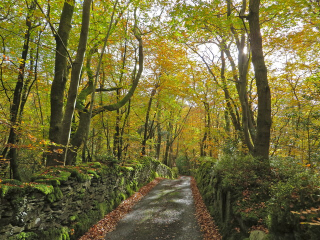
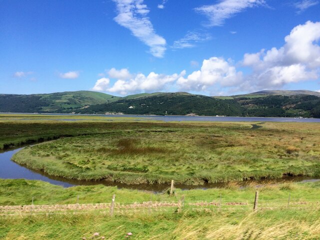
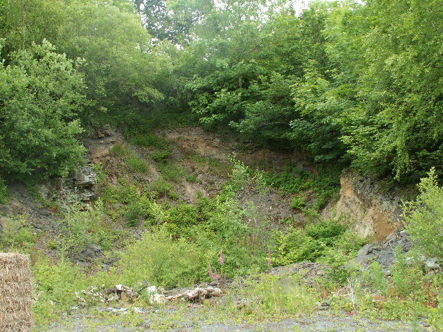
Coed Ysgubor-y-coed is a picturesque woodland located in Cardiganshire, Wales. Covering an area of approximately 100 acres, this enchanting forest is known for its rich biodiversity and serene beauty. The name "Coed Ysgubor-y-coed" translates to "Wood of the Barn of the Trees," reflecting the historical significance of the area.

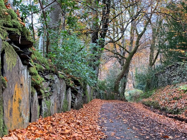
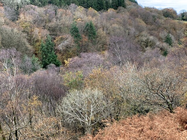
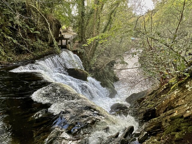
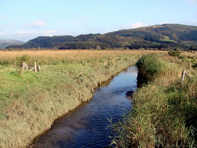
The woodland is predominantly composed of native tree species such as oak, ash, and beech, creating a diverse and lush ecosystem. The dense canopy allows minimal sunlight to reach the forest floor, resulting in a cool and tranquil atmosphere. This, combined with the gentle sound of the nearby stream, makes Coed Ysgubor-y-coed a popular spot for nature enthusiasts and hikers seeking a peaceful retreat.

The forest is home to a wide range of wildlife, including various bird species, small mammals, and insects. Rare and endangered species such as red squirrels and lesser horseshoe bats have been spotted within its boundaries, making it an important conservation site. The forest management focuses on preserving and enhancing the natural habitat to ensure the survival of these precious creatures.

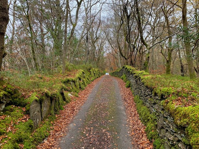
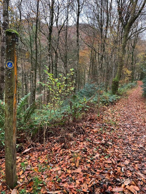
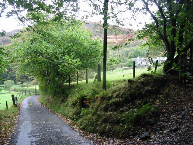
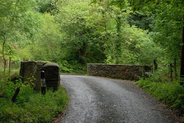
Coed Ysgubor-y-coed offers several walking trails and paths that allow visitors to explore its beauty. These trails are well-maintained and suitable for all ages and fitness levels. Interpretive signage along the trails provides information about the local flora and fauna, adding an educational element to the experience.

Overall, Coed Ysgubor-y-coed is a hidden gem in Cardiganshire, offering a tranquil escape into nature. Its stunning landscapes, diverse wildlife, and well-preserved ecosystem make it a must-visit destination for those seeking a peaceful and immersive woodland experience.

If you have any feedback on the listing, please let us know in the comments section below.

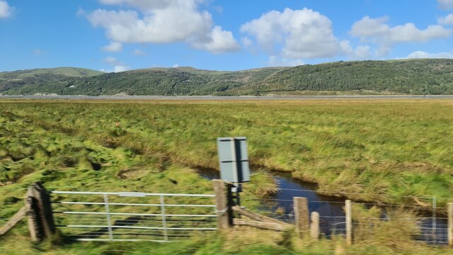
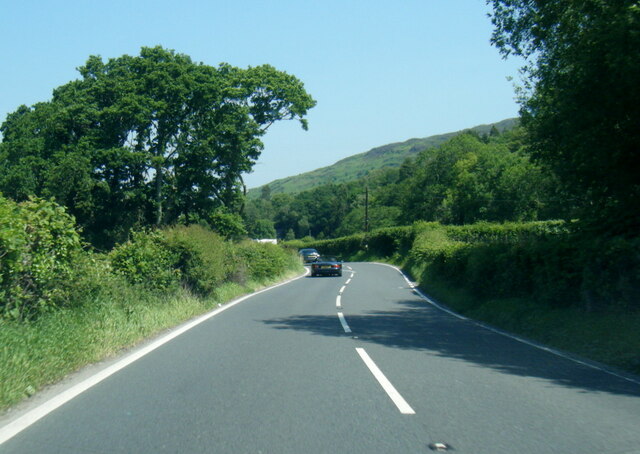
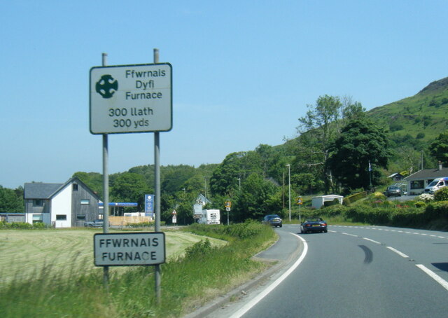
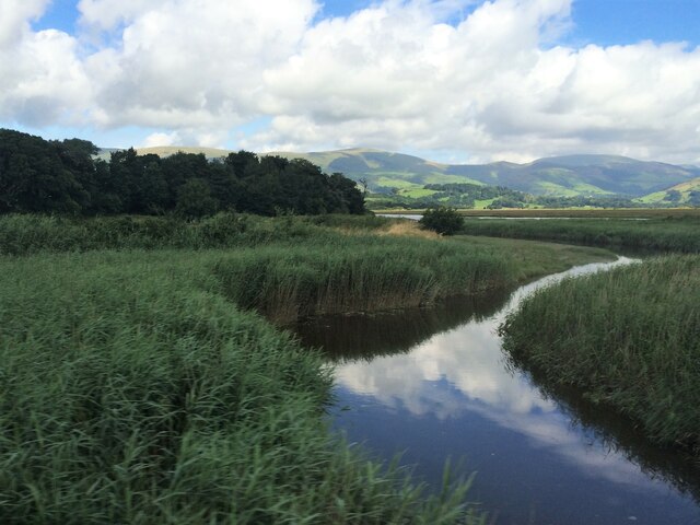
Coed Ysgubor-y-coed Images

Images are sourced within 2km of 52.538857/-3.9437849 or Grid Reference SN6895. Thanks to Geograph Open Source API. All images are credited.

Dyfi Furnace
Dyfi Furnace
Lôn uwchben Ffwrnais The lane above Furnace through the woods.
Lôn uwchben Ffwrnais
The lane above Furnace through the woods.
Bwlcheinion Sea View Arwydd ar A487 yn Ffwrnais / Sign on the A487 in Furnace.
Bwlcheinion Sea View
Arwydd ar A487 yn Ffwrnais / Sign on the A487 in Furnace.
Wal y lôn, Ffwrnais / Lane wall, Furnace
Lôn uwchben Ffwrnais / Lane above Furnace In the last of the autumn colours.
Lôn uwchben Ffwrnais / Lane above Furnace
In the last of the autumn colours.
Mine adit, in the woods near Furnace In the woods above the rushing Afon Einion are plenty of remnants of the area's industrial age. In the C19, silver, lead, copper and zinc were all mined in the valley.
Mine adit, in the woods near Furnace
In the woods above the rushing Afon Einion are plenty of remnants of the area's industrial age. In the C19, silver, lead, copper and zinc were all mined in the valley.
Yr olaf o liwiau'r hydref / Last of the autumn colours Along Cwm Einion, above Ffwrnais/Furnace village.
Yr olaf o liwiau'r hydref / Last of the autumn colours
Along Cwm Einion, above Ffwrnais/Furnace village.
Wales Coast(less) Path, Cwm Einion Because there's no bridging point of the Dyfi lower than Machynlleth, the coast path has to veer a long way inland. It's a glorious route, all the same, but don't bring a bucket and spade.
Wales Coast(less) Path, Cwm Einion
Because there's no bridging point of the Dyfi lower than Machynlleth, the coast path has to veer a long way inland. It's a glorious route, all the same, but don't bring a bucket and spade.
Salt marsh near Ynis Edwin
A487 near Coed y Fedw
A487 at Furnace village boundary
From a Machynlleth-Aberystwyth train, crossing saltmarshes
From a Machynlleth-Aberystwyth train, saltmarsh by the Dovey estuary
Rhaeadr yr Afon Einion, Ffwrnais At the top of the Furnace waterfall, looking down it and the Afon Einion towards the A487 bridge. The furnace building itself is behind the rock top left. The old leat running to the waterwheel there can be seen, with a sluice gate in front of it.
Rhaeadr yr Afon Einion, Ffwrnais
At the top of the Furnace waterfall, looking down it and the Afon Einion towards the A487 bridge. The furnace building itself is behind the rock top left. The old leat running to the waterwheel there can be seen, with a sluice gate in front of it.
Artist's Valley looking down towards Furnace
Bridge over the Afon Einion Solid, although like the road fairly narrow. On the other side is one of the infrequent passing places on the road.
Bridge over the Afon Einion
Solid, although like the road fairly narrow. On the other side is one of the infrequent passing places on the road.
Quarry, near Penrhyngerwin Remains of small stone quarry, probably used as source of building stone.
Quarry, near Penrhyngerwin
Remains of small stone quarry, probably used as source of building stone.
Show me another place!

Coed Ysgubor-y-coed is located at Grid Ref: SN6895 (Lat: 52.538857, Lng: -3.9437849)

Unitary Authority: Ceredigion

Police Authority: Dyfed Powys

What 3 Words

///roaring.defensive.occupy. Near Machynlleth, Powys

Related Wikis

Furnace, Ceredigion

Furnace (Welsh: Ffwrnais) is a hamlet in Ceredigion, Wales on the A487 trunk road from Machynlleth to Aberystwyth, near Eglwysfach. It is the location...
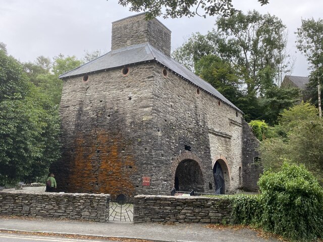
Dyfi Furnace

Dyfi Furnace is a restored mid 18th century charcoal fired blast furnace used for smelting iron ore. It has given its name to the adjoining hamlet of Furnace...

Eglwys Fach

Eglwys Fach, also known as Eglwys-fach or Eglwysfach, is a small village, roughly 12 miles (19 km) outside of Aberystwyth, Ceredigion. It is known for...

Coed y Garth, Ceredigion

Coed y Garth is a small village in the community of Ysgubor-y-coed, Ceredigion, Wales, which is 79.7 miles (128.2 km) from Cardiff and 176.9 miles (284...

Ynys-hir RSPB reserve

Ynys-hir RSPB reserve is a nature reserve of the RSPB situated beside the Dyfi estuary in Ceredigion, mid Wales between Aberystwyth and Machynlleth. The...

Coed Cwm Einion

Coed Cwm Einion is a woodland to the east of the village of Furnace, in Ceredigion, west Wales. It is designated a Site of Special Scientific Interest...

Afon Llyfnant

The River Llyfnant (Welsh: Afon Llyfnant) is a short river in Ceredigion, on the west coast of Wales. The river rises in the mountains south of Machynlleth...

Aberdyfi Castle

Aberdyfi Castle is a castle located near Glandyfi, Ceredigion, in Wales. All that now remains is the motte, which is referred to as Domen Las (traditionally...

Nearby Amenities

Located within 500m of 52.538857,-3.9437849
Ffwrnais / Furnace
Alt Name: Ffwrnais
Is In: Ceredigion, Wales, UK
Name Cy: Ffwrnais
Name En: Furnace
Place: village
Source: npe - local knowledge
Wikidata: Q3400840
Wikipedia: en:Furnace, Ceredigion
Lat/Long: 52.5381781/-3.9405658
Tourism: camp_site
Lat/Long: 52.5385761/-3.9414456
Bus Stop
Plas Einion
Bus: yes
Departures Board: timetable
Network: T2, X28
Operator: Lloyd's Coaches
Public Transport: platform
Shelter: yes
Source: Photo
Lat/Long: 52.5363907/-3.9427117
Artist Valley Motors
Shop: car
Lat/Long: 52.5374441/-3.9419217
Post Box
Post Box Type: lamp
Lat/Long: 52.5378392/-3.9414355
Parking
Lat/Long: 52.5393817/-3.9411152
Recycling
Recycling Glass: yes
Recycling Paper: yes
Lat/Long: 52.5393118/-3.941508
Furnace Waterfall
Height: 15
Intermittent: no
Waterway: waterfall
Lat/Long: 52.5382069/-3.9399067
Place: farm
Lat/Long: 52.5361001/-3.9487976
Power: pole
Lat/Long: 52.5386419/-3.9370617
Power: pole
Lat/Long: 52.5359157/-3.9393711
Power: pole
Lat/Long: 52.5382748/-3.9442661
Power: pole
Lat/Long: 52.5389209/-3.9432442
Power: pole
Lat/Long: 52.5396925/-3.9432013
Power: pole
Lat/Long: 52.5402276/-3.943153
Power: pole
Lat/Long: 52.5417643/-3.9406747
Power: pole
Lat/Long: 52.5425244/-3.9403367
Furnace camper van sitw
Description: camper van site tents allowed £6 but no toilet or showers.
Office: camping
Shower: none
Toilets: none
Lat/Long: 52.5385766/-3.9414471
Direction: 185
Generator Method: photovoltaic
Generator Output Electricity: yes
Generator Solar Modules: 15
Generator Source: solar
Generator Type: solar_photovoltaic_panel
Location: roof
Power: generator
Lat/Long: 52.5357905/-3.9417261
Direction: 190
Generator Method: photovoltaic
Generator Output Electricity: yes
Generator Solar Modules: 15
Generator Source: solar
Generator Type: solar_photovoltaic_panel
Location: roof
Power: generator
Lat/Long: 52.5358232/-3.9417006
Direction: SSW
Generator Method: photovoltaic
Generator Output Electricity: yes
Generator Solar Modules: 15
Generator Source: solar
Generator Type: solar_photovoltaic_panel
Location: roof
Power: generator
Lat/Long: 52.5358354/-3.9416537
The data included in this document is from www.openstreetmap.org. The data is made available under ODbL.

Have you been to Coed Ysgubor-y-coed?

Leave your review of Coed Ysgubor-y-coed below (or comments, questions and feedback).