Furnace

Settlement in Cardiganshire

Wales

Furnace

Dyfi Furnace
Dyfi Furnace Credit: John H Darch

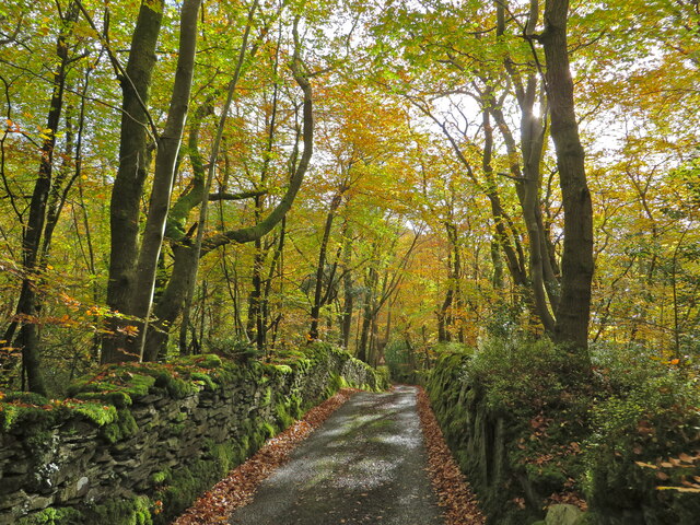
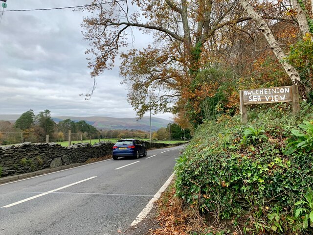
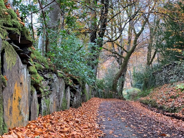
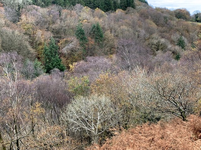
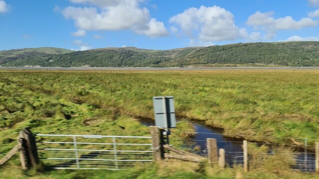
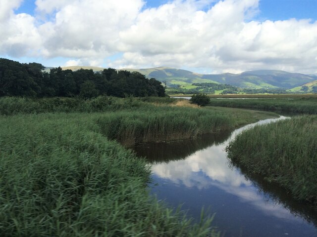
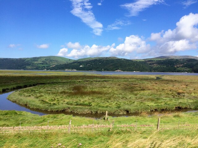
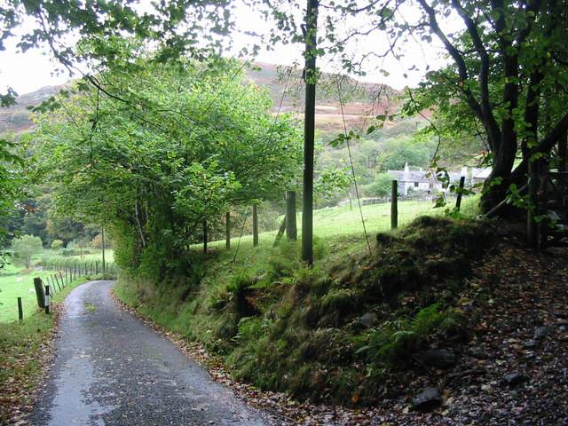
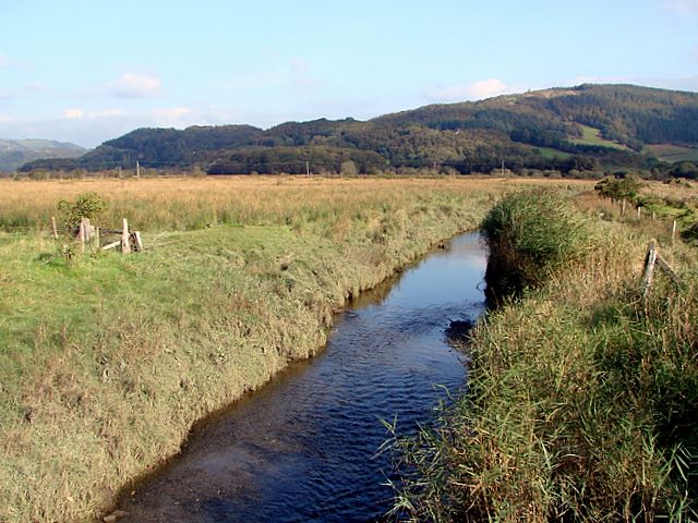
Furnace is a small village located in the county of Cardiganshire, Wales. Situated near the banks of the River Teifi, it lies approximately 9 miles southeast of the town of Aberystwyth. The village is nestled within a picturesque rural landscape, surrounded by lush green fields and rolling hills, giving it a tranquil and idyllic setting.

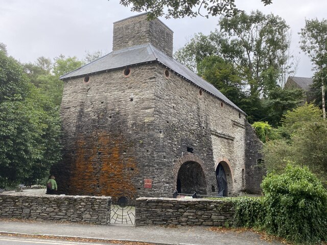
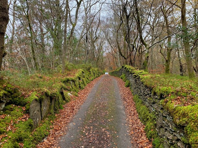
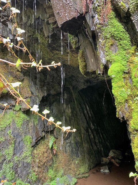
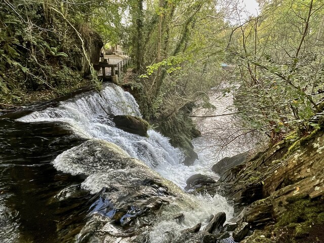
Furnace is known for its rich history in the iron industry. In the 18th and 19th centuries, the village was a hub of iron production, with numerous furnaces and forges operating in the area. These furnaces were powered by the abundant supply of charcoal and iron ore found locally. Today, remnants of this industrial heritage can still be seen, including the ruins of the old ironworks and the preserved ironworkers' cottages.

Despite its small size, Furnace has a strong sense of community. The village is home to a close-knit population, with friendly residents who take pride in their surroundings. There are a few essential amenities available, such as a village hall and a small shop, catering to the needs of the local residents.

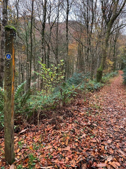
Nature enthusiasts will find plenty to explore in and around Furnace. The nearby Teifi Marshes Nature Reserve offers a diverse range of wildlife and scenic walking trails along the riverbank. The area is also popular for fishing, with the River Teifi being renowned for its salmon and sea trout.

Overall, Furnace is a charming and historically significant village, offering a peaceful retreat for those seeking a slice of rural life in Cardiganshire.

If you have any feedback on the listing, please let us know in the comments section below.

Furnace Images

Images are sourced within 2km of 52.538132/-3.942713 or Grid Reference SN6895. Thanks to Geograph Open Source API. All images are credited.

Dyfi Furnace
Dyfi Furnace
Lôn uwchben Ffwrnais The lane above Furnace through the woods.
Lôn uwchben Ffwrnais
The lane above Furnace through the woods.
Bwlcheinion Sea View Arwydd ar A487 yn Ffwrnais / Sign on the A487 in Furnace.
Bwlcheinion Sea View
Arwydd ar A487 yn Ffwrnais / Sign on the A487 in Furnace.
Wal y lôn, Ffwrnais / Lane wall, Furnace
Lôn uwchben Ffwrnais / Lane above Furnace In the last of the autumn colours.
Lôn uwchben Ffwrnais / Lane above Furnace
In the last of the autumn colours.
Mine adit, in the woods near Furnace In the woods above the rushing Afon Einion are plenty of remnants of the area's industrial age. In the C19, silver, lead, copper and zinc were all mined in the valley.
Mine adit, in the woods near Furnace
In the woods above the rushing Afon Einion are plenty of remnants of the area's industrial age. In the C19, silver, lead, copper and zinc were all mined in the valley.
Yr olaf o liwiau'r hydref / Last of the autumn colours Along Cwm Einion, above Ffwrnais/Furnace village.
Yr olaf o liwiau'r hydref / Last of the autumn colours
Along Cwm Einion, above Ffwrnais/Furnace village.
Wales Coast(less) Path, Cwm Einion Because there's no bridging point of the Dyfi lower than Machynlleth, the coast path has to veer a long way inland. It's a glorious route, all the same, but don't bring a bucket and spade.
Wales Coast(less) Path, Cwm Einion
Because there's no bridging point of the Dyfi lower than Machynlleth, the coast path has to veer a long way inland. It's a glorious route, all the same, but don't bring a bucket and spade.
Salt marsh near Ynis Edwin
A487 near Coed y Fedw
A487 at Furnace village boundary
From a Machynlleth-Aberystwyth train, crossing saltmarshes
From a Machynlleth-Aberystwyth train, saltmarsh by the Dovey estuary
Rhaeadr yr Afon Einion, Ffwrnais At the top of the Furnace waterfall, looking down it and the Afon Einion towards the A487 bridge. The furnace building itself is behind the rock top left. The old leat running to the waterwheel there can be seen, with a sluice gate in front of it.
Rhaeadr yr Afon Einion, Ffwrnais
At the top of the Furnace waterfall, looking down it and the Afon Einion towards the A487 bridge. The furnace building itself is behind the rock top left. The old leat running to the waterwheel there can be seen, with a sluice gate in front of it.
Artist's Valley looking down towards Furnace
Bwlch-y-maen A recently renovated building high above Cwm Einion.
Bwlch-y-maen
A recently renovated building high above Cwm Einion.
Hillside above Cymerau Un-named buildings high up above the Cymerau valley. The vast expanses of molinia grass to the right killed my interest in exploring further!
Hillside above Cymerau
Un-named buildings high up above the Cymerau valley. The vast expanses of molinia grass to the right killed my interest in exploring further!
Show me another place!

Furnace is located at Grid Ref: SN6895 (Lat: 52.538132, Lng: -3.942713)

Unitary Authority: Ceredigion

Police Authority: Dyfed Powys

What 3 Words

///inhales.squaring.staple. Near Machynlleth, Powys

Related Wikis

Furnace, Ceredigion

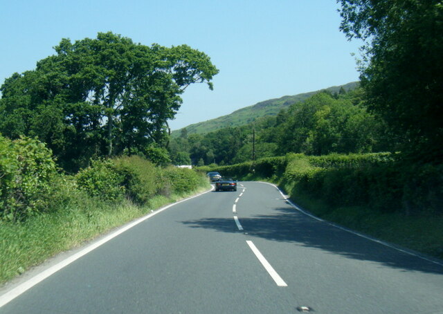
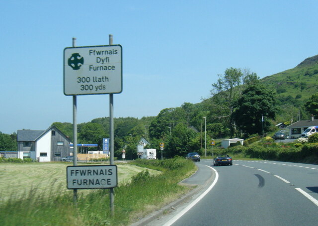
Furnace (Welsh: Ffwrnais) is a hamlet in Ceredigion, Wales on the A487 trunk road from Machynlleth to Aberystwyth, near Eglwysfach. It is the location...

Dyfi Furnace

Dyfi Furnace is a restored mid 18th century charcoal fired blast furnace used for smelting iron ore. It has given its name to the adjoining hamlet of Furnace...

Coed y Garth, Ceredigion

Coed y Garth is a small village in the community of Ysgubor-y-coed, Ceredigion, Wales, which is 79.7 miles (128.2 km) from Cardiff and 176.9 miles (284...

Eglwys Fach

Eglwys Fach, also known as Eglwys-fach or Eglwysfach, is a small village, roughly 12 miles (19 km) outside of Aberystwyth, Ceredigion. It is known for...

Coed Cwm Einion

Coed Cwm Einion is a woodland to the east of the village of Furnace, in Ceredigion, west Wales. It is designated a Site of Special Scientific Interest...

Ynys-hir RSPB reserve

Ynys-hir RSPB reserve is a nature reserve of the RSPB situated beside the Dyfi estuary in Ceredigion, mid Wales between Aberystwyth and Machynlleth. The...

Afon Llyfnant

The River Llyfnant (Welsh: Afon Llyfnant) is a short river in Ceredigion, on the west coast of Wales. The river rises in the mountains south of Machynlleth...

Aberdyfi Castle

Aberdyfi Castle is a castle located near Glandyfi, Ceredigion, in Wales. All that now remains is the motte, which is referred to as Domen Las (traditionally...

Nearby Amenities

Located within 500m of 52.538132,-3.942713
Ffwrnais / Furnace
Alt Name: Ffwrnais
Is In: Ceredigion, Wales, UK
Name Cy: Ffwrnais
Name En: Furnace
Place: village
Source: npe - local knowledge
Wikidata: Q3400840
Wikipedia: en:Furnace, Ceredigion
Lat/Long: 52.5381781/-3.9405658
Tourism: camp_site
Lat/Long: 52.5385761/-3.9414456
Bus Stop
Plas Einion
Bus: yes
Departures Board: timetable
Network: T2, X28
Operator: Lloyd's Coaches
Public Transport: platform
Shelter: yes
Source: Photo
Lat/Long: 52.5363907/-3.9427117
Artist Valley Motors
Shop: car
Lat/Long: 52.5374441/-3.9419217
Post Box
Post Box Type: lamp
Lat/Long: 52.5378392/-3.9414355
Parking
Lat/Long: 52.5393817/-3.9411152
Recycling
Recycling Glass: yes
Recycling Paper: yes
Lat/Long: 52.5393118/-3.941508
Furnace Waterfall
Height: 15
Intermittent: no
Waterway: waterfall
Lat/Long: 52.5382069/-3.9399067
Place: farm
Lat/Long: 52.5361001/-3.9487976
Power: pole
Lat/Long: 52.5386419/-3.9370617
Power: pole
Lat/Long: 52.5359157/-3.9393711
Power: pole
Lat/Long: 52.5382748/-3.9442661
Power: pole
Lat/Long: 52.5389209/-3.9432442
Power: pole
Lat/Long: 52.5396925/-3.9432013
Power: pole
Lat/Long: 52.5402276/-3.943153
Power: pole
Lat/Long: 52.5417643/-3.9406747
Furnace camper van sitw
Description: camper van site tents allowed £6 but no toilet or showers.
Office: camping
Shower: none
Toilets: none
Lat/Long: 52.5385766/-3.9414471
Direction: 185
Generator Method: photovoltaic
Generator Output Electricity: yes
Generator Solar Modules: 15
Generator Source: solar
Generator Type: solar_photovoltaic_panel
Location: roof
Power: generator
Lat/Long: 52.5357905/-3.9417261
Direction: 190
Generator Method: photovoltaic
Generator Output Electricity: yes
Generator Solar Modules: 15
Generator Source: solar
Generator Type: solar_photovoltaic_panel
Location: roof
Power: generator
Lat/Long: 52.5358232/-3.9417006
Direction: SSW
Generator Method: photovoltaic
Generator Output Electricity: yes
Generator Solar Modules: 15
Generator Source: solar
Generator Type: solar_photovoltaic_panel
Location: roof
Power: generator
Lat/Long: 52.5358354/-3.9416537
The data included in this document is from www.openstreetmap.org. The data is made available under ODbL.

Have you been to Furnace?

Leave your review of Furnace below (or comments, questions and feedback).