Eglwys Fach

Settlement in Cardiganshire

Wales

Eglwys Fach

Track junction in Cwm Cymerau Straight on for Brwyno Farm, to the right for Dynyn Farm and the mountain path to Pemprys.
Track junction in Cwm Cymerau Credit: John Lucas

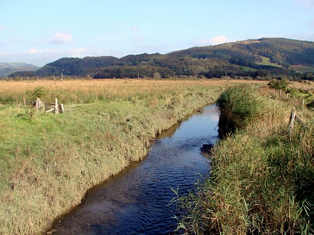
Eglwys Fach is a small village located in the county of Cardiganshire, Wales. Situated in the western part of the country, it lies approximately 5 miles northeast of the town of Cardigan. The village is nestled amidst the beautiful countryside, surrounded by rolling hills and lush green fields.

Eglwys Fach is a rural community with a relatively small population. The village mainly consists of traditional Welsh cottages and houses, adding to its charm and character. The landscape surrounding Eglwys Fach is largely agricultural, with farming being a significant part of the local economy.

One of the notable features of Eglwys Fach is its beautiful parish church, which dates back to the medieval period. The church, known as St. Michael's Church, is a fine example of Gothic architecture and attracts visitors interested in history and heritage.

The village enjoys a peaceful and picturesque setting, making it a popular destination for those seeking a tranquil retreat or outdoor activities. The surrounding area offers opportunities for hiking, biking, and exploring the nearby nature reserves and coastal areas.

While Eglwys Fach is a small village, it benefits from its proximity to larger towns and cities. The vibrant town of Cardigan is just a short drive away, offering a range of amenities, including shops, restaurants, and leisure facilities.

Overall, Eglwys Fach is a charming and idyllic village with a rich history and natural beauty. It provides a peaceful escape for residents and visitors alike, offering a taste of rural Welsh life.

If you have any feedback on the listing, please let us know in the comments section below.

Eglwys Fach Images

Images are sourced within 2km of 52.545791/-3.936223 or Grid Reference SN6895. Thanks to Geograph Open Source API. All images are credited.

Track junction in Cwm Cymerau Straight on for Brwyno Farm, to the right for Dynyn Farm and the mountain path to Pemprys.
Track junction in Cwm Cymerau
Straight on for Brwyno Farm, to the right for Dynyn Farm and the mountain path to Pemprys.
Permissive Bridleway Markers on the gateposts show this to be the entrance to a permissive bridleway sponsored by Ceredigion Bridleway Group and The British Horse Society. As it is not marked on current maps, its length and route are unknown (to me). It possibly links with the nearby Wales Coast Path.
Permissive Bridleway
Markers on the gateposts show this to be the entrance to a permissive bridleway sponsored by Ceredigion Bridleway Group and The British Horse Society. As it is not marked on current maps, its length and route are unknown (to me). It possibly links with the nearby Wales Coast Path.
Cattle grid in Cwm Cymerau Not so long ago, this was a gated road.
Cattle grid in Cwm Cymerau
Not so long ago, this was a gated road.
Cattle grid in Cwm Cymerau Foel Fawr on the left.
Cattle grid in Cwm Cymerau
Foel Fawr on the left.
Road (and path) through a wooded area ... ... and some relief from the blistering sun!
Road (and path) through a wooded area ...
... and some relief from the blistering sun!
The Wales Coastal Path joins the lane through Cwm Cymerau About 5 miles from Machynlleth. It follows the lane for a mile down towards Eglwys Fach and the goes over the hills to Furnace.
The Wales Coastal Path joins the lane through Cwm Cymerau
About 5 miles from Machynlleth. It follows the lane for a mile down towards Eglwys Fach and the goes over the hills to Furnace.
The track to Brwyno The cattle grid is not 'pedestrian friendly', with widely spaced bars and no hand-hold, I chose not to cross it. The status of the track is unknown (to me). There is no indication on the map that it is public (but nothing on the ground to suggest otherwise).
The track to Brwyno
The cattle grid is not 'pedestrian friendly', with widely spaced bars and no hand-hold, I chose not to cross it. The status of the track is unknown (to me). There is no indication on the map that it is public (but nothing on the ground to suggest otherwise).
On the Wales Coast Path An inland section of the path, in the hills south of the river Dyfi
On the Wales Coast Path
An inland section of the path, in the hills south of the river Dyfi
Heading downhill on the Wales Coast path An inland section of the path, in the hills south of the river Dyfi. The Path marker is on the upright post.
Heading downhill on the Wales Coast path
An inland section of the path, in the hills south of the river Dyfi. The Path marker is on the upright post.
Wales Coast Path On the west side of Craig Caerhedyn
Wales Coast Path
On the west side of Craig Caerhedyn
Wales Coast Path In the hills between Cymerau and Brwynau
Wales Coast Path
In the hills between Cymerau and Brwynau
Heading west on the Wales Coast Path On the track between Brwyno and Cymerau
Heading west on the Wales Coast Path
On the track between Brwyno and Cymerau
Ponies on the track The track between Brwyno and Cymerau, though inland, is part of the Wales Coast Path.
Ponies on the track
The track between Brwyno and Cymerau, though inland, is part of the Wales Coast Path.
Road works Laying a gully on the track between Brwyno and Cymerau
Road works
Laying a gully on the track between Brwyno and Cymerau
Dyfi Furnace
Dyfi Furnace
Lôn uwchben Ffwrnais The lane above Furnace through the woods.
Lôn uwchben Ffwrnais
The lane above Furnace through the woods.
Bwlcheinion Sea View Arwydd ar A487 yn Ffwrnais / Sign on the A487 in Furnace.
Bwlcheinion Sea View
Arwydd ar A487 yn Ffwrnais / Sign on the A487 in Furnace.
Wal y lôn, Ffwrnais / Lane wall, Furnace
Show me another place!

Eglwys Fach is located at Grid Ref: SN6895 (Lat: 52.545791, Lng: -3.936223)

Unitary Authority: Ceredigion

Police Authority: Dyfed Powys

Also known as: Eglwys-fach

What 3 Words

///safety.hobble.tortoises. Near Machynlleth, Powys

Related Wikis

Eglwys Fach

Eglwys Fach, also known as Eglwys-fach or Eglwysfach, is a small village, roughly 12 miles (19 km) outside of Aberystwyth, Ceredigion. It is known for...

Afon Llyfnant

The River Llyfnant (Welsh: Afon Llyfnant) is a short river in Ceredigion, on the west coast of Wales. The river rises in the mountains south of Machynlleth...

Ynys-hir RSPB reserve

Ynys-hir RSPB reserve is a nature reserve of the RSPB situated beside the Dyfi estuary in Ceredigion, mid Wales between Aberystwyth and Machynlleth. The...

Aberdyfi Castle

Aberdyfi Castle is a castle located near Glandyfi, Ceredigion, in Wales. All that now remains is the motte, which is referred to as Domen Las (traditionally...

Glandyfi Castle

Glandyfi Castle in Glandyfi, Ceredigion, Wales, is a mock castle dating from the early 19th century. It was built for George Jeffreys, a barrister and...
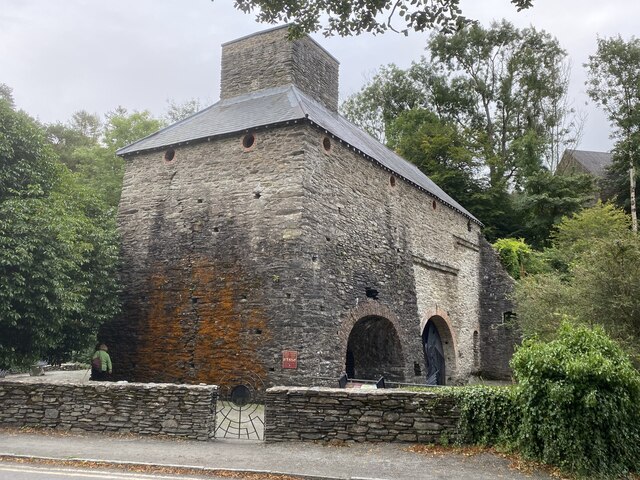
Dyfi Furnace

Dyfi Furnace is a restored mid 18th century charcoal fired blast furnace used for smelting iron ore. It has given its name to the adjoining hamlet of Furnace...

Furnace, Ceredigion

Furnace (Welsh: Ffwrnais) is a hamlet in Ceredigion, Wales on the A487 trunk road from Machynlleth to Aberystwyth, near Eglwysfach. It is the location...
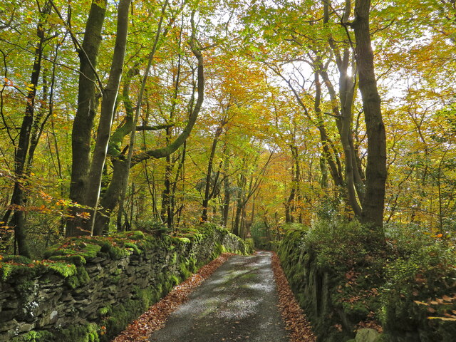
Coed Cwm Einion

Coed Cwm Einion is a woodland to the east of the village of Furnace, in Ceredigion, west Wales. It is designated a Site of Special Scientific Interest...

Nearby Amenities

Located within 500m of 52.545791,-3.936223
Eglwys Fach
Is In: Ceredigion, Wales, UK
Place: village
Source: npe-local knowledge
Wikidata: Q15921374
Wikipedia: en:Eglwys Fach
Lat/Long: 52.543849/-3.9381207
Post Box
Post Box Type: lamp
Lat/Long: 52.5431685/-3.9374387
Bus Stop
Brynheulog Lane
Public Transport: platform
Shelter: yes
Lat/Long: 52.5432873/-3.9371984
Telephone
Defibrillator
Booth: K6
Covered: booth
Defibrillator Location: inside old red phone box, Eglwys Fach
Emergency: defibrillator
Man Made: telephone_box
Lat/Long: 52.5433237/-3.9372201
Place: farm
Lat/Long: 52.5454633/-3.9374358
Power: pole
Lat/Long: 52.5477131/-3.9304662
Power: pole
Lat/Long: 52.5445585/-3.9325771
Power: pole
Lat/Long: 52.5428523/-3.9334568
Power: pole
Lat/Long: 52.5419714/-3.9341918
Power: pole
Lat/Long: 52.5425244/-3.9403367
Power: pole
Lat/Long: 52.5447461/-3.9394248
Power: pole
Lat/Long: 52.5461163/-3.9384002
Power: pole
Lat/Long: 52.5473396/-3.9375633
Bus Stop
Brynheulog Lane
Physically Present: no
Public Transport: platform
Lat/Long: 52.5432935/-3.9374041
Bridge
Lat/Long: 52.5439998/-3.9415106
Direction: 195
Fixme: no certain
Generator Method: photovoltaic
Generator Output Electricity: yes
Generator Solar Modules: 2
Generator Source: solar
Generator Type: solar_photovoltaic_panel
Location: roof
Power: generator
Lat/Long: 52.5434151/-3.9370564
Direction: 190
Fixme: no certain
Generator Method: photovoltaic
Generator Output Electricity: yes
Generator Solar Modules: 4
Generator Source: solar
Generator Type: solar_photovoltaic_panel
Location: roof
Power: generator
Lat/Long: 52.5435113/-3.9375271
Direction: 190
Generator Method: photovoltaic
Generator Output Electricity: yes
Generator Solar Modules: 10
Generator Source: solar
Generator Type: solar_photovoltaic_panel
Location: roof
Power: generator
Lat/Long: 52.5442339/-3.9372012
Post Box
Collection Times: Mo-Fr 16:15; Sa 10:30
Ref: SY20 93
Royal Cypher: EIIR
Royal Cypher Wikidata: Q33102113
Lat/Long: 52.5490408/-3.934067
The data included in this document is from www.openstreetmap.org. The data is made available under ODbL.

Have you been to Eglwys Fach?

Leave your review of Eglwys Fach below (or comments, questions and feedback).