Muriau-cochion Wood

Wood, Forest in Merionethshire

Wales

Muriau-cochion Wood

Road to Cwm-Mynach
Road to Cwm-Mynach Credit: Steven Brown

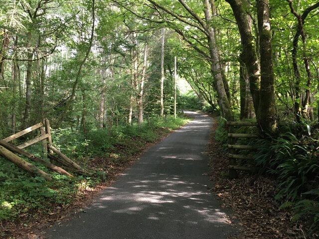
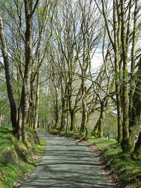
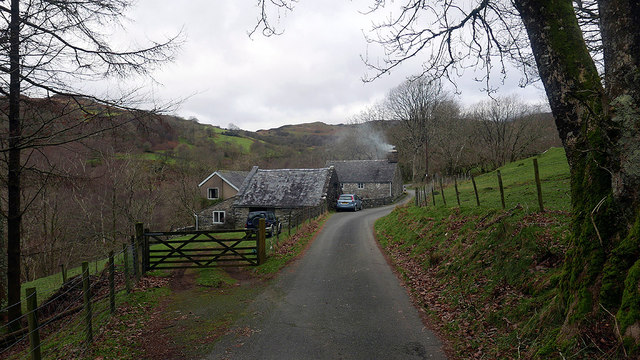
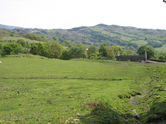
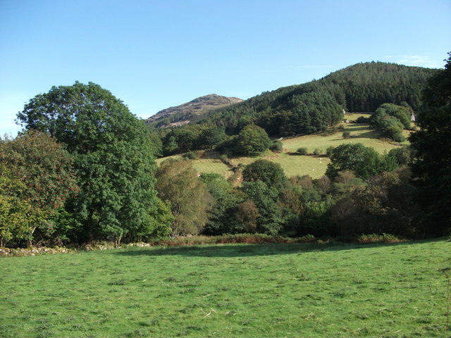
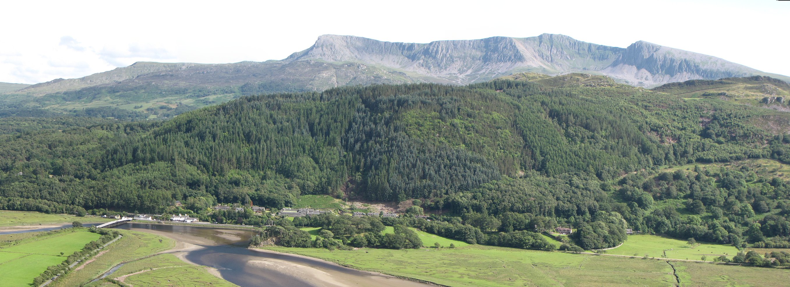
Muriau-cochion Wood is a serene and picturesque forest located in the county of Merionethshire, Wales. Spanning over a vast area, this woodland is renowned for its natural beauty, diverse flora, and tranquil atmosphere.

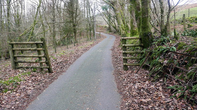
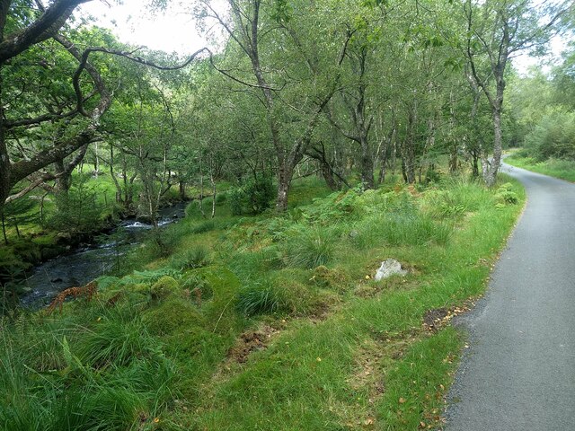
The wood is characterized by a dense canopy formed by a variety of tree species, including oak, beech, ash, and birch. These towering giants provide shade and shelter for a rich undergrowth of ferns, mosses, and wildflowers, creating a vibrant and enchanting environment. The forest floor is adorned with a carpet of lush green grass, further enhancing the magical ambiance.

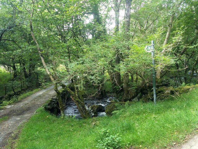
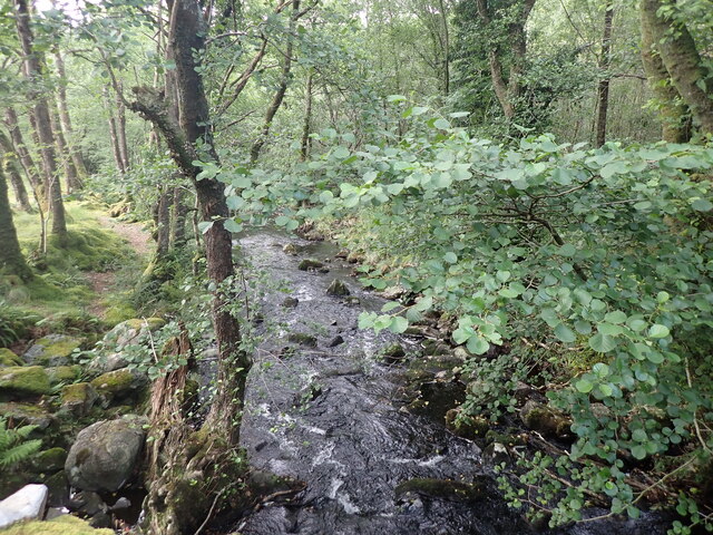
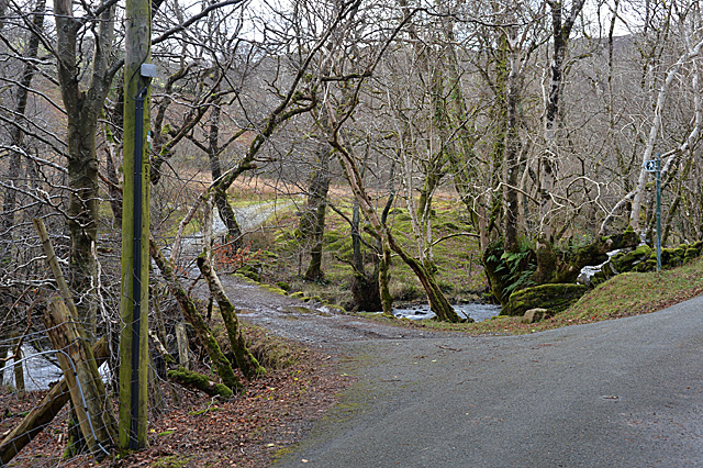
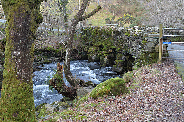
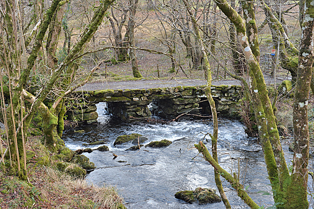
Muriau-cochion Wood is home to a diverse array of wildlife, making it a haven for nature enthusiasts and wildlife photographers. Visitors may be lucky enough to spot red squirrels, badgers, foxes, and a plethora of bird species, including woodpeckers and owls. The wood also boasts a small stream that meanders through its heart, adding to the serene atmosphere and providing a source of freshwater for the local fauna.

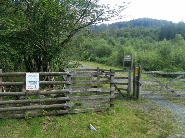
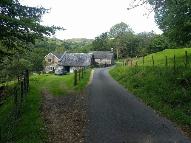
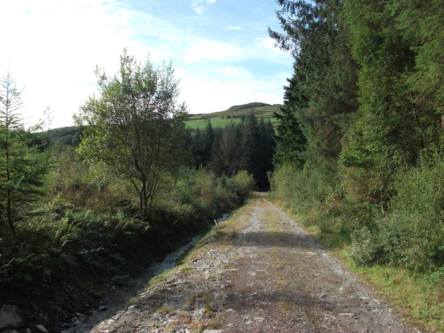
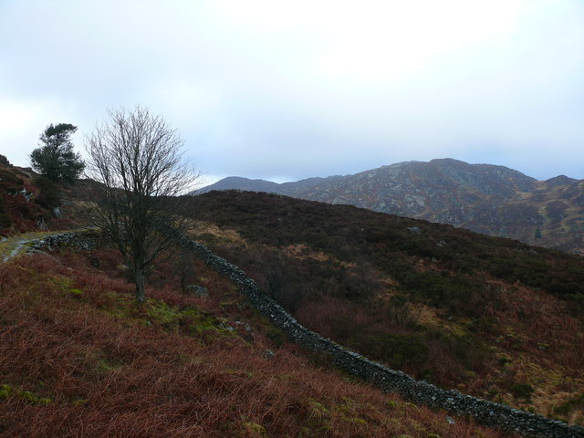
Access to Muriau-cochion Wood is facilitated by a network of well-maintained trails, allowing visitors to explore and appreciate its beauty at their own pace. The forest is a popular destination for hikers, joggers, and families seeking a peaceful retreat in nature. It offers a tranquil escape from the hustle and bustle of everyday life, providing a space for relaxation, reflection, and reconnecting with the natural world.

Overall, Muriau-cochion Wood is a captivating woodland that showcases the beauty of Merionethshire's natural landscape. Its stunning scenery, diverse flora and fauna, and peaceful ambiance make it a must-visit destination for nature lovers and those seeking a rejuvenating experience in the heart of Wales.

If you have any feedback on the listing, please let us know in the comments section below.

Muriau-cochion Wood Images

Images are sourced within 2km of 52.75335/-3.9595171 or Grid Reference SH6719. Thanks to Geograph Open Source API. All images are credited.

Road to Cwm-Mynach
Road to Cwm-Mynach
Ladder Stile Ladder stile over dry stone wall near to Bontddu, Gwynedd.
Ladder Stile
Ladder stile over dry stone wall near to Bontddu, Gwynedd.
Minor Road Minor road looking south near to Pen-y-Bryn, Gwynedd.
Minor Road
Minor road looking south near to Pen-y-Bryn, Gwynedd.
Ty'n-y-coed Cottages in the 'Hidden Valley'.
Ty'n-y-coed
Cottages in the 'Hidden Valley'.
Boundary in Cwm Mynach Just to the south of Ty'n-y-coed, still marked as gated on current maps but the gate stands disused by the bank. There are other gates on this road through the valley which are still in use.
Boundary in Cwm Mynach
Just to the south of Ty'n-y-coed, still marked as gated on current maps but the gate stands disused by the bank. There are other gates on this road through the valley which are still in use.
The Afon Cwm-mynach
The Afon Cwm-mynach
The start of the Climbers' Path to Rhino Buttress See: <span class="nowrap"><a title="https://www.ukclimbing.com/logbook/crags/craig_y_merched-2264" rel="nofollow ugc noopener" href="https://www.ukclimbing.com/logbook/crags/craig_y_merched-2264">Link</a><img style="margin-left:2px;" alt="External link" title="External link - shift click to open in new window" src="https://s1.geograph.org.uk/img/external.png" width="10" height="10"/></span>
The start of the Climbers' Path to Rhino Buttress
See: LinkExternal link
The public footpath at Pont Garth-gell
Ty'n-y-coed in Cwm-Mynach
The Afon Cwm-mynach
The Afon Cwm-mynach
Farmland above Bontddu
Tramway, Clogau Associated with the Old St David workings.
Tramway, Clogau
Associated with the Old St David workings.
Late summer at Cae-mab-seifon Full leaf on all the trees, bracken and thistle control in the rough bits, what a contrast with the early winter photo taken a couple of years back. <a href="https://www.geograph.org.uk/photo/1635403">SH6820 : Looking across to Cae-mab-seifion</a>
Late summer at Cae-mab-seifon
Full leaf on all the trees, bracken and thistle control in the rough bits, what a contrast with the early winter photo taken a couple of years back. SH6820 : Looking across to Cae-mab-seifion
Forest track looking south The Woodland Trust has recently purchased Cwm-Mynach and they have started to implement a long term plan to replace the non-native conifers with broad leaf trees. Initially work to ensure the drains, access and footpaths are all in good condition is being undertaken, the drain to the left of this track has been cleaned and is now working well. 
 <span class="nowrap"><a title="http://visitwoods.org.uk/en/visit-woods/Pages/wood-details.aspx?wood=5630&site=Cwm-Mynach" rel="nofollow ugc noopener" href="http://visitwoods.org.uk/en/visit-woods/Pages/wood-details.aspx?wood=5630&site=Cwm-Mynach">Link</a><img style="margin-left:2px;" alt="External link" title="External link - shift click to open in new window" src="https://s1.geograph.org.uk/img/external.png" width="10" height="10"/></span>
Forest track looking south
The Woodland Trust has recently purchased Cwm-Mynach and they have started to implement a long term plan to replace the non-native conifers with broad leaf trees. Initially work to ensure the drains, access and footpaths are all in good condition is being undertaken, the drain to the left of this track has been cleaned and is now working well. LinkExternal link
Lane to Garth-gell Crossing Pont Garth-gell over the Afon Cwm-mynach. A public footpath crosses the bridge, before heading south towards the Mawddach estuary.
Lane to Garth-gell
Crossing Pont Garth-gell over the Afon Cwm-mynach. A public footpath crosses the bridge, before heading south towards the Mawddach estuary.
Bridge over Afon Cwm-mynach Taking the minor road up the valley over the river. It's a similar structure to <a href="https://www.geograph.org.uk/photo/3823529">SH6820 : Pont Garth-gell</a> lower down, but wider and with the addition of a parapet.
Bridge over Afon Cwm-mynach
Taking the minor road up the valley over the river. It's a similar structure to SH6820 : Pont Garth-gell lower down, but wider and with the addition of a parapet.
Pont Garth-gell A basic but solid-looking stone bridge carrying the lane to Garth-gell farm.
Pont Garth-gell
A basic but solid-looking stone bridge carrying the lane to Garth-gell farm.
Cwm Llechan Trac yn arwain i fyny Cwm Llechan / Track leading up Cwm Llechan
Cwm Llechan
Trac yn arwain i fyny Cwm Llechan / Track leading up Cwm Llechan
Show me another place!

Muriau-cochion Wood is located at Grid Ref: SH6719 (Lat: 52.75335, Lng: -3.9595171)

Unitary Authority: Gwynedd

Police Authority: North Wales

What 3 Words

///tuxedos.ranking.crescendo. Near Dolgellau, Gwynedd

Related Wikis

Bontddu

Bontddu (meaning Black bridge) is a small settlement just east of Barmouth, near the town of Dolgellau in Gwynedd, Wales. It is in the community of Llanelltyd...

Clogau Gold Mine

The Clogau (pronounced "clog-eye") Gold Mine (also known as Clogau St David's) is a gold mine near Bontddu in North Wales. == History == The Clogau mine...

Borthwnog

Borthwnog is a family name given to the Borthwnog estate in Gwynedd, north-west Wales. Borthwnog Hall was the Manor House of the estate which encompassed...

Mawddach Trail

The Mawddach Trail (Welsh: Llwybr Mawddach) is a cycle path route, part of Lôn Las Cymru, which runs for some 8 miles (13 km) from Dolgellau (52.7446°N...

Penmaenpool

Penmaenpool (Welsh: Llynpenmaen) is a hamlet on the south side of the estuary of the River Mawddach in Wales, near Dolgellau. A Grade II listed toll bridge...

Penmaenpool railway station

Penmaenpool railway station at Penmaenpool in Gwynedd, North Wales, was formerly a station on the Dolgelly [sic] branch of the Aberystwith and Welsh Coast...

St Philip's Church, Caerdeon

St Philip's Church, Caerdeon, near Barmouth, in Gwynedd, North Wales, is a redundant church and a Grade I listed building. The church was built in 1862...

Tyn-y-Coed Farmhouse

Tyn-y-Coed Farmhouse is a grade II Listed Building in Caerdeon, Barmouth, Gwynedd. This Georgian farm house was built in 1756 and later extended and altered...

Related Videos

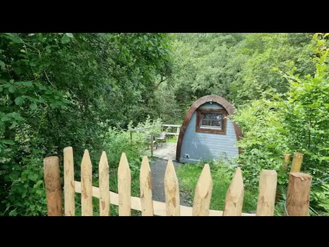
Magical Forest Nest Glamp walk through in North Wales booked via airbnb

Title says it all, lovely hidden gem glamp pod with it's own hottub and lake swim opportunity (not in video tho unfortunately)

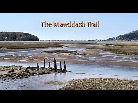
Walking Wales - The Mawddach Trail

Positioned along the estuary of the Mawddach river near Barmouth, this trail follows the coast using the route of a former train line ...

Mawddach Estuary Solo Canoe Trip

A solo trip in an open canoe down and up the Mawddch estuary from Penmaenpool to Barmouth and back. Using the tides and a ...

Our first ever proper trip in our van - Wales - day three

Our first trip in our van was for three nights at an off grid campsite near Dolgellau in West Wales. Today we hiked the spectacular ...

Nearby Amenities

Located within 500m of 52.75335,-3.9595171
Source: PGS
Lat/Long: 52.750081/-3.9642469
Source: PGS
Lat/Long: 52.7502667/-3.9633628
Source: PGS
Lat/Long: 52.7506164/-3.9620394
Source: PGS
Lat/Long: 52.7507018/-3.9614681
Source: PGS
Lat/Long: 52.7507203/-3.9609692
Source: PGS
Lat/Long: 52.7505836/-3.9604237
Source: PGS
Lat/Long: 52.7504401/-3.960002
Source: PGS
Lat/Long: 52.7503316/-3.9600052
Source: PGS
Lat/Long: 52.7503927/-3.9582182
Source: PGS
Lat/Long: 52.7505989/-3.957433
Source: PGS
Lat/Long: 52.7508752/-3.9567464
Source: PGS
Lat/Long: 52.7511032/-3.9557587
Source: PGS
Lat/Long: 52.7513234/-3.955447
Source: PGS
Lat/Long: 52.7515292/-3.9550272
Source: PGS
Lat/Long: 52.7518494/-3.9544329
Source: PGS
Lat/Long: 52.7520354/-3.953783
Source: PGS
Lat/Long: 52.7523027/-3.9529102
Source: PGS
Lat/Long: 52.752534/-3.9522343
Hazard Forward: falling_rocks
Lat/Long: 52.751885/-3.9640256
Parking
Parking: layby
Lat/Long: 52.7516222/-3.9598773
White Horses Cottage
Name En: White Horses Cottage
Tourism: guest_house
Lat/Long: 52.7508837/-3.9581901
Barrier: bollard
Lat/Long: 52.75117/-3.9580128
Barrier: bollard
Lat/Long: 52.7511753/-3.9579644
Post Box
Lat/Long: 52.7525035/-3.9621444
Power: pole
Lat/Long: 52.7530874/-3.9543567
Power: pole
Lat/Long: 52.7529072/-3.953603
Power: pole
Lat/Long: 52.7527303/-3.9529056
Power: pole
Lat/Long: 52.7531913/-3.9547993
Information: sign
Note: the sign says' Welcome to our garden please be respectful & follow the signs'
Tourism: information
Lat/Long: 52.7532741/-3.9539311
Information: route_marker
Tourism: information
Lat/Long: 52.7532451/-3.9541149
Information: guidepost
Tourism: information
Lat/Long: 52.7532214/-3.9544062
Information: guidepost
Tourism: information
Lat/Long: 52.7539783/-3.9546372
Disused Barrier: gate
Lat/Long: 52.7531995/-3.9569731
Information: guidepost
Tourism: information
Lat/Long: 52.7519924/-3.9599027
Information: map
Tourism: information
Lat/Long: 52.7520176/-3.9599041
Leisure: picnic_table
Lat/Long: 52.7521142/-3.9601495
Leisure: picnic_table
Lat/Long: 52.7520554/-3.9603339
Information: route_marker
Tourism: information
Lat/Long: 52.754137/-3.9542386
Information: route_marker
Tourism: information
Lat/Long: 52.7545217/-3.952811
Information: sign
Note: sign says to make sure you do not get cut off by the rising tide
Tourism: information
Lat/Long: 52.7505139/-3.9582646
Information: route_marker
Tourism: information
Lat/Long: 52.7505386/-3.9581358
Information: guidepost
Tourism: information
Lat/Long: 52.7512398/-3.9581037
Information: guidepost
Tourism: information
Lat/Long: 52.7536694/-3.9545222
The data included in this document is from www.openstreetmap.org. The data is made available under ODbL.

Have you been to Muriau-cochion Wood?

Leave your review of Muriau-cochion Wood below (or comments, questions and feedback).