Bryntirion Wood

Wood, Forest in Merionethshire

Wales

Bryntirion Wood

Old barn on Banc-y-Frân A solid but roofless stone barn sits on a small rise in the adjacent field. Diffwys can be seen in the distance.
Old barn on Banc-y-Frân Credit: Nigel Brown

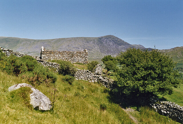
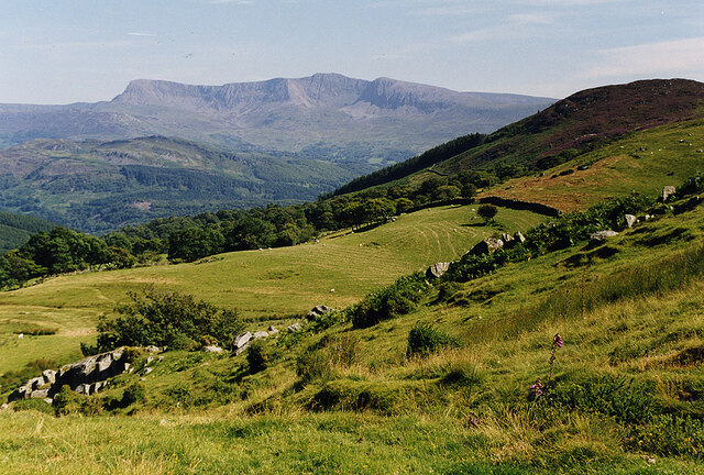
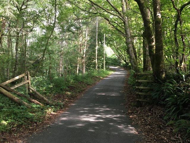
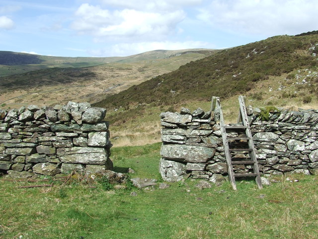
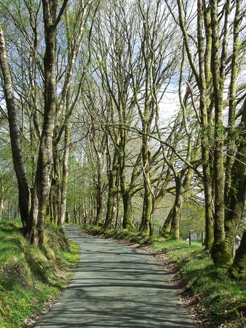
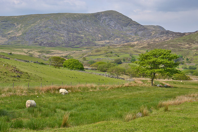
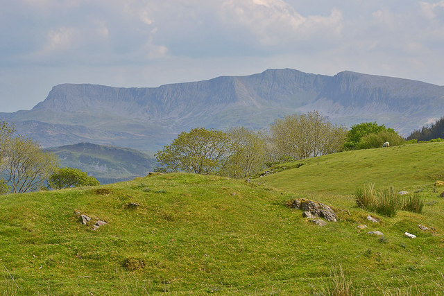
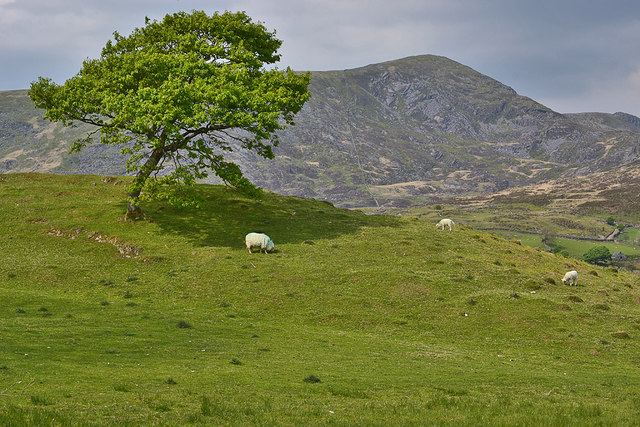
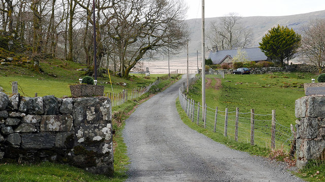
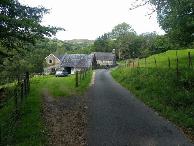
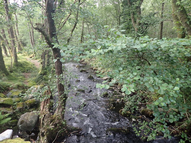
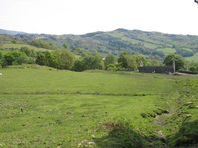
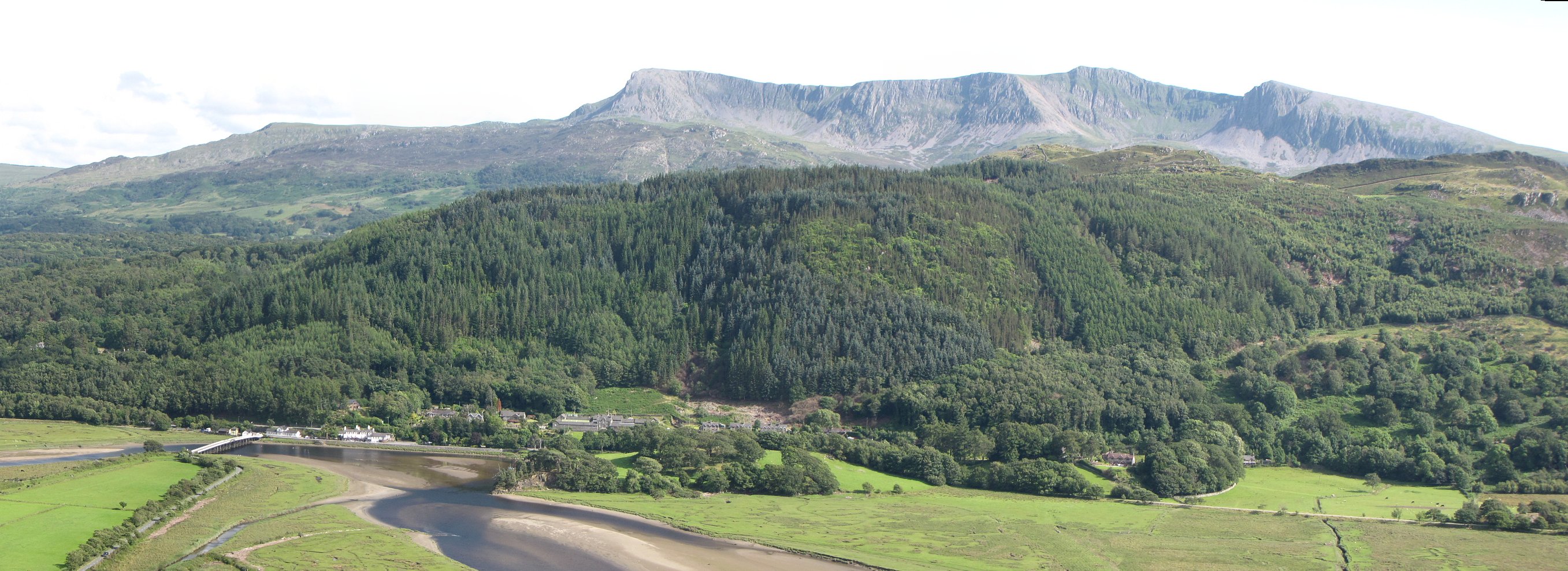
Bryntirion Wood, located in Merionethshire, is a captivating woodland that spans across a vast area, offering a serene and enchanting atmosphere. Nestled amidst the picturesque landscape of Wales, this forest is renowned for its natural beauty, diverse flora, and abundant wildlife.

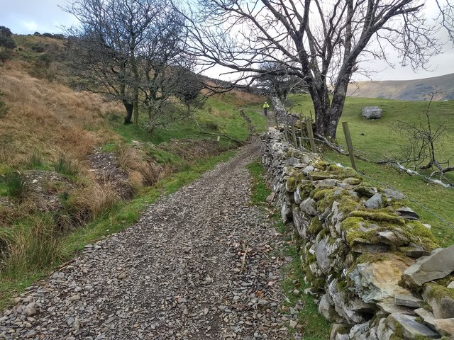
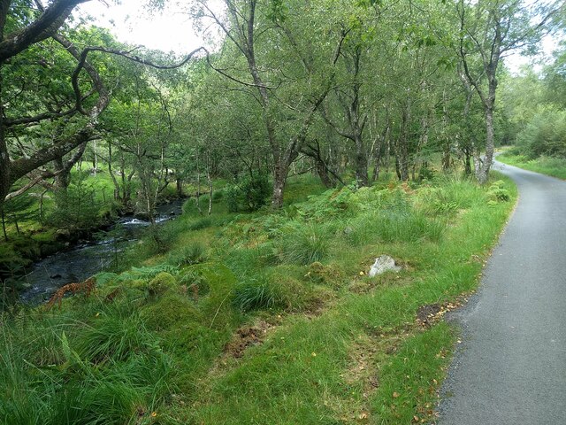
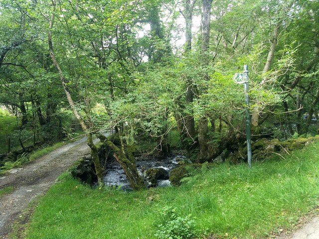
Covering an expansive area, Bryntirion Wood is home to a variety of tree species, including oak, birch, and beech trees. The dense foliage provides a lush canopy, creating a peaceful and shaded environment for visitors to explore. The forest floor is adorned with a tapestry of wildflowers, adding bursts of vibrant colors to the scenery.

As one ventures through the woodland, they are likely to encounter a rich array of wildlife. Bryntirion Wood is known to host numerous bird species, such as the melodious song thrush and the elusive tawny owl. Small mammals like squirrels and rabbits can also be spotted darting between the trees, while larger creatures like deer may occasionally grace the forest with their presence.

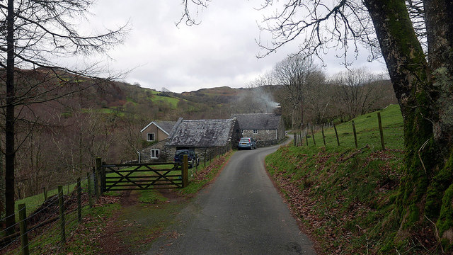
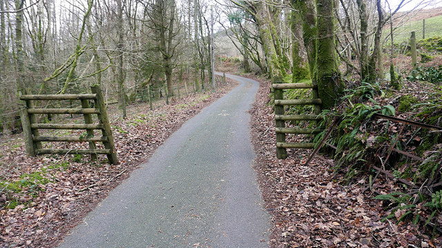
The wood offers various walking trails and paths, allowing visitors to immerse themselves in nature and soak up the peaceful ambiance. Nature enthusiasts can revel in the tranquility of the forest, capturing stunning photographs or simply enjoying a leisurely stroll through the ancient trees.

Bryntirion Wood is a cherished natural treasure of Merionethshire, attracting locals and tourists alike. Its breathtaking beauty, diverse ecosystem, and serene aura make it an ideal destination for those seeking solace in the tranquility of nature.

If you have any feedback on the listing, please let us know in the comments section below.

Bryntirion Wood Images

Images are sourced within 2km of 52.753803/-3.9679989 or Grid Reference SH6719. Thanks to Geograph Open Source API. All images are credited.

Old barn on Banc-y-Frân A solid but roofless stone barn sits on a small rise in the adjacent field. Diffwys can be seen in the distance.
Old barn on Banc-y-Frân
A solid but roofless stone barn sits on a small rise in the adjacent field. Diffwys can be seen in the distance.
Descending Banc-y-Frân Just north of the public road, with the hill of Uwch Mynydd on the right and Cadair Idris in the distance.
Descending Banc-y-Frân
Just north of the public road, with the hill of Uwch Mynydd on the right and Cadair Idris in the distance.
Road to Cwm-Mynach
Road to Cwm-Mynach
Ladder Stile Ladder stile over dry stone wall near to Bontddu, Gwynedd.
Ladder Stile
Ladder stile over dry stone wall near to Bontddu, Gwynedd.
Minor Road Minor road looking south near to Pen-y-Bryn, Gwynedd.
Minor Road
Minor road looking south near to Pen-y-Bryn, Gwynedd.
Grazing near Cae Goronwy farm With Diffwys providing the background.
Grazing near Cae Goronwy farm
With Diffwys providing the background.
Field with a dramatic backdrop The imposing skyline of Cadair Idris never fails to impress.
Field with a dramatic backdrop
The imposing skyline of Cadair Idris never fails to impress.
Tree and field by Banc-y-Frân With Diffwys in the background.
Tree and field by Banc-y-Frân
With Diffwys in the background.
A win-win situation at Banc-y-Frân  (Crow Bank) The drainage has been cleared and the extracted material has been used to repair the track surface. Good idea!
A win-win situation at Banc-y-Frân (Crow Bank)
The drainage has been cleared and the extracted material has been used to repair the track surface. Good idea!
Ty'n-y-coed Cottages in the 'Hidden Valley'.
Ty'n-y-coed
Cottages in the 'Hidden Valley'.
Boundary in Cwm Mynach Just to the south of Ty'n-y-coed, still marked as gated on current maps but the gate stands disused by the bank. There are other gates on this road through the valley which are still in use.
Boundary in Cwm Mynach
Just to the south of Ty'n-y-coed, still marked as gated on current maps but the gate stands disused by the bank. There are other gates on this road through the valley which are still in use.
Old Milestone by Uwch Mynydd, north of Bontddu, Llanelltyd Parish North of the A497 from Bontddu, in parish of Llanelltyd (Gwynedd District), CAE HIR, about 1½ miles North West of village by the side of a track going over the moor to Tal-y-bont.

Inscription reads:-
(North East side) : FROM HARLECH X M :
(South West side) : V FROM TAL Y BONT iiiii M. :

Grade II Listed by Cadw.
Reference Number 16160: <span class="nowrap"><a title="https://cadwpublic-api.azurewebsites.net/reports/listedbuilding/FullReport?lang=&id=16160" rel="nofollow ugc noopener" href="https://cadwpublic-api.azurewebsites.net/reports/listedbuilding/FullReport?lang=&id=16160">Link</a><img style="margin-left:2px;" alt="External link" title="External link - shift click to open in new window" src="https://s1.geograph.org.uk/img/external.png" width="10" height="10"/></span>

Surveyed 

Milestone Society National ID: MER_HLBM10
Old Milestone by Uwch Mynydd, north of Bontddu, Llanelltyd Parish
North of the A497 from Bontddu, in parish of Llanelltyd (Gwynedd District), CAE HIR, about 1½ miles North West of village by the side of a track going over the moor to Tal-y-bont. Inscription reads:- (North East side) : FROM HARLECH X M : (South West side) : V FROM TAL Y BONT iiiii M. : Grade II Listed by Cadw. Reference Number 16160: LinkExternal link Surveyed Milestone Society National ID: MER_HLBM10
Entrance to Cae Goronwy Near the end of the metalled road from Bontddu.
Entrance to Cae Goronwy
Near the end of the metalled road from Bontddu.
The Afon Cwm-mynach
The Afon Cwm-mynach
The public footpath at Pont Garth-gell
Ty'n-y-coed in Cwm-Mynach
The Afon Cwm-mynach
The Afon Cwm-mynach
Farmland above Bontddu
Show me another place!

Bryntirion Wood is located at Grid Ref: SH6719 (Lat: 52.753803, Lng: -3.9679989)

Unitary Authority: Gwynedd

Police Authority: North Wales

What 3 Words

///dreaming.homecare.overtones. Near Dolgellau, Gwynedd

Related Wikis

Bontddu

Bontddu (meaning Black bridge) is a small settlement just east of Barmouth, near the town of Dolgellau in Gwynedd, Wales. It is in the community of Llanelltyd...

Clogau Gold Mine

The Clogau (pronounced "clog-eye") Gold Mine (also known as Clogau St David's) is a gold mine near Bontddu in North Wales. == History == The Clogau mine...

Mawddach Trail

The Mawddach Trail (Welsh: Llwybr Mawddach) is a cycle path route, part of Lôn Las Cymru, which runs for some 8 miles (13 km) from Dolgellau (52.7446°N...

Borthwnog

Borthwnog is a family name given to the Borthwnog estate in Gwynedd, north-west Wales. Borthwnog Hall was the Manor House of the estate which encompassed...

Penmaenpool

Penmaenpool (Welsh: Llynpenmaen) is a hamlet on the south side of the estuary of the River Mawddach in Wales, near Dolgellau. A Grade II listed toll bridge...

Penmaenpool railway station

Penmaenpool railway station at Penmaenpool in Gwynedd, North Wales, was formerly a station on the Dolgelly [sic] branch of the Aberystwith and Welsh Coast...

St Philip's Church, Caerdeon

St Philip's Church, Caerdeon, near Barmouth, in Gwynedd, North Wales, is a redundant church and a Grade I listed building. The church was built in 1862...

Tyn-y-Coed Farmhouse

Tyn-y-Coed Farmhouse is a grade II Listed Building in Caerdeon, Barmouth, Gwynedd. This Georgian farm house was built in 1756 and later extended and altered...

Nearby Amenities

Located within 500m of 52.753803,-3.9679989
Source: PGS
Lat/Long: 52.7496397/-3.9664581
Source: PGS
Lat/Long: 52.749979/-3.9648257
Source: PGS
Lat/Long: 52.7499624/-3.9645763
Source: PGS
Lat/Long: 52.750081/-3.9642469
Hazard Forward: falling_rocks
Lat/Long: 52.751885/-3.9640256
Bus Stop
Bus: yes
Kerb: raised
Naptan AtcoCode: 5400AWD70010
Naptan NaptanCode: gwnatjw
Public Transport: platform
Shelter: no
Timetable: yes
Lat/Long: 52.7514308/-3.9671305
Bontddu
Place: village
Wikidata: Q3402560
Lat/Long: 52.7507205/-3.9682392
Figra Bridge
Place: locality
Lat/Long: 52.7531896/-3.9748012
Historic: memorial
Memorial: war_memorial
Lat/Long: 52.7510928/-3.9687565
Bus Stop
Bench: no
Bus: yes
Naptan AtcoCode: 5400WDB22925
Naptan NaptanCode: gwntgaw
Public Transport: platform
Shelter: no
Lat/Long: 52.7513431/-3.9673447
Post Box
Lat/Long: 52.7525035/-3.9621444
Man Made: adit
Lat/Long: 52.7537597/-3.9737518
Designation: public_footpath
Foot: designated
Prow Ref: Llanelltyd No 47
Lat/Long: 52.7538282/-3.9747143
Bryn Hyfryd
Internet Access: wlan
Phone: +44 7855 804709
Tourism: apartment
Lat/Long: 52.7516503/-3.9673109
Man Made: adit
Lat/Long: 52.7532627/-3.9750794
Power: pole
Lat/Long: 52.7507505/-3.9706591
Power: pole
Lat/Long: 52.7507292/-3.9708346
Power: pole
Lat/Long: 52.750679/-3.9719616
Power: pole
Lat/Long: 52.7507109/-3.9703377
Power: pole
Lat/Long: 52.7508399/-3.9701467
Power: pole
Lat/Long: 52.7511106/-3.9697516
Power: pole
Lat/Long: 52.7513906/-3.9693593
Ford: yes
Lat/Long: 52.752784/-3.9752356
Power: pole
Lat/Long: 52.7504153/-3.9704717
Power: pole
Lat/Long: 52.7501563/-3.9701877
Power: pole
Lat/Long: 52.7497728/-3.9697576
Power: pole
Lat/Long: 52.7564666/-3.9736848
Man Made: adit
Lat/Long: 52.75181/-3.9730946
Man Made: adit
Lat/Long: 52.7518413/-3.9736267
Man Made: adit
Lat/Long: 52.751785/-3.9740106
Direction: 165
Generator Method: photovoltaic
Generator Output Electricity: yes
Generator Solar Modules: 11
Generator Source: solar
Generator Type: solar_photovoltaic_panel
Location: roof
Power: generator
Lat/Long: 52.7513496/-3.9667873
Direction: 165
Generator Method: photovoltaic
Generator Output Electricity: yes
Generator Solar Modules: 10
Generator Source: solar
Generator Type: solar_photovoltaic_panel
Location: roof
Power: generator
Lat/Long: 52.7513268/-3.9669348
Direction: 165
Generator Method: photovoltaic
Generator Output Electricity: yes
Generator Solar Modules: 18
Generator Source: solar
Generator Type: solar_photovoltaic_panel
Location: roof
Power: generator
Lat/Long: 52.7516077/-3.9698155
The data included in this document is from www.openstreetmap.org. The data is made available under ODbL.

Have you been to Bryntirion Wood?

Leave your review of Bryntirion Wood below (or comments, questions and feedback).