Allt Brynarth

Wood, Forest in Cardiganshire

Wales

Allt Brynarth

Road to Brynarth
Road to Brynarth Credit: David Smith

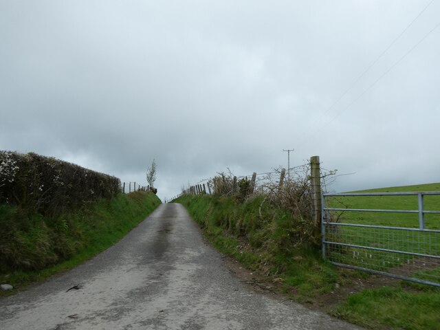
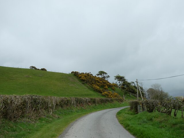
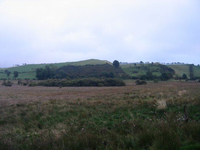
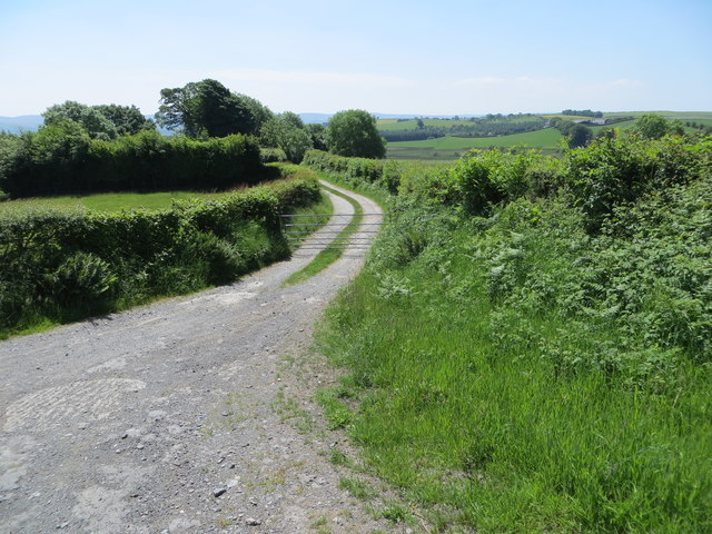
Allt Brynarth is a picturesque woodland area located in the rural county of Cardiganshire, Wales. Covering an expansive area of land, this forest is a haven for nature enthusiasts and those seeking tranquility amidst the breathtaking beauty of the Welsh countryside.

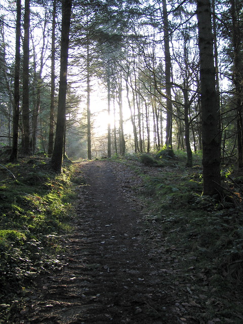
The woodland is characterized by dense foliage, towering trees, and a diverse range of flora and fauna. Ancient oaks, beech, and ash trees dominate the landscape, providing a lush and vibrant canopy that offers shade and shelter to the various wildlife that call this forest their home. The forest floor is carpeted with ferns, mosses, and wildflowers, creating a vibrant tapestry of color and texture.

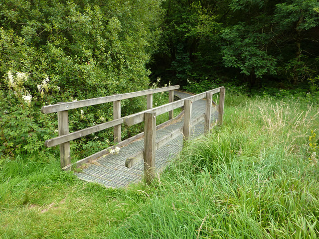
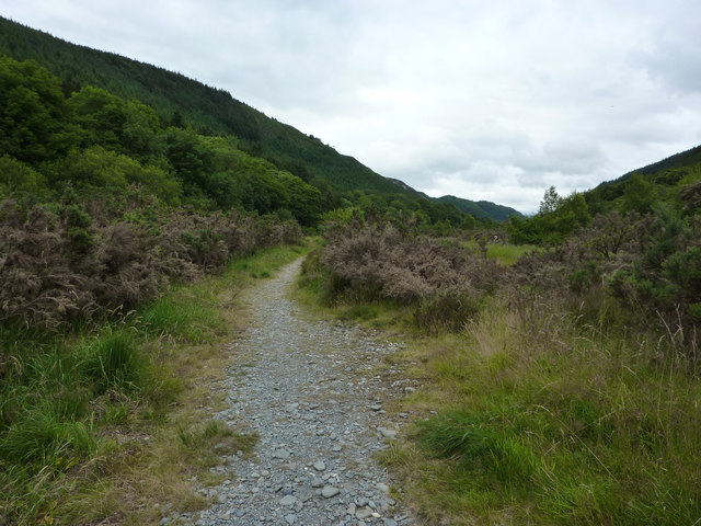
Allt Brynarth is crisscrossed by a network of well-maintained walking trails, allowing visitors to explore the forest at their own pace. These paths wind through the woodland, leading to hidden glades, babbling brooks, and breathtaking viewpoints that offer sweeping vistas of the surrounding countryside. The tranquility of the forest is only interrupted by the gentle chirping of birds and the rustling of leaves underfoot.

In addition to its natural beauty, Allt Brynarth is also home to a wide variety of wildlife. Deer, foxes, and badgers can often be spotted roaming the forest, while a multitude of bird species, including woodpeckers and owls, make their nests among the trees. The forest also supports a diverse array of insects, amphibians, and reptiles, adding to its ecological significance.

Allt Brynarth is a true gem of Cardiganshire, offering visitors a chance to immerse themselves in the wonders of nature and experience the peace and serenity of this enchanting woodland.

If you have any feedback on the listing, please let us know in the comments section below.

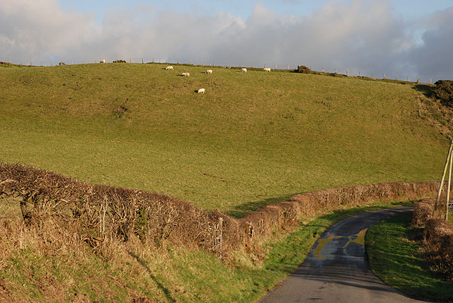
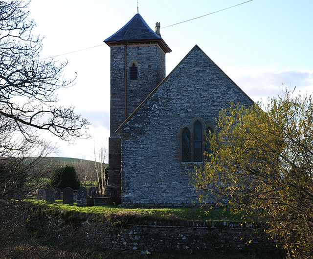
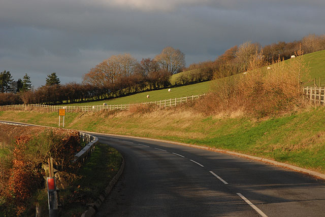
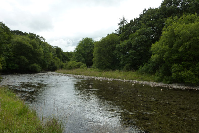
Allt Brynarth Images

Images are sourced within 2km of 52.321601/-3.9430943 or Grid Reference SN6771. Thanks to Geograph Open Source API. All images are credited.

Road to Brynarth
Road to Brynarth
Grass and gorse above the road near Pantyddafad
Cors Ian Mae Cors Ian yn warchodfa bywyd gwyllt Ymddiriedolaeth Natur De a Gorllewin Cymru ger Lledrod gyda mynediad naill ai ar hyd llwybr gyferbyn a Gwesty Brynarth neu trwy'r fynedfa wrth ochr y ffordd rhyw 100 o latheni lan y lôn. / Cors Ian is a reserve of the Wildlife Trust of South and West Wales near Lledrod and can be accessed either from the footpath opposite Brynarth Guesthouse or from the roadside entrance about 100 yards up the lane.
Cors Ian
Mae Cors Ian yn warchodfa bywyd gwyllt Ymddiriedolaeth Natur De a Gorllewin Cymru ger Lledrod gyda mynediad naill ai ar hyd llwybr gyferbyn a Gwesty Brynarth neu trwy'r fynedfa wrth ochr y ffordd rhyw 100 o latheni lan y lôn. / Cors Ian is a reserve of the Wildlife Trust of South and West Wales near Lledrod and can be accessed either from the footpath opposite Brynarth Guesthouse or from the roadside entrance about 100 yards up the lane.
Eglwys Gwnnws / Gwnnws Church Eglwys Gwnnws ger Tynygraig / Gwnnws Church near Tynygraig
Eglwys Gwnnws / Gwnnws Church
Eglwys Gwnnws ger Tynygraig / Gwnnws Church near Tynygraig
Grazing on the hill Sheep graze on the small steep-sided hill, warmed by the late afternoon sun and protected from the cold north-easterly wind.
Grazing on the hill
Sheep graze on the small steep-sided hill, warmed by the late afternoon sun and protected from the cold north-easterly wind.
Eglwys Cwnnws A remote and rather nice church, similar in some ways to the one at Ysbyty Ystwyth.
Eglwys Cwnnws
A remote and rather nice church, similar in some ways to the one at Ysbyty Ystwyth.
The B4340 leaving Tynygraig One of the few good bits of road. The sign ahead warns of the number of accidents in recent years, on what is the popular route between Aberystwyth and Pontrhydfendigaid, but which has a number of tricky sections.
The B4340 leaving Tynygraig
One of the few good bits of road. The sign ahead warns of the number of accidents in recent years, on what is the popular route between Aberystwyth and Pontrhydfendigaid, but which has a number of tricky sections.
Afon Ystwyth near Grogwynion Nature Reserve
Boardwalk at Grogwynion Nature Reserve
Path through Grogwynion Nature Reserve Alongside the Afon Ystwyth. Heavy metal pollution from mining higher up Cwm Ystwyth means that this area is relatively clear of trees. Heather dominates.
Back in 1979 and 1980 this was the site of a free festival - the Psilocybin Fayre. <span class="nowrap"><a title="http://www.ukrockfestivals.com/Psilocybin-Festival.html" rel="nofollow ugc noopener" href="http://www.ukrockfestivals.com/Psilocybin-Festival.html">Link</a><img style="margin-left:2px;" alt="External link" title="External link - shift click to open in new window" src="https://s1.geograph.org.uk/img/external.png" width="10" height="10"/></span>
Path through Grogwynion Nature Reserve
Alongside the Afon Ystwyth. Heavy metal pollution from mining higher up Cwm Ystwyth means that this area is relatively clear of trees. Heather dominates. Back in 1979 and 1980 this was the site of a free festival - the Psilocybin Fayre. LinkExternal link
Forest path in Coed Tynybedw The path is one of several marked trails starting from the small car park at Grogwynion.  It climbs steeply out of the Ystwyth gorge, cutting off several turns in the forestry road.
Forest path in Coed Tynybedw
The path is one of several marked trails starting from the small car park at Grogwynion. It climbs steeply out of the Ystwyth gorge, cutting off several turns in the forestry road.
The wide valley of the Ystwyth near Llanafan
Coed Tynybedw Forestry Commission woodland near Llanafan
Coed Tynybedw
Forestry Commission woodland near Llanafan
Gated track to Pantyddafad Looking southward.
Gated track to Pantyddafad
Looking southward.
Llanafan church This tiny village has little more than a church and a church hall. The gravestones paint a picture of country life. The River Ystwyth runs nearby. All around are hills clad in forest.
Llanafan church
This tiny village has little more than a church and a church hall. The gravestones paint a picture of country life. The River Ystwyth runs nearby. All around are hills clad in forest.
Suspension bridge across the River Ystwyth. This forms part of a footpath with stunningly beautiful walks.
Suspension bridge across the River Ystwyth.
This forms part of a footpath with stunningly beautiful walks.
Coed Tynbedw This is the super view from a bench in this forest area. There are many waymarked walks through the trees. A stream winds its way through the forest.
Coed Tynbedw
This is the super view from a bench in this forest area. There are many waymarked walks through the trees. A stream winds its way through the forest.
Trawsgoed Railway Bridge A long-abandoned bridge on the former Carmarthen to Aberystwyth railway line marks the only road into the tiny village of Crosswood.
Trawsgoed Railway Bridge
A long-abandoned bridge on the former Carmarthen to Aberystwyth railway line marks the only road into the tiny village of Crosswood.
Show me another place!

Allt Brynarth is located at Grid Ref: SN6771 (Lat: 52.321601, Lng: -3.9430943)

Unitary Authority: Ceredigion

Police Authority: Dyfed Powys

What 3 Words

///makeovers.impulsive.timed. Near Lledrod, Ceredigion

Nearby Locations

Allt Brynarth Wenallt

Related Wikis

Wenallt

Wenallt is a hamlet in the community of Trawsgoed, Ceredigion, Wales, 10 miles (16 km) southeast of Aberystwyth. Wenallt is represented in the Senedd...

St Afan's Church, Llanafan

Saint Afan's Church (SN68387192) is located in Llanafan, 8 miles (13 km) east of Aberystwyth, Ceredigion, in Wales. == History == The original church on...

Ernest Vaughan, 7th Earl of Lisburne

Ernest Edmund Henry Malet Vaughan, 7th Earl of Lisburne KStJ (8 February 1892 – 30 June 1965), of Trawsgoed, Cardiganshire, was a Welsh nobleman. ��2...

Llanafan, Ceredigion

Llanafan is a small village between Tregaron and Aberystwyth, Ceredigion, in Wales. Llanafan is around ten miles from Aberystwyth and Tregaron. It is named...

Trawscoed fort

Trawscoed fort is a Roman auxiliary fort in Ceredigion, Wales, located near the modern settlement of Trawsgoed and is cut through by the modern B4340 road...

Trawscoed railway station

Trawscoed railway station was located on the Carmarthen to Aberystwyth Line (originally called the Manchester and Milford Railway before being transferred...

Hendre-Rhys

Hendre-Rhys is a small village in the community of Trawsgoed, Ceredigion, Wales, which is 67.8 miles (109.2 km) from Cardiff and 173 miles (278.4 km)...

Caradog Falls Halt railway station

Caradog Falls Halt railway station was one of five new halts on the Carmarthen to Aberystwyth Line (originally called the Manchester and Milford Railway...

Nearby Amenities

Located within 500m of 52.321601,-3.9430943
Source: npe
Lat/Long: 52.3256098/-3.9456939
Source: npe
Lat/Long: 52.324486/-3.9397267
Source: npe
Lat/Long: 52.3227675/-3.9361466
The data included in this document is from www.openstreetmap.org. The data is made available under ODbL.

Have you been to Allt Brynarth?

Leave your review of Allt Brynarth below (or comments, questions and feedback).