Wenallt

Settlement in Cardiganshire

Wales

Wenallt

Afon Ystwyth near Grogwynion Nature Reserve
Afon Ystwyth near Grogwynion Nature Reserve Credit: Phil Champion

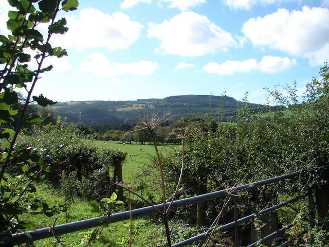
Wenallt is a small village located in the county of Cardiganshire, in Wales, United Kingdom. Situated in the picturesque countryside, it is surrounded by rolling hills and lush green fields. The village is positioned approximately 10 miles northeast of the town of Aberystwyth and is easily accessible by road.

Wenallt is known for its natural beauty and tranquility, making it a popular destination for those seeking a peaceful retreat. The village is characterized by its charming rural atmosphere, with a scattering of traditional stone cottages and farmhouses. The local community is tight-knit and friendly, reflecting the warmth and hospitality of the Welsh people.

Despite its small size, Wenallt boasts a few amenities for its residents and visitors. There is a local pub, The Red Lion, which serves as the social hub of the village. It provides a welcoming environment for locals to gather and enjoy a drink or a meal. Additionally, there is a village hall that hosts various community events and gatherings throughout the year.

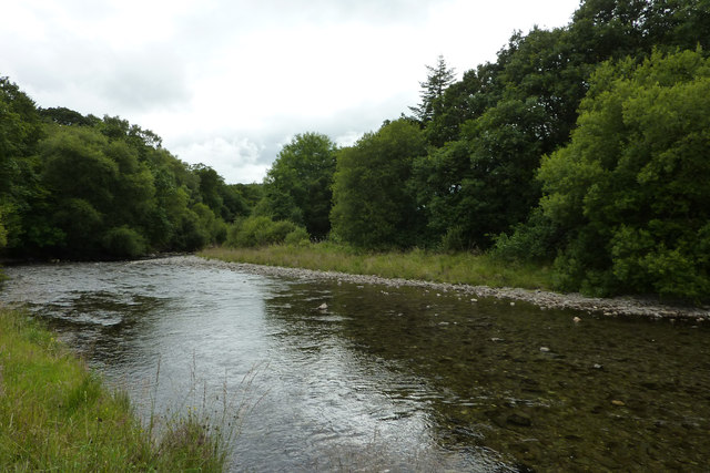
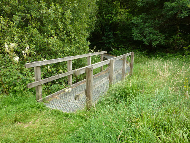
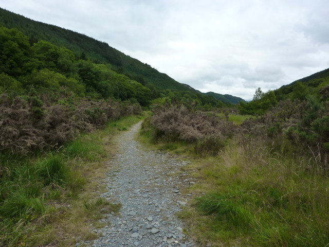
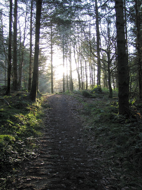
For outdoor enthusiasts, Wenallt offers ample opportunities to explore the surrounding natural beauty. The village is located near the edge of Hafod Estate, a large expanse of ancient woodland and nature reserve. Visitors can enjoy scenic walks, hikes, or simply immerse themselves in the tranquil surroundings.

In conclusion, Wenallt is a charming village in Cardiganshire, Wales, renowned for its idyllic countryside setting, warm community spirit, and proximity to natural attractions. It is a hidden gem for those seeking a peaceful retreat or a taste of traditional Welsh village life.

If you have any feedback on the listing, please let us know in the comments section below.

Wenallt Images

Images are sourced within 2km of 52.327096/-3.942991 or Grid Reference SN6771. Thanks to Geograph Open Source API. All images are credited.

Afon Ystwyth near Grogwynion Nature Reserve
Boardwalk at Grogwynion Nature Reserve
Path through Grogwynion Nature Reserve Alongside the Afon Ystwyth. Heavy metal pollution from mining higher up Cwm Ystwyth means that this area is relatively clear of trees. Heather dominates.
Back in 1979 and 1980 this was the site of a free festival - the Psilocybin Fayre. <span class="nowrap"><a title="http://www.ukrockfestivals.com/Psilocybin-Festival.html" rel="nofollow ugc noopener" href="http://www.ukrockfestivals.com/Psilocybin-Festival.html">Link</a><img style="margin-left:2px;" alt="External link" title="External link - shift click to open in new window" src="https://s1.geograph.org.uk/img/external.png" width="10" height="10"/></span>
Path through Grogwynion Nature Reserve
Alongside the Afon Ystwyth. Heavy metal pollution from mining higher up Cwm Ystwyth means that this area is relatively clear of trees. Heather dominates. Back in 1979 and 1980 this was the site of a free festival - the Psilocybin Fayre. LinkExternal link
Heathland at Grogwynion Nature Reserve Alongside the Afon Ystwyth. Heavy metal pollution from mining higher up Cwm Ystwyth means that this area is relatively clear of trees. Heather dominates.
Back in 1979 and 1980 this was the site of a free festival - the Psilocybin Fayre. <span class="nowrap"><a title="http://www.ukrockfestivals.com/Psilocybin-Festival.html" rel="nofollow ugc noopener" href="http://www.ukrockfestivals.com/Psilocybin-Festival.html">Link</a><img style="margin-left:2px;" alt="External link" title="External link - shift click to open in new window" src="https://s1.geograph.org.uk/img/external.png" width="10" height="10"/></span>
Heathland at Grogwynion Nature Reserve
Alongside the Afon Ystwyth. Heavy metal pollution from mining higher up Cwm Ystwyth means that this area is relatively clear of trees. Heather dominates. Back in 1979 and 1980 this was the site of a free festival - the Psilocybin Fayre. LinkExternal link
Forest path in Coed Tynybedw The path is one of several marked trails starting from the small car park at Grogwynion.  It climbs steeply out of the Ystwyth gorge, cutting off several turns in the forestry road.
Forest path in Coed Tynybedw
The path is one of several marked trails starting from the small car park at Grogwynion. It climbs steeply out of the Ystwyth gorge, cutting off several turns in the forestry road.
The River Ystwyth at Trawscoed From the bridge connecting the B4575 and the B4340
The River Ystwyth at Trawscoed
From the bridge connecting the B4575 and the B4340
A small stream running into the river Ystwyth at Trawscoed
Black Covert parking area Forestry Commission carpark near the river Ystwyth at Trawscoed
Black Covert parking area
Forestry Commission carpark near the river Ystwyth at Trawscoed
The wide valley of the Ystwyth near Llanafan
Coed Tynybedw Forestry Commission woodland near Llanafan
Coed Tynybedw
Forestry Commission woodland near Llanafan
Llanafan church This tiny village has little more than a church and a church hall. The gravestones paint a picture of country life. The River Ystwyth runs nearby. All around are hills clad in forest.
Llanafan church
This tiny village has little more than a church and a church hall. The gravestones paint a picture of country life. The River Ystwyth runs nearby. All around are hills clad in forest.
Suspension bridge across the River Ystwyth. This forms part of a footpath with stunningly beautiful walks.
Suspension bridge across the River Ystwyth.
This forms part of a footpath with stunningly beautiful walks.
Coed Tynbedw This is the super view from a bench in this forest area. There are many waymarked walks through the trees. A stream winds its way through the forest.
Coed Tynbedw
This is the super view from a bench in this forest area. There are many waymarked walks through the trees. A stream winds its way through the forest.
Trawsgoed Railway Bridge A long-abandoned bridge on the former Carmarthen to Aberystwyth railway line marks the only road into the tiny village of Crosswood.
Trawsgoed Railway Bridge
A long-abandoned bridge on the former Carmarthen to Aberystwyth railway line marks the only road into the tiny village of Crosswood.
Dolfor Farm
Dolfor Farm
Farmland at Trawsgoed Bach Looking south-west from almost the centre of the square.
Farmland at Trawsgoed Bach
Looking south-west from almost the centre of the square.
Timber Awaiting collection from the saw mills at Tynbedw.
Timber
Awaiting collection from the saw mills at Tynbedw.
Solar powered bus stop at Trawsgoed The lighting for this bus stop is powered from a solar panel and battery.
Solar powered bus stop at Trawsgoed
The lighting for this bus stop is powered from a solar panel and battery.
Show me another place!

Wenallt is located at Grid Ref: SN6771 (Lat: 52.327096, Lng: -3.942991)

Unitary Authority: Ceredigion

Police Authority: Dyfed Powys

What 3 Words

///congested.instead.rice. Near Lledrod, Ceredigion

Nearby Locations

Wenallt Allt Brynarth

Related Wikis

Wenallt

Wenallt is a hamlet in the community of Trawsgoed, Ceredigion, Wales, 10 miles (16 km) southeast of Aberystwyth. Wenallt is represented in the Senedd...

St Afan's Church, Llanafan

Saint Afan's Church (SN68387192) is located in Llanafan, 8 miles (13 km) east of Aberystwyth, Ceredigion, in Wales. == History == The original church on...

Ernest Vaughan, 7th Earl of Lisburne

Ernest Edmund Henry Malet Vaughan, 7th Earl of Lisburne KStJ (8 February 1892 – 30 June 1965), of Trawsgoed, Cardiganshire, was a Welsh nobleman. ��2...

Llanafan, Ceredigion

Llanafan is a small village between Tregaron and Aberystwyth, Ceredigion, in Wales. Llanafan is around ten miles from Aberystwyth and Tregaron. It is named...

Trawscoed fort

Trawscoed fort is a Roman auxiliary fort in Ceredigion, Wales, located near the modern settlement of Trawsgoed and is cut through by the modern B4340 road...

Trawscoed railway station

Trawscoed railway station was located on the Carmarthen to Aberystwyth Line (originally called the Manchester and Milford Railway before being transferred...

Hendre-Rhys

Hendre-Rhys is a small village in the community of Trawsgoed, Ceredigion, Wales, which is 67.8 miles (109.2 km) from Cardiff and 173 miles (278.4 km)...

Trawsgoed

Trawsgoed (Welsh for "Crosswood") is both a community and an estate in Ceredigion, Wales. The estate is 8 miles (13 km) southeast of Aberystwyth, and has...

Nearby Amenities

Located within 500m of 52.327096,-3.942991
Source: npe
Lat/Long: 52.3283798/-3.9472344
Source: npe
Lat/Long: 52.326547/-3.9474342
Source: npe
Lat/Long: 52.3261319/-3.9472798
Source: npe
Lat/Long: 52.3256098/-3.9456939
Source: npe
Lat/Long: 52.324486/-3.9397267
Ford: yes
Lat/Long: 52.3269872/-3.9475191
The data included in this document is from www.openstreetmap.org. The data is made available under ODbL.

Have you been to Wenallt?

Leave your review of Wenallt below (or comments, questions and feedback).