Allt Bwlch-y-gilwen

Wood, Forest in Carmarthenshire

Wales

Allt Bwlch-y-gilwen

Cyffordd o draciau / A junction of tracks Cyffordd o draciau yn Allt Cwm-dyfiog.

A junction of tracks at Allt Cwm-dyfiog
Cyffordd o draciau / A junction of tracks Credit: Alan Richards

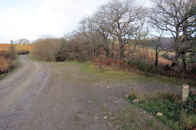
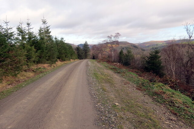
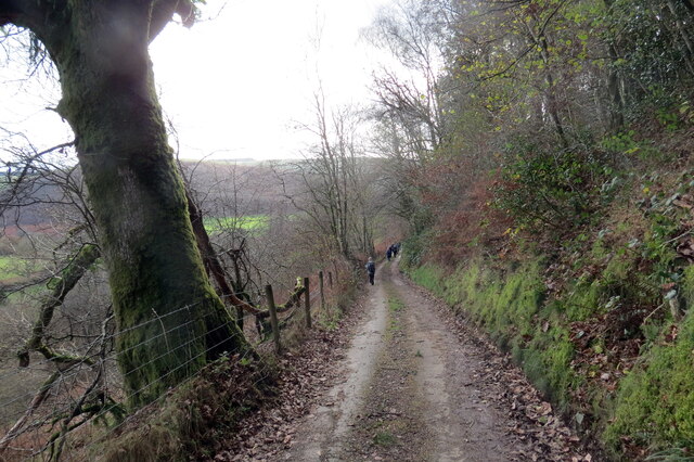
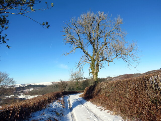
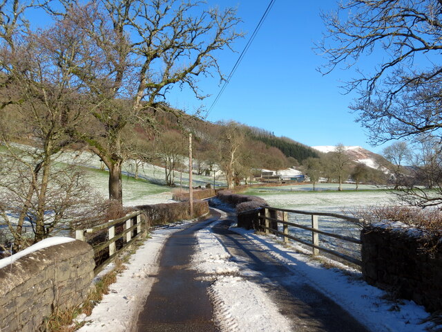
Allt Bwlch-y-gilwen is a picturesque wood located in Carmarthenshire, Wales. Situated in the heart of the Welsh countryside, this enchanting forest is renowned for its natural beauty and tranquility. Spanning over a vast area, it offers visitors a unique opportunity to immerse themselves in the wonders of nature.

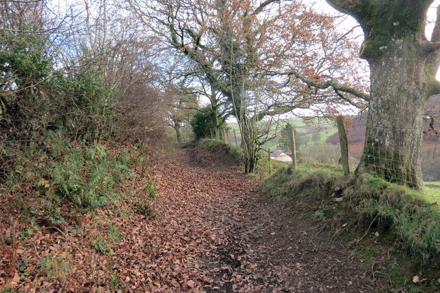
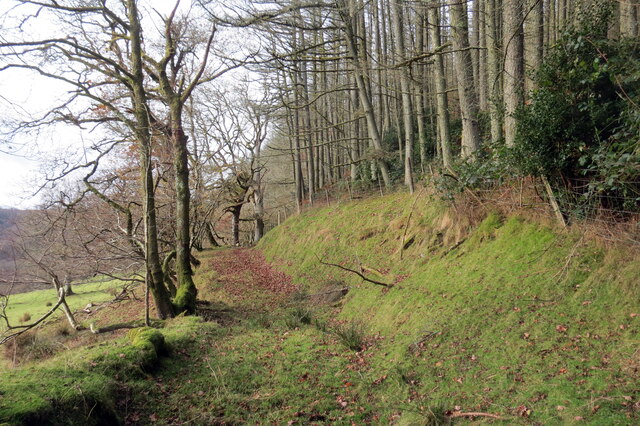
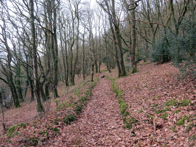
The wood is predominantly composed of a diverse range of deciduous trees, including oak, beech, and birch. These tall and majestic trees create a dense canopy, providing shade and protection for the lush undergrowth below. The forest floor is carpeted with a variety of flora, such as bluebells, ferns, and wild garlic, which add charm and color to the woodland.

Allt Bwlch-y-gilwen is home to a diverse array of wildlife, making it a haven for nature enthusiasts. Visitors may catch glimpses of red squirrels, badgers, and various bird species, including woodpeckers and owls. The forest also houses a number of small streams and a picturesque waterfall, adding to its idyllic charm.

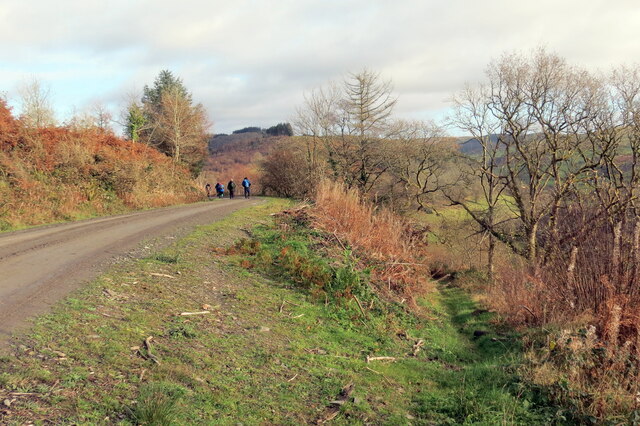
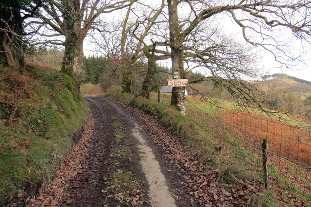
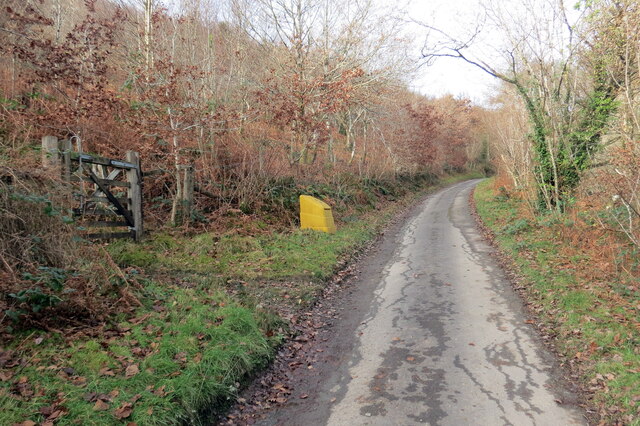
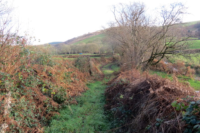
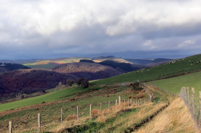
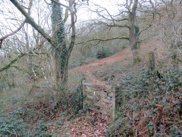
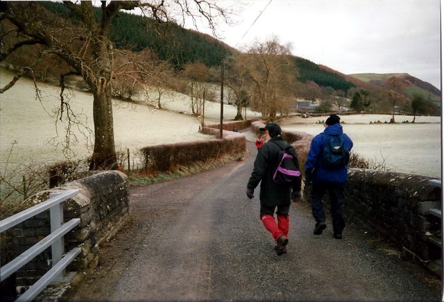
The wood offers numerous walking trails and footpaths, allowing visitors to explore its beauty at their own pace. These paths wind through the forest, offering breathtaking views of the surrounding countryside. The wood is a popular destination for hikers, families, and nature lovers, who often come to relax, picnic, or simply enjoy the serene atmosphere.

Allt Bwlch-y-gilwen is a true gem of Carmarthenshire, offering a peaceful retreat from the hustle and bustle of everyday life. Its natural beauty and diverse wildlife make it a must-visit destination for anyone seeking solace and tranquility in the heart of Wales.

If you have any feedback on the listing, please let us know in the comments section below.

Allt Bwlch-y-gilwen Images

Images are sourced within 2km of 52.069269/-3.9435563 or Grid Reference SN6642. Thanks to Geograph Open Source API. All images are credited.
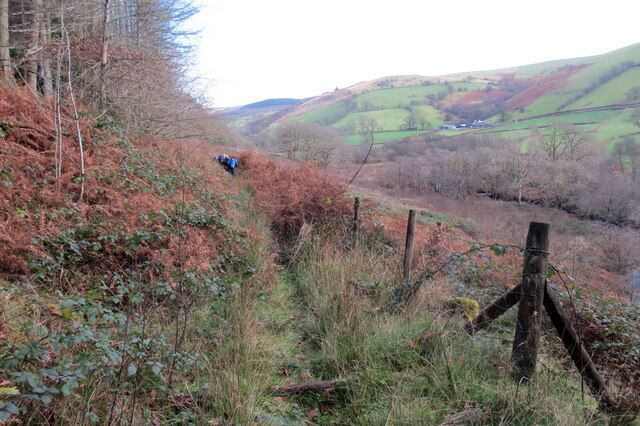
Cyffordd o draciau / A junction of tracks Cyffordd o draciau yn Allt Cwm-dyfiog.

A junction of tracks at Allt Cwm-dyfiog
Cyffordd o draciau / A junction of tracks
Cyffordd o draciau yn Allt Cwm-dyfiog. A junction of tracks at Allt Cwm-dyfiog
Trac y goedwigaeth / Forestry track Trac y goedwigaeth ger Penlan-dolau.

A forestry track near Penlan-dolau (trans. hilltop of meadows)
Trac y goedwigaeth / Forestry track
Trac y goedwigaeth ger Penlan-dolau. A forestry track near Penlan-dolau (trans. hilltop of meadows)
Allt Cwm-dyfiog Llwybr cyhoeddus yn gadael y trac yn Allt Cwm-dyfiog.

A public footpath exits the track at Allt Cwm-dyfiog.
Allt Cwm-dyfiog
Llwybr cyhoeddus yn gadael y trac yn Allt Cwm-dyfiog. A public footpath exits the track at Allt Cwm-dyfiog.
Heol ger Bwlch-y-gilwen / Road near Bwlch-y-gilwen Heol fach ger anhedd-dy o'r enw Bwlch-y-gilwen.

A minor road near a property known as Bwlch-y-gilwen (trans. white nook pass)
Heol ger Bwlch-y-gilwen / Road near Bwlch-y-gilwen
Heol fach ger anhedd-dy o'r enw Bwlch-y-gilwen. A minor road near a property known as Bwlch-y-gilwen (trans. white nook pass)
Heol yn Allt Bwlch-y-gilwen / A road at Allt Bwlch-y-gilwen Heol fach yn mynd i lawr y waered yn Allt Bwlch-y-gilwen.

A minor road descending the hill at Allt Bwlch-y-gilwen (trans. fair nook pass).
Heol yn Allt Bwlch-y-gilwen / A road at Allt Bwlch-y-gilwen
Heol fach yn mynd i lawr y waered yn Allt Bwlch-y-gilwen. A minor road descending the hill at Allt Bwlch-y-gilwen (trans. fair nook pass).
Llwybr Allt Bwlch-y-gelain / Allt Bwlch-y-gelain Llwybr yn gadael yr heol fach o dan Allt Bwlch-y-gilwen.

A path exits the road beneath Allt Bwlch-y-gilwen.
Llwybr Allt Bwlch-y-gelain / Allt Bwlch-y-gelain
Llwybr yn gadael yr heol fach o dan Allt Bwlch-y-gilwen. A path exits the road beneath Allt Bwlch-y-gilwen.
Llwybr Aber-Mangoed / Aber-Mangoed path Llwybr yn mynd i gyfeiriad Ffarm Aber-Mangoed.

A path heading in the direction of Aber-Mangoed Farm.
 (trans. confluence of the Mangoed stream).
Llwybr Aber-Mangoed / Aber-Mangoed path
Llwybr yn mynd i gyfeiriad Ffarm Aber-Mangoed. A path heading in the direction of Aber-Mangoed Farm. (trans. confluence of the Mangoed stream).
Llwybr Aber-Mangoed / Aber-Mangoed path Llwybr yn mynd i gyfeiriad Ffarm Aber-Mangoed.

A path heading towards Aber-Mangoed Farm (trans. confluence of the Mangoed stream).
Llwybr Aber-Mangoed / Aber-Mangoed path
Llwybr yn mynd i gyfeiriad Ffarm Aber-Mangoed. A path heading towards Aber-Mangoed Farm (trans. confluence of the Mangoed stream).
Llwybr Aber-Mangoed / Aber-Mangoed path Cerddwyr yn dilyn llwybr o dan Allt Aber-Mangoed.

Walkers following a path below Allt Aber-Mangoed (trans. wooded slope near the confluence of the Mangoed stream).
Llwybr Aber-Mangoed / Aber-Mangoed path
Cerddwyr yn dilyn llwybr o dan Allt Aber-Mangoed. Walkers following a path below Allt Aber-Mangoed (trans. wooded slope near the confluence of the Mangoed stream).
Llwybr ger Ffarm Brynteg / Path near Brynteg Farm Llwybr yn agosau at yr heol ger Ffarm Brynteg.

A path approaches the road near Brynteg Farm (trans. fairhill).
Llwybr ger Ffarm Brynteg / Path near Brynteg Farm
Llwybr yn agosau at yr heol ger Ffarm Brynteg. A path approaches the road near Brynteg Farm (trans. fairhill).
Hen heol i Gwmcothi  / Old road to Cwmcothi Hen heol sy wedi ei hisraddio i lwybr troed yn mynd i lawr y waered i gyfeiriad Cwmcothi.

An old road now downgraded to a footpath descends the hill towards Cwmcothi (trans. Cothi valley).
Hen heol i Gwmcothi / Old road to Cwmcothi
Hen heol sy wedi ei hisraddio i lwybr troed yn mynd i lawr y waered i gyfeiriad Cwmcothi. An old road now downgraded to a footpath descends the hill towards Cwmcothi (trans. Cothi valley).
Llwyr ger Glan Meddyg / Path near Glan Meddyg Heol fynedfa a llwybr cyhoeddus ger Ffarm Glan Meddyg.

An access road and public footpath near Glan Meddyg Farm (trans. bank of the ?physician's stream).
Llwyr ger Glan Meddyg / Path near Glan Meddyg
Heol fynedfa a llwybr cyhoeddus ger Ffarm Glan Meddyg. An access road and public footpath near Glan Meddyg Farm (trans. bank of the ?physician's stream).
Tuag at Gwm Cothi / Towards Cwm Cothi Llwybr troed cyhoeddus yn mynd i lawr y waered tuag ay Gwm Cothi.

A public footpath descending towards Cwm Cothi (trans. [river] Cothi valley).
Tuag at Gwm Cothi / Towards Cwm Cothi
Llwybr troed cyhoeddus yn mynd i lawr y waered tuag ay Gwm Cothi. A public footpath descending towards Cwm Cothi (trans. [river] Cothi valley).
Pont dros Afon Cothi / Bridge over Afon Cothi Heol fach wledig yn croesi pont sy'n rhychwantu Afon Cothi.

A minor rural road crosses a bridge spanning Afon Cothi.
Pont dros Afon Cothi / Bridge over Afon Cothi
Heol fach wledig yn croesi pont sy'n rhychwantu Afon Cothi. A minor rural road crosses a bridge spanning Afon Cothi.
Llwybr ceffyl Allt Dinbeth / Allt Dinbeth bridleway Llwybr ceffyl ar droed Allt Dinbeth.

A bridleway at the foot of Allt Dinbeth (trans. wooded hill of ?_____ fort).
Llwybr ceffyl Allt Dinbeth / Allt Dinbeth bridleway
Llwybr ceffyl ar droed Allt Dinbeth. A bridleway at the foot of Allt Dinbeth (trans. wooded hill of ?_____ fort).
Llwybr Glan Meddyg Path Cerddwyr yn dilyn llwybr cyhoeddus i lawr y waered i gyfeiriad Ffarm Glan Meddyg yn y pellter.

Walkers descending along a public footpath in the direction of Glan Meddyg Farm (trans. bank of the doctor(?) stream)
Llwybr Glan Meddyg Path
Cerddwyr yn dilyn llwybr cyhoeddus i lawr y waered i gyfeiriad Ffarm Glan Meddyg yn y pellter. Walkers descending along a public footpath in the direction of Glan Meddyg Farm (trans. bank of the doctor(?) stream)
Ger Ffarm Brynteg / Near Brynteg Farm Cerddwyr yn croesi pont sy'n rhychwantu Afon Cothi wrth ddilyn yr heol tuag at Gwrtycadno.

Walkers crossing the bridge which spans the Cothi River while following the road toward Cwrtycadno (trans. fox court).
Ger Ffarm Brynteg / Near Brynteg Farm
Cerddwyr yn croesi pont sy'n rhychwantu Afon Cothi wrth ddilyn yr heol tuag at Gwrtycadno. Walkers crossing the bridge which spans the Cothi River while following the road toward Cwrtycadno (trans. fox court).
Show me another place!

Allt Bwlch-y-gilwen is located at Grid Ref: SN6642 (Lat: 52.069269, Lng: -3.9435563)

Unitary Authority: Carmarthenshire

Police Authority: Dyfed Powys

What 3 Words

///finest.bearable.apply. Near Llansawel, Carmarthenshire

Related Wikis

Cynwyl Gaeo

Cynwyl Gaeo is a parish and community located in rural Carmarthenshire, Wales, near the boundary with Ceredigion, in the upper Cothi valley about halfway...

Dolaucothi Estate

The Dolaucothi Estate (also Dolaucothy) is situated about 1 mile (1.6 km) north-west of the village of Caio up the Cothi Valley in the community of Cynwyl...

Ffarmers

Ffarmers is a village near Lampeter, in the north of Carmarthenshire, Wales. It was named after the old "Farmers' Arms" public house, which is now closed...

Pumsaint

Pumsaint is a village in Carmarthenshire, Wales, halfway between Llanwrda and Lampeter on the A482 in the valley of the Afon Cothi. It forms part of the...

Dolaucothi Gold Mines

The Dolaucothi Gold Mines (pronounced [ˌdɔlaiˈkɔθɪ]; Welsh: Mwynfeydd Aur Dolaucothi) (grid reference SN662403), also known as the Ogofau Gold Mine, are...

Afon Twrch, Carmarthenshire

The Afon Twrch is a short river in Carmarthenshire, West Wales. It joins the River Cothi (itself a left-bank tributary of the River Towy) at the village...

Luentinum

Luentinum or Loventium refers to the Roman fort at Pumsaint, Carmarthenshire. The 1.9 hectares (4.7 acres) site lies either side of the A482 in Pumsaint...

Llanycrwys

Llanycrwys is a hamlet and community located in Carmarthenshire, Wales. Situated in the historical Cayo Hundred in the Union of Lampeter, it is situated...

Nearby Amenities

Located within 500m of 52.069269,-3.9435563
Ford: yes
Lat/Long: 52.070394/-3.9417943
Ford: yes
Lat/Long: 52.0682165/-3.9405961
The data included in this document is from www.openstreetmap.org. The data is made available under ODbL.

Have you been to Allt Bwlch-y-gilwen?

Leave your review of Allt Bwlch-y-gilwen below (or comments, questions and feedback).