Allt y Bwllfa
Wood, Forest in Carmarthenshire
Wales
Allt y Bwllfa
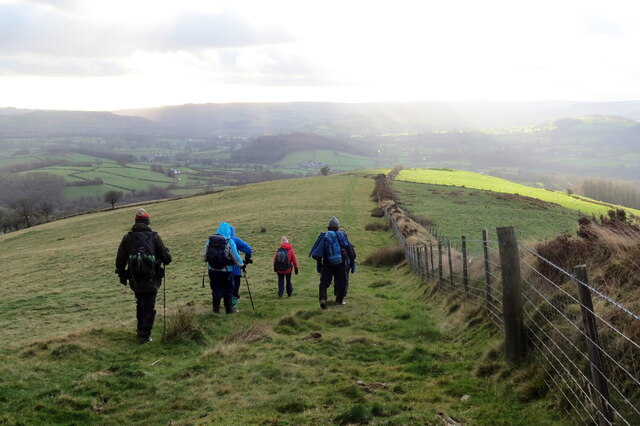
Allt y Bwllfa is a picturesque woodland located in Carmarthenshire, Wales. Covering an area of approximately 100 hectares, it is a popular destination for nature enthusiasts and outdoor adventurers. The woodland is situated on the southern slopes of the Black Mountain, offering stunning panoramic views of the surrounding countryside.
The main feature of Allt y Bwllfa is its diverse range of trees and plant species. The forest is predominantly composed of native broadleaf trees, including oak, beech, and ash. These trees provide a rich habitat for a variety of wildlife, such as birds, squirrels, and deer.
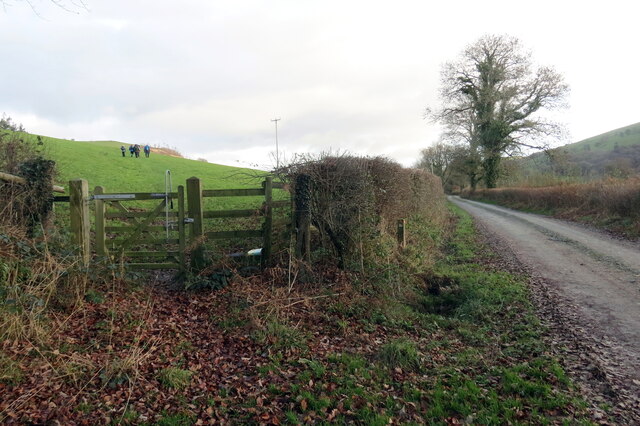
Visitors to Allt y Bwllfa can enjoy a number of walking trails that wind through the woodland. These trails offer a chance to explore the natural beauty of the area and observe the wildlife in its natural habitat. The forest is also home to a network of mountain biking trails, which attract many cycling enthusiasts.
In addition to its natural beauty, Allt y Bwllfa has historical significance. The woodland was once part of an extensive estate owned by the local gentry. Remnants of this past can still be seen in the form of old stone walls and ruins of buildings.
Overall, Allt y Bwllfa is a captivating woodland that offers a tranquil escape from the bustling city life. Whether it be for a leisurely walk or an exhilarating bike ride, this forest is a must-visit destination for nature lovers and outdoor enthusiasts.
If you have any feedback on the listing, please let us know in the comments section below.
Allt y Bwllfa Images
Images are sourced within 2km of 52.03476/-3.9413007 or Grid Reference SN6639. Thanks to Geograph Open Source API. All images are credited.
![Llwybr yn gadael yr heol / Path exiting the road Llwybr yn gadael heol fach ger Mwyngloddiau Aur Dolaucothi.
Path exiting a minor road near the Dolaucothi Goldmines (trans. Cothi [river] meadows).](https://s0.geograph.org.uk/geophotos/07/03/08/7030836_ae53f00f.jpg)


Allt y Bwllfa is located at Grid Ref: SN6639 (Lat: 52.03476, Lng: -3.9413007)
Unitary Authority: Carmarthenshire
Police Authority: Dyfed Powys
What 3 Words
///fizzled.gliders.resettle. Near Llansawel, Carmarthenshire
Nearby Locations
Related Wikis

Caio, Carmarthenshire
Caio (or Caeo) is a village in the county of Carmarthenshire, south-west Wales, sited near to the Dolaucothi Gold Mines. == Location == It is located between...

Dolaucothi Gold Mines
The Dolaucothi Gold Mines (pronounced [ˌdɔlaiˈkɔθɪ]; Welsh: Mwynfeydd Aur Dolaucothi) (grid reference SN662403), also known as the Ogofau Gold Mine, are...

Dolaucothi Estate
The Dolaucothi Estate (also Dolaucothy) is situated about 1 mile (1.6 km) north-west of the village of Caio up the Cothi Valley in the community of Cynwyl...

Luentinum
Luentinum or Loventium refers to the Roman fort at Pumsaint, Carmarthenshire. The 1.9 hectares (4.7 acres) site lies either side of the A482 in Pumsaint...

Afon Twrch, Carmarthenshire
The Afon Twrch is a short river in Carmarthenshire, West Wales. It joins the River Cothi (itself a left-bank tributary of the River Towy) at the village...

Pumsaint
Pumsaint is a village in Carmarthenshire, Wales, halfway between Llanwrda and Lampeter on the A482 in the valley of the Afon Cothi. It forms part of the...

Crugybar
Crugybar is a village in Carmarthenshire, Wales, located between Talley and Pumsaint. It is roughly of equal distance from Lampeter, Llandovery and Llandeilo...

Cynwyl Gaeo
Cynwyl Gaeo is a parish and community located in rural Carmarthenshire, Wales, near the boundary with Ceredigion, in the upper Cothi valley about halfway...
Nearby Amenities
Located within 500m of 52.03476,-3.9413007Have you been to Allt y Bwllfa?
Leave your review of Allt y Bwllfa below (or comments, questions and feedback).