Coed Dol-wreiddiog

Wood, Forest in Merionethshire

Wales

Coed Dol-wreiddiog

Below Carreg Fawr
Below Carreg Fawr Credit: Chris Andrews

Coed Dol-wreiddiog is a picturesque woodland located in Merionethshire, Wales. Covering an area of approximately 200 acres, this enchanting forest is renowned for its natural beauty and diverse range of plant and animal species.

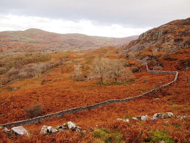
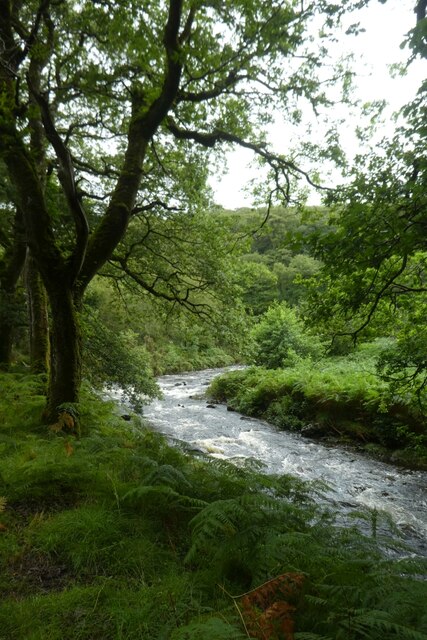
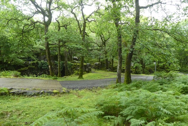
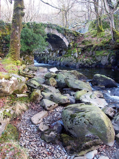
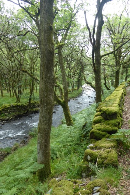
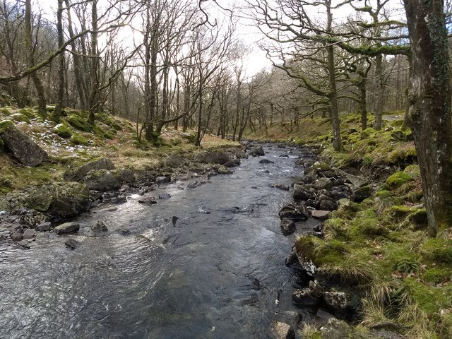
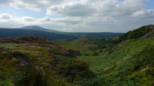
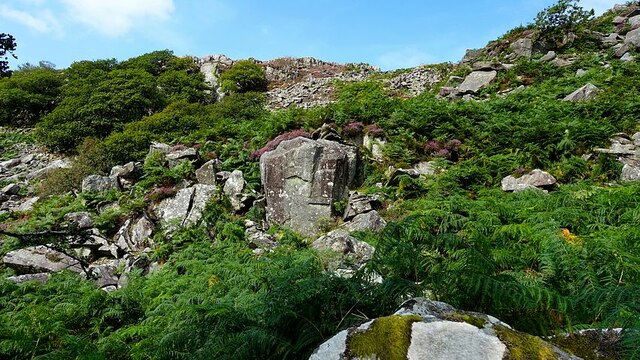
Situated in the heart of Snowdonia National Park, Coed Dol-wreiddiog is surrounded by stunning mountainous landscapes, providing visitors with breathtaking views and a sense of tranquility. The forest is mainly composed of native tree species, including oak, birch, and beech, which form a dense canopy overhead, creating a cool and shaded environment.

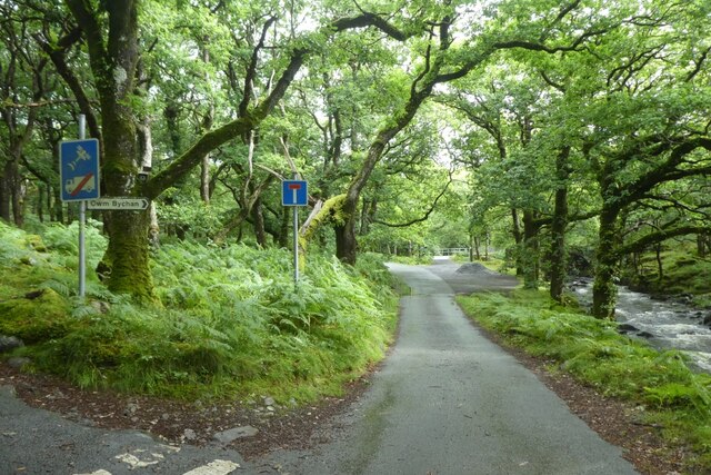
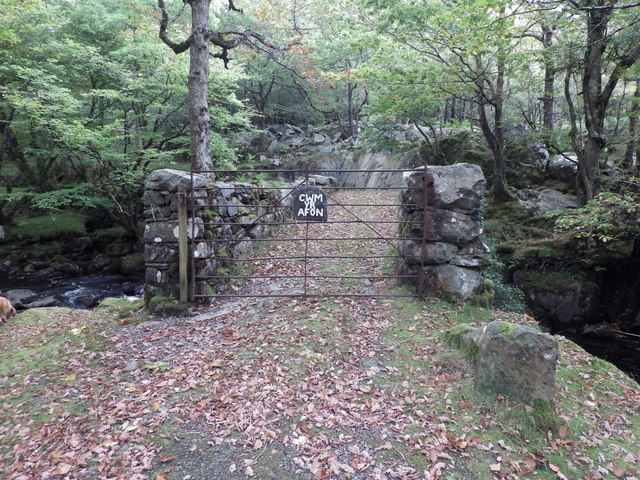
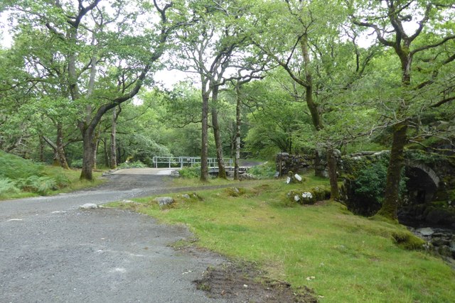
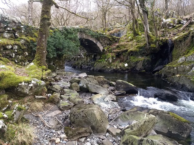
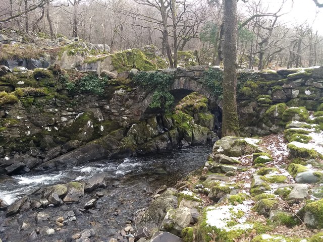
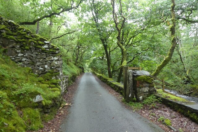
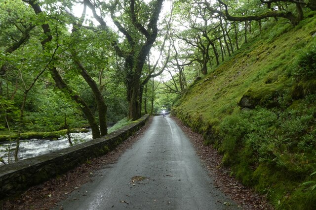
The woodland is crisscrossed by a network of walking trails, allowing visitors to explore its hidden treasures at their own pace. These paths lead to various points of interest, such as secluded waterfalls, ancient ruins, and vibrant wildflower meadows. The forest is also home to a rich variety of wildlife, including red squirrels, badgers, and a wide array of bird species, making it a haven for nature enthusiasts and birdwatchers.

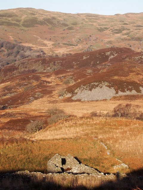
Coed Dol-wreiddiog is not only a natural gem but also holds historical significance. It was once part of an extensive estate and has remnants of a medieval hunting lodge, adding to its charm and allure. The forest is managed by a local conservation trust, which ensures its preservation and promotes sustainable practices.

Whether it's for a leisurely stroll, wildlife spotting, or simply to immerse oneself in nature's wonders, Coed Dol-wreiddiog offers a captivating experience for visitors of all ages, making it a must-visit destination in Merionethshire.

If you have any feedback on the listing, please let us know in the comments section below.

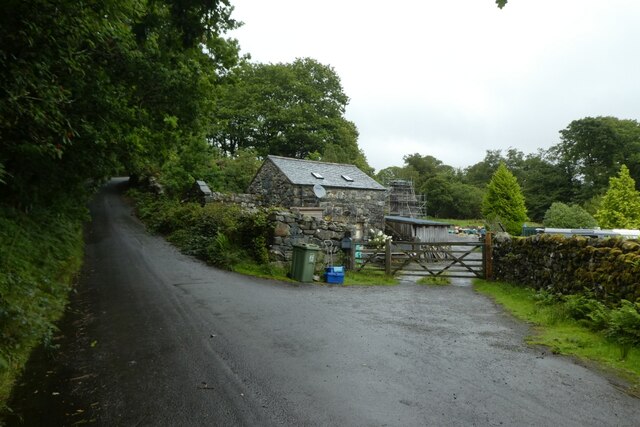
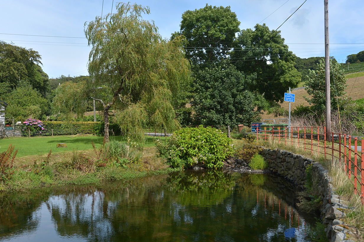
Coed Dol-wreiddiog Images

Images are sourced within 2km of 52.86052/-4.0417086 or Grid Reference SH6231. Thanks to Geograph Open Source API. All images are credited.

Below Carreg Fawr
Below Carreg Fawr
Bend in the Artro Looking upstream along the Afon Artro from the road to Cwm Bychan.
Bend in the Artro
Looking upstream along the Afon Artro from the road to Cwm Bychan.
Road junction near the river The left hand road heads up to Gerddi Bluog with the left leading to Cwm Bychan.
Road junction near the river
The left hand road heads up to Gerddi Bluog with the left leading to Cwm Bychan.
Pont Cwm-yr-afon A bridge over the Afon Artro beside the road to Cwm Bychan.
Pont Cwm-yr-afon
A bridge over the Afon Artro beside the road to Cwm Bychan.
Towards Pont Cwm-yr-afon The bridge crosses the Afon Artro.
Towards Pont Cwm-yr-afon
The bridge crosses the Afon Artro.
Pont Cwm-yr-Afon Built in 1835.
Pont Cwm-yr-Afon
Built in 1835.
The Ruins of Hafotty The name means summer house or dwelling and is associated with the practice of transhumance, that is moving livestock from one grazing ground to another, such as the highlands in the summer.
The Ruins of Hafotty
The name means summer house or dwelling and is associated with the practice of transhumance, that is moving livestock from one grazing ground to another, such as the highlands in the summer.
Start of the track to Cwm Yr Afon Over the narrow Pont Yr Afon crossing the Afon Artro.
Start of the track to Cwm Yr Afon
Over the narrow Pont Yr Afon crossing the Afon Artro.
Pont Cwm yr Afon Looking towards the old and new bridges.
Pont Cwm yr Afon
Looking towards the old and new bridges.
Beside the Artro The road follows the Artro down the valley from Cwm Bychan.
Beside the Artro
The road follows the Artro down the valley from Cwm Bychan.
Pont Cwm-yr-afon
Pont Cwm-yr-afon
Looking downstream from Pont Cwm-yr-afon On the Afon Artro.
Looking downstream from Pont Cwm-yr-afon
On the Afon Artro.
Pont Cwm-yr-afon from the east bank of Afon Artro
Taith Ardudwy south of Fridd Farm The Taith Ardudwy descends a short rough valley.
Today the bracken was so high and dense it smothered the waymark posts except the first one right of centre near the bottom.
Taith Ardudwy south of Fridd Farm
The Taith Ardudwy descends a short rough valley. Today the bracken was so high and dense it smothered the waymark posts except the first one right of centre near the bottom.
Rock and heather from the Taith Ardudwy The Taith Ardudwy path descends through this very rough but splendid cleft of rock and heather.
Care was needed today because the man-eating bracken covered the path and the marker posts - and almost us as well!.
There are some well hidden goats in this picture, no problem with the terrain for them.
Rock and heather from the Taith Ardudwy
The Taith Ardudwy path descends through this very rough but splendid cleft of rock and heather. Care was needed today because the man-eating bracken covered the path and the marker posts - and almost us as well!. There are some well hidden goats in this picture, no problem with the terrain for them.
Gate on the road near Cwm-yr-afon The road to Cwm Bychan from Llanbedr.
Gate on the road near Cwm-yr-afon
The road to Cwm Bychan from Llanbedr.
Road beside the Afon Artro The road to Cwm Bychan from Llanbedr.
Road beside the Afon Artro
The road to Cwm Bychan from Llanbedr.
Road passing Dolwreiddiog The road to Cwm Bychan from Llanbedr.
Road passing Dolwreiddiog
The road to Cwm Bychan from Llanbedr.
Show me another place!

Coed Dol-wreiddiog is located at Grid Ref: SH6231 (Lat: 52.86052, Lng: -4.0417086)

Unitary Authority: Gwynedd

Police Authority: North Wales

What 3 Words

///flattens.foggy.hunt. Near Harlech, Gwynedd

Related Wikis

Llyn Cwm Bychan

Llyn Cwm Bychan is a lake in north Wales, and is one of the sources of the River Artro which flows south westwards through Llanbedr and onwards to the...

River Artro

The River Artro (Welsh: Afon Artro) is a river in Gwynedd, Wales. It is about 4.5 miles (7.2 km) long and has its source at Llyn Cwm Bychan below Rhinog...

Eisingrug

Eisingrug (meaning: a place where corn was winnowed after husking) is a rural hamlet near Harlech, Gwynedd, Wales. It is located to the southeast of Porthmadog...

Ellis Wynne

Ellis Wynne (7 March 1671 – 13 July 1734) was a Welsh clergyman and author. He is remembered mainly for one of the most important and influential pieces...

Nearby Amenities

Located within 500m of 52.86052,-4.0417086
Ford: yes
Lat/Long: 52.8585952/-4.0380618
Power: pole
Lat/Long: 52.8564671/-4.0445982
Power: pole
Lat/Long: 52.8564637/-4.0436247
Power: pole
Lat/Long: 52.8564547/-4.0424603
Power: pole
Lat/Long: 52.8571808/-4.0420727
The data included in this document is from www.openstreetmap.org. The data is made available under ODbL.

Have you been to Coed Dol-wreiddiog?

Leave your review of Coed Dol-wreiddiog below (or comments, questions and feedback).