Allt y Fedw

Wood, Forest in Carmarthenshire

Wales

Allt y Fedw

Talley Abbey
Talley Abbey Credit: Chris Andrews

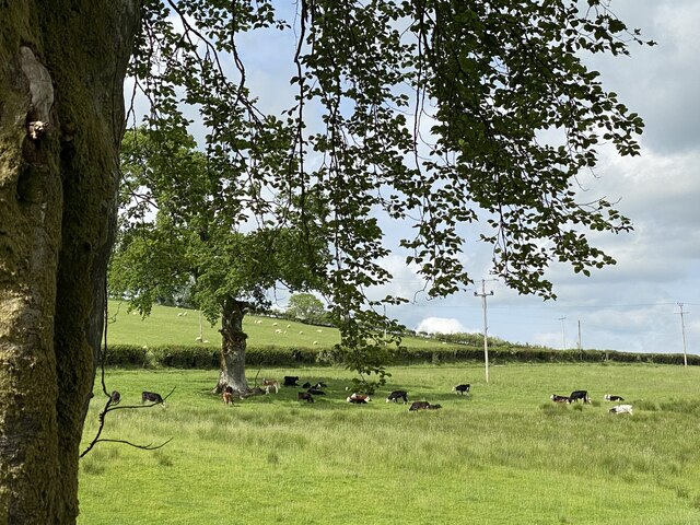
Allt y Fedw, located in Carmarthenshire, Wales, is a picturesque woodland area known for its natural beauty and tranquil atmosphere. The name "Allt y Fedw" translates to "hillside of the birch trees" in English, a fitting description of the abundance of birch trees that populate the forest.

Covering an area of approximately 50 acres, Allt y Fedw offers visitors a peaceful retreat from the hustle and bustle of everyday life. The forest is home to a diverse range of flora and fauna, providing a haven for various bird species, small mammals, and insects. The enchanting woodland is particularly popular among birdwatchers and nature enthusiasts, who can spot species such as woodpeckers, thrushes, and owls.

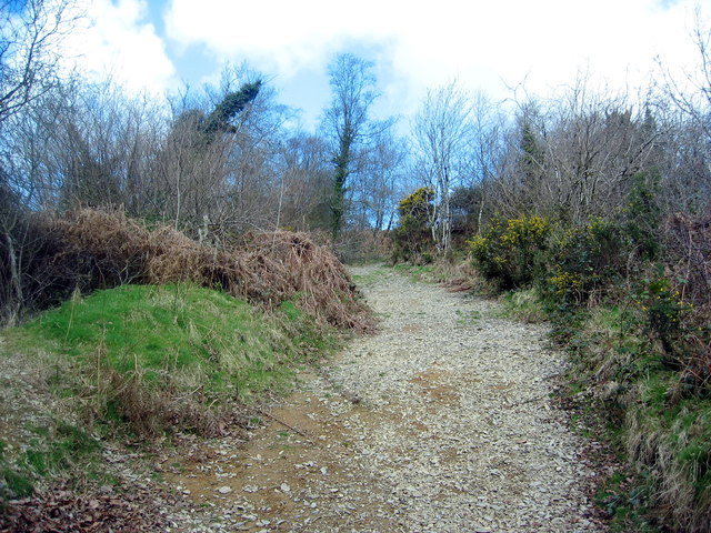
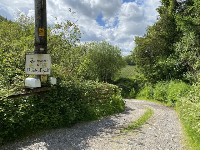
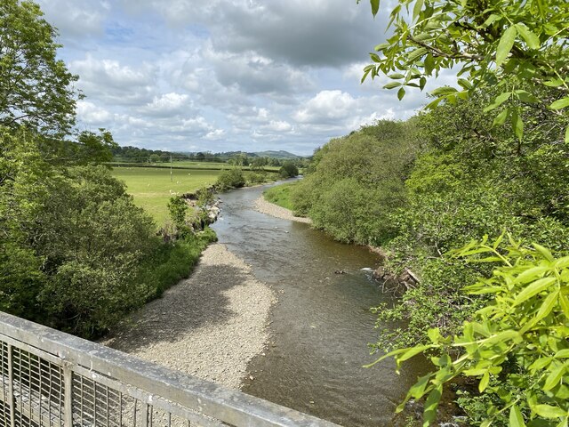
The forest boasts a network of well-maintained footpaths, making it an ideal destination for walking, hiking, and exploring. The trails wind through ancient oak woodlands, carpeted with wildflowers during the spring and summer months. Visitors can also discover a charming stream that meanders through the forest, adding to the area's rustic charm.

Allt y Fedw is a popular spot for outdoor activities, such as picnicking and camping. It offers a serene setting for families and friends to gather and enjoy a day surrounded by nature. The forest's peaceful ambiance and stunning vistas make it a favored destination for artists and photographers seeking inspiration.

Overall, Allt y Fedw in Carmarthenshire is a magical woodland retreat, providing a welcome escape for nature lovers and those looking to reconnect with the great outdoors.

If you have any feedback on the listing, please let us know in the comments section below.
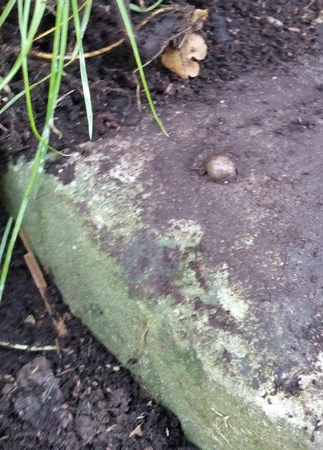
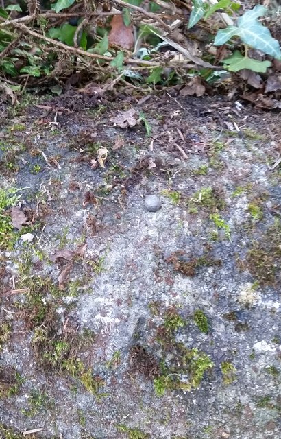
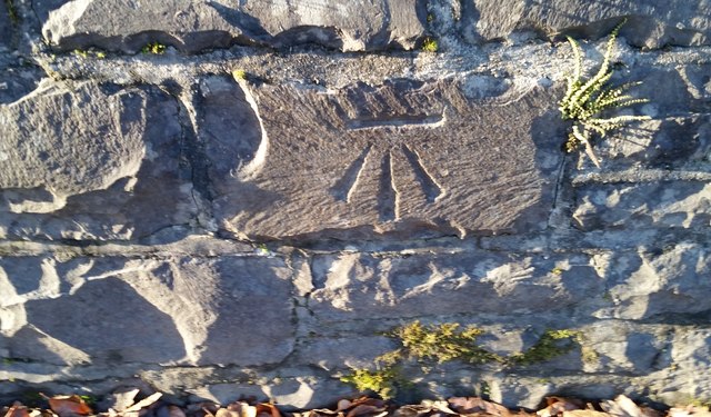
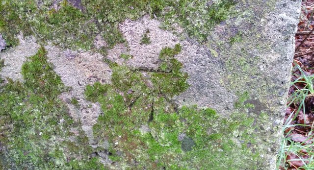
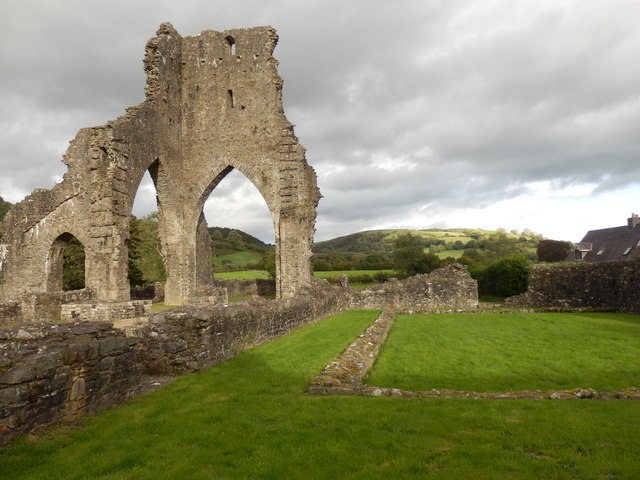
Allt y Fedw Images

Images are sourced within 2km of 51.988589/-4.0049593 or Grid Reference SN6234. Thanks to Geograph Open Source API. All images are credited.

Talley Abbey
Talley Abbey
Talley Abbey The abbey was of the Premonstratensian order, founded by Rhys ap Gruffydd around 1185. The remains are of no great size and do not compare with those of Easby Abbey near Richmond, North Yorkshire, which belonged to the same order.
Talley Abbey
The abbey was of the Premonstratensian order, founded by Rhys ap Gruffydd around 1185. The remains are of no great size and do not compare with those of Easby Abbey near Richmond, North Yorkshire, which belonged to the same order.
Upper Talley Lake One of two shallow lakes in the valley at Talley.
Upper Talley Lake
One of two shallow lakes in the valley at Talley.
Ordnance Survey Rivet This OS rivet can be found on the milk stand at Penlan Farm. It marks a point 154.622m above mean sea level.
Ordnance Survey Rivet
This OS rivet can be found on the milk stand at Penlan Farm. It marks a point 154.622m above mean sea level.
Ordnance Survey Rivet This OS rivet can be found on the NE parapet of Pont Pwll Du. It marks a point 103.245m above mean sea level.
Ordnance Survey Rivet
This OS rivet can be found on the NE parapet of Pont Pwll Du. It marks a point 103.245m above mean sea level.
Ordnance Survey Cut Mark This OS cut mark can be found on the west parapet of the bridge. It marks a point 95.866m above mean sea level.
Ordnance Survey Cut Mark
This OS cut mark can be found on the west parapet of the bridge. It marks a point 95.866m above mean sea level.
Ordnance Survey Cut Mark This OS cut mark can be found on the roadside house. It marks a point 127.840m above mean sea level.
Ordnance Survey Cut Mark
This OS cut mark can be found on the roadside house. It marks a point 127.840m above mean sea level.
Ordnance Survey Cut Mark This OS cut mark can be found on the milk stand at Cilyllynfawr Farm. It marks a point 134.623m above mean sea level.
Ordnance Survey Cut Mark
This OS cut mark can be found on the milk stand at Cilyllynfawr Farm. It marks a point 134.623m above mean sea level.
Ordnance Survey Rivet This OS rivet can be found on the Milk Stand at Cwm-gwlaw-fawr Farm. It marks a point 180.838m above mean sea level.
Ordnance Survey Rivet
This OS rivet can be found on the Milk Stand at Cwm-gwlaw-fawr Farm. It marks a point 180.838m above mean sea level.
Tally Abbey
Tally Abbey
Llwybr Cyhoeddus i Lansawel / Path to Llansawel Llwybr cyhoeddus yn dringo'r tyle mas o Gwm Cothi ac yn mynd i gyfeiriad pentre Llansawel.

A public footpath climbing out of the Cothi Valley and heading in the direction of Llansawel (trans. church of St Sawel).
Llwybr Cyhoeddus i Lansawel / Path to Llansawel
Llwybr cyhoeddus yn dringo'r tyle mas o Gwm Cothi ac yn mynd i gyfeiriad pentre Llansawel. A public footpath climbing out of the Cothi Valley and heading in the direction of Llansawel (trans. church of St Sawel).
Llwybr yn gadael y cilffordd / Path exiting the byway Llwybr cyhoeddus ar y chwith yn gadael cilffordd yng nghwm Cothi. Yn y pellter gellir gweld talen bwthyn o'r enw Cwm.

A public footpath on the left exiting a byway in the Cothi valley. In the distance the gable end of a cottage known as Cwm can be seen.
Llwybr yn gadael y cilffordd / Path exiting the byway
Llwybr cyhoeddus ar y chwith yn gadael cilffordd yng nghwm Cothi. Yn y pellter gellir gweld talen bwthyn o'r enw Cwm. A public footpath on the left exiting a byway in the Cothi valley. In the distance the gable end of a cottage known as Cwm can be seen.
Three arches at Talley Abbey Ruined monastery of the Premonstratensians.

<span class="nowrap"><a title="https://en.wikipedia.org/wiki/Talley_Abbey" rel="nofollow ugc noopener" href="https://en.wikipedia.org/wiki/Talley_Abbey">Link</a><img style="margin-left:2px;" alt="External link" title="External link - shift click to open in new window" src="https://s1.geograph.org.uk/img/external.png" width="10" height="10"/></span>
Three arches at Talley Abbey
Ruined monastery of the Premonstratensians. LinkExternal link
Garnwen a Beudy Bach
Cattle grazing
Cattle grazing
Afon Cothi
Afon Cothi
Barn conversion at Bwlch y Rhyd
Bwlch y Rhyd
Bwlch y Rhyd
Show me another place!

Allt y Fedw is located at Grid Ref: SN6234 (Lat: 51.988589, Lng: -4.0049593)

Unitary Authority: Carmarthenshire

Police Authority: Dyfed Powys

What 3 Words

///notifying.recount.hairspray. Near Llansawel, Carmarthenshire

Related Wikis

Edwinsford

Edwinsford is a small hamlet situated about the historic Edwinsford Estate and fishery on the river Cothi, a tributary of the River Tywi, in Carmarthenshire...

Talley Lakes

Upper Talley Lake (Welsh: Llyn Talyllychau Uchaf) and Lower Talley Lake (Welsh: Llyn Talyllychau Isaf) are two small lakes immediately north of the village...
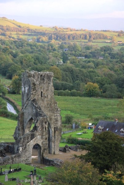
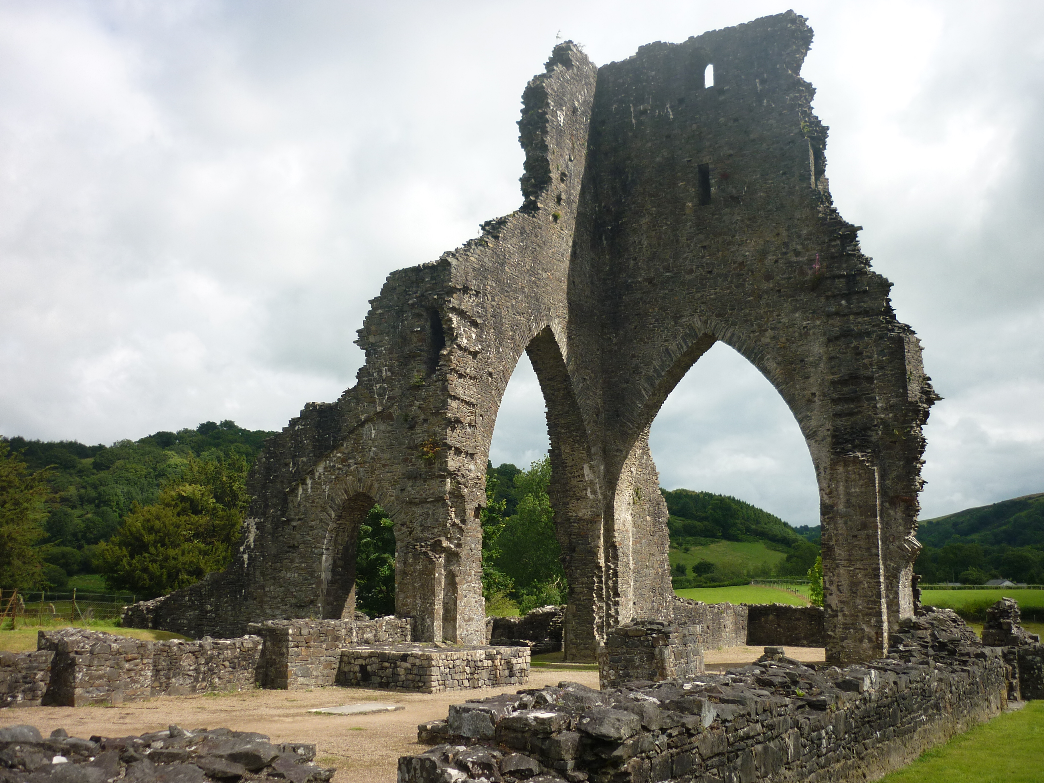
Talley Abbey

Talley Abbey (Welsh: Abaty Talyllychau) is a ruined former monastery of the Premonstratensians ("White Canons") in the village of Talley in Carmarthenshire...

Talley

Talley (Welsh: Talyllychau, historically Tal y Llychau) is a village and community in Carmarthenshire, Wales.The population taken at the 2011 census was...

Nearby Amenities

Located within 500m of 51.988589,-4.0049593
Addr City: Talley
Addr Country: GB
Addr Housename: Cil-y-llyn-fawr
Lat/Long: 51.9843397/-4.0053251
Addr Country: GB
Addr Housename: Moelfre Lodge
Addr Postcode: SA19 7BJ
Lat/Long: 51.9868874/-4.0029055
Direction: 195
Generator Method: photovoltaic
Generator Output Electricity: yes
Generator Solar Modules: 16
Generator Source: solar
Generator Type: solar_photovoltaic_panel
Location: roof
Power: generator
Lat/Long: 51.9841508/-4.0051241
The data included in this document is from www.openstreetmap.org. The data is made available under ODbL.

Have you been to Allt y Fedw?

Leave your review of Allt y Fedw below (or comments, questions and feedback).