Allt Disgwylfa
Wood, Forest in Cardiganshire
Wales
Allt Disgwylfa
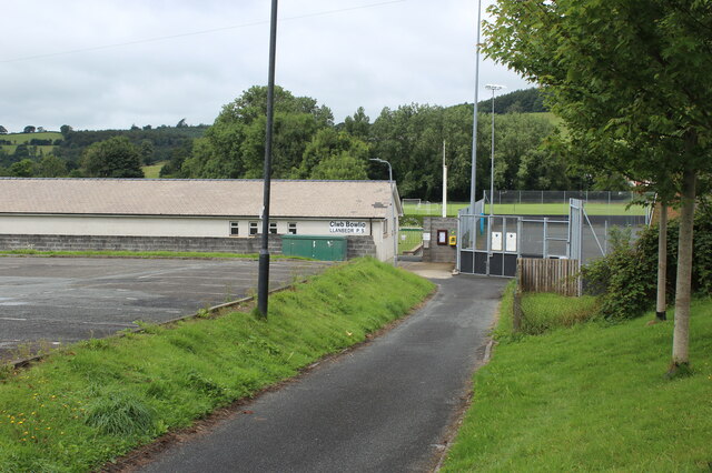
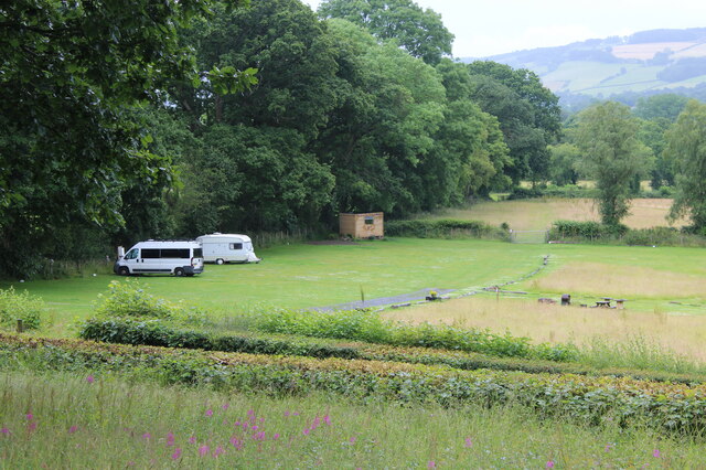
Allt Disgwylfa is a picturesque wood located in the county of Cardiganshire, Wales. It is nestled in the heart of the countryside, providing a tranquil and serene escape from the hustle and bustle of city life. The wood covers a vast area, encompassing rolling hills, lush green meadows, and dense clusters of trees.
The forest is primarily composed of native tree species such as oak, beech, and ash, which create a rich and diverse ecosystem. The thick canopy of leaves provides a cool and shaded environment, perfect for leisurely walks and nature exploration. The forest floor is covered in a carpet of moss and ferns, adding to the enchanting atmosphere.
Allt Disgwylfa is home to a wide variety of wildlife, making it a haven for nature enthusiasts and photographers. Visitors can spot a range of bird species, including woodpeckers, owls, and songbirds. Small mammals like foxes, badgers, and squirrels also call this forest their home.
The wood is crisscrossed by a network of well-maintained trails, allowing visitors to navigate through its beauty with ease. These paths lead to breathtaking viewpoints, offering panoramic vistas of the surrounding countryside. There are also picnic areas and benches strategically placed throughout the wood, providing opportunities for visitors to relax and enjoy the peaceful ambiance.
In summary, Allt Disgwylfa is a charming wood in Cardiganshire, Wales, that offers stunning natural beauty, diverse wildlife, and a serene atmosphere. It is an ideal destination for those seeking an escape into nature and a chance to reconnect with the great outdoors.
If you have any feedback on the listing, please let us know in the comments section below.
Allt Disgwylfa Images
Images are sourced within 2km of 52.11184/-4.1066297 or Grid Reference SN5548. Thanks to Geograph Open Source API. All images are credited.


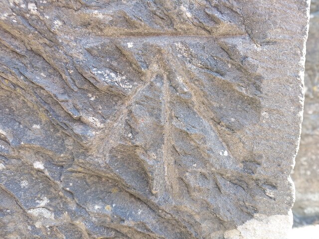


![OSBM Flush Bracket S0451 - Lampeter Town Hall Ordnance Survey Benchmark (OSBM) used for levelling height above Ordnance Datum (OD).
Height (1955): 121.2122m OD (Newlyn). Mark verified by the Ordnance Survey in 1971. Description: FB S0451 E FACE TOWN HALL. 0.9m above ground. 1st Order BM. (Listed as a cut mark in the current OS database)
The bracket was used on the Lampeter to Llandovery secondary line of the Second Geodetic Levelling of England &amp; Wales in 1942. It was levelled with a height of 397.758&#039; above OD (Newlyn). Description: Flush Bracket on SE angle of Town Hall. Abstract A 491: <span class="nowrap"><a title="http://discovery.nationalarchives.gov.uk/details/r/C11178833" rel="nofollow ugc noopener" href="http://discovery.nationalarchives.gov.uk/details/r/C11178833">Link</a><img style="margin-left:2px;" alt="External link" title="External link - shift click to open in new window" src="https://s1.geograph.org.uk/img/external.png" width="10" height="10"/></span> [OS 54/154]
The bracket was used on the Lampeter to Llandovery line (G098) of the Third Geodetic Levelling of England &amp; Wales in 1955. It was levelled with a height of 397.740&#039; above OD (Newlyn). Abstract G 65: <span class="nowrap"><a title="http://discovery.nationalarchives.gov.uk/SearchUI/details?Uri=C11264473" rel="nofollow ugc noopener" href="http://discovery.nationalarchives.gov.uk/SearchUI/details?Uri=C11264473">Link</a><img style="margin-left:2px;" alt="External link" title="External link - shift click to open in new window" src="https://s1.geograph.org.uk/img/external.png" width="10" height="10"/></span> [OS 54/754]
Context: <a href="https://www.geograph.org.uk/photo/7518122">SN5748 : OSBM Flush Bracket S0451 - Lampeter Town Hall</a>](https://s2.geograph.org.uk/geophotos/07/51/81/7518118_ad2f01b7.jpg)
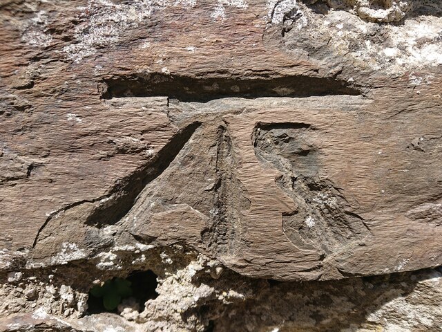
![OSBM Flush Bracket S0451 - Lampeter Town Hall Ordnance Survey Benchmark (OSBM) used for levelling height above Ordnance Datum (OD).
Height (1955): 121.2122m OD (Newlyn). Mark verified by the Ordnance Survey in 1971. Description: FB S0451 E FACE TOWN HALL. 0.9m above ground. 1st Order BM. (Listed as a cut mark in the current OS database)
The bracket was used on the Lampeter to Llandovery secondary line of the Second Geodetic Levelling of England &amp; Wales in 1942. It was levelled with a height of 397.758&#039; above OD (Newlyn). Description: Flush Bracket on SE angle of Town Hall. Abstract A 491: <span class="nowrap"><a title="http://discovery.nationalarchives.gov.uk/details/r/C11178833" rel="nofollow ugc noopener" href="http://discovery.nationalarchives.gov.uk/details/r/C11178833">Link</a><img style="margin-left:2px;" alt="External link" title="External link - shift click to open in new window" src="https://s1.geograph.org.uk/img/external.png" width="10" height="10"/></span> [OS 54/154]
The bracket was used on the Lampeter to Llandovery line (G098) of the Third Geodetic Levelling of England &amp; Wales in 1955. It was levelled with a height of 397.740&#039; above OD (Newlyn). Abstract G 65: <span class="nowrap"><a title="http://discovery.nationalarchives.gov.uk/SearchUI/details?Uri=C11264473" rel="nofollow ugc noopener" href="http://discovery.nationalarchives.gov.uk/SearchUI/details?Uri=C11264473">Link</a><img style="margin-left:2px;" alt="External link" title="External link - shift click to open in new window" src="https://s1.geograph.org.uk/img/external.png" width="10" height="10"/></span> [OS 54/754]
Close-up: <a href="https://www.geograph.org.uk/photo/7518118">SN5748 : OSBM Flush Bracket S0451 - Lampeter Town Hall</a>](https://s2.geograph.org.uk/geophotos/07/51/81/7518122_3a4de3e1.jpg)

Allt Disgwylfa is located at Grid Ref: SN5548 (Lat: 52.11184, Lng: -4.1066297)
Unitary Authority: Ceredigion
Police Authority: Dyfed Powys
What 3 Words
///belonged.reactions.rock. Near Lampeter, Ceredigion
Nearby Locations
Related Wikis

Pentre-bach, Ceredigion
Pentre-bach is a small village in the community of Lampeter, Ceredigion, Wales. Pentre-bach is represented in the Senedd by Elin Jones (Plaid Cymru) and...
Falcondale
Falcondale (Welsh: Glyn Hebog) is a hamlet in the community of Lampeter, Ceredigion, Wales, and occupies a low bluff overlooking the Nant Creuddyn north...
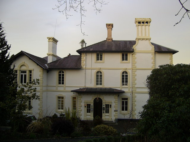
Falcondale House
Falcondale House is a Grade II listed former country house, now the Falcondale Mansion Hotel, which is situated some 1 mile north-west of Lampeter, Ceredigion...
Maestir
Maestir is a hamlet in the community of Llanwnnen, Ceredigion, Wales, which is 59.9 miles (96.3 km) from Cardiff and 175.5 miles (282.4 km) from London...

Church of Our Lady of Mount Carmel, Lampeter
The Church of Our Lady of Mount Carmel is a Roman Catholic church located in the university town of Lampeter in Ceredigion, Wales. Constructed by the London...
Ysgol Bro Pedr
Ysgol Bro Pedr is a mixed middle school for pupils aged 3–19. The school is situated in Lampeter, Ceredigion, Wales. The school is a product of the amalgamation...

St Peter's Church, Lampeter
St Peter's Church, Lampeter, is the Church in Wales parish church for the University town of Lampeter. It is a Grade II listed building, and has been described...

Lampeter Town Hall
Lampeter Town Hall (Welsh: Neuadd y Dref Llanbedr Pont Steffan) is a municipal structure in the High Street, Lampeter, Wales. The town hall, which was...
Nearby Amenities
Located within 500m of 52.11184,-4.1066297Have you been to Allt Disgwylfa?
Leave your review of Allt Disgwylfa below (or comments, questions and feedback).