Allt Llain
Wood, Forest in Cardiganshire
Wales
Allt Llain
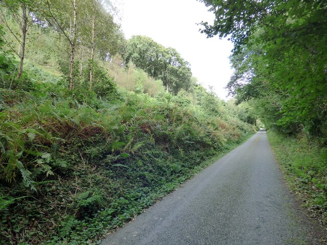
Allt Llain is a picturesque woodland located in the county of Cardiganshire, Wales. Covering an area of approximately 100 acres, it is nestled in the scenic countryside, offering a tranquil and serene environment for visitors. The woodland is primarily composed of native trees, including oak, ash, and beech, creating a diverse and vibrant ecosystem.
The dense canopy of Allt Llain provides a haven for a variety of wildlife species, making it a popular spot for birdwatchers and nature enthusiasts. Visitors can expect to see a wide range of bird species, such as woodpeckers, buzzards, and owls, as well as smaller creatures like squirrels and rabbits.
The woodland is crisscrossed by several well-maintained footpaths, allowing visitors to explore and appreciate the natural beauty of the area. These paths lead to hidden spots, including a charming stream that meanders through the woods, adding to the enchanting atmosphere.
Allt Llain also holds historical significance, with remnants of ancient settlements dating back to the Bronze Age. Archaeological findings, such as burial mounds and stone circles, provide insight into the area's rich past, making it an intriguing destination for history buffs.
Visitors to Allt Llain can enjoy a range of activities, from leisurely walks and picnics to birdwatching and nature photography. The woodland offers a peaceful retreat from the hustle and bustle of everyday life, allowing visitors to reconnect with nature and immerse themselves in its beauty.
If you have any feedback on the listing, please let us know in the comments section below.
Allt Llain Images
Images are sourced within 2km of 52.118463/-4.1083298 or Grid Reference SN5548. Thanks to Geograph Open Source API. All images are credited.


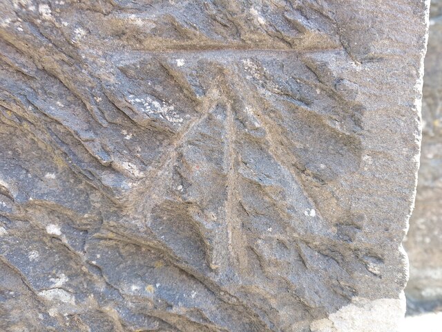


![OSBM Flush Bracket S0451 - Lampeter Town Hall Ordnance Survey Benchmark (OSBM) used for levelling height above Ordnance Datum (OD).
Height (1955): 121.2122m OD (Newlyn). Mark verified by the Ordnance Survey in 1971. Description: FB S0451 E FACE TOWN HALL. 0.9m above ground. 1st Order BM. (Listed as a cut mark in the current OS database)
The bracket was used on the Lampeter to Llandovery secondary line of the Second Geodetic Levelling of England &amp; Wales in 1942. It was levelled with a height of 397.758&#039; above OD (Newlyn). Description: Flush Bracket on SE angle of Town Hall. Abstract A 491: <span class="nowrap"><a title="http://discovery.nationalarchives.gov.uk/details/r/C11178833" rel="nofollow ugc noopener" href="http://discovery.nationalarchives.gov.uk/details/r/C11178833">Link</a><img style="margin-left:2px;" alt="External link" title="External link - shift click to open in new window" src="https://s1.geograph.org.uk/img/external.png" width="10" height="10"/></span> [OS 54/154]
The bracket was used on the Lampeter to Llandovery line (G098) of the Third Geodetic Levelling of England &amp; Wales in 1955. It was levelled with a height of 397.740&#039; above OD (Newlyn). Abstract G 65: <span class="nowrap"><a title="http://discovery.nationalarchives.gov.uk/SearchUI/details?Uri=C11264473" rel="nofollow ugc noopener" href="http://discovery.nationalarchives.gov.uk/SearchUI/details?Uri=C11264473">Link</a><img style="margin-left:2px;" alt="External link" title="External link - shift click to open in new window" src="https://s1.geograph.org.uk/img/external.png" width="10" height="10"/></span> [OS 54/754]
Context: <a href="https://www.geograph.org.uk/photo/7518122">SN5748 : OSBM Flush Bracket S0451 - Lampeter Town Hall</a>](https://s2.geograph.org.uk/geophotos/07/51/81/7518118_ad2f01b7.jpg)
![OSBM Flush Bracket S0451 - Lampeter Town Hall Ordnance Survey Benchmark (OSBM) used for levelling height above Ordnance Datum (OD).
Height (1955): 121.2122m OD (Newlyn). Mark verified by the Ordnance Survey in 1971. Description: FB S0451 E FACE TOWN HALL. 0.9m above ground. 1st Order BM. (Listed as a cut mark in the current OS database)
The bracket was used on the Lampeter to Llandovery secondary line of the Second Geodetic Levelling of England &amp; Wales in 1942. It was levelled with a height of 397.758&#039; above OD (Newlyn). Description: Flush Bracket on SE angle of Town Hall. Abstract A 491: <span class="nowrap"><a title="http://discovery.nationalarchives.gov.uk/details/r/C11178833" rel="nofollow ugc noopener" href="http://discovery.nationalarchives.gov.uk/details/r/C11178833">Link</a><img style="margin-left:2px;" alt="External link" title="External link - shift click to open in new window" src="https://s1.geograph.org.uk/img/external.png" width="10" height="10"/></span> [OS 54/154]
The bracket was used on the Lampeter to Llandovery line (G098) of the Third Geodetic Levelling of England &amp; Wales in 1955. It was levelled with a height of 397.740&#039; above OD (Newlyn). Abstract G 65: <span class="nowrap"><a title="http://discovery.nationalarchives.gov.uk/SearchUI/details?Uri=C11264473" rel="nofollow ugc noopener" href="http://discovery.nationalarchives.gov.uk/SearchUI/details?Uri=C11264473">Link</a><img style="margin-left:2px;" alt="External link" title="External link - shift click to open in new window" src="https://s1.geograph.org.uk/img/external.png" width="10" height="10"/></span> [OS 54/754]
Close-up: <a href="https://www.geograph.org.uk/photo/7518118">SN5748 : OSBM Flush Bracket S0451 - Lampeter Town Hall</a>](https://s2.geograph.org.uk/geophotos/07/51/81/7518122_3a4de3e1.jpg)
Allt Llain is located at Grid Ref: SN5548 (Lat: 52.118463, Lng: -4.1083298)
Unitary Authority: Ceredigion
Police Authority: Dyfed Powys
What 3 Words
///strapped.inflating.nitrate. Near Lampeter, Ceredigion
Nearby Locations
Related Wikis

Falcondale
Falcondale (Welsh: Glyn Hebog) is a hamlet in the community of Lampeter, Ceredigion, Wales, and occupies a low bluff overlooking the Nant Creuddyn north...
Maestir
Maestir is a hamlet in the community of Llanwnnen, Ceredigion, Wales, which is 59.9 miles (96.3 km) from Cardiff and 175.5 miles (282.4 km) from London...
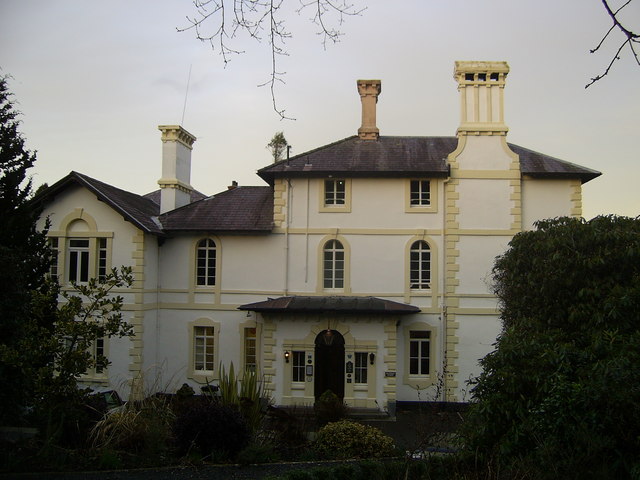
Falcondale House
Falcondale House is a Grade II listed former country house, now the Falcondale Mansion Hotel, which is situated some 1 mile north-west of Lampeter, Ceredigion...
Pentre-bach, Ceredigion
Pentre-bach is a small village in the community of Lampeter, Ceredigion, Wales. Pentre-bach is represented in the Senedd by Elin Jones (Plaid Cymru) and...

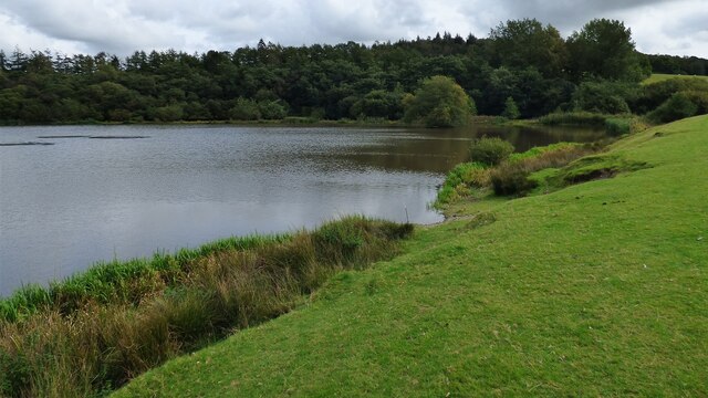
Falcondale Lake
Falcondale Lake is a man-made lake in the hamlet of Falcondale near Lampeter in Ceredigion It was created as part of the landscaping for Falcondale House...

Lampeter
Lampeter (; Welsh: Llanbedr Pont Steffan (formal); Llambed (colloquial)) is a town, community and electoral ward in Ceredigion, Wales, at the confluence...

Church of Our Lady of Mount Carmel, Lampeter
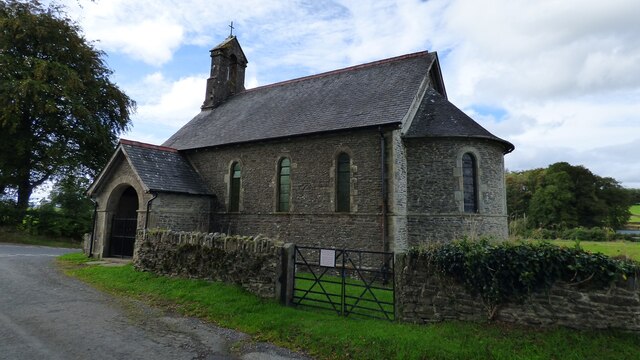
The Church of Our Lady of Mount Carmel is a Roman Catholic church located in the university town of Lampeter in Ceredigion, Wales. Constructed by the London...

St Peter's Church, Lampeter
St Peter's Church, Lampeter, is the Church in Wales parish church for the University town of Lampeter. It is a Grade II listed building, and has been described...
Nearby Amenities
Located within 500m of 52.118463,-4.1083298Have you been to Allt Llain?
Leave your review of Allt Llain below (or comments, questions and feedback).