Courthouse Wood

Wood, Forest in Glamorgan

Wales

Courthouse Wood

Swansea Airport on Fairwood Common A small airport for lighter aircraft.
Swansea Airport on Fairwood Common Credit: Nigel Davies

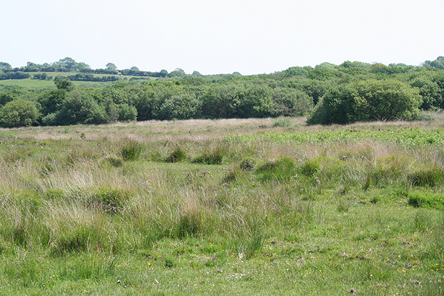
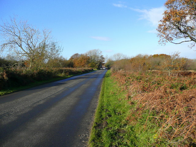
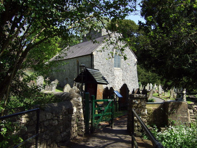
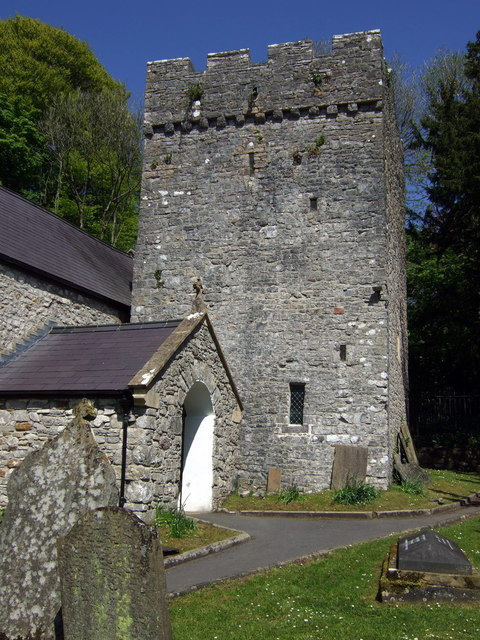
Courthouse Wood is a charming woodland situated in Glamorgan, Wales. Covering an area of approximately 50 acres, it is renowned for its natural beauty and diverse flora and fauna. The wood is located near the small village of Courthouse, creating a peaceful and tranquil atmosphere that attracts visitors seeking solace in nature.

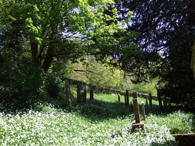
The wood is predominantly made up of deciduous trees, including oak, beech, and ash, which provide a stunning display of colors during the autumn months. The forest floor is adorned with a carpet of bluebells in the spring, creating a picturesque scene that draws in photographers and nature enthusiasts alike.

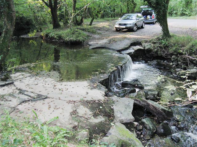
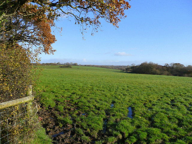
Courthouse Wood offers a network of well-maintained walking trails, allowing visitors to explore its vast expanse. The paths wind through the woodland, leading to hidden clearings, babbling brooks, and serene ponds. Along the way, visitors may encounter a variety of wildlife, including foxes, badgers, and a plethora of bird species.

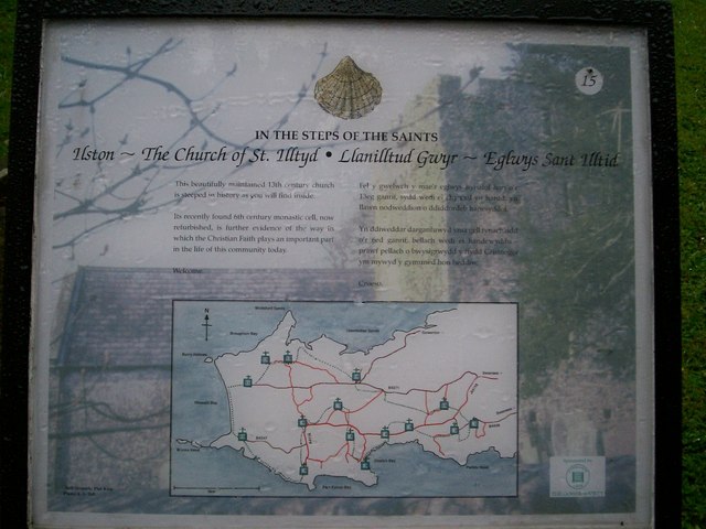
The wood also boasts a small picnic area, providing visitors with the opportunity to relax and enjoy a meal amidst the tranquil surroundings. Additionally, there are information boards dotted throughout the woodland, offering visitors insights into the local wildlife and the history of Courthouse Wood.

Courthouse Wood is a haven for nature lovers and those seeking a peaceful retreat away from the hustle and bustle of everyday life. Its stunning scenery, diverse wildlife, and well-maintained trails make it a must-visit destination for anyone in Glamorgan.

If you have any feedback on the listing, please let us know in the comments section below.

Courthouse Wood Images

Images are sourced within 2km of 51.592872/-4.0814693 or Grid Reference SS5590. Thanks to Geograph Open Source API. All images are credited.

Swansea Airport on Fairwood Common A small airport for lighter aircraft.
Swansea Airport on Fairwood Common
A small airport for lighter aircraft.
Runway 04 at Swansea Airport View to the North East coming into land
Runway 04 at Swansea Airport
View to the North East coming into land
Ilston Community: Fairwood Common Looking west-south-west towards Cartersford Bridge on the B4271
Ilston Community: Fairwood Common
Looking west-south-west towards Cartersford Bridge on the B4271
Ilston Community: Pengwern Common Looking south east
Ilston Community: Pengwern Common
Looking south east
St. Illtyds Church, Ilston
Road junction on North Gower road Junction of road to Lunnon and the B4271. The footpath to Little Hills can be seen running ahead to the left.
Road junction on North Gower road
Junction of road to Lunnon and the B4271. The footpath to Little Hills can be seen running ahead to the left.
Road junction from the entrance to Willoxton Farm Ilston ahead, Lunnon to the right, B4271 to the left.
Road junction from the entrance to Willoxton Farm
Ilston ahead, Lunnon to the right, B4271 to the left.
On Fairwood Common Junction of Hen Parc Lane with A4118. The entrance to Swansea Airport is visible across the road on the left. The main airport buildings are ahead behind the trees.
On Fairwood Common
Junction of Hen Parc Lane with A4118. The entrance to Swansea Airport is visible across the road on the left. The main airport buildings are ahead behind the trees.
Notice outside Ilston Church
Ford at entrance to former Ilston Quarry The quarry is now a National Trust nature reserve. This photo is taken from near the stile into the reserve. 
Unfortunately the water is too deep to cross without waterproof footwear and there's nowhere to park if you wanted to drive across.
Ford at entrance to former Ilston Quarry
The quarry is now a National Trust nature reserve. This photo is taken from near the stile into the reserve. Unfortunately the water is too deep to cross without waterproof footwear and there's nowhere to park if you wanted to drive across.
Pasture land in eastern Gower Hams Wood is in the distance, right.
Pasture land in eastern Gower
Hams Wood is in the distance, right.
Gower moorland View north from north of Kittle near Swansea Airport.
Gower moorland
View north from north of Kittle near Swansea Airport.
Edge of moorland Looking north from the Kittle Road.
Edge of moorland
Looking north from the Kittle Road.
Kittle Road Looking west towards the A4118 and Ilston.
Kittle Road
Looking west towards the A4118 and Ilston.
Ilston church Hunkered down in Ilston cwm and reached across a narrow footbridge this chunky little church is essentially a Victorian reconstruction of the original mediaeval version. Apart from its delightful setting the church has an unexpected claim to fame in that it acted as the meeting place for the earliest Baptist congregation, under the leadership of one John Miles/Myles a parliamentarian who took over the living from the royalist incumbent in 1649.

"From 1649 until 1660 the Ilston Baptists met in the parish church St Illtyd, of which Miles was rector or minister, though they always referred to the place as their ‘Meeting House’, not their ‘church’ or ‘chapel’. Baptist services and meetings were open only to members. Indeed, Miles was insistent that non-baptised sympathisers should not be allowed to attend. But Miles would also have held more general services for all the parishioners of Ilston, the majority of whom remained non-Baptists. The church had been built by the local de Breos family in the thirteenth century, probably on the site of an earlier Christian cell. It was drastically ‘restored’ inside and out in the mid nineteenth century, and many of the features familiar to Miles and his Baptists have been destroyed or altered beyond recognition."

At the Restoration Miles was ejected, the Baptist movement was forced underground and in 1663 he emigrated to America along with many more of his co-religionists, and died there in 1684.

The full story, from which the above quotation is abstracted, can be read here <span class="nowrap"><a title="http://www.olivercromwell.org/ilston.htm" rel="nofollow ugc noopener" href="http://www.olivercromwell.org/ilston.htm">Link</a><img style="margin-left:2px;" alt="External link" title="External link - shift click to open in new window" src="https://s1.geograph.org.uk/img/external.png" width="10" height="10"/></span>
Ilston church
Hunkered down in Ilston cwm and reached across a narrow footbridge this chunky little church is essentially a Victorian reconstruction of the original mediaeval version. Apart from its delightful setting the church has an unexpected claim to fame in that it acted as the meeting place for the earliest Baptist congregation, under the leadership of one John Miles/Myles a parliamentarian who took over the living from the royalist incumbent in 1649. "From 1649 until 1660 the Ilston Baptists met in the parish church St Illtyd, of which Miles was rector or minister, though they always referred to the place as their ‘Meeting House’, not their ‘church’ or ‘chapel’. Baptist services and meetings were open only to members. Indeed, Miles was insistent that non-baptised sympathisers should not be allowed to attend. But Miles would also have held more general services for all the parishioners of Ilston, the majority of whom remained non-Baptists. The church had been built by the local de Breos family in the thirteenth century, probably on the site of an earlier Christian cell. It was drastically ‘restored’ inside and out in the mid nineteenth century, and many of the features familiar to Miles and his Baptists have been destroyed or altered beyond recognition." At the Restoration Miles was ejected, the Baptist movement was forced underground and in 1663 he emigrated to America along with many more of his co-religionists, and died there in 1684. The full story, from which the above quotation is abstracted, can be read here LinkExternal link
Ilston church tower St. Illtyd's church probably derives from a 6th century monastic cell. The present church was originally built during the 13th century incorporating the 6th century cell in the base of a massive embattled tower with a transverse saddle-back roof. There was the inevitable Victorian restoration and further work was carried out at the millennium.
St Illtud/Illtyd converted from a military career to a life of asceticism. He achieved great fame as a teacher and is also credited with improving agricultural methods in Wales.
Ilston church tower
St. Illtyd's church probably derives from a 6th century monastic cell. The present church was originally built during the 13th century incorporating the 6th century cell in the base of a massive embattled tower with a transverse saddle-back roof. There was the inevitable Victorian restoration and further work was carried out at the millennium. St Illtud/Illtyd converted from a military career to a life of asceticism. He achieved great fame as a teacher and is also credited with improving agricultural methods in Wales.
Wild garlic at St Illtyd The steep churchyard at Ilston was deep in ramsons on this day in mid-May. There is said to be an old well in the upper part that has long since dried up. However, in the past, locals believed the well to be haunted. On one occasion a ghostly white horse called a 'ceffyl dwr' or water horse in Welsh folklore, was seen in the churchyard before it vanished into the waters of the well.
Wild garlic at St Illtyd
The steep churchyard at Ilston was deep in ramsons on this day in mid-May. There is said to be an old well in the upper part that has long since dried up. However, in the past, locals believed the well to be haunted. On one occasion a ghostly white horse called a 'ceffyl dwr' or water horse in Welsh folklore, was seen in the churchyard before it vanished into the waters of the well.
Ilston church, south face The tower in this view is partially concealed by a huge yew tree which is said to be as old as the church.
Ilston church, south face
The tower in this view is partially concealed by a huge yew tree which is said to be as old as the church.
Show me another place!

Courthouse Wood is located at Grid Ref: SS5590 (Lat: 51.592872, Lng: -4.0814693)

Unitary Authority: Swansea

Police Authority: South Wales

What 3 Words

///remains.shredding.warrior. Near Pennard, Swansea

Related Wikis

List of villages in Gower

The Gower Peninsula (Welsh: Gŵyr) in the City and County of Swansea, Wales, United Kingdom is an Area of Outstanding Natural Beauty. It contains over twenty...
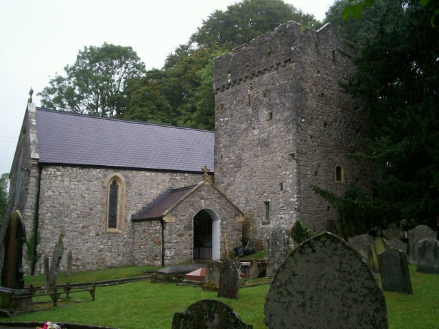
Ilston

Ilston (Welsh: Llanilltud Gwyr) is the name of a village and a local government community in Swansea, southwest Wales. Ilston has its own community council...

Kilvrough Manor

Kilvrough Manor is a large country house near Swansea. It is a Grade II* listed building. Its park is listed on the Cadw/ICOMOS Register of Parks and Gardens...
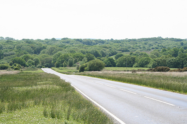
A4118 road

The A4118 road is in Swansea, Wales, connecting Dyfatty Street in Swansea City Centre with Port Eynon in the Gower Peninsula. The route runs through suburban...

Gower Peninsula

Gower (Welsh: Gŵyr) or the Gower Peninsula (Penrhyn Gŵyr) is in South West Wales and is the most westerly part of the historic county of Glamorgan, Wales...

RAF Fairwood Common

Royal Air Force Fairwood Common, or more simply RAF Fairwood Common, (IATA: EGFH, ICAO: SWS) is a former Royal Air Force Sector Station located on Fairwood...
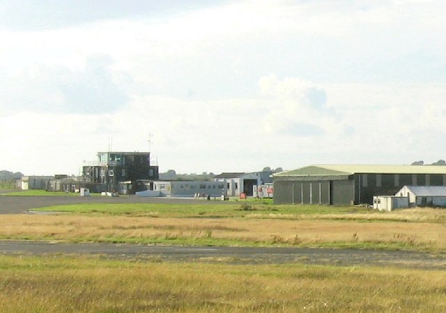
Swansea Airport

Swansea Airport (Welsh: Maes Awyr Abertawe) (IATA: SWS, ICAO: EGFH) is located in the middle of Fairwood Common on the Gower Peninsula 6 miles (9.7 km...

Pennard

Pennard (previously Llanarthbodu) is a village and community on the south of the Gower Peninsula, about 7 miles south-west of Swansea city centre. It falls...

Nearby Amenities

Located within 500m of 51.592872,-4.0814693
Ilston
Name Cy: Llanilltud Gŵyr
Place: village
Wikidata: Q20567728
Wikipedia: en:Ilston
Lat/Long: 51.5935064/-4.0865154
Barrier: stile
Lat/Long: 51.5898153/-4.0800109
Post Box
Lat/Long: 51.5947021/-4.0852182
Barrier: kissing_gate
Lat/Long: 51.5927785/-4.084596
Power: pole
Source: bing
Lat/Long: 51.594008/-4.0792098
Power: pole
Source: bing
Lat/Long: 51.5948817/-4.0826878
Power: pole
Source: bing
Lat/Long: 51.5944362/-4.0809573
Power: pole
Source: bing
Lat/Long: 51.5956807/-4.0837576
Power: pole
Source: bing
Lat/Long: 51.5962801/-4.0845977
Power: pole
Source: bing
Lat/Long: 51.593464/-4.077025
Barrier: stile
Foot: yes
Material: wood
Lat/Long: 51.5937469/-4.0793617
Information: route_marker
Tourism: information
Lat/Long: 51.5907907/-4.0810062
Courthouse Wood
Natural: wood
Lat/Long: 51.5923541/-4.0815427
Canisland Wood
Natural: wood
Lat/Long: 51.5908611/-4.0779598
Carey's Wood
Natural: wood
Lat/Long: 51.5911054/-4.0825433
The data included in this document is from www.openstreetmap.org. The data is made available under ODbL.

Have you been to Courthouse Wood?

Leave your review of Courthouse Wood below (or comments, questions and feedback).