Allt y Clyniau

Wood, Forest in Carmarthenshire

Wales

Allt y Clyniau

Llwybr yn gadael yr heol / Path exits the road Llwybr troed cyhoeddus yn gadael yr heol ar lethrau Mynydd Llanllwni.

A public footpath exits the road on the slopes of Mynydd Llanllwni (trans. St Llwni's parish mountain).
Llwybr yn gadael yr heol / Path exits the road Credit: Alan Richards

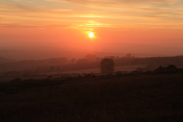
Allt y Clyniau is a picturesque wood located in the county of Carmarthenshire, Wales. Situated near the village of Cwmduad, it covers an area of approximately 100 acres. The wood is known for its dense forestation and is a popular destination for nature lovers and outdoor enthusiasts.

The wood is primarily composed of native tree species such as oak, ash, beech, and birch. These trees create a vibrant and diverse ecosystem, providing a habitat for a variety of wildlife, including birds, mammals, and insects. The area is particularly renowned for its birdlife, with species such as the red kite, buzzard, and woodpecker frequently spotted.

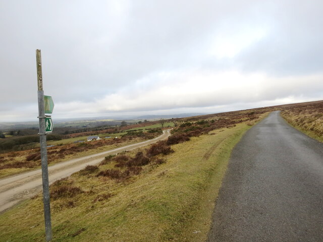
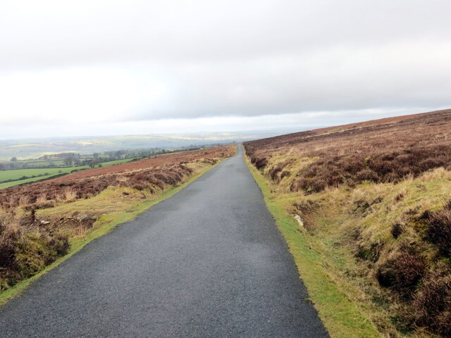
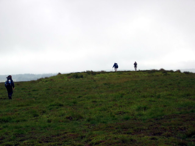
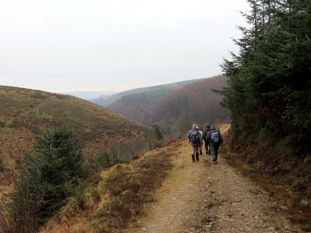
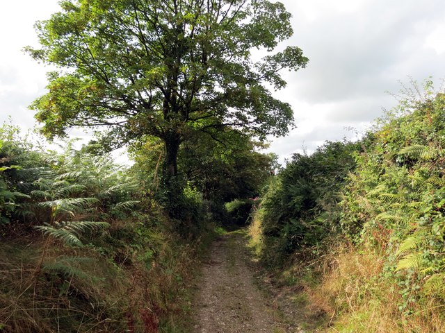
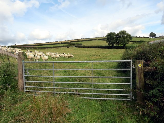
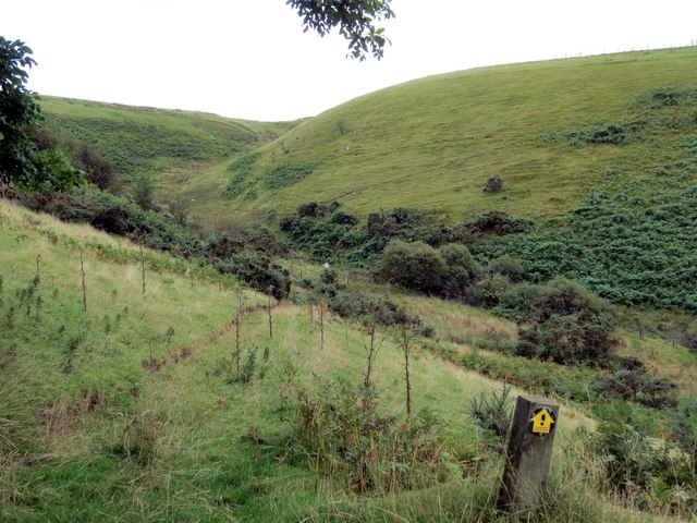
Several walking trails traverse the wood, allowing visitors to explore its natural beauty. These paths meander through the trees, offering breathtaking views of the surrounding countryside. The wood is also intersected by a small stream, adding to its charm and providing a tranquil atmosphere.

Allt y Clyniau is well-maintained, with efforts made to preserve its natural state. The wood is a designated Site of Special Scientific Interest (SSSI), acknowledging its ecological importance. As a result, there are guidelines in place to ensure the conservation of the flora and fauna within the area.

Overall, Allt y Clyniau is a captivating wood that showcases the beauty of nature in Carmarthenshire. Its rich biodiversity, stunning landscapes, and peaceful ambiance make it a must-visit destination for anyone seeking a tranquil escape in the heart of Wales.

If you have any feedback on the listing, please let us know in the comments section below.

Allt y Clyniau Images

Images are sourced within 2km of 52.005241/-4.2018619 or Grid Reference SN4836. Thanks to Geograph Open Source API. All images are credited.

Llwybr yn gadael yr heol / Path exits the road Llwybr troed cyhoeddus yn gadael yr heol ar lethrau Mynydd Llanllwni.

A public footpath exits the road on the slopes of Mynydd Llanllwni (trans. St Llwni's parish mountain).
Llwybr yn gadael yr heol / Path exits the road
Llwybr troed cyhoeddus yn gadael yr heol ar lethrau Mynydd Llanllwni. A public footpath exits the road on the slopes of Mynydd Llanllwni (trans. St Llwni's parish mountain).
Heol fach ar Fynydd Llanllwni / Minor road on Mynydd Llanllwni Heol fach ar lethrau Mynydd Llanllwni.

A minor road on the slopes of Mynydd Llanllwni (trans. St Llwni's parish mountain).
Heol fach ar Fynydd Llanllwni / Minor road on Mynydd Llanllwni
Heol fach ar lethrau Mynydd Llanllwni. A minor road on the slopes of Mynydd Llanllwni (trans. St Llwni's parish mountain).
Ordnance Survey Cut Mark This OS cut mark can be found on the house NW side of the road. It marks a point 185.941m above mean sea level.
Ordnance Survey Cut Mark
This OS cut mark can be found on the house NW side of the road. It marks a point 185.941m above mean sea level.
Crugiau Giar Cerddwyr yn ymweld ag un o'r ddwy domen gladdu ar Fynydd Llanllwni a elwir yn 'Crugiau Giar'. 

Walkers visiting one of two Bronze Age burial mounds on Mynydd Llanllwni known as 'Crugiau Giar'
Crugiau Giar
Cerddwyr yn ymweld ag un o'r ddwy domen gladdu ar Fynydd Llanllwni a elwir yn 'Crugiau Giar'. Walkers visiting one of two Bronze Age burial mounds on Mynydd Llanllwni known as 'Crugiau Giar'
Ger / Near Esgair Garn Llwybr ar lethrau Mynydd Llanllwi ger Farm Esgair Garn.

A footpath on the slopes of Mynydd Llanllwni near Esgair Garn (trans. ridge cairn).
Ger / Near Esgair Garn
Llwybr ar lethrau Mynydd Llanllwi ger Farm Esgair Garn. A footpath on the slopes of Mynydd Llanllwni near Esgair Garn (trans. ridge cairn).
Carn Heddwch / Peace Monument Carn Heddwch ar Fynydd Llanfihangel Rhos y Corn. Codwyd y garn yn 2007 gan Brian Denman, cerflunydd ac oddi mewn iddi fe ddodwyd capan amser gan blant Ysgol Gynradd Brechfa. O amgylch y gofeb fe naddwyd y gair 'heddwch' mewn pedair iaith sef Cymraeg, Hebraeg, Arebeg a Saesneg. 

Peace Monument located on Mynydd Llanfihangel Rhos y Corn. It was constructed in 2007 by sculptor, Brian Denman and a time capsule placed within it by pupils of Brechfa Primary School. Around the cairn the word 'peace' has been carved in four languages i.e. Cymraeg (Welsh), Hebrew, Arabic and English.
Carn Heddwch / Peace Monument
Carn Heddwch ar Fynydd Llanfihangel Rhos y Corn. Codwyd y garn yn 2007 gan Brian Denman, cerflunydd ac oddi mewn iddi fe ddodwyd capan amser gan blant Ysgol Gynradd Brechfa. O amgylch y gofeb fe naddwyd y gair 'heddwch' mewn pedair iaith sef Cymraeg, Hebraeg, Arebeg a Saesneg. Peace Monument located on Mynydd Llanfihangel Rhos y Corn. It was constructed in 2007 by sculptor, Brian Denman and a time capsule placed within it by pupils of Brechfa Primary School. Around the cairn the word 'peace' has been carved in four languages i.e. Cymraeg (Welsh), Hebrew, Arabic and English.
A485 approaching Aberglwydeth
A485 to the north of New Inn New Inn sign visible on the left verge
A485 to the north of New Inn
New Inn sign visible on the left verge
New Inn from A485
New Inn from A485
A Blue Sheep A sheep with its owner's marking of blue - belonging to one of the Graziers of Mynydd Llanllwni common. In the background, some of the ten giant wind turbines near Gwyddgrug, called the Alltwalis wind farm [110 m high]. Although there was a brisk breeze that day, the turbine blades were standing still; not an unusual occurrence. Mynydd Llanllni is the area where another wind farm company want to put 21 more turbines at 127m high.
A Blue Sheep
A sheep with its owner's marking of blue - belonging to one of the Graziers of Mynydd Llanllwni common. In the background, some of the ten giant wind turbines near Gwyddgrug, called the Alltwalis wind farm [110 m high]. Although there was a brisk breeze that day, the turbine blades were standing still; not an unusual occurrence. Mynydd Llanllni is the area where another wind farm company want to put 21 more turbines at 127m high.
New Inn
New Inn
Cwm Marlais Cerddwyr yn dilyn trac ym mhen uchaf Cwm Marlais

Walkers following a track at the upper reaches of Cwm Marlais
Cwm Marlais
Cerddwyr yn dilyn trac ym mhen uchaf Cwm Marlais Walkers following a track at the upper reaches of Cwm Marlais
Llwybr Blaen Gwyddgrug / Blaen Gwyddgrug path Llwybr cyhoeddus ger anhedd-dy o'r enw Blaen Gwyddgrug yn arwain at Ffarm Foel y Ddafad Ddu.

A public footpath near a property known as Blaen Gwyddgrug (trans. source of the Gwyddgrug [conspicuous mound] stream heading in the direction of Foel y Ddafad Ddu Farm (trans. bare hill of the black sheep).
Llwybr Blaen Gwyddgrug / Blaen Gwyddgrug path
Llwybr cyhoeddus ger anhedd-dy o'r enw Blaen Gwyddgrug yn arwain at Ffarm Foel y Ddafad Ddu. A public footpath near a property known as Blaen Gwyddgrug (trans. source of the Gwyddgrug [conspicuous mound] stream heading in the direction of Foel y Ddafad Ddu Farm (trans. bare hill of the black sheep).
Llwybr Foel y Ddafad Ddu  / Foel y Dafad Ddu path Llwybr cyhoeddus yn agosau at Ffarm Foel y Ddafad Ddu.

A public footpath approaching Foel y Ddafad Ddu Farm (trans. bare hill of the black sheep).
Llwybr Foel y Ddafad Ddu / Foel y Dafad Ddu path
Llwybr cyhoeddus yn agosau at Ffarm Foel y Ddafad Ddu. A public footpath approaching Foel y Ddafad Ddu Farm (trans. bare hill of the black sheep).
Llwybr Foel y Ddafad Ddu / Llwybr Foel y Ddafad Ddu path Llwybr cyhoeddus yn arwain o Ffarm y Castell tuag at Ffarm Foel y Ddafad Ddu. Serch nad oes dafad ddu ymhlith y rhain!

A public footpath linking Castell Farm (trans. castle) with  Foel Y Ddafad Ddu Farm (trans. bare hill of the black sheep). No black sheep amongst this lot though!
Llwybr Foel y Ddafad Ddu / Llwybr Foel y Ddafad Ddu path
Llwybr cyhoeddus yn arwain o Ffarm y Castell tuag at Ffarm Foel y Ddafad Ddu. Serch nad oes dafad ddu ymhlith y rhain! A public footpath linking Castell Farm (trans. castle) with Foel Y Ddafad Ddu Farm (trans. bare hill of the black sheep). No black sheep amongst this lot though!
Llwybr Trybedd / Trybedd path Llwybr cyhoeddus islaw adfeilion anhedd-dy o'r enw Trybedd.

A public footpath below the ruined property of Trybedd.
Llwybr Trybedd / Trybedd path
Llwybr cyhoeddus islaw adfeilion anhedd-dy o'r enw Trybedd. A public footpath below the ruined property of Trybedd.
Sunset over Llanllwni
Ordnance Survey Rivet This OS rivet can be found on the culvert to the east of the road. It marks a point 310.551m above mean sea level.
Ordnance Survey Rivet
This OS rivet can be found on the culvert to the east of the road. It marks a point 310.551m above mean sea level.
Show me another place!

Allt y Clyniau is located at Grid Ref: SN4836 (Lat: 52.005241, Lng: -4.2018619)

Unitary Authority: Carmarthenshire

Police Authority: Dyfed Powys

What 3 Words

///quite.prowl.counts. Near Pencader, Carmarthenshire

Related Wikis

New Inn, Carmarthenshire

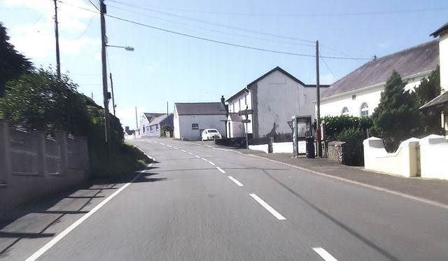
New Inn is a small village located in Carmarthenshire, Wales with a population of 348. It is situated along the A485 A road between Llanllwni and Gwyddgrug...

Gwyddgrug

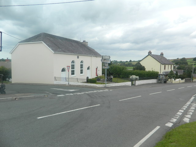
Gwyddgrug is a small village in Carmarthenshire, West Wales. It is located on the main A485 road south of New Inn. == References ==

Llanllwni

Llanllwni is a village and community in Carmarthenshire, Wales, on the A485 road south-west of Llanybydder. To the south lies the mountain, Mynydd Llanllwni...

Brechfa Forest Wind Farm

Brechfa Forest West Wind Farm is a wind farm in Brechfa Forest in Carmarthenshire in south west Wales. Construction of the wind farm began in November...

Nearby Amenities

Located within 500m of 52.005241,-4.2018619
Direction: 150
Generator Method: photovoltaic
Generator Output Electricity: yes
Generator Solar Modules: 16
Generator Source: solar
Generator Type: solar_photovoltaic_panel
Location: roof
Power: generator
Lat/Long: 52.0064699/-4.1956154
The data included in this document is from www.openstreetmap.org. The data is made available under ODbL.

Have you been to Allt y Clyniau?

Leave your review of Allt y Clyniau below (or comments, questions and feedback).