Burlinch

Settlement in Somerset Somerset West and Taunton

England

Burlinch

The National Grid and two cows The pylons are crossing the southern end of the Quantock Hills.
The National Grid and two cows Credit: Barbara Cook

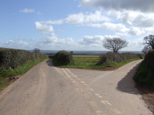
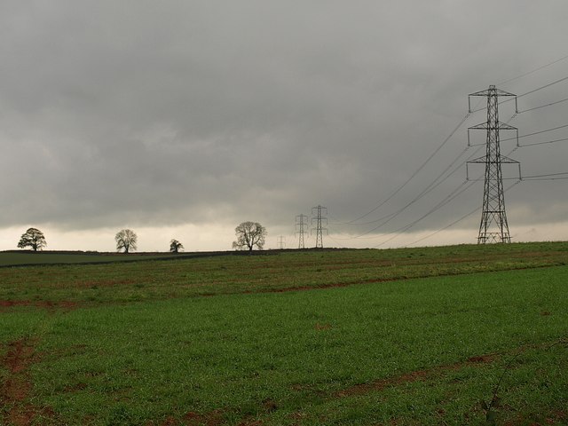
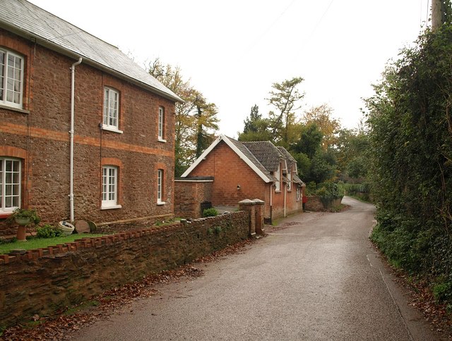
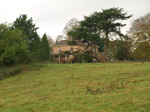
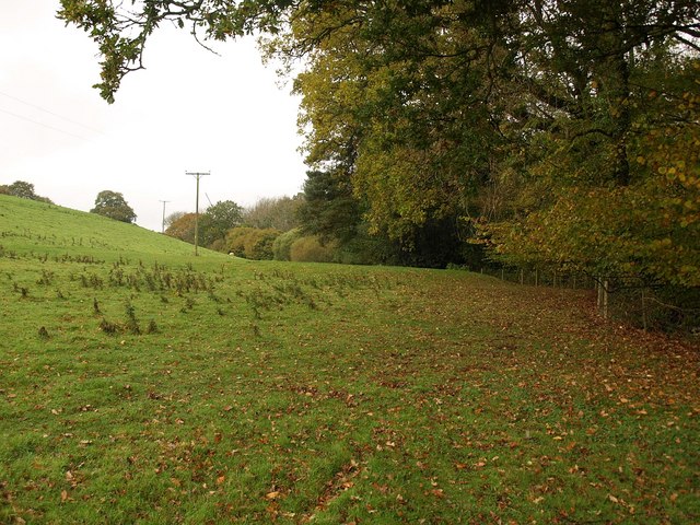
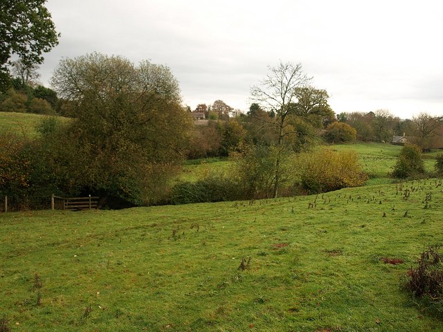
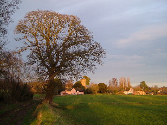
Burlinch is a small village located in the county of Somerset, in the southwest of England. Situated approximately 10 miles northwest of the county town of Taunton, Burlinch is nestled in a picturesque rural setting, surrounded by rolling hills and farmland.

The village is home to a population of around 500 residents, making it a close-knit community where neighbors often know each other. It boasts a charming and peaceful atmosphere, making it an ideal place for those seeking a quiet and tranquil lifestyle.

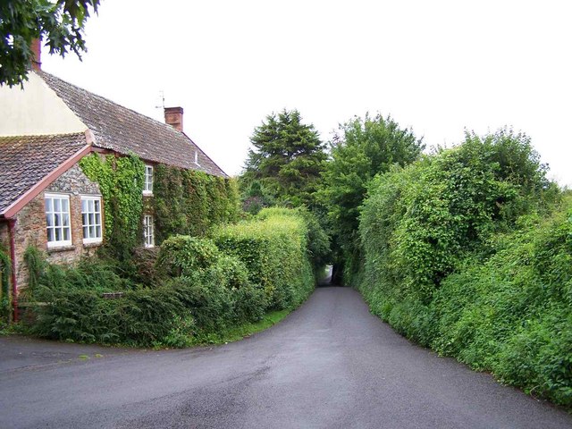
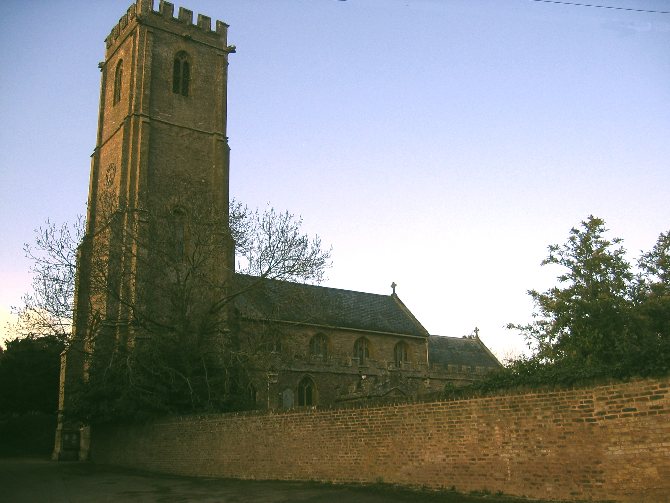
Burlinch is characterized by its traditional architecture, with many of the houses and buildings dating back several centuries. The village center is dominated by a historic church, St. Mary's, which serves as a focal point for both religious and community events.

Amenities in Burlinch include a local pub, The Red Lion, where locals and visitors can enjoy a drink or a meal in a welcoming and friendly environment. There is also a small village shop that provides essential groceries and everyday items.

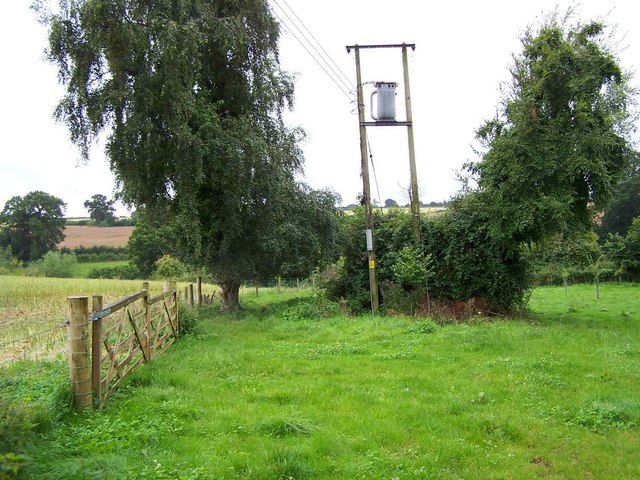
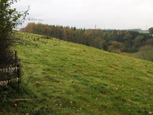
The surrounding countryside offers ample opportunities for outdoor activities such as hiking, cycling, and horse riding. Close by, there are several nature reserves and parks where residents can enjoy the beauty of the Somerset countryside.

Overall, Burlinch is a peaceful and idyllic village that offers a serene lifestyle for its residents. Its natural beauty, historic charm, and sense of community make it a truly special place to live or visit in Somerset.

If you have any feedback on the listing, please let us know in the comments section below.

Burlinch Images

Images are sourced within 2km of 51.055555/-3.0572069 or Grid Reference ST2629. Thanks to Geograph Open Source API. All images are credited.

The National Grid and two cows The pylons are crossing the southern end of the Quantock Hills.
The National Grid and two cows
The pylons are crossing the southern end of the Quantock Hills.
Black Barn With incumbants who must be wondering if the grass is long enough now to let them out!
Black Barn
With incumbants who must be wondering if the grass is long enough now to let them out!
Lane to Clavelshay The road degrades to a track over the next rise.
Lane to Clavelshay
The road degrades to a track over the next rise.
One pylon and Wood Close Copse
Two Pylons and Eleven Acre Copse This gridsquare is crossed by three lines of pylons taking power from Hinkley Point Power Station to the west country.
Two Pylons and Eleven Acre Copse
This gridsquare is crossed by three lines of pylons taking power from Hinkley Point Power Station to the west country.
Left or right Take your pick - left is Boez Lane to Thurloxton and right is Whiteleaze Lane to Adsborough.
Left or right
Take your pick - left is Boez Lane to Thurloxton and right is Whiteleaze Lane to Adsborough.
Lane Signed To Taunton, Thurloxton
Footpath From Thurloxton Church
Muddy field entrance, Boez Lane The lane is on a ridge between two wooded valleys, and this view is towards the southern of the two, which leads down to Combe Bottom.
Muddy field entrance, Boez Lane
The lane is on a ridge between two wooded valleys, and this view is towards the southern of the two, which leads down to Combe Bottom.
Pylon line and trees east of Standards Pylon lines rather dominate this square - there are three of them running parallel diagonally across it. Here the westernmost row strides towards Taunton.
Pylon line and trees east of Standards
Pylon lines rather dominate this square - there are three of them running parallel diagonally across it. Here the westernmost row strides towards Taunton.
Buildings in Thurloxton Beyond the pair of red stone semis is the village hall. "A village hall for the use of the inhabitants of the parish of Thurloxton without distinction of political, religious or other opinions including use for meetings lectures and classes and for other forms of recreation and leisure-time occupation with the object of improving the conditions of life for the said inhabitants" is how its function is described on the public register of charities. <span class="nowrap"><a title="http://www.guidestar.org.uk/gs_summary.aspx?CCReg=290720" rel="nofollow ugc noopener" href="http://www.guidestar.org.uk/gs_summary.aspx?CCReg=290720">Link</a><img style="margin-left:2px;" alt="External link" title="External link - shift click to open in new window" src="https://s1.geograph.org.uk/img/external.png" width="10" height="10"/></span>
Buildings in Thurloxton
Beyond the pair of red stone semis is the village hall. "A village hall for the use of the inhabitants of the parish of Thurloxton without distinction of political, religious or other opinions including use for meetings lectures and classes and for other forms of recreation and leisure-time occupation with the object of improving the conditions of life for the said inhabitants" is how its function is described on the public register of charities. LinkExternal link
Manor House, Thurloxton The mid-C19 manor house, perched at the west end of the village above a steep-sided valley, and built for the Colthurst family, of Colthurst Symons, producers of Bridgwater brick, of which the house is constructed <span class="nowrap"><a title="http://webapp1.somerset.gov.uk/her/details.asp?prn=13693" rel="nofollow ugc noopener" href="http://webapp1.somerset.gov.uk/her/details.asp?prn=13693">Link</a><img style="margin-left:2px;" alt="External link" title="External link - shift click to open in new window" src="https://s1.geograph.org.uk/img/external.png" width="10" height="10"/></span> . Seen from footpath BW33/11.
Manor House, Thurloxton
The mid-C19 manor house, perched at the west end of the village above a steep-sided valley, and built for the Colthurst family, of Colthurst Symons, producers of Bridgwater brick, of which the house is constructed LinkExternal link . Seen from footpath BW33/11.
Meadow near Thurloxton Taken close to the point where footpath BW33/11 crosses the stream in the valley which runs across the south side of the village.
Meadow near Thurloxton
Taken close to the point where footpath BW33/11 crosses the stream in the valley which runs across the south side of the village.
Valley, Thurloxton Taken in the same meadow as <a href="https://www.geograph.org.uk/photo/1586942">ST2730 : Meadow near Thurloxton</a>, from footpath BW33/11, looking back towards the largely hidden village. Such was my haste to take advantage of the sun's only appearance of the day that the result is slightly blurred, and there seems to be very little evidence of sunshine anyway.
Valley, Thurloxton
Taken in the same meadow as ST2730 : Meadow near Thurloxton, from footpath BW33/11, looking back towards the largely hidden village. Such was my haste to take advantage of the sun's only appearance of the day that the result is slightly blurred, and there seems to be very little evidence of sunshine anyway.
Countryside west of Thurloxton From Boez Lane, looking across the valley shown in <a href="https://www.geograph.org.uk/photo/1586954">ST2730 : Valley, Thurloxton</a> about 400 metres further up to the west.
Countryside west of Thurloxton
From Boez Lane, looking across the valley shown in ST2730 : Valley, Thurloxton about 400 metres further up to the west.
Eleven Acre Copse From the same gateway as <a href="https://www.geograph.org.uk/photo/1586968">ST2630 : Countryside west of Thurloxton</a>, looking to the left up the valley, where plantations occupy it for a kilometre.
Eleven Acre Copse
From the same gateway as ST2630 : Countryside west of Thurloxton, looking to the left up the valley, where plantations occupy it for a kilometre.
Old barn, Thurloxton
Fields and woods, Thurloxton
Show me another place!

Burlinch is located at Grid Ref: ST2629 (Lat: 51.055555, Lng: -3.0572069)

Administrative County: Somerset

District: Somerset West and Taunton

Police Authority: Avon and Somerset

What 3 Words

///cabs.muddy.stream. Near Creech St Michael, Somerset

Related Wikis

Harold Redler

Lieutenant Harold Bolton Redler (27 January 1897 – 21 June 1918) was a British World War I flying ace credited with ten aerial victories. His most notable...

West Monkton

West Monkton is a village and civil parish in Somerset, England, situated 2 miles (3.2 km) north east of Taunton. The parish includes the hamlets of Monkton...

Walford, Somerset

Walford is a small village 3 miles (5 km) north east of Taunton in Somerset, England. Most of the village, including Walford Cross at the junction of...
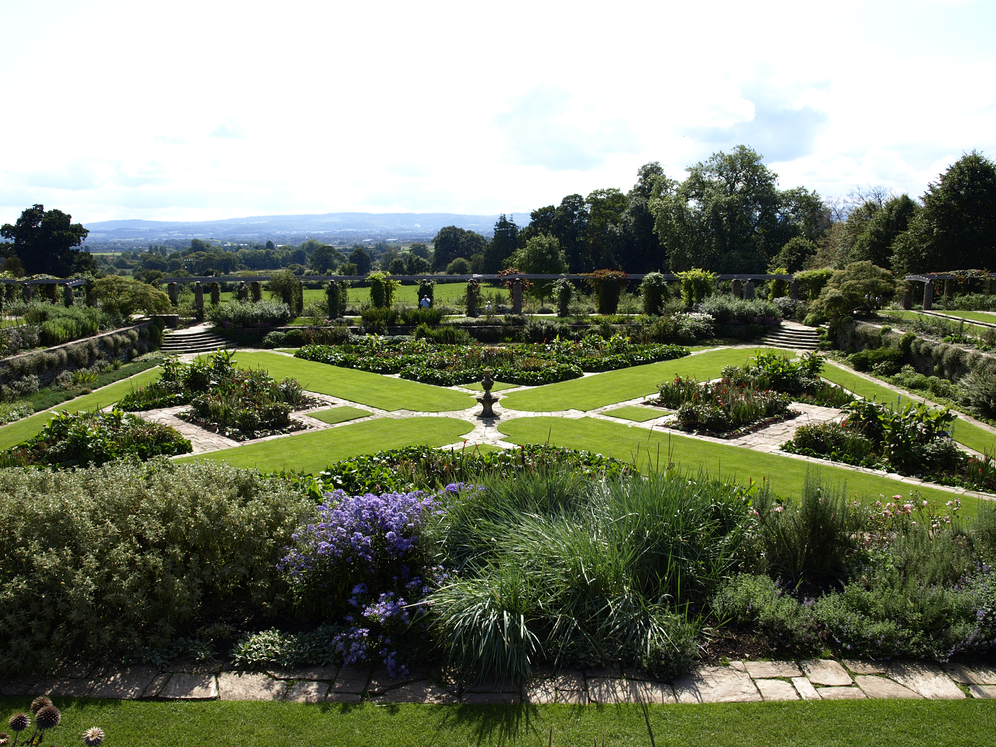
Hestercombe Gardens

Hestercombe Gardens is a garden complex situated on the grounds of Hestercombe House in the southwestern English county of Somerset. The entire garden...
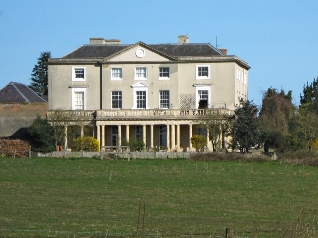
Hestercombe House

Hestercombe House is a historic country house in the parish of West Monkton in the Quantock Hills, near Taunton in Somerset, England. The house is a Grade...

Church of St Giles, Thurloxton

The Norman Anglican Church of St Giles in Thurloxton dates from the 14th century but is predominantly from the 15th century with 19th-century restoration...

Thurloxton

Thurloxton is a village and civil parish 5 miles (8 km) north-east of Taunton, and 5 miles south-west of Bridgwater on the south-eastern slopes of the...

Cheddon Fitzpaine

Cheddon Fitzpaine is a village and civil parish in Somerset, England, situated on the Quantock Hills 2 miles (3.2 km) north of Taunton. The village is...

Nearby Amenities

Located within 500m of 51.055555,-3.0572069
Give Way
Lat/Long: 51.0522063/-3.0537579
The data included in this document is from www.openstreetmap.org. The data is made available under ODbL.

Have you been to Burlinch?

Leave your review of Burlinch below (or comments, questions and feedback).