Coombe Bottom

Valley in Somerset Somerset West and Taunton

England

Coombe Bottom

Ordnance Survey Cut Mark This OS cut mark can be found on the porch of St Giles Church. It marks a point 81.292m above mean sea level.
Ordnance Survey Cut Mark Credit: Adrian Dust

Coombe Bottom is a picturesque valley located in the county of Somerset, England. Nestled amidst the rolling hills of the Quantock Hills Area of Outstanding Natural Beauty, this tranquil valley is a haven for nature lovers and outdoor enthusiasts.

The valley is characterized by its lush green meadows, dense woodlands, and meandering streams. It stretches approximately 2 miles in length and is situated to the east of the village of Holford. Coombe Bottom is known for its stunning natural scenery and is a popular destination for hikers, cyclists, and birdwatchers.

The valley is home to a rich variety of flora and fauna, with a diverse range of plant species and an abundance of wildlife. Visitors can spot various birds, including buzzards, owls, and woodpeckers, as well as deer, badgers, and foxes.

Coombe Bottom offers a network of footpaths and trails that allow visitors to explore its beauty. One of the most popular routes is the Coombe Bottom Circular Walk, which takes walkers through the valley, past charming cottages, and along the banks of the glistening stream.

The valley also has historical significance, with traces of ancient settlements and archaeological sites found in the area. It is believed that Coombe Bottom has been inhabited since prehistoric times.

Overall, Coombe Bottom in Somerset is a hidden gem, offering a peaceful retreat in the heart of nature. Its scenic beauty, diverse wildlife, and historical charm make it a must-visit destination for nature enthusiasts and those seeking a peaceful escape.

If you have any feedback on the listing, please let us know in the comments section below.

Coombe Bottom Images

Images are sourced within 2km of 51.060119/-3.0456525 or Grid Reference ST2629. Thanks to Geograph Open Source API. All images are credited.

Ordnance Survey Cut Mark This OS cut mark can be found on the porch of St Giles Church. It marks a point 81.292m above mean sea level.
Ordnance Survey Cut Mark
This OS cut mark can be found on the porch of St Giles Church. It marks a point 81.292m above mean sea level.
Thurloxton : Taunton Road A38 The A38 seen at the road junction.
Thurloxton : Taunton Road A38
The A38 seen at the road junction.
Thurloxton : Knotcroft Lane Looking along a small lane through the village.
Thurloxton : Knotcroft Lane
Looking along a small lane through the village.
Thurloxton : Driveway A small driveway into the nearby homes.
Thurloxton : Driveway
A small driveway into the nearby homes.
Thurloxton : Country Lane A small lane heading to the village.
Thurloxton : Country Lane
A small lane heading to the village.
Thurloxton : Grassy Field A field off Howell's Lane.
Thurloxton : Grassy Field
A field off Howell's Lane.
Thurloxton : Howell's Lane Looking along a small country lane.
Thurloxton : Howell's Lane
Looking along a small country lane.
Thurloxton : St Giles Church Entrance gates into the churchyard.
Thurloxton : St Giles Church
Entrance gates into the churchyard.
Thurloxton : St Giles Church The Norman Anglican Church of St Giles in Thurloxton dates from the 14th century but is predominantly from the 15th century with 19th-century restoration including the addition of the north aisle in 1868.
Thurloxton : St Giles Church
The Norman Anglican Church of St Giles in Thurloxton dates from the 14th century but is predominantly from the 15th century with 19th-century restoration including the addition of the north aisle in 1868.
Thurloxton : St Giles Church The two-stage west tower is supported by diagonal buttresses.
Thurloxton : St Giles Church
The two-stage west tower is supported by diagonal buttresses.
Thurloxton : St Giles Church Looking to the Christmas tree in the church grounds.
Thurloxton : St Giles Church
Looking to the Christmas tree in the church grounds.
Thurloxton : St Giles Church The two-stage west tower is supported by diagonal buttresses. The Norman Anglican Church of St Giles in Thurloxton dates from the 14th century but is predominantly from the 15th century with 19th-century restoration including the addition of the north aisle in 1868.
Thurloxton : St Giles Church
The two-stage west tower is supported by diagonal buttresses. The Norman Anglican Church of St Giles in Thurloxton dates from the 14th century but is predominantly from the 15th century with 19th-century restoration including the addition of the north aisle in 1868.
Thurloxton : St Giles Church The church consists of a two-bay nave which has a south porch and three-bay north aisle, and a two-bay chancel with vestry. The interior includes an octagonal Norman font and 18th century rood screen.
Thurloxton : St Giles Church
The church consists of a two-bay nave which has a south porch and three-bay north aisle, and a two-bay chancel with vestry. The interior includes an octagonal Norman font and 18th century rood screen.
Thurloxton : St Giles Church A window dedicated to Queen Elizabeth II and Prince Philip for the Diamond Jubilee.
Thurloxton : St Giles Church
A window dedicated to Queen Elizabeth II and Prince Philip for the Diamond Jubilee.
Thurloxton : St Giles Church A place for some bell ringing.
Thurloxton : St Giles Church
A place for some bell ringing.
Thurloxton : St Giles Church The church consists of a two-bay nave which has a south porch and three-bay north aisle, and a two-bay chancel with vestry. The interior includes an octagonal Norman font and 18th century rood screen.
Thurloxton : St Giles Church
The church consists of a two-bay nave which has a south porch and three-bay north aisle, and a two-bay chancel with vestry. The interior includes an octagonal Norman font and 18th century rood screen.
Thurloxton : St Giles Church One of the windows of the church.
Thurloxton : St Giles Church
One of the windows of the church.
Show me another place!

Coombe Bottom is located at Grid Ref: ST2629 (Lat: 51.060119, Lng: -3.0456525)

Administrative County: Somerset

District: Somerset West and Taunton

Police Authority: Avon and Somerset

What 3 Words

///carry.zebra.ramps. Near Creech St Michael, Somerset

Related Wikis

West Monkton

West Monkton is a village and civil parish in Somerset, England, situated 2 miles (3.2 km) north east of Taunton. The parish includes the hamlets of Monkton...

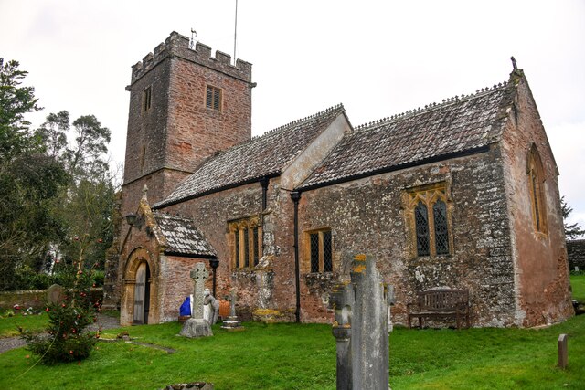
Church of St Giles, Thurloxton

The Norman Anglican Church of St Giles in Thurloxton dates from the 14th century but is predominantly from the 15th century with 19th-century restoration...

Harold Redler

Lieutenant Harold Bolton Redler (27 January 1897 – 21 June 1918) was a British World War I flying ace credited with ten aerial victories. His most notable...
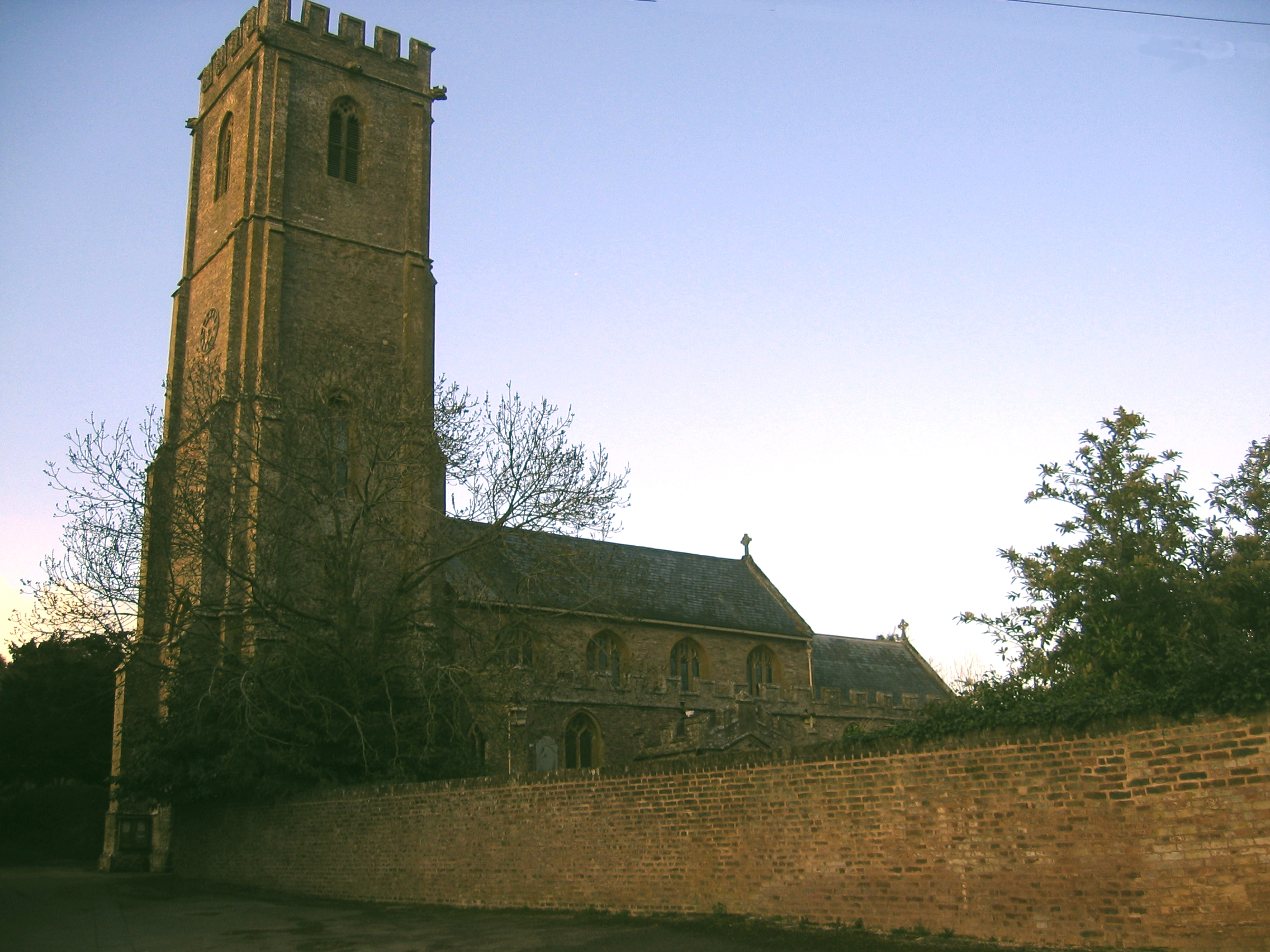
Thurloxton

Thurloxton is a village and civil parish 5 miles (8 km) north-east of Taunton, and 5 miles south-west of Bridgwater on the south-eastern slopes of the...

Walford, Somerset

Walford is a small village 3 miles (5 km) north east of Taunton in Somerset, England. Most of the village, including Walford Cross at the junction of...

Buckland Priory

Buckland Priory (also known as Minchin Buckland Preceptory or Buckland Sororum (Latin: "Buckland of the Sisters")) was established around 1167 in Lower...
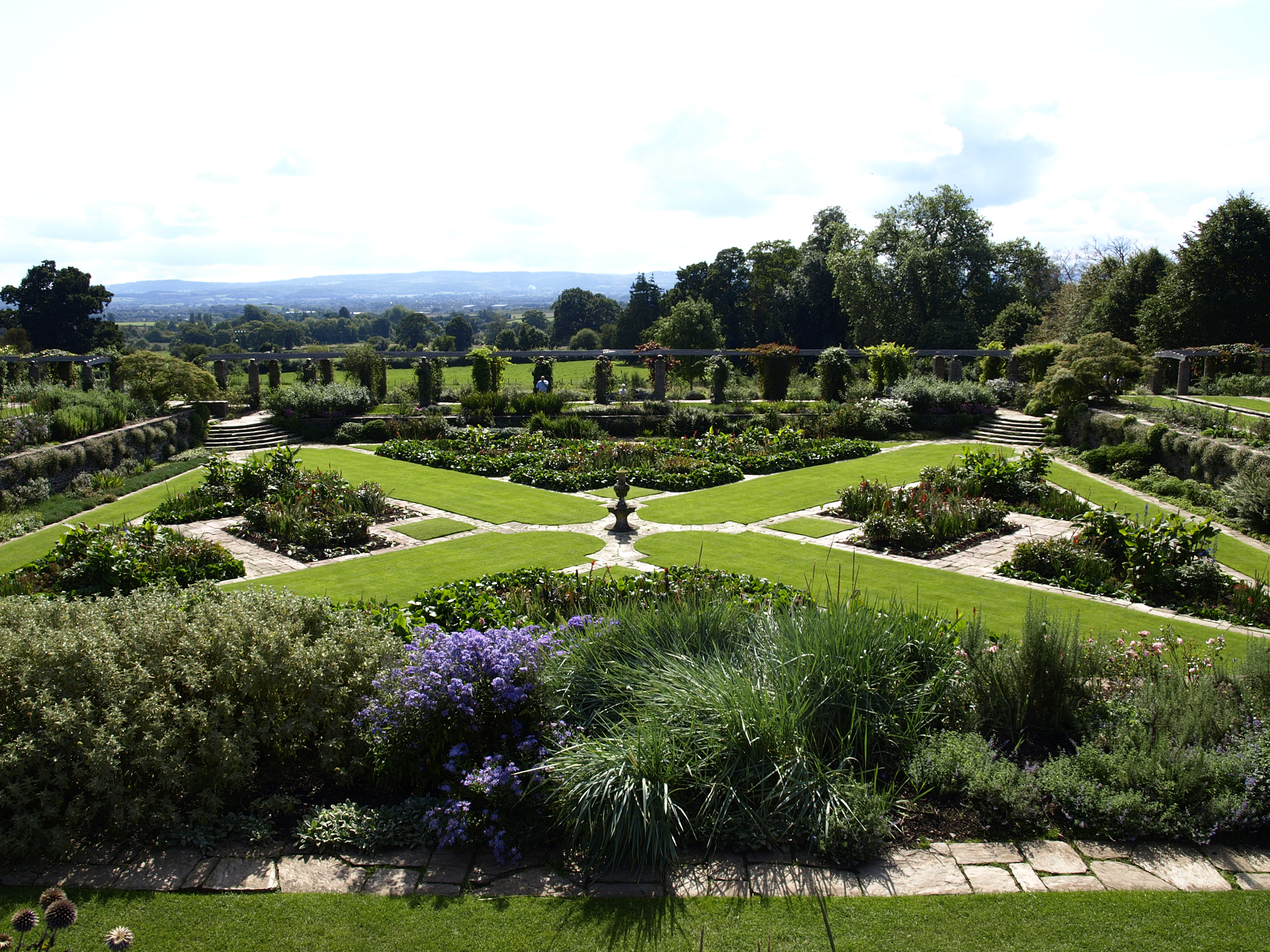
Hestercombe Gardens

Hestercombe Gardens is a garden complex situated on the grounds of Hestercombe House in the southwestern English county of Somerset. The entire garden...
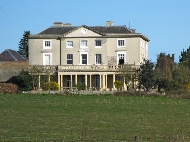
Hestercombe House

Hestercombe House is a historic country house in the parish of West Monkton in the Quantock Hills, near Taunton in Somerset, England. The house is a Grade...

Nearby Amenities

Located within 500m of 51.060119,-3.0456525
Coombe Bottom
Place: hamlet
Lat/Long: 51.0573594/-3.0420725
The data included in this document is from www.openstreetmap.org. The data is made available under ODbL.

Have you been to Coombe Bottom?

Leave your review of Coombe Bottom below (or comments, questions and feedback).