Coed Mochras

Wood, Forest in Caernarfonshire

Wales

Coed Mochras

On Carn Fadryn - view towards Yr Eifl
On Carn Fadryn - view towards Yr Eifl Credit: Colin Park

Coed Mochras, located in Caernarfonshire, Wales, is a stunning wood or forest that captivates visitors with its natural beauty and tranquility. Covering an area of approximately 1,000 hectares, this ancient woodland is a haven for wildlife and a popular destination for nature enthusiasts.

The wood is predominantly composed of native tree species, including oak, beech, ash, and birch. The diverse range of flora and fauna found in Coed Mochras makes it an important ecological site. The forest floor is adorned with a vibrant carpet of wildflowers, while the trees provide shade and shelter for a variety of bird species, including the elusive red kite and the melodious nightingale.

There are several walking trails that wind their way through the wood, allowing visitors to immerse themselves in the natural splendor of Coed Mochras. These paths provide opportunities for hikers to enjoy scenic views, spot wildlife, and breathe in the fresh, crisp air. The forest also offers picnic areas and designated camping sites, making it an ideal destination for families and outdoor enthusiasts.

Coed Mochras holds historical significance as well. The wood has been carefully managed for centuries, and remnants of ancient settlements, such as stone circles and burial mounds, can still be found within its boundaries. These archaeological sites offer a glimpse into the lives of the people who once called this forest home.

In conclusion, Coed Mochras is a picturesque woodland in Caernarfonshire that showcases the beauty of nature and preserves the rich history of the area. Whether it is for a leisurely stroll, birdwatching, or simply escaping the hustle and bustle of everyday life, this enchanting forest is a must-visit destination for those seeking solace in the embrace of nature.

If you have any feedback on the listing, please let us know in the comments section below.
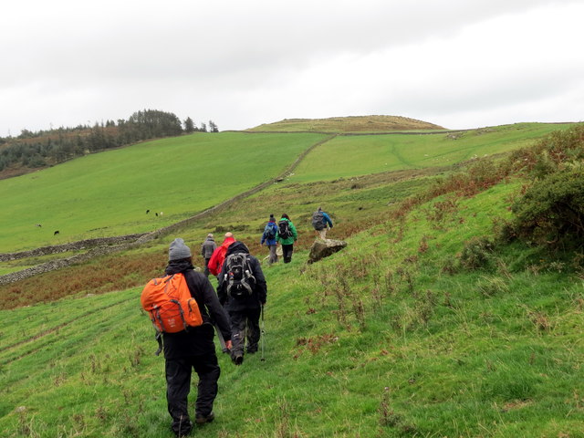
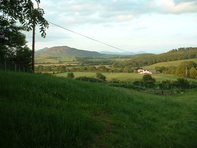
Coed Mochras Images

Images are sourced within 2km of 52.899825/-4.5311337 or Grid Reference SH2936. Thanks to Geograph Open Source API. All images are credited.

On Carn Fadryn - view towards Yr Eifl
Sticil / Stile Cerddwr yn dringo sticil ger Ffarm Caeau Gwynion.

Walkers climbing a stile near Caeau Gwynion (trans. white / fair fields)
Sticil / Stile
Cerddwr yn dringo sticil ger Ffarm Caeau Gwynion. Walkers climbing a stile near Caeau Gwynion (trans. white / fair fields)
Tuag at Foel Caerau / Towards Moel Caerau Cerddwyr yn mynd I gyfeiriad Moel Caearau, y bryn yn y pellter.

Walkers heading towards Moel Caearau (trans. bare hilltop of the forts), the hill in the distance.
Tuag at Foel Caerau / Towards Moel Caerau
Cerddwyr yn mynd I gyfeiriad Moel Caearau, y bryn yn y pellter. Walkers heading towards Moel Caearau (trans. bare hilltop of the forts), the hill in the distance.
Llwybr Caerau Uchaf / Upper Caerau Path Cerddwyr yn dilyn llwybr cyhoeddus tuag at Ffarm Caerau Uchaf.

Walkers following a public footpath towards Caerau Uchaf Farm (trans. upper forts).
Llwybr Caerau Uchaf / Upper Caerau Path
Cerddwyr yn dilyn llwybr cyhoeddus tuag at Ffarm Caerau Uchaf. Walkers following a public footpath towards Caerau Uchaf Farm (trans. upper forts).
Tuag at Garn Bach / Towards Garn Bach Cerddwyr yn dilyn llwybr cyhoeddus tuag at Garn Bach, y bryncyn yn y pellter.

Walkers following a public footpath towards Garn Fach (trans. little rock), the hillock in the distance.
Tuag at Garn Bach / Towards Garn Bach
Cerddwyr yn dilyn llwybr cyhoeddus tuag at Garn Bach, y bryncyn yn y pellter. Walkers following a public footpath towards Garn Fach (trans. little rock), the hillock in the distance.
Access road for Caerau Uchaf The quite lengthy access road to the farm at Caerau Uchaf leaves a minor road from which the image was recorded. The cloud-shadowed hill in the distance is Moel Caerau.
Access road for Caerau Uchaf
The quite lengthy access road to the farm at Caerau Uchaf leaves a minor road from which the image was recorded. The cloud-shadowed hill in the distance is Moel Caerau.
Field with ewes and lambs Warm Spring sunshine has started the grass growing and is getting the new lambs off to a good start. This view is to the East taking in the B4415 as it drops towards Rhyd-y-clafdy.
Field with ewes and lambs
Warm Spring sunshine has started the grass growing and is getting the new lambs off to a good start. This view is to the East taking in the B4415 as it drops towards Rhyd-y-clafdy.
Disused quarry A small, disused quarry at the roadside is developed in a localised outcrop of a rhyolitic tuff called the Bodgadle Member, of Ordovician, Caradoc age and associated with volcanic activity in the Pwllheli and Llanbedrog area. This rock has a very pale colour when weathered and can be seen as distinctive outcrops on the edge of the hill (e.g. <a href="https://www.geograph.org.uk/photo/1989291">SH3135 : View across pastureland towards Bodgadle Farm</a>).
Disused quarry
A small, disused quarry at the roadside is developed in a localised outcrop of a rhyolitic tuff called the Bodgadle Member, of Ordovician, Caradoc age and associated with volcanic activity in the Pwllheli and Llanbedrog area. This rock has a very pale colour when weathered and can be seen as distinctive outcrops on the edge of the hill (e.g. SH3135 : View across pastureland towards Bodgadle Farm).
Road junction near Garnfadryn Both roads lead to Botwnnog, the one on the right via Garnfadryn.
Road junction near Garnfadryn
Both roads lead to Botwnnog, the one on the right via Garnfadryn.
Milestone - Pwllheli 5
Farmland below Carn Fadryn Looking northish, towards Yr Eifl. The hill in the middle distance is Moel Ty-gwyn, I think.
Farmland below Carn Fadryn
Looking northish, towards Yr Eifl. The hill in the middle distance is Moel Ty-gwyn, I think.
Farmland below Garn Bach Looking south west towards Carneddol.
Farmland below Garn Bach
Looking south west towards Carneddol.
Farmland near Olwen Farm Looking north east. Olwen Farm is visible, in the adjacent square. The hill is Garn Boduan.
Farmland near Olwen Farm
Looking north east. Olwen Farm is visible, in the adjacent square. The hill is Garn Boduan.
Madryn Castle Caravan Park A nicely laid out and landscaped park, in a pleasant location.
Madryn Castle Caravan Park
A nicely laid out and landscaped park, in a pleasant location.
Lane to Cors-yr-hafod Looking south.
Lane to Cors-yr-hafod
Looking south.
Woodland on Foel Ddu Foel Ddu means 'Black hill'.
Woodland on Foel Ddu
Foel Ddu means 'Black hill'.
Peniel Chapel Near Groesffordd.
Peniel Chapel
Near Groesffordd.
Crossroads at Groesffordd I think that "Groesffordd" means "Crossroads" in Welsh, but it is the name of this place, and it does have a crossroads.
Crossroads at Groesffordd
I think that "Groesffordd" means "Crossroads" in Welsh, but it is the name of this place, and it does have a crossroads.
Show me another place!

Coed Mochras is located at Grid Ref: SH2936 (Lat: 52.899825, Lng: -4.5311337)

Unitary Authority: Gwynedd

Police Authority: North Wales

What 3 Words

///skippers.tycoons.launch. Near Nefyn, Gwynedd

Related Wikis

Cors Geirch National Nature Reserve

Cors Geirch National Nature Reserve is an extensive wetland site on the Llŷn Peninsula, in the central part of the valley that runs between Nefyn and Pwllheli...

Llandudwen

Llandudwen is a former civil parish in the Welsh county of Gwynedd. It was abolished in 1934, and divided between Buan and Tudweiliog. == References ==

Ceidio

Ceidio is a former civil parish in the Welsh county of Gwynedd. It was abolished in 1934, and incorporated into Buan. == References ==

Llanfihangel Bachellaeth

Llanfihangel Bachellaeth is a former civil parish in the Welsh county of Gwynedd. It was abolished in 1934, and incorporated into Buan. == References ==

Have you been to Coed Mochras?

Leave your review of Coed Mochras below (or comments, questions and feedback).