Coed Faenol-fach

Wood, Forest in Cardiganshire

Wales

Coed Faenol-fach

Afon Teifi and ruined house The house (white) can be seen left of centre. Walking by the river now it is hard to imagine that not so long ago it was a hive of activity, industry, commerce and quarrying.
Afon Teifi and ruined house Credit: Trevor Harris

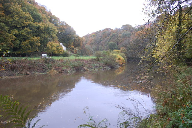
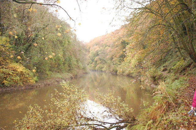
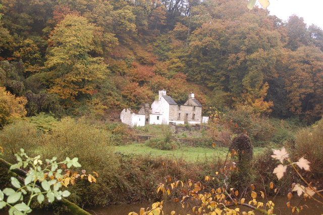
Coed Faenol-fach is a captivating woodland located in the picturesque county of Cardiganshire, Wales. Spanning over a vast area, this enchanting forest is renowned for its natural beauty and rich biodiversity. The name "Coed Faenol-fach" translates to "small stone grove," which aptly reflects the presence of ancient rock formations scattered throughout the woodland.

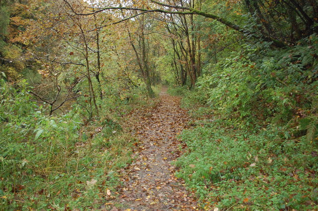
The forest boasts a diverse range of tree species, including oak, beech, birch, and pine, which create a lush and verdant canopy overhead. The forest floor is adorned with a vibrant carpet of wildflowers, ferns, and mosses, adding to the ethereal atmosphere. Numerous walking trails meander through the woodland, allowing visitors to immerse themselves in its tranquility and explore its hidden treasures.

Wildlife thrives within Coed Faenol-fach, with an abundance of bird species, such as owls, woodpeckers, and thrushes, filling the air with their melodious songs. Squirrels scamper through the treetops, while badgers and foxes roam stealthily in search of sustenance. The forest is also home to several species of butterflies, beetles, and other insects, creating a vibrant ecosystem.

Coed Faenol-fach holds a special place in the hearts of locals and visitors alike, providing a haven for relaxation, meditation, and reconnecting with nature. It is a popular destination for hikers, nature enthusiasts, and families seeking a peaceful escape from the hustle and bustle of everyday life.

With its breathtaking beauty and abundant wildlife, Coed Faenol-fach is a true gem of Cardiganshire, offering a sanctuary where one can immerse themselves in the wonders of the natural world.

If you have any feedback on the listing, please let us know in the comments section below.

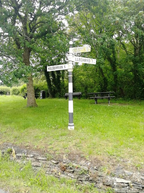
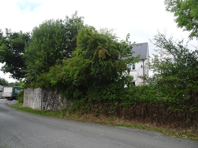
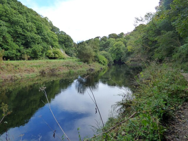
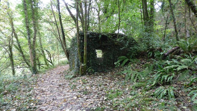
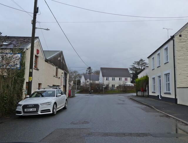
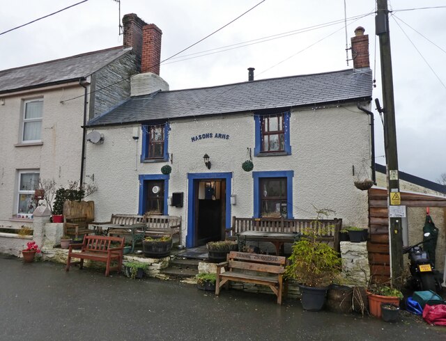
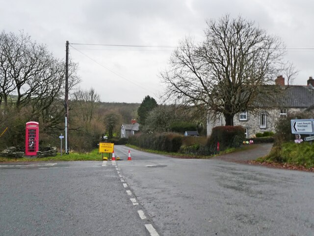
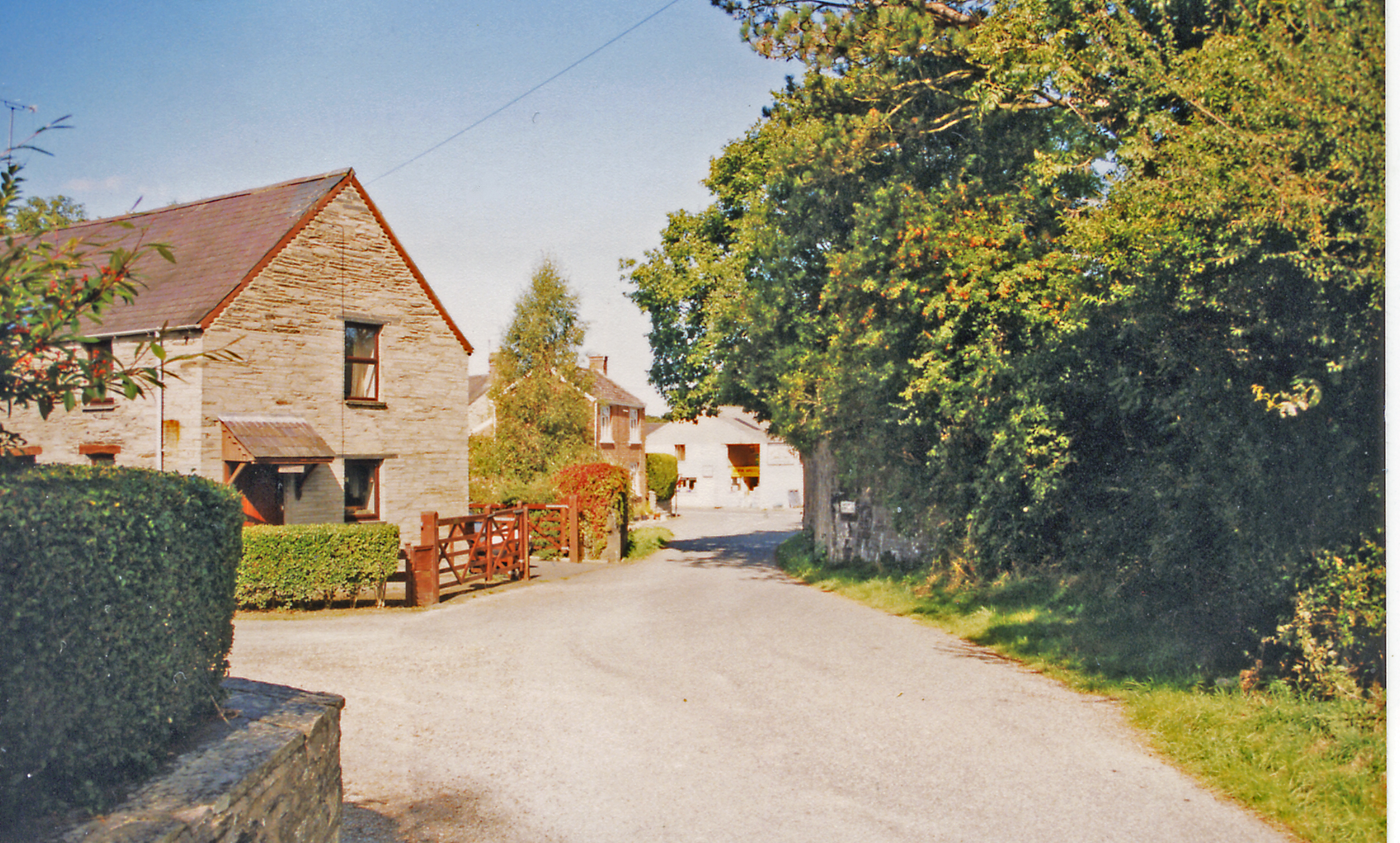
Coed Faenol-fach Images

Images are sourced within 2km of 52.064292/-4.6277793 or Grid Reference SN1943. Thanks to Geograph Open Source API. All images are credited.

Afon Teifi and ruined house The house (white) can be seen left of centre. Walking by the river now it is hard to imagine that not so long ago it was a hive of activity, industry, commerce and quarrying.
Afon Teifi and ruined house
The house (white) can be seen left of centre. Walking by the river now it is hard to imagine that not so long ago it was a hive of activity, industry, commerce and quarrying.
Riverside path By the Teifi near Cnwcau.
Riverside path
By the Teifi near Cnwcau.
Bend on the Afon Teifi Near Llechryd.
Bend on the Afon Teifi
Near Llechryd.
Ruined house by the Afon Teifi Either a former farmhouse or associated with the industry and quarrying in the valley here.
Ruined house by the Afon Teifi
Either a former farmhouse or associated with the industry and quarrying in the valley here.
Anglers by the River Teifi, Llechryd The River Teifi is the longest river which is wholly in Wales and flows 75 miles from its source in the Cambrian mountains to its estuary at Cardigan.
It is tidal up to Llechryd.
In this view it is flowing from right to left.
Salmon and Sea Trout (Sewin) are fished here.
The viewpoint is in Pembrokeshire and the far bank in Ceredigion; the river being the boundary between these two counties at this point.
Anglers by the River Teifi, Llechryd
The River Teifi is the longest river which is wholly in Wales and flows 75 miles from its source in the Cambrian mountains to its estuary at Cardigan. It is tidal up to Llechryd. In this view it is flowing from right to left. Salmon and Sea Trout (Sewin) are fished here. The viewpoint is in Pembrokeshire and the far bank in Ceredigion; the river being the boundary between these two counties at this point.
Ordnance Survey Cut Mark This OS cut mark can be found on the SW face of the Lodge. It marks a point 66.023m above mean sea level.
Ordnance Survey Cut Mark
This OS cut mark can be found on the SW face of the Lodge. It marks a point 66.023m above mean sea level.
Ordnance Survey Cut Mark This OS cut mark can be found on the west face of St Tydfil's Church. It marks a point 22.785m above mean sea level.
Ordnance Survey Cut Mark
This OS cut mark can be found on the west face of St Tydfil's Church. It marks a point 22.785m above mean sea level.
Old Milestone by the B4570 at Cilbronnau Lodge Cardigan tombstone by the B4570, in parish of Llangoedmor (Ceredigion District), West of entrance to Cilbronnau Lodge, on verge back to hedge.

Inscription reads:-
TO
CARDIGAN
2 MILES
Cancelled carved bench mark below inscription.

Grade II listed by Cadw. 
Reference Number 14777: <span class="nowrap"><a title="https://cadwpublic-api.azurewebsites.net/reports/listedbuilding/FullReport?lang=&id=14777" rel="nofollow ugc noopener" href="https://cadwpublic-api.azurewebsites.net/reports/listedbuilding/FullReport?lang=&id=14777">Link</a><img style="margin-left:2px;" alt="External link" title="External link - shift click to open in new window" src="https://s1.geograph.org.uk/img/external.png" width="10" height="10"/></span>

Surveyed

Milestone Society National ID: CRD_CALA02
Old Milestone by the B4570 at Cilbronnau Lodge
Cardigan tombstone by the B4570, in parish of Llangoedmor (Ceredigion District), West of entrance to Cilbronnau Lodge, on verge back to hedge. Inscription reads:- TO CARDIGAN 2 MILES Cancelled carved bench mark below inscription. Grade II listed by Cadw. Reference Number 14777: LinkExternal link Surveyed Milestone Society National ID: CRD_CALA02
Direction Sign – Signpost Located on the northeast side of the T junction on Garnon's Mill Road in Cilgerran community. 3 arms and ball finial. 

Milestone Society National ID: PEM_SN2042
Direction Sign – Signpost
Located on the northeast side of the T junction on Garnon's Mill Road in Cilgerran community. 3 arms and ball finial. Milestone Society National ID: PEM_SN2042
Afon Teifi at Llechryd
Kilgerran railway station (site), Pembrokeshire Opened in 1886 by the Whitland and Taf Vale Railway, later part of the Great Western Railway, on the line from Whitland to Cardigan, this station closed to passengers in 1962 and completely in 1963.
View north east at the site. A steep path led up to the station building, now replaced by a small housing estate. The abutment which carried the former railway bridge left to right over the road is however still clearly visible, on the left of the image. Note the station was always "Kilgerran" whereas the village is "Cilgerran".
For more information, see <span class="nowrap"><a title="http://www.disused-stations.org.uk/k/kilgerran/index.shtml" rel="nofollow ugc noopener" href="http://www.disused-stations.org.uk/k/kilgerran/index.shtml">Link</a><img style="margin-left:2px;" alt="External link" title="External link - shift click to open in new window" src="https://s1.geograph.org.uk/img/external.png" width="10" height="10"/></span>.
Kilgerran railway station (site), Pembrokeshire
Opened in 1886 by the Whitland and Taf Vale Railway, later part of the Great Western Railway, on the line from Whitland to Cardigan, this station closed to passengers in 1962 and completely in 1963. View north east at the site. A steep path led up to the station building, now replaced by a small housing estate. The abutment which carried the former railway bridge left to right over the road is however still clearly visible, on the left of the image. Note the station was always "Kilgerran" whereas the village is "Cilgerran". For more information, see LinkExternal link.
River Teifi
River Teifi
Quarry Building Remains of a building associated with slate quarrying near Cilgerran.
Quarry Building
Remains of a building associated with slate quarrying near Cilgerran.
Llechryd Bridge A 17th century stone bridge. At the time of the visit there were large tree trunks caught up the arches <span class="nowrap"><a title="https://coflein.gov.uk/en/site/23895/#:~:text=Llechryd%20or%20Castle%20Malgwyn%20Bridge,inscribed%20on%20a%20small%20stone" rel="nofollow ugc noopener" href="https://coflein.gov.uk/en/site/23895/#:~:text=Llechryd%20or%20Castle%20Malgwyn%20Bridge,inscribed%20on%20a%20small%20stone">Link</a><img style="margin-left:2px;" alt="External link" title="External link - shift click to open in new window" src="https://s1.geograph.org.uk/img/external.png" width="10" height="10"/></span>.
Llechryd Bridge
A 17th century stone bridge. At the time of the visit there were large tree trunks caught up the arches LinkExternal link.
Llechryd Bridge Log Jam
Masons Arms, Cnwcau
Masons Arms, Cnwcau
Turning for Llechryd
Show me another place!

Coed Faenol-fach is located at Grid Ref: SN1943 (Lat: 52.064292, Lng: -4.6277793)

Unitary Authority: Ceredigion

Police Authority: Dyfed Powys

What 3 Words

///shovels.file.thousands. Near Cardigan, Ceredigion

Related Wikis

Coedmor National Nature Reserve

Coedmor National Nature Reserve is a nature reserve in Wales, located just south of Cardigan, between Llechryd Bridge and the Teifi Marshes in Ceredigion...

Cilgerran Castle

Cilgerran Castle (Welsh: Castell Cilgerran) is a 13th-century ruined castle located in Cilgerran, Pembrokeshire, Wales, near Cardigan. The first castle...

Neuadd Wilym

Neuadd Wilym is a small village in the community of Llangoedmor, Ceredigion, Wales, which is 74.2 miles (119.4 km) from Cardiff and 196 miles (315.4 km...

Kilgerran Halt railway station

Kilgerran Halt railway station served the village of Cilgerran, Pembrokeshire, Wales, from 1886 to 1963 on the Whitland and Cardigan Railway. == History... ==

Nearby Amenities

Located within 500m of 52.064292,-4.6277793
Ele: 77
Natural: peak
Lat/Long: 52.0649225/-4.6237619
Direction: 170
Generator Method: photovoltaic
Generator Output Electricity: yes
Generator Solar Modules: 15
Generator Source: solar
Generator Type: solar_photovoltaic_panel
Location: roof
Power: generator
Lat/Long: 52.0643167/-4.6224707
The data included in this document is from www.openstreetmap.org. The data is made available under ODbL.

Have you been to Coed Faenol-fach?

Leave your review of Coed Faenol-fach below (or comments, questions and feedback).