Arenig Fawr South Ridge Top

Hill, Mountain in Merionethshire

Wales

Arenig Fawr South Ridge Top

Amnodd-wen A dignified, ruined agricultural settlement with a long history of improvement, but long-abandoned and positively exuding 'hiraeth'. Buildings here are numerous and recorded in the Coflein database of the National Monuments Record of Wales.
Amnodd-wen Credit: Jonathan Wilkins

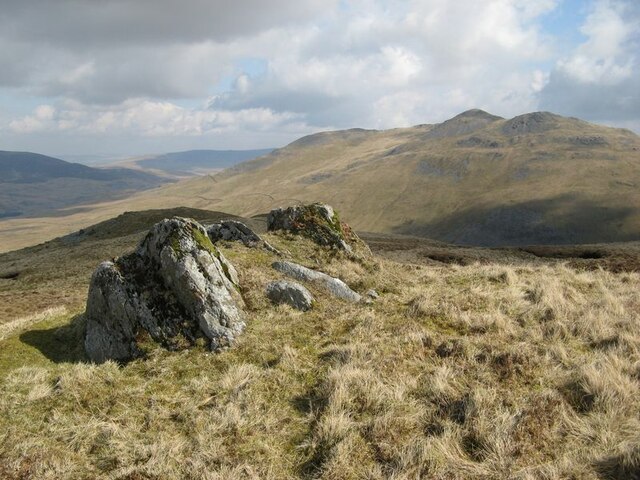
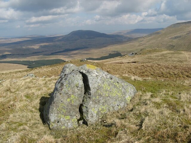
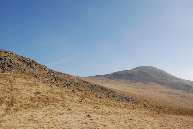
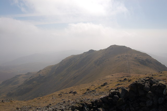
Arenig Fawr South Ridge Top, located in Merionethshire, Wales, is a prominent hill/mountain within the Snowdonia National Park. Standing at an elevation of 854 meters (2,802 feet), it offers stunning panoramic views of the surrounding landscape.

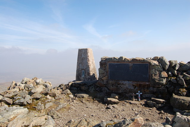
The summit of Arenig Fawr South Ridge Top is marked by a trig point, a concrete pillar used in land surveying. It is a popular destination for hikers and outdoor enthusiasts, attracting both experienced climbers and beginners. The ascent to the summit is relatively straightforward, with well-defined paths and trails leading to the top. However, caution is advised during inclement weather conditions, as the exposed nature of the ridge can make it treacherous.

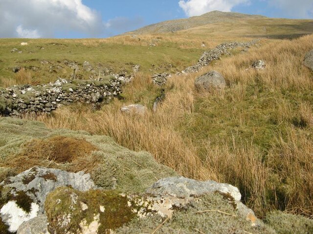
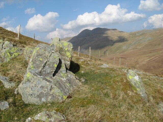
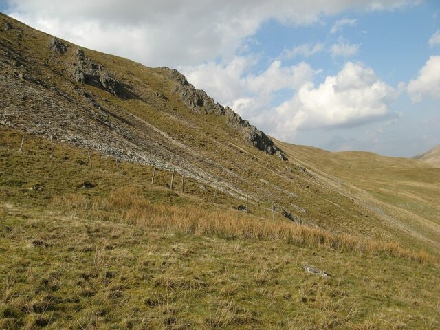
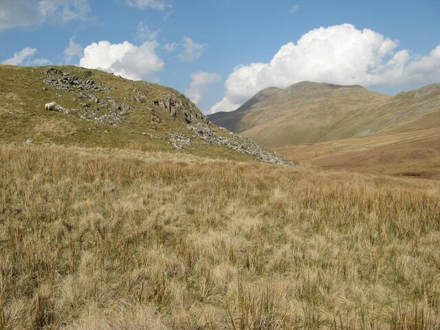
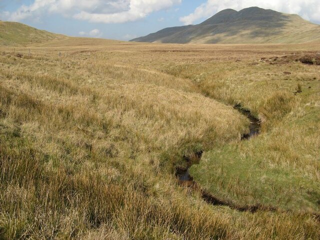
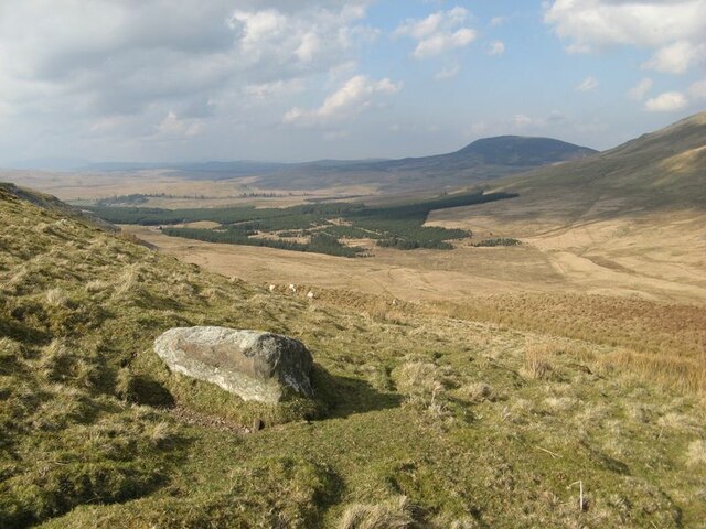
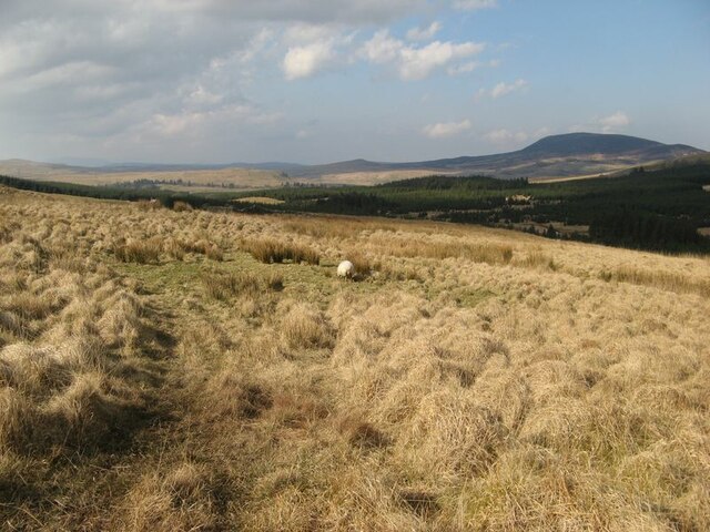
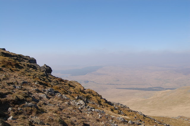
The terrain of Arenig Fawr South Ridge Top is largely rocky and rugged, characteristic of the Snowdonia region. As visitors ascend the mountain, they are treated to breathtaking views of the surrounding countryside, including the nearby Lake Celyn and the rolling hills of Merionethshire. On clear days, it is even possible to catch a glimpse of the Irish Sea to the west.

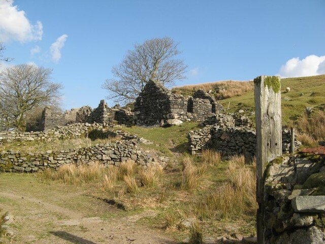
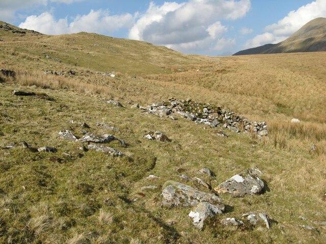
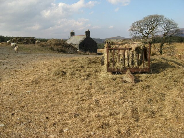
The area surrounding Arenig Fawr South Ridge Top is rich in wildlife and biodiversity. The mountain is home to various species of birds, including red grouse and peregrine falcons, and is known for its diverse flora, featuring heather, mosses, and lichens. In addition to its natural beauty, the mountain also holds historical significance, with remnants of ancient settlements and mining operations scattered throughout the area.

Overall, Arenig Fawr South Ridge Top offers a memorable hiking experience, combining stunning landscapes, fascinating wildlife, and a sense of history. It is a must-visit destination for those exploring the Snowdonia National Park in Merionethshire.

If you have any feedback on the listing, please let us know in the comments section below.

Arenig Fawr South Ridge Top Images

Images are sourced within 2km of 52.907688/-3.7456163 or Grid Reference SH8235. Thanks to Geograph Open Source API. All images are credited.

Amnodd-wen A dignified, ruined agricultural settlement with a long history of improvement, but long-abandoned and positively exuding 'hiraeth'. Buildings here are numerous and recorded in the Coflein database of the National Monuments Record of Wales.
Amnodd-wen
A dignified, ruined agricultural settlement with a long history of improvement, but long-abandoned and positively exuding 'hiraeth'. Buildings here are numerous and recorded in the Coflein database of the National Monuments Record of Wales.
Mossy walls Old field walls at Amnodd-wen testify to the wet climate that prevails in these uplands.
Mossy walls
Old field walls at Amnodd-wen testify to the wet climate that prevails in these uplands.
Tor-like outcrop Each of the many false summits of Moel Llyfnant is surmounted by a small periglacial feature such as a small stone pavement or tor. This tor presents an outcrop of the Benglog Volcanic Formation, which is a basaltic tuff member of the Aran Volcanic Group (Ordovician, Llanvirn to Caradoc).
Tor-like outcrop
Each of the many false summits of Moel Llyfnant is surmounted by a small periglacial feature such as a small stone pavement or tor. This tor presents an outcrop of the Benglog Volcanic Formation, which is a basaltic tuff member of the Aran Volcanic Group (Ordovician, Llanvirn to Caradoc).
Glacial erratic boulder A fabulous erratic boulder on the gentle slopes below the summit of Moel Llyfnant. The periglacial features which dominate the local landscape are indicative of cold climate without ice cover, but this rounded boulder belongs to a time when ice was waning after covering the area to significant depth.
Glacial erratic boulder
A fabulous erratic boulder on the gentle slopes below the summit of Moel Llyfnant. The periglacial features which dominate the local landscape are indicative of cold climate without ice cover, but this rounded boulder belongs to a time when ice was waning after covering the area to significant depth.
Loose rock with fence Starting the descent of the steep eastern flank of Moel Llyfnant, which is steep but grass-covered and not a nasty scree!
Loose rock with fence
Starting the descent of the steep eastern flank of Moel Llyfnant, which is steep but grass-covered and not a nasty scree!
Scree and outcrop, Moel Llyfnant The inhospitable eastern side of the hill, with prominent rock outcrop and some thin patches of scree.
Scree and outcrop, Moel Llyfnant
The inhospitable eastern side of the hill, with prominent rock outcrop and some thin patches of scree.
Moorland buttress The prominent buttress which protrudes from the lower slope of Moel Llyfnant is indicative of a change of rock type. The foot of the hillside is of microgabbro (or dolerite) which has been intruded into the stack of rhyolitic and basaltic ejecta and sedimentary rocks which comprise the Aran Volcaninc Group (Ordovician, Arenig to Caradoc). The tough rock is prominent because it has resisted glacial erosion.
Moorland buttress
The prominent buttress which protrudes from the lower slope of Moel Llyfnant is indicative of a change of rock type. The foot of the hillside is of microgabbro (or dolerite) which has been intruded into the stack of rhyolitic and basaltic ejecta and sedimentary rocks which comprise the Aran Volcaninc Group (Ordovician, Arenig to Caradoc). The tough rock is prominent because it has resisted glacial erosion.
Meandering stream The map gives this stream the name Ceunant Coch, echoing that of another stream to the west, though this one is a headwater of the Afon Erwent.
Meandering stream
The map gives this stream the name Ceunant Coch, echoing that of another stream to the west, though this one is a headwater of the Afon Erwent.
Upper valley Looking down from the strange col between the valleys of Amnodd-bwll and Erwent. About the only local feature is this splendid glacial erratic boulder, which the local sheep obviously enjoy using for a good scratch. Having ascended from the Erwent, the sudden vista is a surprise.
Upper valley
Looking down from the strange col between the valleys of Amnodd-bwll and Erwent. About the only local feature is this splendid glacial erratic boulder, which the local sheep obviously enjoy using for a good scratch. Having ascended from the Erwent, the sudden vista is a surprise.
Hillside with ruined wall Old walls obviously have no relevance to current land use, and in this area the only sign of human interference is a quad-bike track and an intermittent string of red sheep-lick pots. Ahead lies the curious, flat-lying col above the valley of the Afon Amnodd-bwll.
Hillside with ruined wall
Old walls obviously have no relevance to current land use, and in this area the only sign of human interference is a quad-bike track and an intermittent string of red sheep-lick pots. Ahead lies the curious, flat-lying col above the valley of the Afon Amnodd-bwll.
Moorland above forestry Despite following a footpath on the map, in fact the only path in evidence is one made by a visiting quad-bike, which is presumably checking-up on these distant sheep. At least it smooths out the tussocks! What an empty place this is today.
Moorland above forestry
Despite following a footpath on the map, in fact the only path in evidence is one made by a visiting quad-bike, which is presumably checking-up on these distant sheep. At least it smooths out the tussocks! What an empty place this is today.
Beudy'r Cwm A distant outpost of Amnodd-bwll is this ruined beudy (byre). It is well-made and substantial, being much more solid than a sheepfold. This structure is shown on the OS map of 1887, and appears to be the reason for the footpath running up the west side of the valley.
Beudy'r Cwm
A distant outpost of Amnodd-bwll is this ruined beudy (byre). It is well-made and substantial, being much more solid than a sheepfold. This structure is shown on the OS map of 1887, and appears to be the reason for the footpath running up the west side of the valley.
Strew of boulders A field of boulders runs down from the hillside to the west, which has abundant enclosures and stone-built shelters, presumably because of the lavish supply of building stone. My eye was caught by the widespread white-coloured lichen on the stones, which differs from that found elsewhere in the area. The abundant rocks are boulders of microgabbro, whose outcrop is extensive at the northern end of Moel Llyfnant.
Strew of boulders
A field of boulders runs down from the hillside to the west, which has abundant enclosures and stone-built shelters, presumably because of the lavish supply of building stone. My eye was caught by the widespread white-coloured lichen on the stones, which differs from that found elsewhere in the area. The abundant rocks are boulders of microgabbro, whose outcrop is extensive at the northern end of Moel Llyfnant.
Sheep-feed at Amnodd-bwll The spring growth of grass has not yet started at this altitude, so supplements are still needed for the flock. The smell of summer grass coming off the bales was fabulous. In the background is the new farmhouse, which dates from the very end of the 19th century. Other farm buildings here are much older.
Sheep-feed at Amnodd-bwll
The spring growth of grass has not yet started at this altitude, so supplements are still needed for the flock. The smell of summer grass coming off the bales was fabulous. In the background is the new farmhouse, which dates from the very end of the 19th century. Other farm buildings here are much older.
Arenig Fawr from the slopes of Craig y Hyrddod
View looking south from the summit of Arenig Fawr
Triangulation pillar and B-17 memorial on the summit of Arenig Fawr
The upper slopes of Arenig Fawr
Show me another place!

Arenig Fawr South Ridge Top is located at Grid Ref: SH8235 (Lat: 52.907688, Lng: -3.7456163)

Unitary Authority: Gwynedd

Police Authority: North Wales

What 3 Words

///countries.presuming.vest. Near Llanuwchllyn, Gwynedd

Related Wikis

Arenigs

Arenigs is an informal term for a group of mountains in central Snowdonia, in north Wales. They are not strictly defined, but normally include at least...

Foel Boeth

Foel Boeth is the twin top of Gallt y Daren in the southern half of the Snowdonia National Park in Gwynedd, North Wales, and forms part of the Arenig mountain...

Gallt y Daren

Gallt y Daren is a peak in the southern half of the Snowdonia National Park in Gwynedd, North Wales, and forms part of the Arenig mountain range. It is...

Arenig Fawr South Top

Arenig Fawr South Top is the twin top of Arenig Fawr in southern Snowdonia, North Wales. It is the second highest member of the Arenig range, being 18...

Nearby Amenities

Located within 500m of 52.907688,-3.7456163
Arenig Fawr South Ridge Top
Ele: 712
Name Cy: Arenig Fawr Copa'r Grib Ddeheuol
Natural: peak
Note: I checked 20 historic maps from 1830 to 1965 and this peak is not given a name, the given Welsh name is a direct translation from the English name Arenig Fawr South Ridge Top
Source: gps
Wikidata: Q14122302
Wikipedia: cy:Arenig Fawr (copa'r grib ddeheuol)
Lat/Long: 52.9080983/-3.7449575
The data included in this document is from www.openstreetmap.org. The data is made available under ODbL.

Have you been to Arenig Fawr South Ridge Top?

Leave your review of Arenig Fawr South Ridge Top below (or comments, questions and feedback).