Llyn Crafanc

Lake, Pool, Pond, Freshwater Marsh in Merionethshire

Wales

Llyn Crafanc
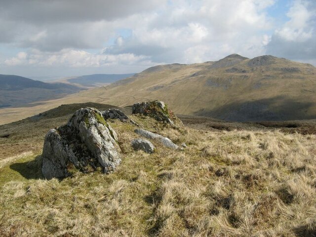
Tor-like outcrop Each of the many false summits of Moel Llyfnant is surmounted by a small periglacial feature such as a small stone pavement or tor. This tor presents an outcrop of the Benglog Volcanic Formation, which is a basaltic tuff member of the Aran Volcanic Group (Ordovician, Llanvirn to Caradoc).
Tor-like outcrop Credit: Jonathan Wilkins

The requested URL returned error: 429 Too Many Requests

If you have any feedback on the listing, please let us know in the comments section below.

Llyn Crafanc Images

Images are sourced within 2km of 52.899594/-3.7494688 or Grid Reference SH8235. Thanks to Geograph Open Source API. All images are credited.

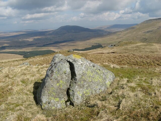
Tor-like outcrop Each of the many false summits of Moel Llyfnant is surmounted by a small periglacial feature such as a small stone pavement or tor. This tor presents an outcrop of the Benglog Volcanic Formation, which is a basaltic tuff member of the Aran Volcanic Group (Ordovician, Llanvirn to Caradoc).
Tor-like outcrop
Each of the many false summits of Moel Llyfnant is surmounted by a small periglacial feature such as a small stone pavement or tor. This tor presents an outcrop of the Benglog Volcanic Formation, which is a basaltic tuff member of the Aran Volcanic Group (Ordovician, Llanvirn to Caradoc).
Glacial erratic boulder A fabulous erratic boulder on the gentle slopes below the summit of Moel Llyfnant. The periglacial features which dominate the local landscape are indicative of cold climate without ice cover, but this rounded boulder belongs to a time when ice was waning after covering the area to significant depth.
Glacial erratic boulder
A fabulous erratic boulder on the gentle slopes below the summit of Moel Llyfnant. The periglacial features which dominate the local landscape are indicative of cold climate without ice cover, but this rounded boulder belongs to a time when ice was waning after covering the area to significant depth.
The crest of Moel Llyfnant Not the actual summit, of course, but the southern tip of the crest which runs along the summit. This feature is a type of tor, formed over a long period of exposure to cold climate without the presence of permanent ice. Repeated freezing and thawing of surface water breaks down the jointed rock to form a blockfield or scree, depending upon the slope of the ground. Accumulations of large, angular boulders originated as rockfalls.
The crest of Moel Llyfnant
Not the actual summit, of course, but the southern tip of the crest which runs along the summit. This feature is a type of tor, formed over a long period of exposure to cold climate without the presence of permanent ice. Repeated freezing and thawing of surface water breaks down the jointed rock to form a blockfield or scree, depending upon the slope of the ground. Accumulations of large, angular boulders originated as rockfalls.
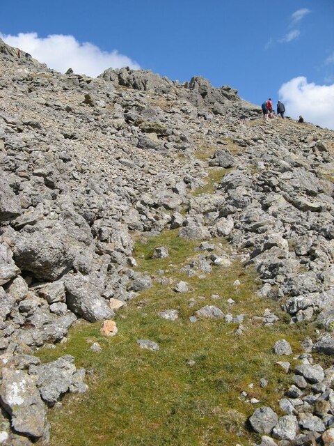
Scree, Moel Llyfnant The summit area of Moel Llyfnant abounds with excellent periglacial features such as this scree. The feature is named on the map as Marian Llwyd. Notable in the far distance are the buildings of the disused nuclear power station at Trawsfynydd.
Scree, Moel Llyfnant
The summit area of Moel Llyfnant abounds with excellent periglacial features such as this scree. The feature is named on the map as Marian Llwyd. Notable in the far distance are the buildings of the disused nuclear power station at Trawsfynydd.
Manganese mine adit Optimistically described as a mine, this is little more than a trial adit showing no long-term history of mining or mineral processing, and very little development. The origin of mineralisation by manganese ores is cryptic, and unexpected in rhyolitic tuff belonging to the Aran Fawddwy Formation (Ordovician, Caradoc).
Manganese mine adit
Optimistically described as a mine, this is little more than a trial adit showing no long-term history of mining or mineral processing, and very little development. The origin of mineralisation by manganese ores is cryptic, and unexpected in rhyolitic tuff belonging to the Aran Fawddwy Formation (Ordovician, Caradoc).
Rhyolitic tuff, Aran Fawddwy Formation Explosive eruptions of very hot, but largely solid material is a characteristic of silica-rich magma (rhyolite). This rock surface shows how more or less angular fragments with random orientation have coalesced into a newly-welded mass on settling after transport. This is a local expression of a very widespread volcanic style across Snowdonia.
Rhyolitic tuff, Aran Fawddwy Formation
Explosive eruptions of very hot, but largely solid material is a characteristic of silica-rich magma (rhyolite). This rock surface shows how more or less angular fragments with random orientation have coalesced into a newly-welded mass on settling after transport. This is a local expression of a very widespread volcanic style across Snowdonia.
Moraine with peat hag Small, rounded hills at the foot of scree slopes on Moel Llyfnant appear to be hummocky moraine.
Moraine with peat hag
Small, rounded hills at the foot of scree slopes on Moel Llyfnant appear to be hummocky moraine.
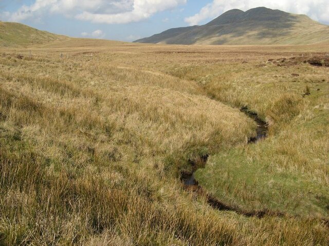
Ceunant Coch A small stream eroding a gully into glacial deposits in the form of hummocky moraine.
Ceunant Coch
A small stream eroding a gully into glacial deposits in the form of hummocky moraine.
Marian Llwyd Screes below crags at the end of the summit ridge of Moel Llyfnant.
Marian Llwyd
Screes below crags at the end of the summit ridge of Moel Llyfnant.
Castell Gwyn Another tor-like feature developed on a summit to the southwest of Moel Llyfnant, seen across the apron of scree named Marian Llwyd.
Castell Gwyn
Another tor-like feature developed on a summit to the southwest of Moel Llyfnant, seen across the apron of scree named Marian Llwyd.
Miners' path Little remains of an access path which was developed below the mine adit of Moel Llyfnant. The careful placing of large blocks of rock on the downhill side of the path and the subsequent growth of turf on the levelled ground is testament to the skill of workers so long ago. Most of the path is now lost under falling rocks and movement of the scree.
Miners' path
Little remains of an access path which was developed below the mine adit of Moel Llyfnant. The careful placing of large blocks of rock on the downhill side of the path and the subsequent growth of turf on the levelled ground is testament to the skill of workers so long ago. Most of the path is now lost under falling rocks and movement of the scree.
Access to upper workings A level path which gives access to another small excavation, which is up the hill above the adit opening of the manganese mine. I loved the texture of the rocks here which is both rough and blocky, but not completely irregular. The rocks are rhyolitic tuffs belonging to the Aran Fawddwy Formation, of Ordovician (Caradoc) age.
Access to upper workings
A level path which gives access to another small excavation, which is up the hill above the adit opening of the manganese mine. I loved the texture of the rocks here which is both rough and blocky, but not completely irregular. The rocks are rhyolitic tuffs belonging to the Aran Fawddwy Formation, of Ordovician (Caradoc) age.
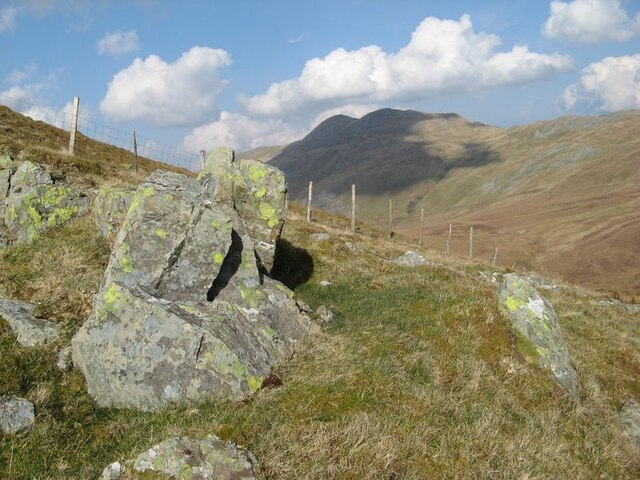
Loose rock with fence Starting the descent of the steep eastern flank of Moel Llyfnant, which is steep but grass-covered and not a nasty scree!
Loose rock with fence
Starting the descent of the steep eastern flank of Moel Llyfnant, which is steep but grass-covered and not a nasty scree!
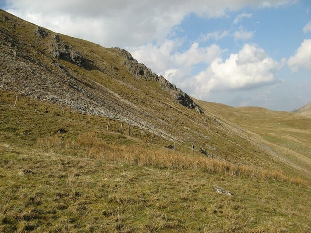
Scree and outcrop, Moel Llyfnant The inhospitable eastern side of the hill, with prominent rock outcrop and some thin patches of scree.
Scree and outcrop, Moel Llyfnant
The inhospitable eastern side of the hill, with prominent rock outcrop and some thin patches of scree.
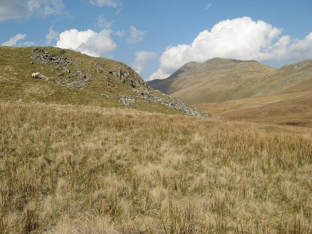
Moorland buttress The prominent buttress which protrudes from the lower slope of Moel Llyfnant is indicative of a change of rock type. The foot of the hillside is of microgabbro (or dolerite) which has been intruded into the stack of rhyolitic and basaltic ejecta and sedimentary rocks which comprise the Aran Volcaninc Group (Ordovician, Arenig to Caradoc). The tough rock is prominent because it has resisted glacial erosion.
Moorland buttress
The prominent buttress which protrudes from the lower slope of Moel Llyfnant is indicative of a change of rock type. The foot of the hillside is of microgabbro (or dolerite) which has been intruded into the stack of rhyolitic and basaltic ejecta and sedimentary rocks which comprise the Aran Volcaninc Group (Ordovician, Arenig to Caradoc). The tough rock is prominent because it has resisted glacial erosion.
Meandering stream The map gives this stream the name Ceunant Coch, echoing that of another stream to the west, though this one is a headwater of the Afon Erwent.
Meandering stream
The map gives this stream the name Ceunant Coch, echoing that of another stream to the west, though this one is a headwater of the Afon Erwent.
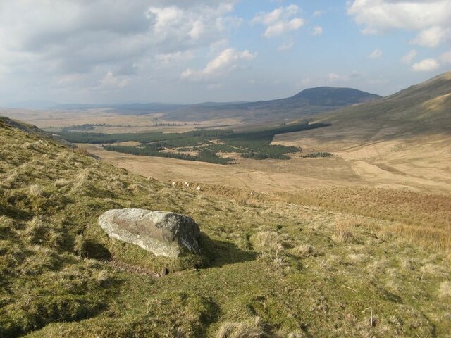
Upper valley Looking down from the strange col between the valleys of Amnodd-bwll and Erwent. About the only local feature is this splendid glacial erratic boulder, which the local sheep obviously enjoy using for a good scratch. Having ascended from the Erwent, the sudden vista is a surprise.
Upper valley
Looking down from the strange col between the valleys of Amnodd-bwll and Erwent. About the only local feature is this splendid glacial erratic boulder, which the local sheep obviously enjoy using for a good scratch. Having ascended from the Erwent, the sudden vista is a surprise.
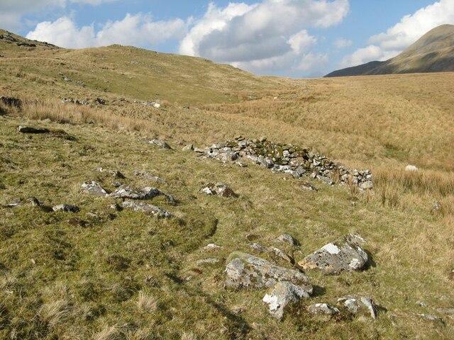
Hillside with ruined wall Old walls obviously have no relevance to current land use, and in this area the only sign of human interference is a quad-bike track and an intermittent string of red sheep-lick pots. Ahead lies the curious, flat-lying col above the valley of the Afon Amnodd-bwll.
Hillside with ruined wall
Old walls obviously have no relevance to current land use, and in this area the only sign of human interference is a quad-bike track and an intermittent string of red sheep-lick pots. Ahead lies the curious, flat-lying col above the valley of the Afon Amnodd-bwll.
Show me another place!

Llyn Crafanc is located at Grid Ref: SH8235 (Lat: 52.899594, Lng: -3.7494688)

Unitary Authority: Gwynedd

Police Authority: North Wales

What 3 Words

///demanding.played.quitter. Near Llanuwchllyn, Gwynedd

Related Wikis

Moel Llyfnant

Moel Llyfnant is a mountain in the southern portion of the Snowdonia National Park in Gwynedd, Wales. It is a peak in the Arenig mountain range. It lies...

Foel Boeth

Foel Boeth is the twin top of Gallt y Daren in the southern half of the Snowdonia National Park in Gwynedd, North Wales, and forms part of the Arenig mountain...

Gallt y Daren

Gallt y Daren is a peak in the southern half of the Snowdonia National Park in Gwynedd, North Wales, and forms part of the Arenig mountain range. It is...

Arenig Fawr South Top

Arenig Fawr South Top is the twin top of Arenig Fawr in southern Snowdonia, North Wales. It is the second highest member of the Arenig range, being 18...

Nearby Amenities

Located within 500m of 52.899594,-3.7494688
Craig y Bychau
Ele: 695
Natural: peak
Lat/Long: 52.9031157/-3.7475904
Ele: 654
Natural: peak
Lat/Long: 52.8978805/-3.7450726
The data included in this document is from www.openstreetmap.org. The data is made available under ODbL.

Have you been to Llyn Crafanc?

Leave your review of Llyn Crafanc below (or comments, questions and feedback).