Arenig Fawr

Hill, Mountain in Merionethshire

Wales

Arenig Fawr

Erratic boulders on Waun Goch Fine glacial erratic boulders lying on wet, rushy moorland.
Erratic boulders on Waun Goch Credit: Jonathan Wilkins

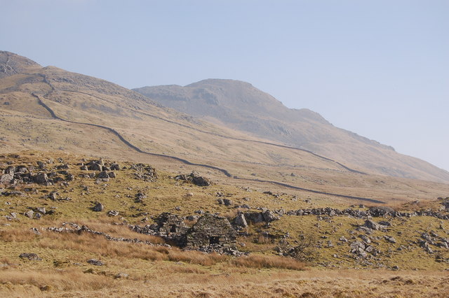
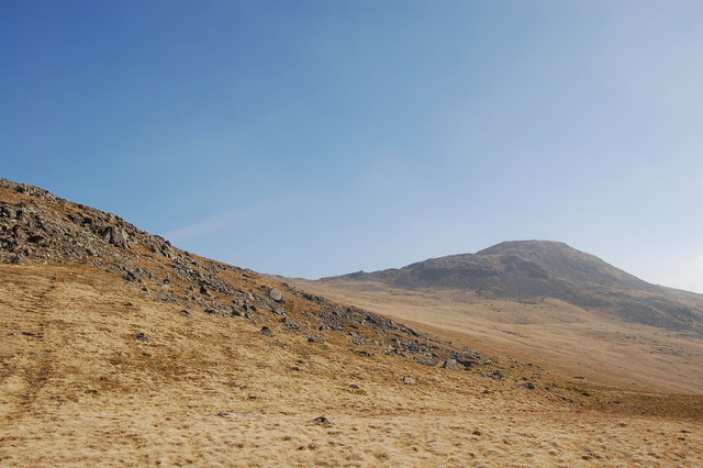
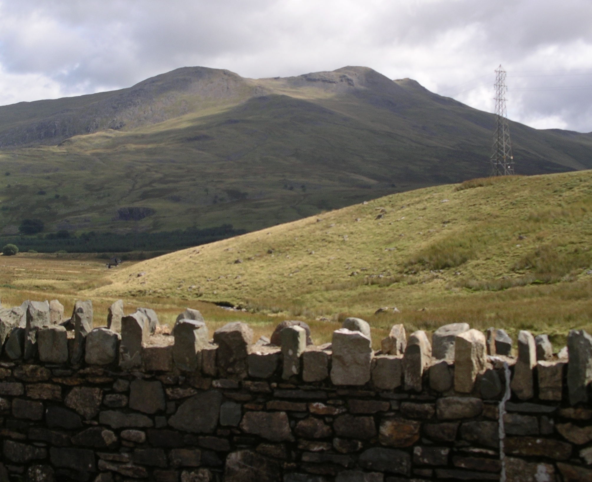
Arenig Fawr is a prominent hill/mountain located in Merionethshire, Wales. It stands at an impressive height of 854 meters (2,802 feet) above sea level, making it one of the highest peaks in the region.

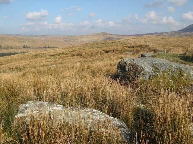
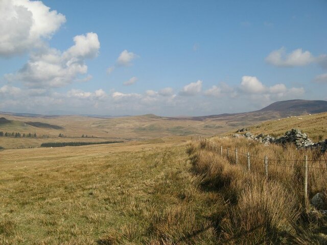
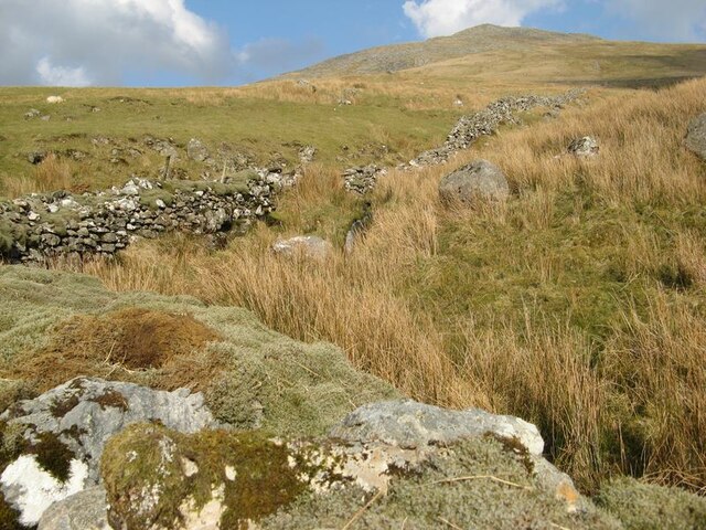
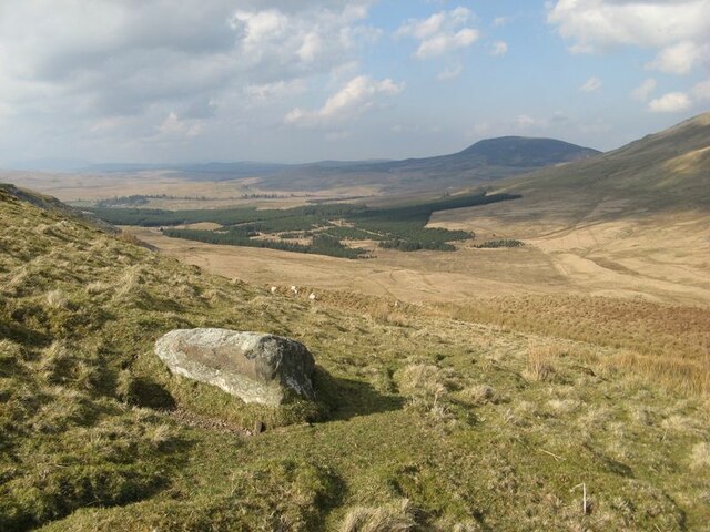
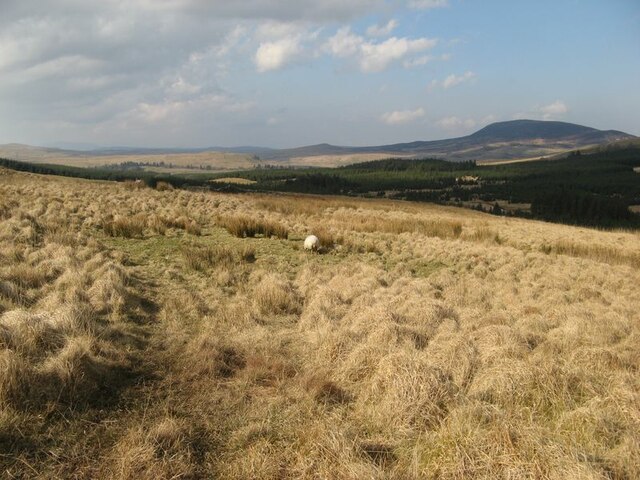
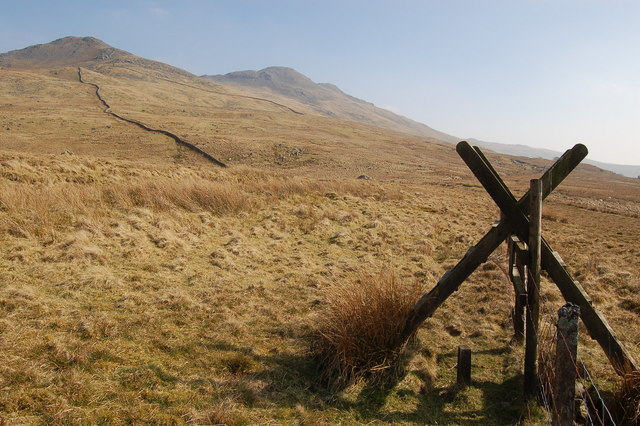
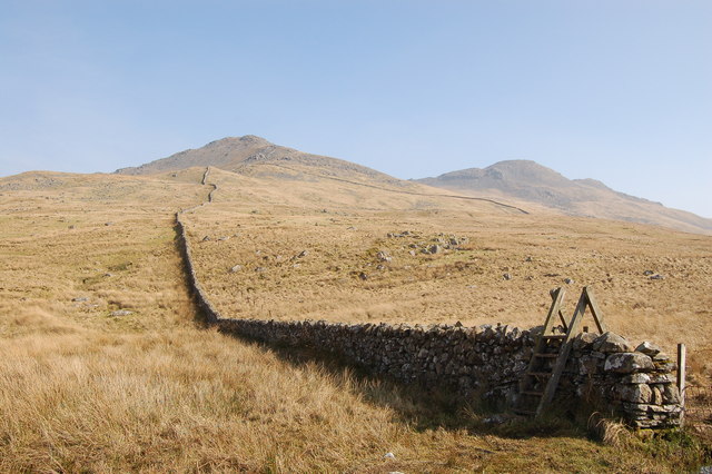
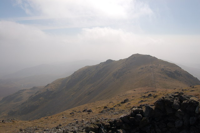
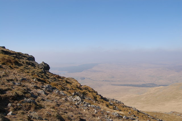
Situated within the southern part of Snowdonia National Park, Arenig Fawr offers breathtaking views of the surrounding landscape. Its location provides an ideal spot for hikers and outdoor enthusiasts to explore the natural beauty of the area. The mountain is often covered in heather and grass, creating a picturesque scene during the warmer months.

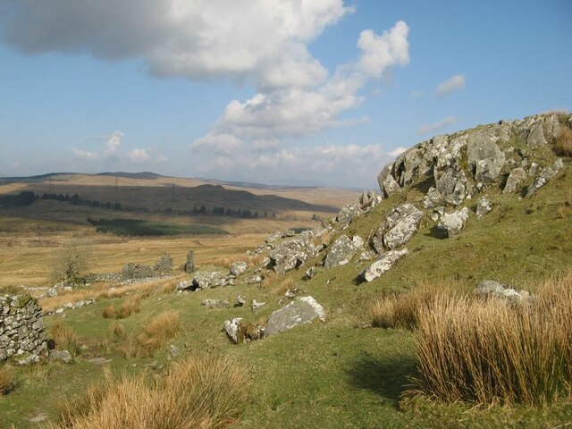
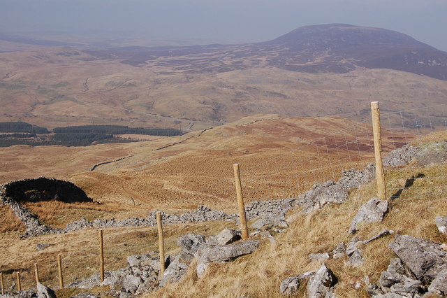
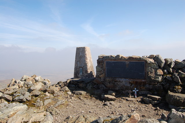
The ascent to the summit of Arenig Fawr can be challenging, with steep and rocky sections along the way. However, the effort is rewarded with stunning panoramic vistas of the surrounding countryside, including the nearby Lake Celyn, which adds to the allure of this magnificent mountain.

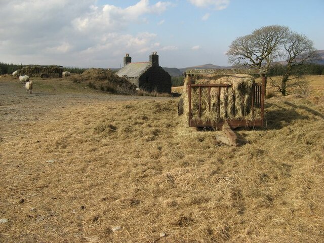
Arenig Fawr is also known for its rich biodiversity, boasting a variety of flora and fauna. The hill/mountain is home to a range of bird species, such as the red grouse and peregrine falcon, as well as various mammals, including mountain hares and red deer.

For those interested in geology, Arenig Fawr offers an opportunity to study the area's unique rock formations. The mountain is composed mainly of volcanic rocks, formed during volcanic activity that occurred millions of years ago.

Overall, Arenig Fawr is a remarkable natural landmark in Merionethshire, attracting visitors from near and far to experience its beauty, challenge themselves with the ascent, and immerse themselves in the stunning surroundings.

If you have any feedback on the listing, please let us know in the comments section below.
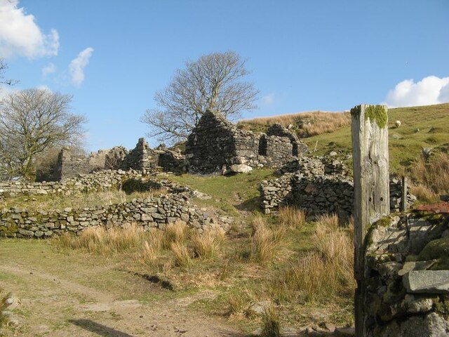
Arenig Fawr Images

Images are sourced within 2km of 52.916673/-3.7459778 or Grid Reference SH8236. Thanks to Geograph Open Source API. All images are credited.

Erratic boulders on Waun Goch Fine glacial erratic boulders lying on wet, rushy moorland.
Erratic boulders on Waun Goch
Fine glacial erratic boulders lying on wet, rushy moorland.
View towards Nant Goch A peerless vista of moorland grazing from the track to Amnodd-wen.
View towards Nant Goch
A peerless vista of moorland grazing from the track to Amnodd-wen.
Rock outcrop and ruin Every farm needs building stone, and I suspect that this was where much of the original stone for the building of Amnodd-wen was sourced. The rock is a microgabbro (or dolerite) intrusion of Ordovician age, a highly-prized building stone because of its lack of 'grain'. The outcrop of this sill-like intrusion runs with the track across Waun Goch from the railway, where there is a quarry (see <a href="https://www.geograph.org.uk/photo/2417177">SH8138 : Disused Quarry</a>), and along the foot of Arenig Fawr for over 5km.
Rock outcrop and ruin
Every farm needs building stone, and I suspect that this was where much of the original stone for the building of Amnodd-wen was sourced. The rock is a microgabbro (or dolerite) intrusion of Ordovician age, a highly-prized building stone because of its lack of 'grain'. The outcrop of this sill-like intrusion runs with the track across Waun Goch from the railway, where there is a quarry (see SH8138 : Disused Quarry), and along the foot of Arenig Fawr for over 5km.
Amnodd-wen A dignified, ruined agricultural settlement with a long history of improvement, but long-abandoned and positively exuding 'hiraeth'. Buildings here are numerous and recorded in the Coflein database of the National Monuments Record of Wales.
Amnodd-wen
A dignified, ruined agricultural settlement with a long history of improvement, but long-abandoned and positively exuding 'hiraeth'. Buildings here are numerous and recorded in the Coflein database of the National Monuments Record of Wales.
Mossy walls Old field walls at Amnodd-wen testify to the wet climate that prevails in these uplands.
Mossy walls
Old field walls at Amnodd-wen testify to the wet climate that prevails in these uplands.
Upper valley Looking down from the strange col between the valleys of Amnodd-bwll and Erwent. About the only local feature is this splendid glacial erratic boulder, which the local sheep obviously enjoy using for a good scratch. Having ascended from the Erwent, the sudden vista is a surprise.
Upper valley
Looking down from the strange col between the valleys of Amnodd-bwll and Erwent. About the only local feature is this splendid glacial erratic boulder, which the local sheep obviously enjoy using for a good scratch. Having ascended from the Erwent, the sudden vista is a surprise.
Moorland above forestry Despite following a footpath on the map, in fact the only path in evidence is one made by a visiting quad-bike, which is presumably checking-up on these distant sheep. At least it smooths out the tussocks! What an empty place this is today.
Moorland above forestry
Despite following a footpath on the map, in fact the only path in evidence is one made by a visiting quad-bike, which is presumably checking-up on these distant sheep. At least it smooths out the tussocks! What an empty place this is today.
Beudy'r Cwm A distant outpost of Amnodd-bwll is this ruined beudy (byre). It is well-made and substantial, being much more solid than a sheepfold. This structure is shown on the OS map of 1887, and appears to be the reason for the footpath running up the west side of the valley.
Beudy'r Cwm
A distant outpost of Amnodd-bwll is this ruined beudy (byre). It is well-made and substantial, being much more solid than a sheepfold. This structure is shown on the OS map of 1887, and appears to be the reason for the footpath running up the west side of the valley.
Strew of boulders A field of boulders runs down from the hillside to the west, which has abundant enclosures and stone-built shelters, presumably because of the lavish supply of building stone. My eye was caught by the widespread white-coloured lichen on the stones, which differs from that found elsewhere in the area. The abundant rocks are boulders of microgabbro, whose outcrop is extensive at the northern end of Moel Llyfnant.
Strew of boulders
A field of boulders runs down from the hillside to the west, which has abundant enclosures and stone-built shelters, presumably because of the lavish supply of building stone. My eye was caught by the widespread white-coloured lichen on the stones, which differs from that found elsewhere in the area. The abundant rocks are boulders of microgabbro, whose outcrop is extensive at the northern end of Moel Llyfnant.
Sheep-feed at Amnodd-bwll The spring growth of grass has not yet started at this altitude, so supplements are still needed for the flock. The smell of summer grass coming off the bales was fabulous. In the background is the new farmhouse, which dates from the very end of the 19th century. Other farm buildings here are much older.
Sheep-feed at Amnodd-bwll
The spring growth of grass has not yet started at this altitude, so supplements are still needed for the flock. The smell of summer grass coming off the bales was fabulous. In the background is the new farmhouse, which dates from the very end of the 19th century. Other farm buildings here are much older.
Former quarry buildings below Craig yr Hyrddod
Stile below Arenig Fawr
Stone wall ascends Craig yr Hyrddod
New fencing on the flanks of Arenig Fawr Arenig Fach is in the background on the right.
New fencing on the flanks of Arenig Fawr
Arenig Fach is in the background on the right.
Arenig Fawr from the slopes of Craig y Hyrddod
View looking south from the summit of Arenig Fawr
Triangulation pillar and B-17 memorial on the summit of Arenig Fawr
The upper slopes of Arenig Fawr
Show me another place!

Arenig Fawr is located at Grid Ref: SH8236 (Lat: 52.916673, Lng: -3.7459778)

Unitary Authority: Gwynedd

Police Authority: North Wales

What 3 Words

///occupy.broached.folk. Near Llanuwchllyn, Gwynedd

Related Wikis

Foel Boeth

Foel Boeth is the twin top of Gallt y Daren in the southern half of the Snowdonia National Park in Gwynedd, North Wales, and forms part of the Arenig mountain...

Gallt y Daren

Gallt y Daren is a peak in the southern half of the Snowdonia National Park in Gwynedd, North Wales, and forms part of the Arenig mountain range. It is...

Arenig Fawr South Top

Arenig Fawr South Top is the twin top of Arenig Fawr in southern Snowdonia, North Wales. It is the second highest member of the Arenig range, being 18...

Arenig Fawr

Arenig Fawr (English: "Great High Ground") is a mountain in Snowdonia, North Wales, close to Llyn Celyn reservoir, alongside the A4212 between Trawsfynydd...

Arenig Fawr South Ridge Top

Arenig Fawr South Ridge Top is a top of Arenig Fawr in southern Snowdonia, North Wales. It lies in area of rocky knolls and small tarns, found on the broad...
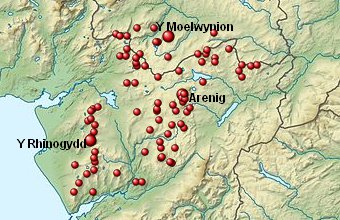
Arenigs

Arenigs is an informal term for a group of mountains in central Snowdonia, in north Wales. They are not strictly defined, but normally include at least...

Llyn Arenig Fawr

Llyn Arenig Fawr is a lake and reservoir located near the summit of Arenig Fawr, a mountain in North Wales. The lake's primary purpose is to supply water...

Arenig railway station

Arenig railway station stood beneath Arenig Fawr on the Great Western Railway's Bala Ffestiniog Line in Gwynedd, Wales. It served this thinly populated...

Nearby Amenities

Located within 500m of 52.916673,-3.7459778
Flying Fortress Crash August 1943
Historic: memorial
Source: survey
Lat/Long: 52.9170908/-3.745939
Arenig Fawr
Ele: 854
Natural: peak
Source: survey
Wikidata: Q4789023
Wikipedia: cy:Arenig Fawr
Lat/Long: 52.9171069/-3.7459656
Barrier: stile
Source: survey
Lat/Long: 52.9158494/-3.7461591
Arenig Fawr South Top
Description: A "Nuttall" - one of the 2000 foot peaks of England and Wales
Ele: 836
Name Cy: Arenig Fawr Copa Deheuol
Natural: peak
Note: I checked 20 historic maps from 1830 to 1965 and this peak is not given a name, the given Welsh name is a direct translation from the English name Arenig Fawr South Top
Source: gps
Wikidata: Q13125582
Wikipedia: cy:Arenig Fawr (y copa deheuol)
Lat/Long: 52.9144948/-3.7461204
Arenig
Description: OS trig pillar
Ele: 854.049
Man Made: survey_point
Ref: S1614
Survey Point: pillar
Tpuk Ref: TP0883
Lat/Long: 52.917096/-3.74595
The data included in this document is from www.openstreetmap.org. The data is made available under ODbL.

Have you been to Arenig Fawr?

Leave your review of Arenig Fawr below (or comments, questions and feedback).