Arenig Fach

Hill, Mountain in Merionethshire

Wales

Arenig Fach

Ffridd Bwlch Llestri Moorland north of the B4391.
Ffridd Bwlch Llestri Credit: John H Darch

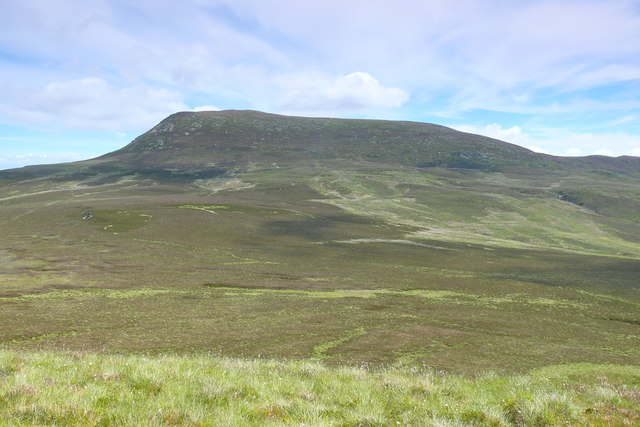
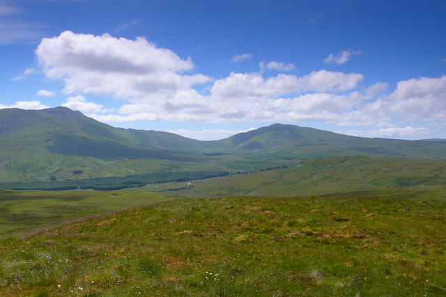
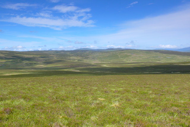
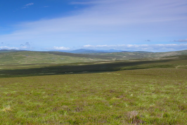
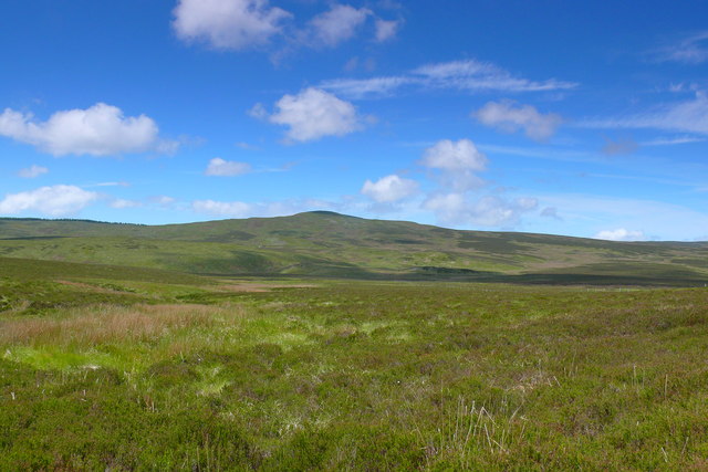
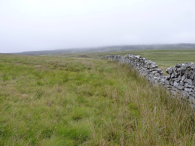
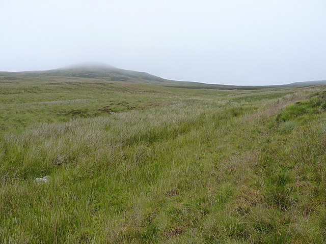
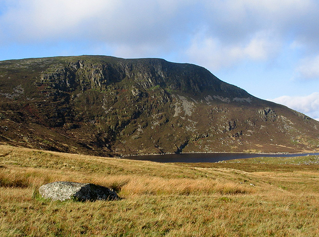
Arenig Fach is a prominent hill located in the historic county of Merionethshire, Wales. It is situated within the Arenig mountain range, which lies within the Snowdonia National Park. Standing at an elevation of 2,802 feet (854 meters), Arenig Fach is a popular destination among hikers and outdoor enthusiasts due to its impressive views and challenging terrain.

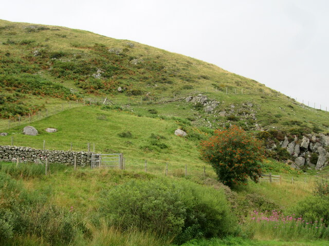
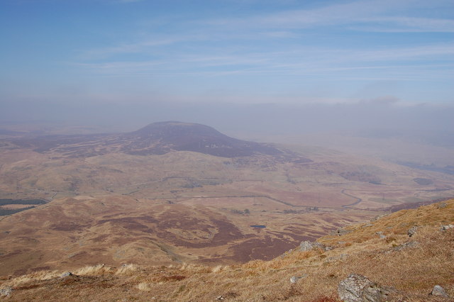
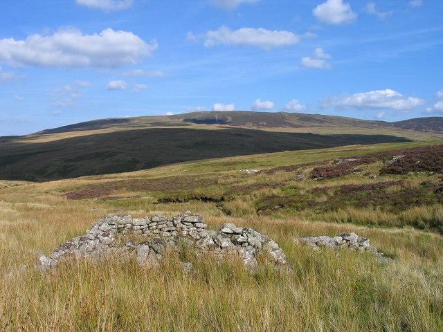
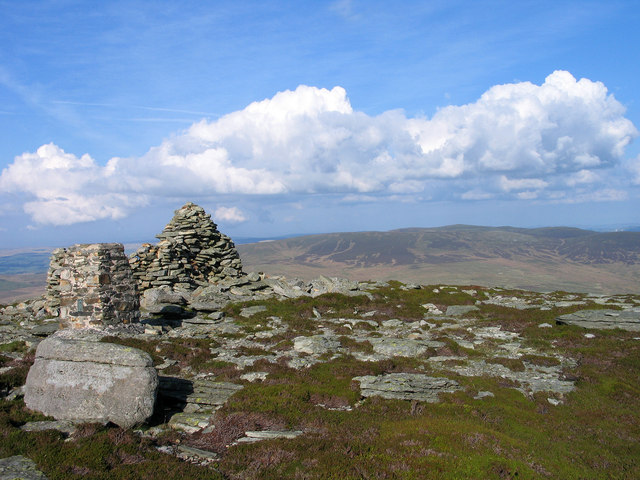
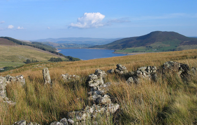
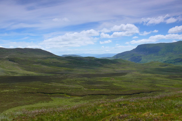
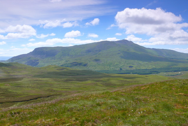
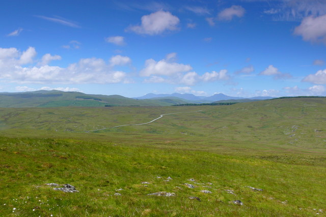
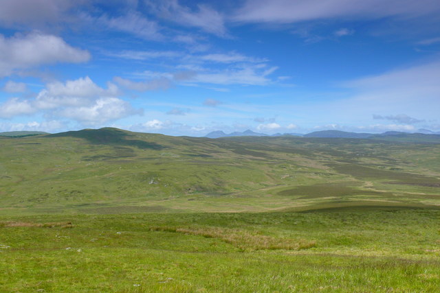
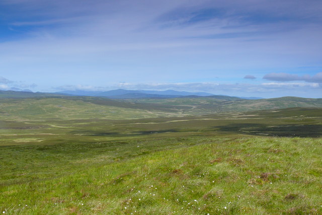
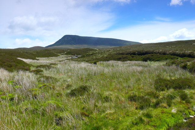
The hill is characterized by its rugged landscape, featuring steep slopes and rocky outcrops. Its summit offers breathtaking panoramic views of the surrounding countryside, including the nearby Llyn Celyn reservoir and the Snowdonia mountains.

Arenig Fach is renowned for its diverse flora and fauna, with several rare and protected species found within its vicinity. The hill is home to a variety of bird species, including red grouse, skylarks, and peregrine falcons. It also supports a rich array of plant life, such as heather, bilberry, and mosses.

There are several hiking routes that lead to the summit of Arenig Fach, catering to both experienced and novice hikers. The most popular route starts from the small village of Llanycil, taking walkers through open moorland and grassy slopes. The ascent can be challenging at times, but the rewarding views and sense of accomplishment make it well worth the effort.

Overall, Arenig Fach offers a memorable outdoor experience for those seeking adventure and natural beauty in the heart of Snowdonia National Park.

If you have any feedback on the listing, please let us know in the comments section below.

Arenig Fach Images

Images are sourced within 2km of 52.957851/-3.7580581 or Grid Reference SH8241. Thanks to Geograph Open Source API. All images are credited.

Ffridd Bwlch Llestri Moorland north of the B4391.
Ffridd Bwlch Llestri
Moorland north of the B4391.
Arenig Fach from Arenig Fawr
Ruin beside Trinant Trinant is a stream flowing in the groove passing the ruined stone feature - perhaps a sheepfold but rather small. The ruin isn't marked on OS maps at any scale but can be discerned clearly on Google Earth. Llechwedd-llyfn is the mountain dome on the skyline.
Ruin beside Trinant
Trinant is a stream flowing in the groove passing the ruined stone feature - perhaps a sheepfold but rather small. The ruin isn't marked on OS maps at any scale but can be discerned clearly on Google Earth. Llechwedd-llyfn is the mountain dome on the skyline.
Summit area of Arenig Fach The summit of Arenig Fach has minor rock exposures, a cairn and a trig point - stone built and bearing a flush bracket numbered S8547; curiously just below the FB number, a coin (1p) has been glued! The view distantly is towards the mountains of Snowdonia.
Summit area of Arenig Fach
The summit of Arenig Fach has minor rock exposures, a cairn and a trig point - stone built and bearing a flush bracket numbered S8547; curiously just below the FB number, a coin (1p) has been glued! The view distantly is towards the mountains of Snowdonia.
Walls below Clogwyn Du These walls are reached as access land ends below the roughness of Clogwyn Du which is a minor feature on the eastern side of the mountain Arenig Fach. The reservoir beyond is Llyn Celyn and the hill rising above it is Mynydd Nodol.
Walls below Clogwyn Du
These walls are reached as access land ends below the roughness of Clogwyn Du which is a minor feature on the eastern side of the mountain Arenig Fach. The reservoir beyond is Llyn Celyn and the hill rising above it is Mynydd Nodol.
Mochowgryn Golygfa o Arenig Fach oddi ar Fochowgryn / A view of Arenig Fach from Mochowgryn.
Mochowgryn
Golygfa o Arenig Fach oddi ar Fochowgryn / A view of Arenig Fach from Mochowgryn.
Mochowgryn Golygfa tuag at Arenig Fawr oddi ar Fochowgryn / A view towards Arenig Fawr from Mochowgryn.
Mochowgryn
Golygfa tuag at Arenig Fawr oddi ar Fochowgryn / A view towards Arenig Fawr from Mochowgryn.
Mochowgryn Arenig Fawr oddi ar Fochowgryn / Arenig Fawr from Mochowgryn.
Mochowgryn
Arenig Fawr oddi ar Fochowgryn / Arenig Fawr from Mochowgryn.
Mochowgryn Golygfa o Foel Llyfnant oddi ar Fochowgryn / A view of Moel Llyfnant oddi ar Mochowgryn.
Mochowgryn
Golygfa o Foel Llyfnant oddi ar Fochowgryn / A view of Moel Llyfnant oddi ar Mochowgryn.
Mochowgryn Y Rhinogydd oddi ar Fochowgryn / The Rhinogs from Mochowgryn.
Mochowgryn
Y Rhinogydd oddi ar Fochowgryn / The Rhinogs from Mochowgryn.
Mochowgryn Y Moelwynion oddi ar Fochowgryn / The Moelwyns from Mochowgryn.
Mochowgryn
Y Moelwynion oddi ar Fochowgryn / The Moelwyns from Mochowgryn.
Mochowgryn Golygfa dros Y Migneint oddi ar Fochowgryn tuag at Y Glyderau a'r Carneddau / A view over The Migneint from Mochowgryn towards the Glyders and the Carneddau.
Mochowgryn
Golygfa dros Y Migneint oddi ar Fochowgryn tuag at Y Glyderau a'r Carneddau / A view over The Migneint from Mochowgryn towards the Glyders and the Carneddau.
Nant Gwyn Y Migneint / The Mignent
Nant Gwyn
Y Migneint / The Mignent
Nant Gwyn Golygfa dros Y Migneint / A view over The Migneint.
Nant Gwyn
Golygfa dros Y Migneint / A view over The Migneint.
Nant Gwyn Golygfa i fyny Nant Gwyn tuag at Arenig Fach / A view up Nant Gwyn towards Arenig Fach.
Nant Gwyn
Golygfa i fyny Nant Gwyn tuag at Arenig Fach / A view up Nant Gwyn towards Arenig Fach.
Y Migneint Golygfa dros Y Migneint i Garnedd Iago / A view across The Migneint to Garnedd Iago.
Y Migneint
Golygfa dros Y Migneint i Garnedd Iago / A view across The Migneint to Garnedd Iago.
Drystone wall on the moors of Mochowgryn An old wall, but one that peters out in a couple of hundred yards.
Drystone wall on the moors of Mochowgryn
An old wall, but one that peters out in a couple of hundred yards.
The valley of the Nant yr Achub The small stream in the dip about 20 yards away drains the southern slopes of Mochowgryn.
The valley of the Nant yr Achub
The small stream in the dip about 20 yards away drains the southern slopes of Mochowgryn.
Show me another place!

Arenig Fach is located at Grid Ref: SH8241 (Lat: 52.957851, Lng: -3.7580581)

Unitary Authority: Gwynedd

Police Authority: North Wales

What 3 Words

///hotspot.refreshed.rumbles. Near Ffestiniog, Gwynedd

Related Wikis

Arenig Fach

Arenig Fach is a mountain in southern Snowdonia, north Wales. It is a peak in the Arenig range and lies to the north of its parent peak Arenig Fawr. It...

Arenig railway station

Arenig railway station stood beneath Arenig Fawr on the Great Western Railway's Bala Ffestiniog Line in Gwynedd, Wales. It served this thinly populated...

Capel Celyn

Capel Celyn was a rural community to the northwest of Bala in Gwynedd, Wales, in the Afon Tryweryn valley. The village and other parts of the valley were...

Capel Celyn Halt railway station

Capel Celyn Halt was a solely passenger railway station which served the rural area of Capel Celyn west of Bala. It was on the Great Western Railway's...

Cwm Prysor Halt railway station

Cwm Prysor Halt (named simply Cwm Prysor until 1953) was a railway station which served the remote rural area of Cwm Prysor, east of Trawsfynydd, Gwynedd...

Migneint

The Migneint (Welsh pronunciation: [ˈmɪɡnaint]) is a large expanse of moorland in central Snowdonia, north-west Wales. It is part of the Migneint-Arenig...

Llyn Arenig Fawr

Llyn Arenig Fawr is a lake and reservoir located near the summit of Arenig Fawr, a mountain in North Wales. The lake's primary purpose is to supply water...

Llyn Celyn

Llyn Celyn (Welsh pronunciation: [ɬɨ̞n ˈkɛlɨ̞n]) is a reservoir constructed between 1960 and 1965 including the highly controversial Tryweryn flooding...

Nearby Amenities

Located within 500m of 52.957851,-3.7580581
Arenig Fach
Ele: 689
Natural: peak
Wikidata: Q4789021
Wikipedia: en:Arenig Fach
Lat/Long: 52.9587261/-3.7576796
Carnedd Bachgen
Description: OS trig pillar
Ele: 688.848
Man Made: survey_point
Note: Accurate location import for imagery offset calibration. Please do not move.
Ref: S8547
Survey Point: pillar
Tpuk Ref: TP1985
Lat/Long: 52.958711/-3.757661
The data included in this document is from www.openstreetmap.org. The data is made available under ODbL.

Have you been to Arenig Fach?

Leave your review of Arenig Fach below (or comments, questions and feedback).