Allensford

Settlement in Durham

England

Allensford

The Lone Tree at Harvest Time The old cow byre can just be seen above the lone tree.

Photograph was taken facing due west towards A68
The Lone Tree at Harvest Time Credit: Dennis Lovett

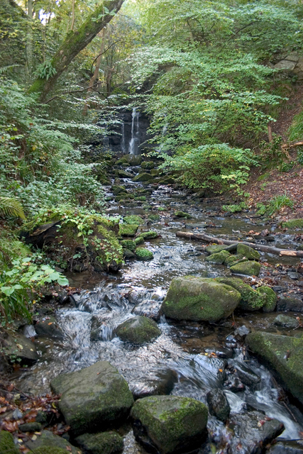
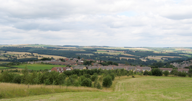
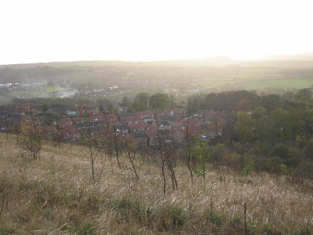
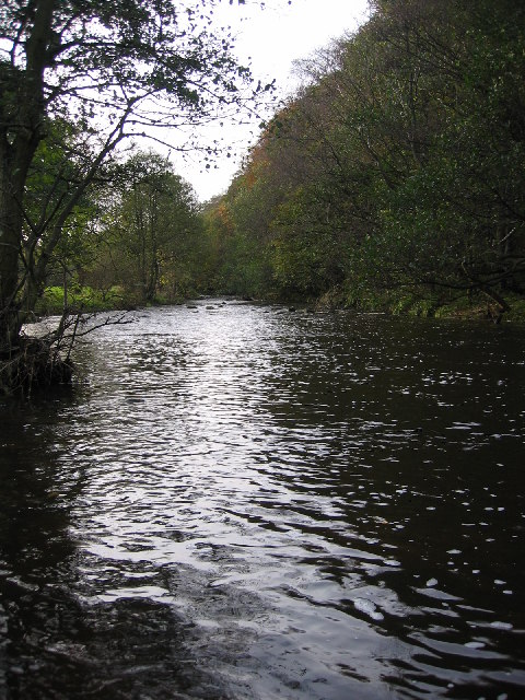
Allensford is a small village located in County Durham, England. Situated on the banks of the River Derwent, it is nestled within the picturesque landscape of the North Pennines Area of Outstanding Natural Beauty. With a population of less than 100 residents, Allensford is a close-knit community that offers a tranquil and rural lifestyle.

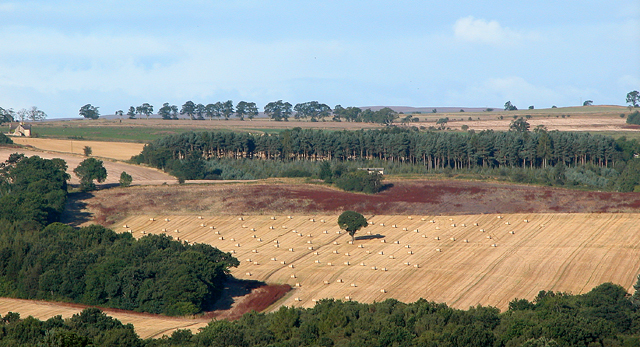
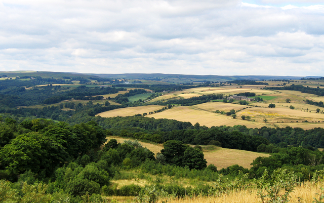
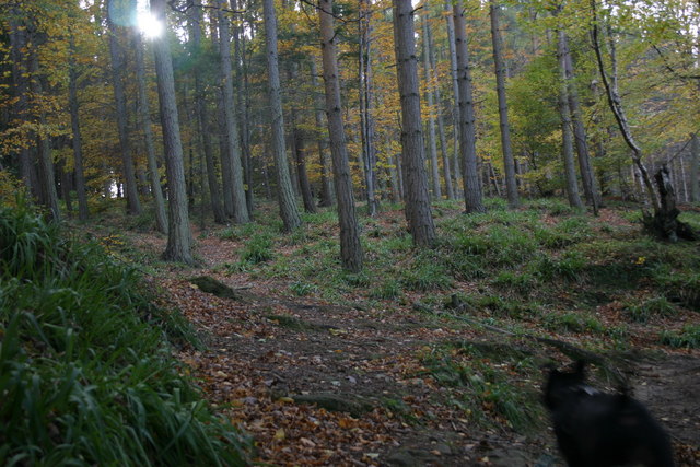
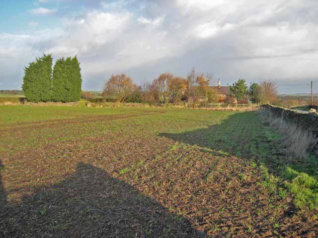
The village is renowned for its beautiful countryside and has become a popular destination for outdoor enthusiasts. Surrounding Allensford are extensive woodlands and walking trails, making it an ideal location for hikers, cyclists, and nature lovers. The nearby Derwent Reservoir also provides opportunities for fishing and watersports.

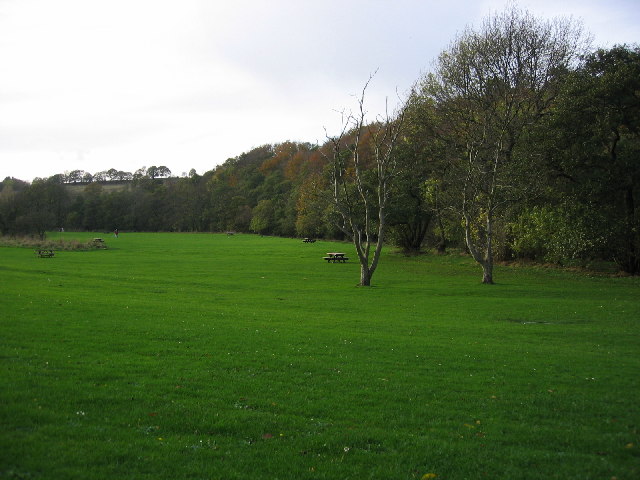
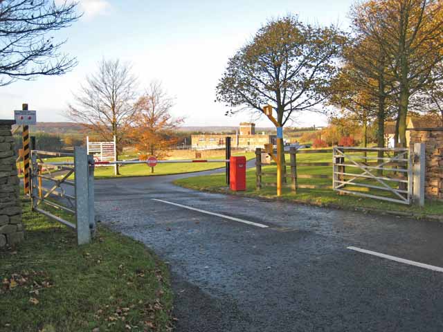
One of the notable landmarks in Allensford is Allensford Country Park, a well-maintained recreational area that offers a range of facilities for visitors. The park features picnic areas, a children's playground, and a café, making it a popular spot for families and day-trippers.

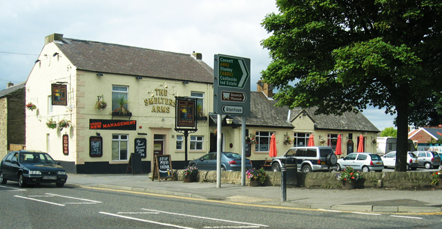
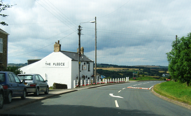
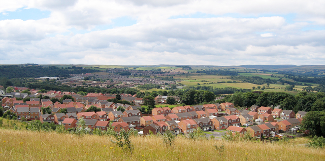
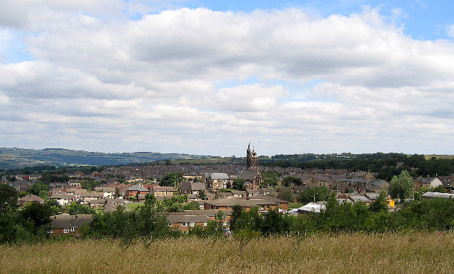
In terms of amenities, Allensford has limited services, with a small number of shops and a pub serving the local community. However, its close proximity to the larger towns of Consett and Durham ensures that residents have access to a wider range of amenities, including schools, healthcare facilities, and shopping centers.

Allensford's location also makes it an attractive place for tourists to explore. With its natural beauty, rich history, and proximity to other attractions in County Durham, such as Durham Cathedral and Beamish Museum, Allensford offers visitors a peaceful and idyllic base from which to discover the region.

If you have any feedback on the listing, please let us know in the comments section below.
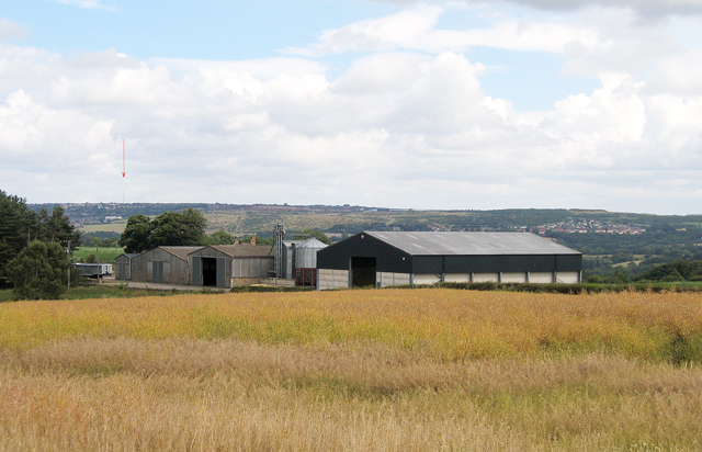
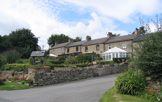
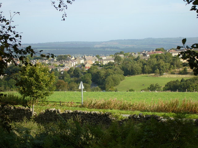
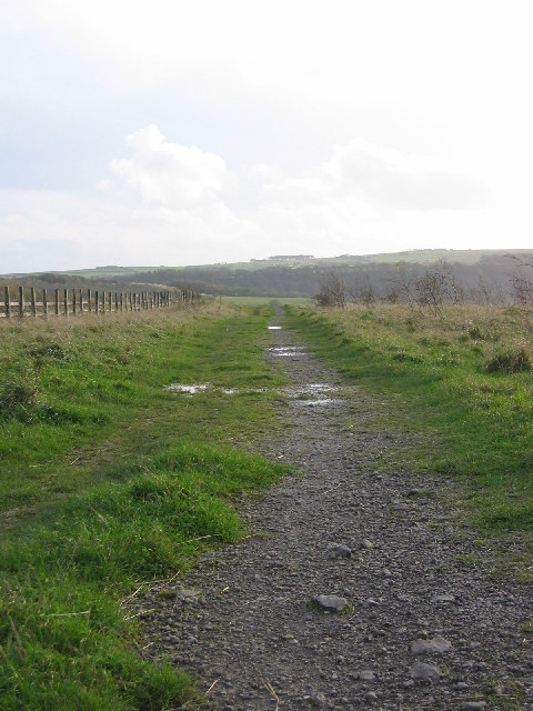
Allensford Images

Images are sourced within 2km of 54.847287/-1.879583 or Grid Reference NZ0750. Thanks to Geograph Open Source API. All images are credited.

The Lone Tree at Harvest Time The old cow byre can just be seen above the lone tree.

Photograph was taken facing due west towards A68
The Lone Tree at Harvest Time
The old cow byre can just be seen above the lone tree. Photograph was taken facing due west towards A68
Wharnley Burn Water Fall
The Smelters Arms at Castleside crossroads The road running left to right is the A68
The Smelters Arms at Castleside crossroads
The road running left to right is the A68
The Fleece Inn On A68 facing North
The Fleece Inn
On A68 facing North
Bridgehill High Ground to left is Grey Mare Hill
Bridgehill
High Ground to left is Grey Mare Hill
Three Groups of Housing Foreground is The Grove, then Moorside and next Castleside which is on the A68. Photograph was taken on the site of the former steel works, which is now landscaped.
Three Groups of Housing
Foreground is The Grove, then Moorside and next Castleside which is on the A68. Photograph was taken on the site of the former steel works, which is now landscaped.
Derwent Valley ( Northumberland/Durham) The Hamlet of Mosswood is beside the visible road (A68). To the right is Derwent Manor hotel.  The River Derwent flows from the left through the valley hidden by the horizontal band of trees.
Derwent Valley ( Northumberland/Durham)
The Hamlet of Mosswood is beside the visible road (A68). To the right is Derwent Manor hotel. The River Derwent flows from the left through the valley hidden by the horizontal band of trees.
Blackhill near Consett
Wallish Walls Pontop Pike  TV transmitter mast can be seen on the horizon.
Wallish Walls
Pontop Pike TV transmitter mast can be seen on the horizon.
Mosswood
Mosswood
Castleside
Castleside
Disused Workings Path Path running alongside main disused workings area now just fields at top of main bank.
Disused Workings Path
Path running alongside main disused workings area now just fields at top of main bank.
The Grove View of the new estate from the top of the disused workings bank.
The Grove
View of the new estate from the top of the disused workings bank.
Derwent River at Allensford View of the derwent river at allensford running alongside the main picnic area and past allensford park.
Derwent River at Allensford
View of the derwent river at allensford running alongside the main picnic area and past allensford park.
Allensford Picnic Area View along the main picnic area, the trees following along derwent river.
Allensford Picnic Area
View along the main picnic area, the trees following along derwent river.
Bog Wood Mixed woodland. Mainly Beech and a conifer which I can't name
but will endeavour to do so.
Bog Wood
Mixed woodland. Mainly Beech and a conifer which I can't name but will endeavour to do so.
Mosswood Water Treatment Works Part of the Derwent Reservoir scheme dating from the 1960s.
Mosswood Water Treatment Works
Part of the Derwent Reservoir scheme dating from the 1960s.
Field and cottage near Mosswood
Show me another place!

Allensford is located at Grid Ref: NZ0750 (Lat: 54.847287, Lng: -1.879583)

Unitary Authority: County Durham

Police Authority: Durham

What 3 Words

///movie.skillet.ulterior. Near Castleside, Co. Durham

Related Wikis

Allensford

Allensford is a small country park and hamlet in County Durham, in England. It is on the River Derwent, about 2 miles SW of Consett, and 1 mile north...

Consett Academy

Consett Academy is a secondary academy school in Consett, the result of a merger between Consett Community Sports College and Moorside Community Technology...

The Grove, County Durham

The Grove is a village in County Durham, in England. It is situated to the south of Consett. The Grove is a post-World War II housing estate. Originally...

Castleside

Castleside is a village in County Durham, England. It is situated a short distance to the south-west of Consett. Castleside is covered by the civil parish...

Shotley Grove

Shotley Grove is a small settlement on the river Derwent, about 1 mile upstream of Shotley Bridge in County Durham, England. Today Shotley Grove is a pleasant...

Bridgehill

Bridgehill is an area of Consett in County Durham, England. It is situated near Benfieldside, Blackhill, Shotley Grove, and the River Derwent. == References... ==

Consett Power Station

Consett Power Station refers to numerous, now demolished coal-fired power stations situated on various sites around Consett in County Durham, North East...

Hownsgill Viaduct

The Hownsgill Viaduct (in some sources called Hownes Gill Viaduct and locally called the Gill bridge) is a former railway bridge located west of Consett...

Nearby Amenities

Located within 500m of 54.847287,-1.879583
Allensford
Place: hamlet
Wikidata: Q4732029
Wikipedia: en:Allensford
Lat/Long: 54.846249/-1.8809034
Waterway: waterfall
Lat/Long: 54.8447579/-1.8851255
Allensford blast furnace
Historic: industrial
Wikidata: Q17643010
Lat/Long: 54.8479883/-1.8782598
Barrier: entrance
Lat/Long: 54.8465929/-1.8813917
Barrier: entrance
Foot: yes
Lat/Long: 54.8464394/-1.8807528
Turning Circle
Lat/Long: 54.8489428/-1.8741104
Power: pole
Lat/Long: 54.846854/-1.8847159
Power: pole
Lat/Long: 54.8460293/-1.8844396
Power: pole
Lat/Long: 54.8453112/-1.8841995
Power: pole
Lat/Long: 54.8447845/-1.8840104
Power: pole
Lat/Long: 54.8444185/-1.8837892
Power: pole
Lat/Long: 54.8439428/-1.8835048
Power: pole
Lat/Long: 54.8436741/-1.8826479
Power: pole
Lat/Long: 54.8433513/-1.8817037
Power: pole
Lat/Long: 54.8429667/-1.880545
Noexit: yes
Source: Bing
Lat/Long: 54.8485527/-1.8751833
Turning Circle
Source: Bing
Lat/Long: 54.8486392/-1.8748936
Noexit: yes
Lat/Long: 54.8489997/-1.8740903
Turning Circle
Source: Bing
Lat/Long: 54.8487187/-1.8745825
Noexit: yes
Source: Bing
Lat/Long: 54.8487666/-1.8746401
Turning Circle
Noexit: yes
Source: Bing
Lat/Long: 54.8483411/-1.8754797
Turning Circle
Source: Bing
Lat/Long: 54.8485187/-1.8751524
Noexit: yes
Source: Bing
Lat/Long: 54.8486716/-1.8749338
Power: pole
Lat/Long: 54.8436324/-1.8826801
Cafe
Cafe at Inn on the Park
Addr City: Consett
Addr Postcode: DH8 9BA
Contact Facebook: Allensfordcafe
Fhrs Id: 1104096
Fixme: Confirm correctly located on imagery
Outdoor Seating: yes
Lat/Long: 54.8482678/-1.8737416
The data included in this document is from www.openstreetmap.org. The data is made available under ODbL.

Have you been to Allensford?

Leave your review of Allensford below (or comments, questions and feedback).