Runston Chapel

Heritage Site in Monmouthshire

Wales

Runston Chapel

The A48 between Caerwent and Crick
The A48 between Caerwent and Crick Credit: Eirian Evans

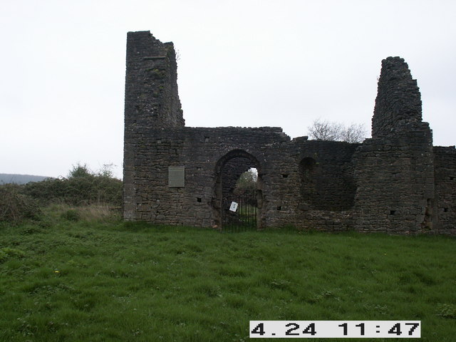
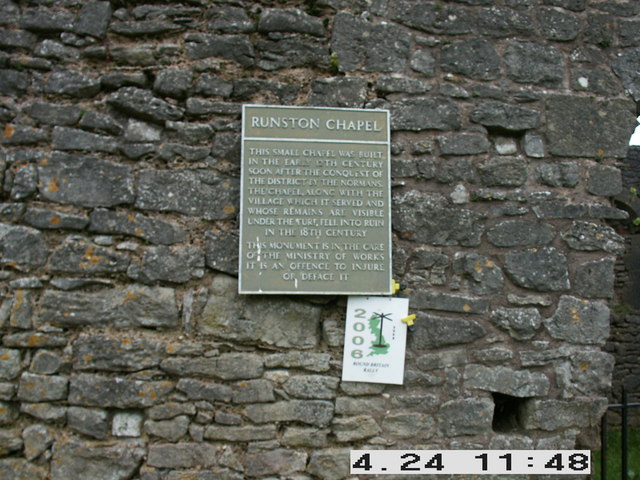
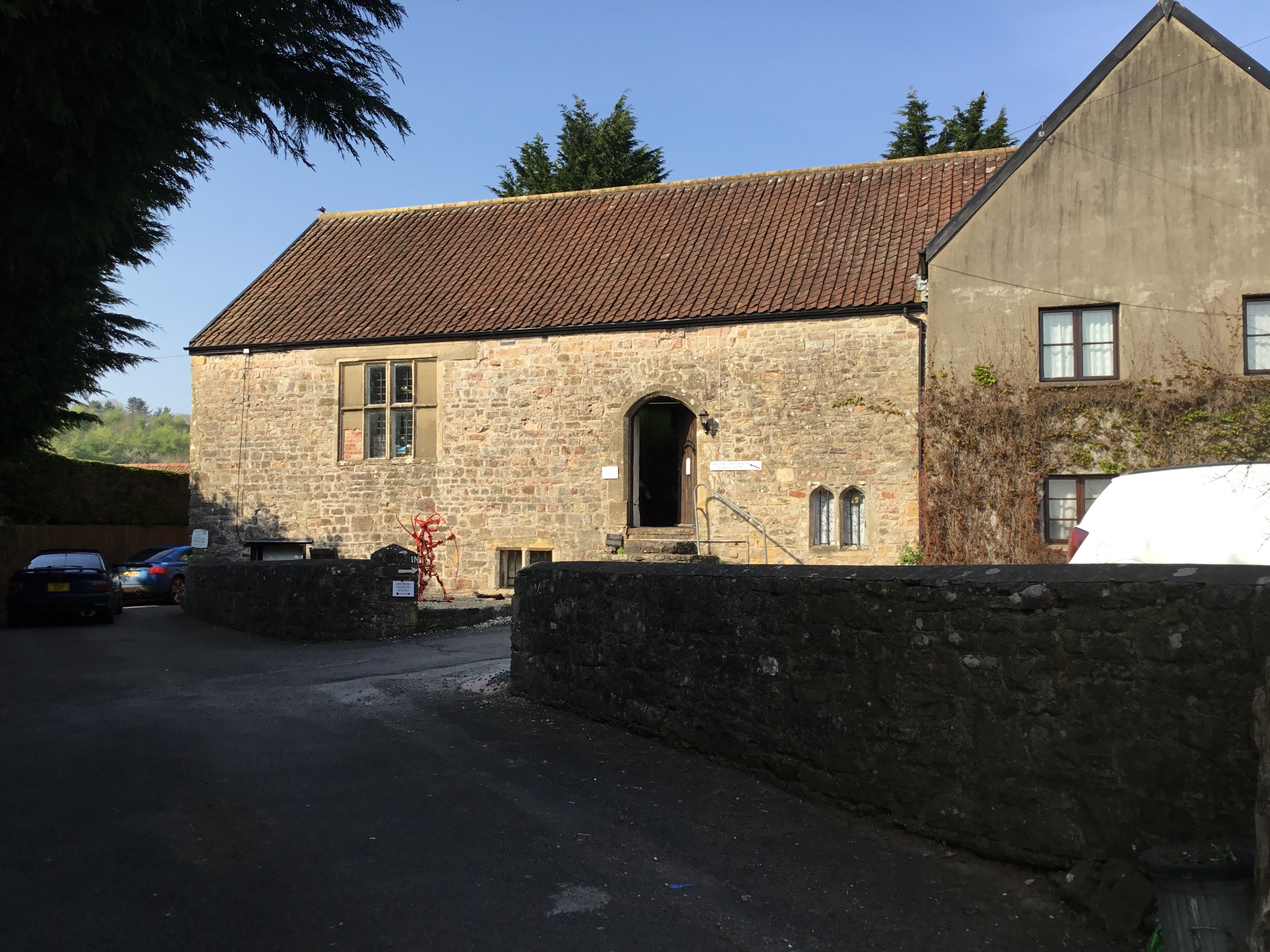
Runston Chapel is a historical heritage site located in Monmouthshire, Wales. Situated in the village of Runston, this 12th-century chapel is renowned for its architectural significance and religious history. The chapel is a Grade II* listed building, recognized for its well-preserved medieval features.

The chapel's design reflects the Romanesque architectural style prevalent during the Norman period. Its compact size and simple layout consist of a rectangular nave and chancel, with a bellcote positioned above the west gable. The exterior showcases a combination of local red sandstone and limestone, which adds to its visual appeal.

Inside the chapel, visitors can witness a remarkable collection of medieval wall paintings that date back to the 13th and 14th centuries. These paintings depict scenes from the Bible, including the Crucifixion and the Last Judgment, showcasing the artistic and religious practices of the time. The original wooden roof, adorned with intricate carvings, further adds to the chapel's medieval charm.

Throughout its history, Runston Chapel has served as a place of worship for the local community. However, due to its dwindling congregation, the chapel is now primarily used for special services and events. Despite this, its significance as a cultural and historical landmark continues to attract tourists and researchers interested in the area's rich heritage.

Runston Chapel stands as a testament to the enduring architectural and artistic achievements of the medieval period in Monmouthshire. Its well-preserved structure, stunning wall paintings, and religious significance make it an invaluable heritage site.

If you have any feedback on the listing, please let us know in the comments section below.

Runston Chapel Images

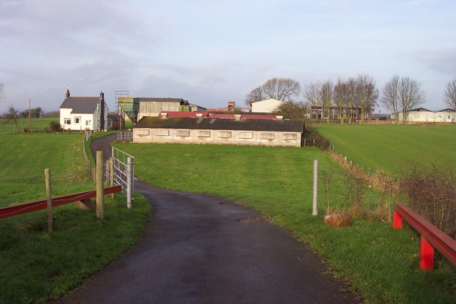
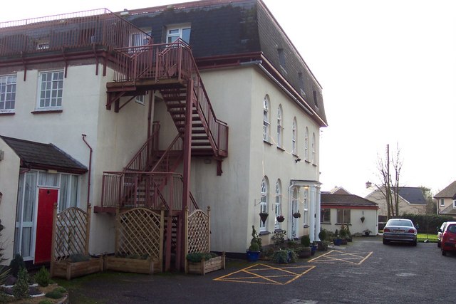
Images are sourced within 2km of 51.6204/-2.7293 or Grid Reference ST4991. Thanks to Geograph Open Source API. All images are credited.

The A48 between Caerwent and Crick
Ordnance Survey Flush Bracket S1355 This can be found on the wall of a building beside the A48 in Crick.
For more detail see : <span class="nowrap"><a title="http://www.bench-marks.org.uk/bm15774" rel="nofollow ugc noopener" href="http://www.bench-marks.org.uk/bm15774">Link</a><img style="margin-left:2px;" alt="External link" title="External link - shift click to open in new window" src="https://s1.geograph.org.uk/img/external.png" width="10" height="10"/></span>
Ordnance Survey Flush Bracket S1355
This can be found on the wall of a building beside the A48 in Crick. For more detail see : LinkExternal link
Road (A48) passing through Crick Looking south-westward.
Road (A48) passing through Crick
Looking south-westward.
Ordnance Survey Flush Bracket S1354 This can be found on the wall of a house, Bradbury's - a private dwelling - in Crick.
For more detail see : <span class="nowrap"><a title="http://www.bench-marks.org.uk/bm15775" rel="nofollow ugc noopener" href="http://www.bench-marks.org.uk/bm15775">Link</a><img style="margin-left:2px;" alt="External link" title="External link - shift click to open in new window" src="https://s1.geograph.org.uk/img/external.png" width="10" height="10"/></span>
Ordnance Survey Flush Bracket S1354
This can be found on the wall of a house, Bradbury's - a private dwelling - in Crick. For more detail see : LinkExternal link
Stubble field near New House Farm Off the A48.
Stubble field near New House Farm
Off the A48.
A48 towards Chepstow Dual carriageway ending shortly.
A48 towards Chepstow
Dual carriageway ending shortly.
Railway bridge over the A48, Crick
Poultry Farm, Bentley Green
M48 motorway bridge over the A48
Stubble field, Bentley Green
A48 towards Chepstow
Road Junction in Crick The view is towards Chepstow. The road to the left leads to Shirenewton, the road to the right, Portskewett.
Road Junction in Crick
The view is towards Chepstow. The road to the left leads to Shirenewton, the road to the right, Portskewett.
The Dual Carriageway Approaching Crick The OS map indicates this section was a Roman Road.
The Dual Carriageway Approaching Crick
The OS map indicates this section was a Roman Road.
Crick - Start of Dual Carriageway To the left is the road junction to Portskewett, just after which the dual carriageway starts, continuing to the outskirts of Caerwent.
Crick - Start of Dual Carriageway
To the left is the road junction to Portskewett, just after which the dual carriageway starts, continuing to the outskirts of Caerwent.
Runston Chapel
Runston Chapel
Plaque on Runston Chapel
Hawthorn Farm
Hawthorn Farm
Nursing home in Crick
Show me another place!

Runston Chapel is located at Grid Ref: ST4991 (Lat: 51.6204, Lng: -2.7293)

Unitary Authority: Monmouthshire

Police Authority: Gwent

What 3 Words

///confident.chef.glass. Near Caerwent, Monmouthshire

Related Wikis

Runston Chapel

Runston Chapel, Mathern, Monmouthshire, Wales, is the ruin of a chapel dating back to the early 12th century. It is the only remaining visible remnant...

Manor Farmhouse, Crick

Manor Farmhouse, or Crick Manor, Crick, Monmouthshire is a late medieval manor house dating from the 15th century. The buildings comprise a chapel, of...

Crick, Monmouthshire

Crick (Welsh: Crug) is a small village or hamlet in the Welsh county of Monmouthshire, United Kingdom. It is located on the A48 road 1 mile north of the...

Mathern Mill

Mathern Mill, Mathern, Monmouthshire is a watermill dating from either the late 18th or early 19th centuries. It continued in use as a functioning mill...

Nearby Amenities

Located within 500m of 51.6204,-2.7293
Power: pole
Lat/Long: 51.6239916/-2.7328062
Power: pole
Lat/Long: 51.6209409/-2.7323663
Power: pole
Lat/Long: 51.621164/-2.7238449
Power: pole
Lat/Long: 51.6206128/-2.7252638
Power: pole
Lat/Long: 51.6203114/-2.7262294
Power: pole
Lat/Long: 51.6199667/-2.7271763
Power: pole
Lat/Long: 51.6192955/-2.7290967
Power: pole
Lat/Long: 51.6189608/-2.7300516
Power: pole
Lat/Long: 51.6171156/-2.7320579
Power: pole
Lat/Long: 51.6198718/-2.7320498
Power: pole
Lat/Long: 51.6191007/-2.7317628
Power: pole
Lat/Long: 51.6184729/-2.7315456
Power: pole
Lat/Long: 51.6179016/-2.7309984
Power: pole
Lat/Long: 51.6172921/-2.7304459
Power: pole
Lat/Long: 51.6162512/-2.7290082
Power: pole
Lat/Long: 51.6184212/-2.7318822
The data included in this document is from www.openstreetmap.org. The data is made available under ODbL.

Have you been to Runston Chapel?

Leave your review of Runston Chapel below (or comments, questions and feedback).