Margam Stones Museum

Heritage Site in Glamorgan

Wales

Margam Stones Museum

Margam Moor Shunting Yard Railway crossing and shunting yard at southern end of the Port Talbot steelworks.
Margam Moor Shunting Yard Credit: Chris Shaw

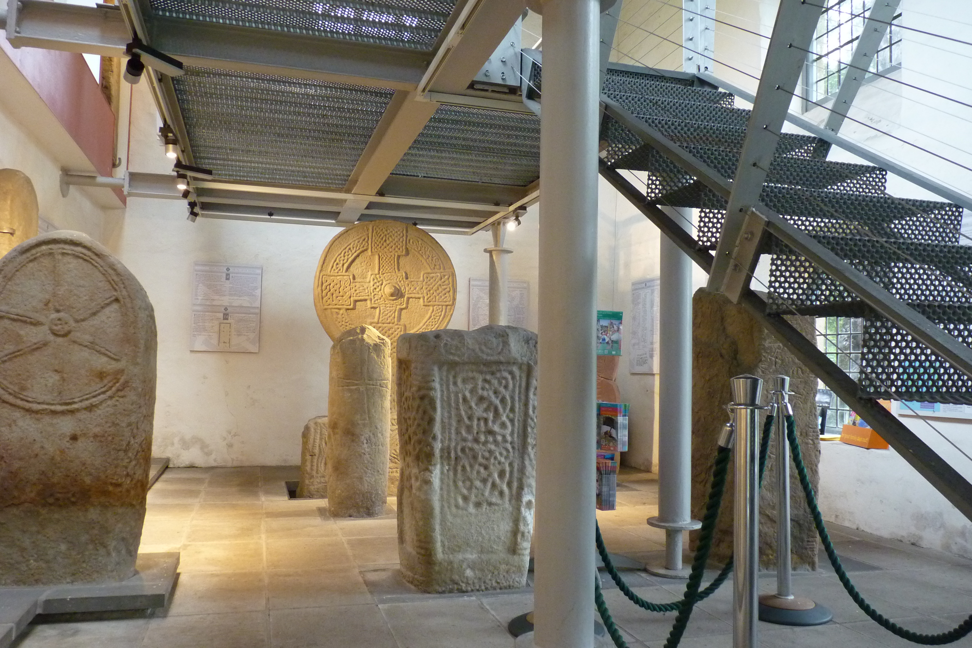
The Margam Stones Museum is a prominent heritage site located in Glamorgan, Wales. Situated within the grounds of Margam Country Park, the museum showcases a remarkable collection of early Christian and medieval stones of historical significance.

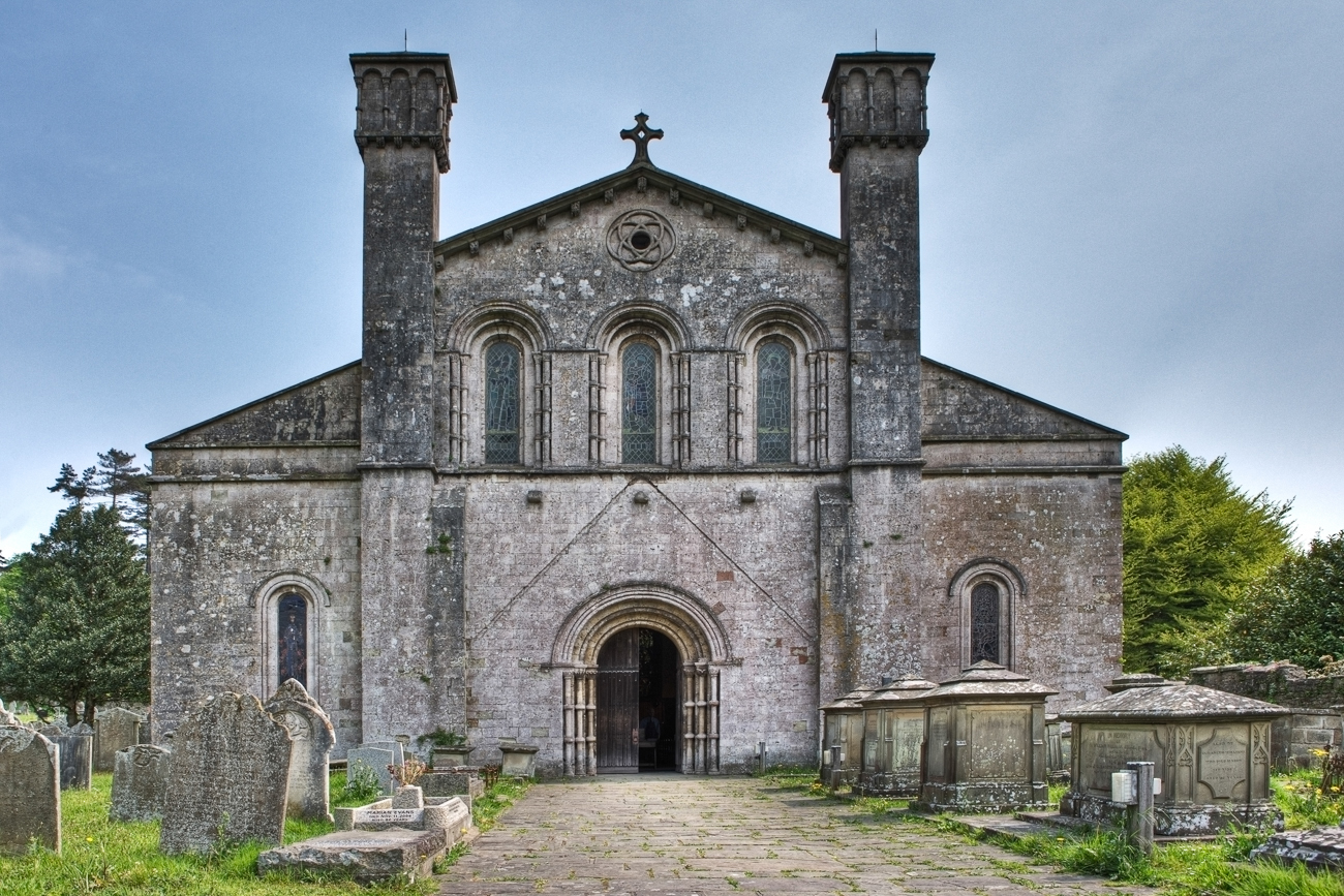
The museum is housed in the former stable block of Margam Castle, a Grade I listed building, which adds to the overall charm and character of the site. It was established in 1980 and has since become a major attraction for history enthusiasts, archaeologists, and visitors interested in the rich heritage of Wales.

The collection at Margam Stones Museum comprises over 70 stones, some of which date back as far as the 6th century AD. These stones are intricately carved and depict various designs, including crosses, Celtic patterns, and human figures. They provide valuable insights into the early Christian and medieval periods in Wales, shedding light on the culture, beliefs, and artistry of the time.

The museum offers a comprehensive display, with each stone accompanied by detailed information about its origin, meaning, and historical context. The knowledgeable staff is always available to provide additional insights and answer any questions visitors may have.

In addition to its impressive collection, the Margam Stones Museum also hosts temporary exhibitions and educational activities, making it an engaging and informative experience for visitors of all ages. The picturesque setting of Margam Country Park further enhances the visit, offering opportunities to explore the beautiful gardens, woodlands, and wildlife habitats that surround the museum.

If you have any feedback on the listing, please let us know in the comments section below.

Margam Stones Museum Images

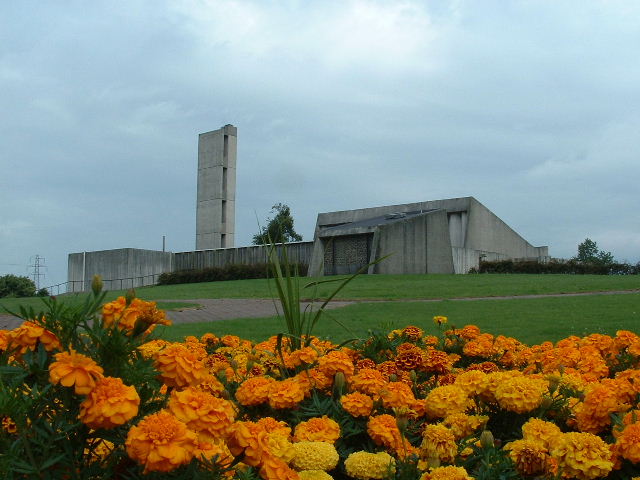
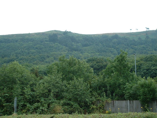
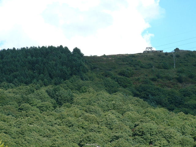
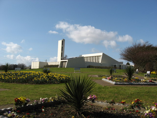
Images are sourced within 2km of 51.5637/-3.7312 or Grid Reference SS8086. Thanks to Geograph Open Source API. All images are credited.

Margam Moor Shunting Yard Railway crossing and shunting yard at southern end of the Port Talbot steelworks.
Margam Moor Shunting Yard
Railway crossing and shunting yard at southern end of the Port Talbot steelworks.
Margam Shops Looking SW near centre of grid square
Margam Shops
Looking SW near centre of grid square
Margam Crematorium Looking North towards main building, just North of the reservoir
Margam Crematorium
Looking North towards main building, just North of the reservoir
Margam Hills Dramatic Wooded Hillside - looking NE from centre of square (across the M4)
Margam Hills
Dramatic Wooded Hillside - looking NE from centre of square (across the M4)
Cricket Field & sport Club East of Steelworks (note mill sheds in background)
Cricket Field & sport Club
East of Steelworks (note mill sheds in background)
Hilltop nr Brombill Heavily wooded hillside East of motorway
Hilltop nr Brombill
Heavily wooded hillside East of motorway
Margam Crematorium
Margam Crematorium
Coast Defence Radar Station Swansea Bay CHL/Coast Defence Radar Station. The Coast Defence/Chain Home Low chain was set up to provide radar plotting of both shipping and aircraft movements and operated on the same 1.5 m wavelength as CHL stations. The CD/CHL stations were originally manned solely by the Army, or jointly by all three services, until the RAF assumed responsibility for them. A 60 Group (RAF) Statement Map (2nd edition) identifies Swansea Bay as a CHL (Type 2) Station.The equipment was housed in a building sharing many similarities with the brick CHL combined transmitter/receiver block, but the gantry supporting the aerial array was mounted on top of the block rather than on the ground with four buttresses for support.  Three concrete buildings survive at the Swansea Bay site on the east side of a public footpath running along the ridge that overlooks Swansea Bay. The largest of these, at the north end of the site, was the operations block which is of the standard design illustrated in the diagram above. It is divided into three rooms with some of the windows retaining their metal shutters. The building is completely empty apart from some wiring remnants. A 10 foot high metal gantry on the roof would have mounted the radar array.The power house is located a few yards to the south, this is a smaller rectangular concrete building with a blast protected door at one end and small vents high in each wall. As this station was not connected to mains electricity this building would have housed a diesel generator. All that remains now is the concrete engine bed. An identical building stands 100 yards to the south east close to an electricity pylon. This would have housed a standby generator which would have been used if the main set failed.
Coast Defence Radar Station
Swansea Bay CHL/Coast Defence Radar Station. The Coast Defence/Chain Home Low chain was set up to provide radar plotting of both shipping and aircraft movements and operated on the same 1.5 m wavelength as CHL stations. The CD/CHL stations were originally manned solely by the Army, or jointly by all three services, until the RAF assumed responsibility for them. A 60 Group (RAF) Statement Map (2nd edition) identifies Swansea Bay as a CHL (Type 2) Station.The equipment was housed in a building sharing many similarities with the brick CHL combined transmitter/receiver block, but the gantry supporting the aerial array was mounted on top of the block rather than on the ground with four buttresses for support. Three concrete buildings survive at the Swansea Bay site on the east side of a public footpath running along the ridge that overlooks Swansea Bay. The largest of these, at the north end of the site, was the operations block which is of the standard design illustrated in the diagram above. It is divided into three rooms with some of the windows retaining their metal shutters. The building is completely empty apart from some wiring remnants. A 10 foot high metal gantry on the roof would have mounted the radar array.The power house is located a few yards to the south, this is a smaller rectangular concrete building with a blast protected door at one end and small vents high in each wall. As this station was not connected to mains electricity this building would have housed a diesel generator. All that remains now is the concrete engine bed. An identical building stands 100 yards to the south east close to an electricity pylon. This would have housed a standby generator which would have been used if the main set failed.
Gorsedd Stones
Gorsedd Stones
An Oil Train heads East at Margam Moors Crossing
M4 motorway passing Eglwys Nunydd reservoir, Margam The waters of Eglwys Nunydd reservoir can be glimpsed  behind the barrier with the steelworks beyond. The reservoir covers the site of an early medieval monastic settlement associated with St Non, mother of St David.
M4 motorway passing Eglwys Nunydd reservoir, Margam
The waters of Eglwys Nunydd reservoir can be glimpsed behind the barrier with the steelworks beyond. The reservoir covers the site of an early medieval monastic settlement associated with St Non, mother of St David.
Railway crossing, Margam Moors from the east View of the eastern entrance to the crossing. Immediately beyond the gate in the foreground lies the main Cardiff to Swansea line. Once this has been negotiated, there remain to be crossed several stretches of track which are in sidings and/or serve Margam steelworks.
Railway crossing, Margam Moors from the east
View of the eastern entrance to the crossing. Immediately beyond the gate in the foreground lies the main Cardiff to Swansea line. Once this has been negotiated, there remain to be crossed several stretches of track which are in sidings and/or serve Margam steelworks.
Milepost  (Relocated?) Last in a series of mileposts along the A48 before the M4 at Junction 38. This is located less than a mile from the previous one near Margam Country Park, and is opposite a lay-by. Was it moved when the M4 was built and the A48 was remodelled between Junctions 38 and 39?
Milepost (Relocated?)
Last in a series of mileposts along the A48 before the M4 at Junction 38. This is located less than a mile from the previous one near Margam Country Park, and is opposite a lay-by. Was it moved when the M4 was built and the A48 was remodelled between Junctions 38 and 39?
BOC Gases plant nr Margam
Level Crossing at Margam Moors. Permanent Way crew work as a west bound train passes.
Level Crossing at Margam Moors.
Permanent Way crew work as a west bound train passes.
Brombil Reservoir Brombil reservoir, near Port Talbot. The start of the walk can be accessed via Latitude:  51°34'24.56"N Longitude:   3°44'52.54"W. The trail splits off to the left, but where the photo was taken is across the river to the right. If you start walking up a long steep trail, you've gone the wrong way.
Brombil Reservoir
Brombil reservoir, near Port Talbot. The start of the walk can be accessed via Latitude: 51°34'24.56"N Longitude: 3°44'52.54"W. The trail splits off to the left, but where the photo was taken is across the river to the right. If you start walking up a long steep trail, you've gone the wrong way.
Steelworks plume
Steelworks plume
Margam Crematorium entrance
Show me another place!

Margam Stones Museum is located at Grid Ref: SS8086 (Lat: 51.5637, Lng: -3.7312)

Unitary Authority: Neath Port Talbot

Police Authority: South Wales

What 3 Words

///gates.baguette.chimp. Near Taibach, Neath Port Talbot

Related Wikis

Margam Stones Museum

Margam Stones Museum is a small Victorian schoolhouse near Port Talbot, South Wales, which now provides a home for one of the most important collections...

Margam Country Park

Margam Country Park is a country park estate in Wales, of around 850 acres (3.4 km²). It is situated in Margam, about 2 miles (3 km) from Port Talbot in...

Margam Castle

Margam Castle, Margam, Port Talbot, Wales, is a late Georgian country house built for Christopher Rice Mansel Talbot. Designed by Thomas Hopper, the castle...

Margam Abbey

Margam Abbey (Welsh: Abaty Margam) was a Cistercian monastery, located in the village of Margam, a suburb of modern Port Talbot in Wales. == History... ==

Nearby Amenities

Located within 500m of 51.5637,-3.7312
Created By: Potlatch 0.10f
Historic: memorial
Lat/Long: 51.5626395/-3.7314057
Margam Abbey
Historic: archaeological_site
Tourism: attraction
Wikidata: Q1894788
Lat/Long: 51.562599/-3.73009
Created By: Potlatch 0.10f
Tourism: picnic_site
Lat/Long: 51.5635648/-3.7299507
Margam Village
Name Cy: Margam
Name En: Margam
Place: hamlet
Lat/Long: 51.5626022/-3.7362551
Parking
Created By: Potlatch 0.10f
Lat/Long: 51.5632051/-3.7310795
Historic: ruins
Lat/Long: 51.5625244/-3.7299159
Parking
Margam Country Park
Lat/Long: 51.5604962/-3.73019
Orangery
Historic: Orangery
Lat/Long: 51.5621647/-3.7308747
Parking
Lat/Long: 51.5631878/-3.7251581
Barrier: cattle_grid
Lat/Long: 51.5613775/-3.7284343
Passing Place
Lat/Long: 51.561581/-3.7262392
Passing Place
Lat/Long: 51.561675/-3.727584
Events Venue
The Orangery
Addr City: Margam
Addr Housename: The Orangery
Addr Postcode: SA13 2TJ
Addr Street: Margam Park
Name Cy: Y Orendy
Website: http://www.margamorangery.com/
Lat/Long: 51.5622394/-3.73134
Margam mass vaccination centre
Addr City: Margam
Addr Housename: The Orangery
Addr Postcode: SA13 2TJ
Addr Street: Margam Park
Email: sbu.inquiries@wales.nhs.uk
Healthcare: vaccination_centre
Healthcare Speciality: vaccination
Name Cy: Canolfan Brechu Torfol Margam
Opening Hours: Mo-Su 08:00-18:00
Operator: Swansea Bay University Health Board
Phone: +44 1639 683 344
Vaccination: covid19
Website: https://sbuhb.nhs.wales/coronavirus-covid-19/information/vaccine-in-swansea-and-npt/getting-to-our-mass-vaccination-centres/
Wheelchair: yes
Lat/Long: 51.5622296/-3.7305929
Post Box
Collection Times: Mo-Fr 16:00; Sa 11:00
Operator: Royal Mail
Post Box Mounting: pier
Post Box Type: lamp
Ref: SA13 37
Royal Cypher: EIIR
Royal Cypher Wikidata: Q33102113
Lat/Long: 51.5618983/-3.7361857
Cafe
Lat/Long: 51.5627539/-3.7243327
Toilets
Access: yes
Female: yes
Male: yes
Lat/Long: 51.5626066/-3.7330075
The data included in this document is from www.openstreetmap.org. The data is made available under ODbL.

Have you been to Margam Stones Museum?

Leave your review of Margam Stones Museum below (or comments, questions and feedback).