Wappenbury

Civil Parish in Warwickshire Warwick

England

Wappenbury

Fosse Way bridge over the River Leam
Fosse Way bridge over the River Leam Credit: Jonathan Thacker

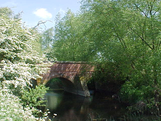
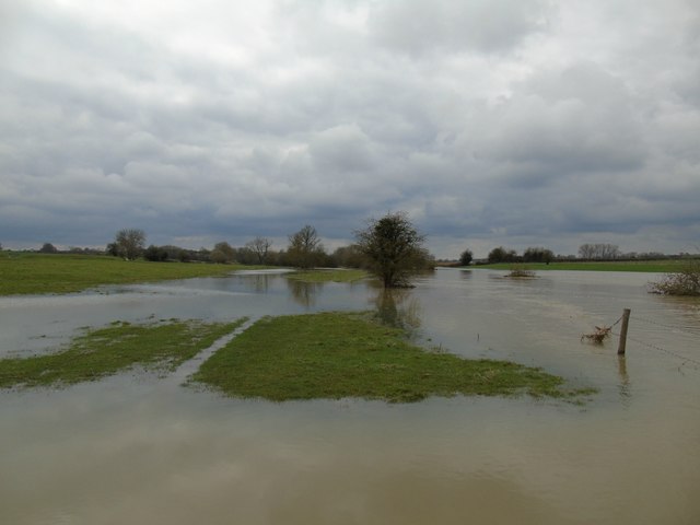
Wappenbury is a civil parish located in the county of Warwickshire, England. Situated approximately 7 miles southeast of the town of Leamington Spa, it is a rural area with a small population. The parish covers an area of around 5 square miles and is bordered by the River Leam to the east.

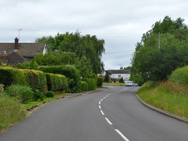
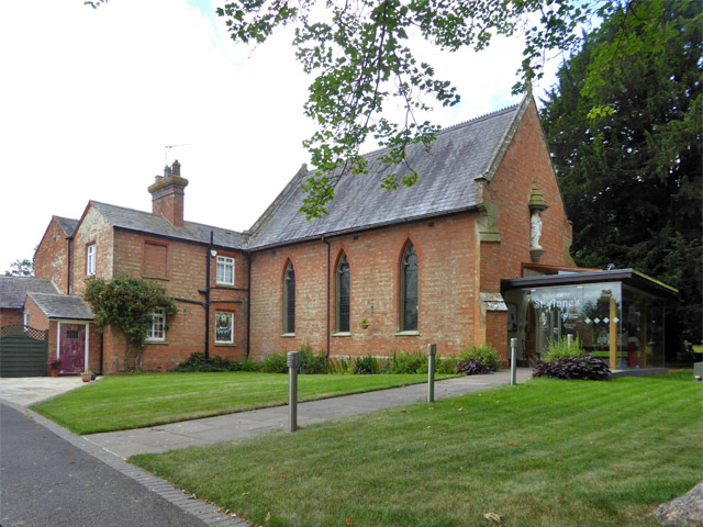
The village of Wappenbury itself is a charming and picturesque settlement, known for its historic buildings and idyllic countryside views. The parish is home to a mix of residential properties, including traditional cottages and modern houses. The architectural style reflects the village's rich heritage, with some buildings dating back to the 17th century.

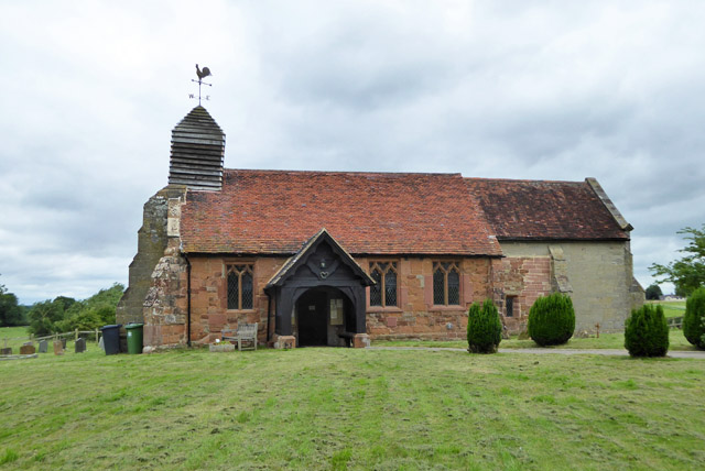
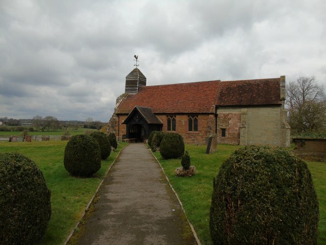
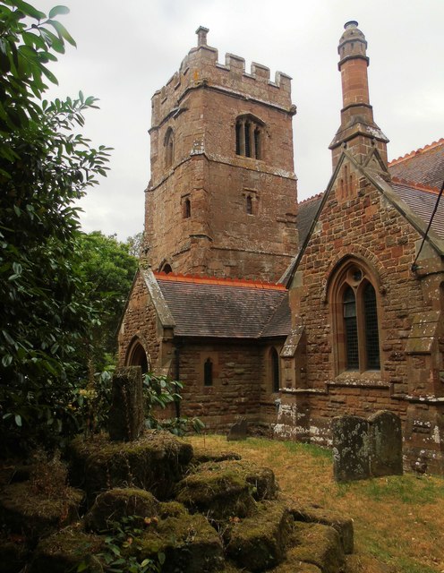
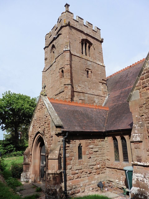
The focal point of Wappenbury is St. John the Baptist Church, a Grade II listed building that dates back to the 12th century. This beautiful church features stunning stained glass windows and a peaceful churchyard, attracting visitors and locals alike.

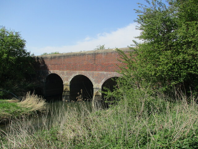
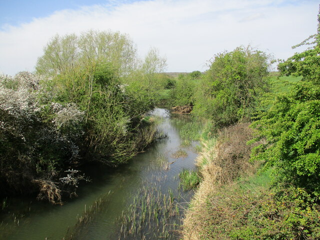
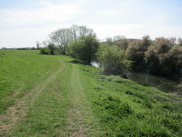
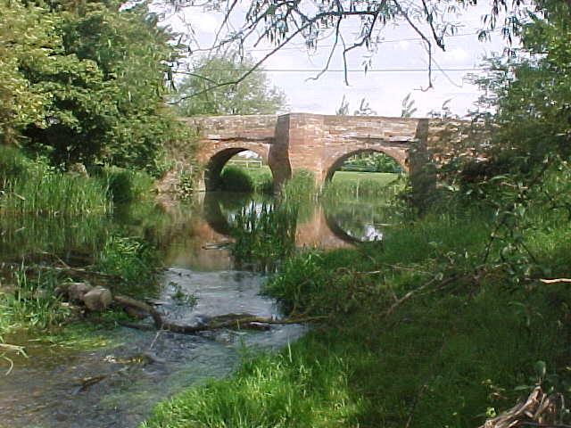
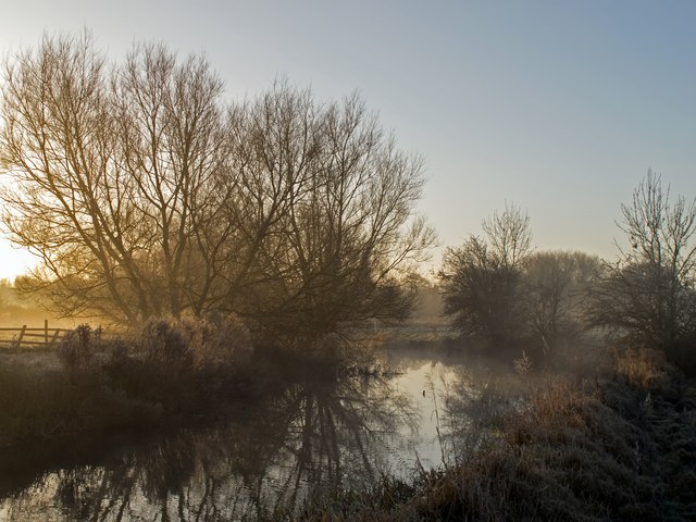
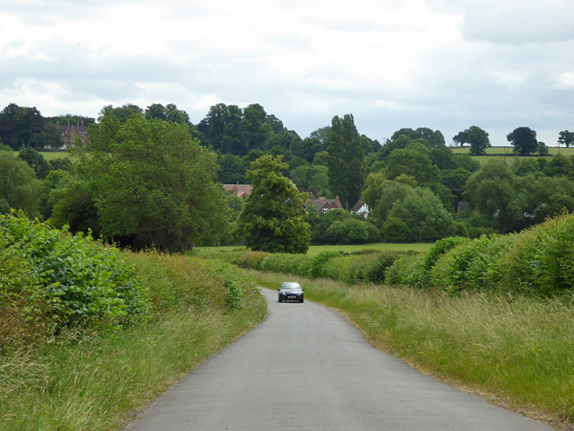
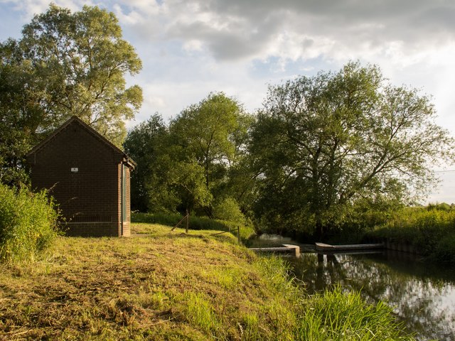
The surrounding countryside offers ample opportunities for outdoor activities such as hiking, cycling, and picnicking. The parish is part of the Heart of England Way, a long-distance footpath that stretches from Milford Common to Bourton-on-the-Water. The peaceful River Leam also provides a serene setting for fishing and boating enthusiasts.

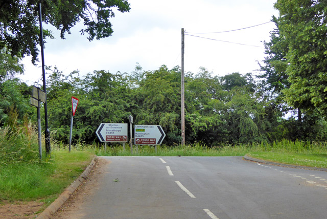
Despite its rural setting, Wappenbury benefits from good transport links, with easy access to major roads such as the A45 and A423. The closest railway station is located in neighbouring Leamington Spa, connecting residents to larger cities like Birmingham and London.

In summary, Wappenbury is a quaint and picturesque civil parish in Warwickshire, offering a peaceful and rural lifestyle with easy access to amenities and transport links.

If you have any feedback on the listing, please let us know in the comments section below.
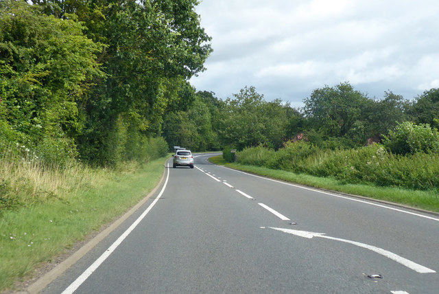
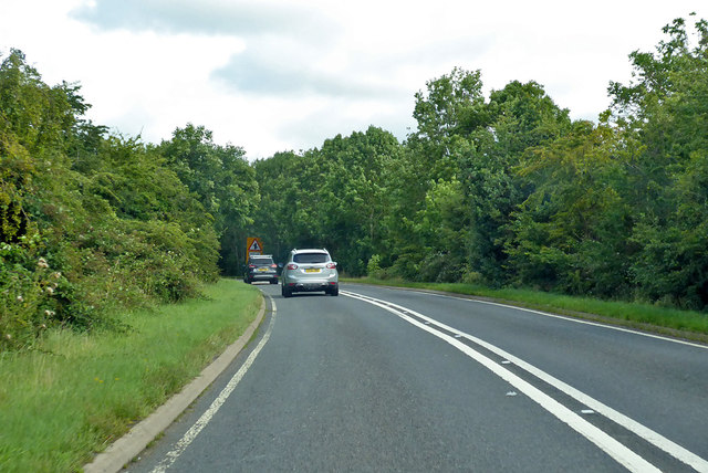
Wappenbury Images

Images are sourced within 2km of 52.326188/-1.444567 or Grid Reference SP3769. Thanks to Geograph Open Source API. All images are credited.

Fosse Way bridge over the River Leam
The River Leam north of Eathorpe Looking downstream.
The River Leam north of Eathorpe
Looking downstream.
The River Leam north of Eathorpe Looking upstream.
The River Leam north of Eathorpe
Looking upstream.
Bridge over the River Leam
River Leam at Eathorpe Sunlight catches the willows on a frosty winter morning as the river steams.
River Leam at Eathorpe
Sunlight catches the willows on a frosty winter morning as the river steams.
Hunningham church St. Margaret's is a grade II listed building.
Hunningham church
St. Margaret's is a grade II listed building.
Outskirts of Weston under Wetherley Most of the village is off to the left at the junction ahead.
Outskirts of Weston under Wetherley
Most of the village is off to the left at the junction ahead.
Wappenbury Roman Catholic church St. Anne's is administered by the Missionaries of the Sacred Heart, I think it says on the glass porch.
Wappenbury Roman Catholic church
St. Anne's is administered by the Missionaries of the Sacred Heart, I think it says on the glass porch.
Road from Wappenbury to Eathorpe Descending to cross the River Leam.
Road from Wappenbury to Eathorpe
Descending to cross the River Leam.
Road from Eathorpe meets the Fosse Way The B4455 signs have brown parts indicating that it is the historic route of the Fosse Way, but just here the current road seems to make a small diversion around the local big house and park off to the right. The road whose end is just showing at the near right looks a more convincing ancient alignment.
Road from Eathorpe meets the Fosse Way
The B4455 signs have brown parts indicating that it is the historic route of the Fosse Way, but just here the current road seems to make a small diversion around the local big house and park off to the right. The road whose end is just showing at the near right looks a more convincing ancient alignment.
Bridge over the River Leam
Hunningham Church
Hunningham Church
River Leam at Hunningham In flood, Easter 2018.
River Leam at Hunningham
In flood, Easter 2018.
Wappenbury Church
Wappenbury Church
Wappenbury, Warwickshire, St John the Baptist
Eathorpe Pumping Station A sluice and building near the pumping station on the River Leam at Eathorpe.
Eathorpe Pumping Station
A sluice and building near the pumping station on the River Leam at Eathorpe.
B4455 Fosse Way heading north Approaching Eathorpe, where the Roman straight road was blocked by the building of the local 'big house' and its park. The through route originally deviated to the west through the village, but now the main road has been taken to the east of both village and house.
B4455 Fosse Way heading north
Approaching Eathorpe, where the Roman straight road was blocked by the building of the local 'big house' and its park. The through route originally deviated to the west through the village, but now the main road has been taken to the east of both village and house.
B4455 Fosse Way heading north A modern deviation off the Roman route, bypassing Eathorpe.
B4455 Fosse Way heading north
A modern deviation off the Roman route, bypassing Eathorpe.
Show me another place!

Wappenbury is located at Grid Ref: SP3769 (Lat: 52.326188, Lng: -1.444567)

Administrative County: Warwickshire

District: Warwick

Police Authority: Warwickshire

What 3 Words

///tame.caves.interlude. Near Ryton on Dunsmore, Warwickshire

Related Wikis

Wappenbury

Wappenbury is a small village and civil parish in the English county of Warwickshire. Located on the north bank of the River Leam Wappenbury is almost...

Eathorpe

Eathorpe is a small village and civil parish five miles east of Leamington Spa, in Warwickshire, England. The parish is part of the electoral ward of Cubbington...

Weston under Wetherley

Weston under Wetherley, often known by locals as just Weston, is a small village and civil parish in Warwickshire, England. It is on the B4453, 4 miles...

Princethorpe College

Princethorpe College is a Catholic independent day school located in Princethorpe, near Rugby, Warwickshire, England. Princethorpe College opened in September...

Hunningham

Hunningham is a small village and civil parish in Warwickshire, England. It is 3 miles to the north-east of Leamington Spa, within the Radford Semele ward...

Princethorpe

Princethorpe is a village and civil parish in the Rugby district of Warwickshire, England. In the 2011 census the parish had a population 376, increasing...

Ryton Pools Country Park

Ryton Pools Country Park is a country park one mile (1.6 km) south west of the village of Ryton on Dunsmore in Warwickshire, England. The park occupies...

River Itchen, Warwickshire

The River Itchen flows through east Warwickshire in England. It is a small river, about 18 miles (29 km) long, and its general course is from south to...

Nearby Amenities

Located within 500m of 52.326188,-1.444567
Bus Stop
Leamington Road
Bus: yes
Naptan AtcoCode: 4200F071900
Naptan Bearing: N
Naptan CommonName: Leamington Road
Naptan Indicator: Jcn
Naptan NaptanCode: waragpdt
Naptan Street: Main Street
Naptan Verified: no
Public Transport: platform
Source: naptan_import
Lat/Long: 52.3248392/-1.4476346
Bus Stop
Leamington Road
Bus: yes
Naptan AtcoCode: 4200F071901
Naptan Bearing: S
Naptan BusStopType: CUS
Naptan CommonName: Leamington Road
Naptan Indicator: Jcn
Naptan NaptanCode: wardjmwd
Naptan Street: Main Street
Naptan Verified: no
Public Transport: platform
Source: naptan_import
Lat/Long: 52.3247751/-1.447386
Barrier: kissing_gate
Lat/Long: 52.3238632/-1.4438998
Barrier: kissing_gate
Lat/Long: 52.3258713/-1.4374012
Bench
Source: survey
Lat/Long: 52.3219446/-1.4460847
Material: wood
Operator: National Grid Electricity Distribution
Operator Wikidata: Q7988183
Power: pole
Lat/Long: 52.3286272/-1.4389321
Brand: National Grid
Brand Wikidata: Q1465461
Material: wood
Operator: National Grid Electricity Distribution
Operator Old: Western Power Distribution
Operator Wikidata: Q7988183
Owner: National Grid Electricity Distribution (East Midlands) Plc
Owner Wikidata: Q114348127
Power: pole
Lat/Long: 52.3254145/-1.4400324
Brand: National Grid
Brand Wikidata: Q1465461
Material: wood
Operator: National Grid Electricity Distribution
Operator Old: Western Power Distribution
Operator Wikidata: Q7988183
Owner: National Grid Electricity Distribution (East Midlands) Plc
Owner Wikidata: Q114348127
Power: pole
Lat/Long: 52.3256592/-1.4387986
Brand: National Grid
Brand Wikidata: Q1465461
Material: wood
Operator: National Grid Electricity Distribution
Operator Old: Western Power Distribution
Operator Wikidata: Q7988183
Owner: National Grid Electricity Distribution (East Midlands) Plc
Owner Wikidata: Q114348127
Power: pole
Lat/Long: 52.325926/-1.4373545
Brand: National Grid
Brand Wikidata: Q1465461
Material: wood
Operator: National Grid Electricity Distribution
Operator Old: Western Power Distribution
Operator Wikidata: Q7988183
Owner: National Grid Electricity Distribution (East Midlands) Plc
Owner Wikidata: Q114348127
Power: pole
Lat/Long: 52.3235906/-1.4472139
Brand: National Grid
Brand Wikidata: Q1465461
Material: wood
Operator: National Grid Electricity Distribution
Operator Old: Western Power Distribution
Operator Wikidata: Q7988183
Owner: National Grid Electricity Distribution (East Midlands) Plc
Owner Wikidata: Q114348127
Power: pole
Lat/Long: 52.3246979/-1.4429654
Brand: National Grid
Brand Wikidata: Q1465461
Material: wood
Operator: National Grid Electricity Distribution
Operator Old: Western Power Distribution
Operator Wikidata: Q7988183
Owner: National Grid Electricity Distribution (East Midlands) Plc
Owner Wikidata: Q114348127
Power: pole
Lat/Long: 52.3243155/-1.4443481
Brand: National Grid
Brand Wikidata: Q1465461
Material: wood
Operator: National Grid Electricity Distribution
Operator Old: Western Power Distribution
Operator Wikidata: Q7988183
Owner: National Grid Electricity Distribution (East Midlands) Plc
Owner Wikidata: Q114348127
Power: pole
Lat/Long: 52.3251678/-1.4413344
Brand: National Grid
Brand Wikidata: Q1465461
Material: wood
Operator: National Grid Electricity Distribution
Operator Old: Western Power Distribution
Operator Wikidata: Q7988183
Owner: National Grid Electricity Distribution (East Midlands) Plc
Owner Wikidata: Q114348127
Power: pole
Lat/Long: 52.3239318/-1.4457079
Brand: National Grid
Brand Wikidata: Q1465461
Material: wood
Operator: National Grid Electricity Distribution
Operator Old: Western Power Distribution
Operator Wikidata: Q7988183
Owner: National Grid Electricity Distribution (East Midlands) Plc
Owner Wikidata: Q114348127
Power: pole
Lat/Long: 52.3230203/-1.4481874
The data included in this document is from www.openstreetmap.org. The data is made available under ODbL.

Have you been to Wappenbury?

Leave your review of Wappenbury below (or comments, questions and feedback).