Wappenham

Civil Parish in Northamptonshire

England

Wappenham

St Mary the Virgin's, Wappenham
St Mary the Virgin's, Wappenham Credit: Andrew Smith

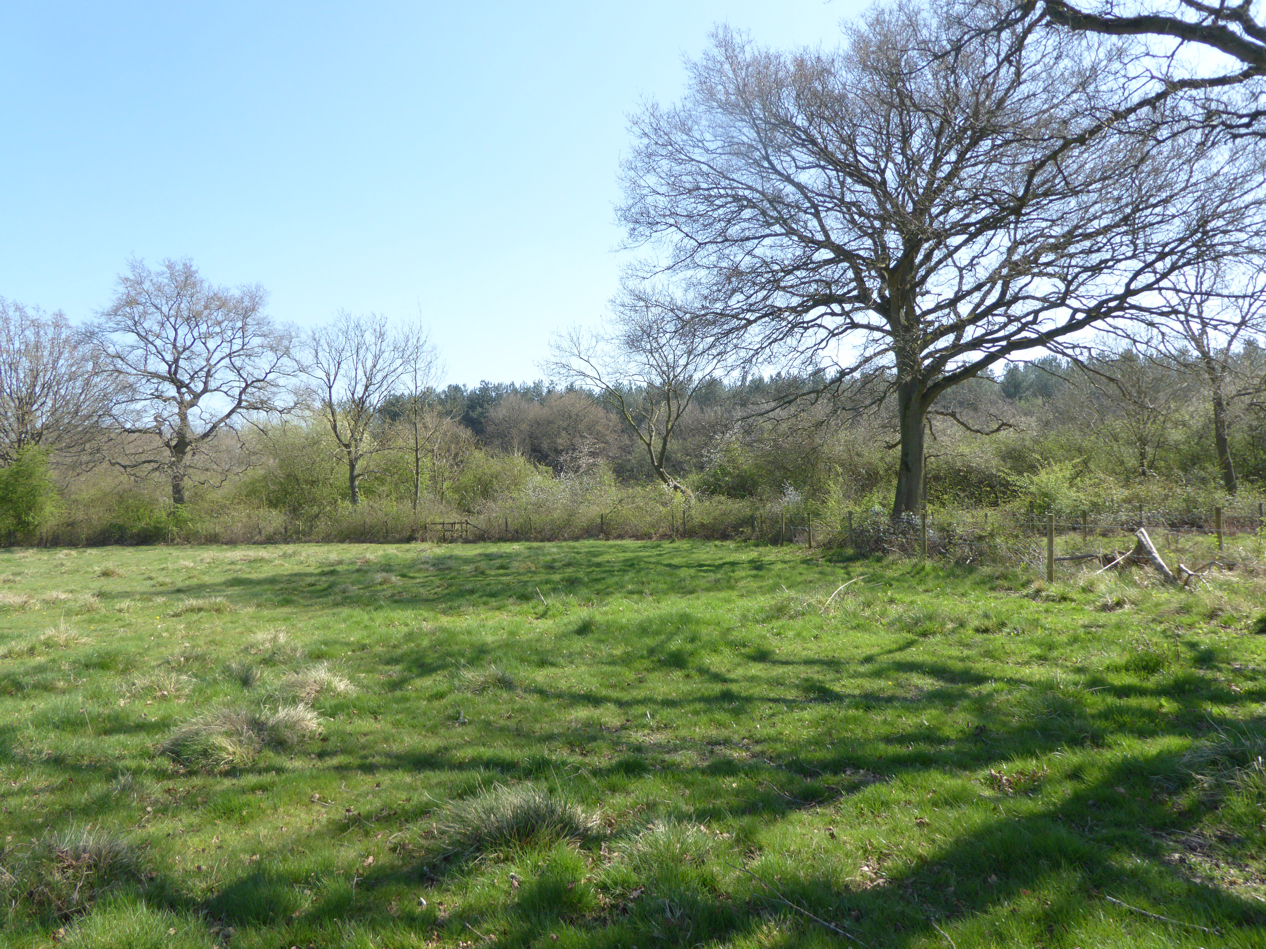
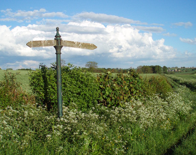
Wappenham is a small civil parish located in the county of Northamptonshire, England. Situated approximately 9 miles southeast of the town of Daventry, it covers an area of around 1,200 acres. The village of Wappenham itself is nestled in a picturesque rural setting, surrounded by rolling countryside and farmland.

The parish is home to a population of around 250 people, living in a mix of historic cottages and more modern houses. The village has a close-knit community, with various social activities and events organized throughout the year. There is also a local pub, The Red Lion, which serves as a gathering place for residents and visitors alike.

Wappenham has a rich history, dating back to at least the 11th century. The village church, dedicated to St. Mary, is a prominent feature, with parts of the building dating back to the 13th century. The churchyard is the final resting place of many generations of Wappenham residents.

The surrounding countryside offers ample opportunities for outdoor activities, such as walking, cycling, and horse riding. The nearby Sulgrave Manor, a Tudor and Georgian house, is a popular tourist attraction and offers visitors a glimpse into the area's past.

Overall, Wappenham is a charming and peaceful village, known for its community spirit and scenic surroundings. It provides a tranquil retreat for those seeking a slower pace of life amidst the beauty of the Northamptonshire countryside.

If you have any feedback on the listing, please let us know in the comments section below.

Wappenham Images

Images are sourced within 2km of 52.102338/-1.084206 or Grid Reference SP6245. Thanks to Geograph Open Source API. All images are credited.

St Mary the Virgin's, Wappenham
Manor Farm Fields Other than Manor Farm in the NE corner this square consists of fields and a small patch of woodland.
Manor Farm Fields
Other than Manor Farm in the NE corner this square consists of fields and a small patch of woodland.
Railway now Water This former railway line is now home to what appears to be a water treatment works.
Railway now Water
This former railway line is now home to what appears to be a water treatment works.
Station now Barn This barn is built close to the site of the former Wappenham railway station.  It appears to be built on the former track bed.
Station now Barn
This barn is built close to the site of the former Wappenham railway station. It appears to be built on the former track bed.
Steep Track This steep farm track climbs up to farm buildings behind the trees.
Steep Track
This steep farm track climbs up to farm buildings behind the trees.
Footpath and Bridleway A footpath runs off to the left to Wappenham and a bridleway follows the line of the track past the tree.
Footpath and Bridleway
A footpath runs off to the left to Wappenham and a bridleway follows the line of the track past the tree.
Path to Wappenham The only indication of this footpath to Wappenham is the gap in the trees.
Path to Wappenham
The only indication of this footpath to Wappenham is the gap in the trees.
Inside Out Gates The gates which hang from these posts at the entrance to Radmore Farm appear to have been hung on the wrong side.
Inside Out Gates
The gates which hang from these posts at the entrance to Radmore Farm appear to have been hung on the wrong side.
Triangle with an old wooden sign
Start of footpath and bridleway The sign is wonky,  not the photographer!
Start of footpath and bridleway
The sign is wonky, not the photographer!
Abandoned farm machinery Beside the footpath
Abandoned farm machinery
Beside the footpath
Footpath to Wappenham
Old and new barns
Old and new barns
An odd sign to find in the corner of a field What are you likely to load round here?
This is a junction of two byways - one goes left towards Wappenham and the other forward from Wappenham Lodge Farm up to Abthorpe.
An odd sign to find in the corner of a field
What are you likely to load round here? This is a junction of two byways - one goes left towards Wappenham and the other forward from Wappenham Lodge Farm up to Abthorpe.
Wappenham Lodge Farm
Byway Runs down the driveway to Wappenham Lodge Farm, then off into fields.
Byway
Runs down the driveway to Wappenham Lodge Farm, then off into fields.
Gates to Wappenham Lodge Farm There is an "other right of way" up this drive to meet up with the byway and footpaths that start at the corner of the driveway up near the house.
Gates to Wappenham Lodge Farm
There is an "other right of way" up this drive to meet up with the byway and footpaths that start at the corner of the driveway up near the house.
Byway starts here Although it is technically an open byway the "except for access" and large yellow chains on the gates (hidden by the grass) mean that only the farmer's vehicles can use it.  Horses and cycles can use the smaller gate.
Byway starts here
Although it is technically an open byway the "except for access" and large yellow chains on the gates (hidden by the grass) mean that only the farmer's vehicles can use it. Horses and cycles can use the smaller gate.
Show me another place!

Wappenham is located at Grid Ref: SP6245 (Lat: 52.102338, Lng: -1.084206)

Unitary Authority: West Northamptonshire

Police Authority: Northamptonshire

What 3 Words

///aimlessly.contained.swanky. Near Silverstone, Northamptonshire

Related Wikis

Wappenham

Wappenham is a linear village and civil parish in Northamptonshire, England. It is 5 miles (8 km) south-west of Towcester, north of Syresham and north...

South Northamptonshire

South Northamptonshire was a local government district in Northamptonshire, England, from 1974 to 2021. Its council was based in the town of Towcester...

Wappenham railway station

Wappenham was a railway station on the Stratford-upon-Avon and Midland Junction Railway (SMJ) which served the Northamptonshire village of Wappenham between...

Bucknell Wood Meadows

Bucknell Wood Meadows is a 9.2-hectare (23-acre) biological Site of Special Scientific Interest north-west of Silverstone in Northamptonshire.This site...

Slapton, Northamptonshire

Slapton is a small village in Northamptonshire, England, about 4 miles (6.4 km) from Towcester and the same from Silverstone. It is close to the A43 road...

South Northamptonshire (UK Parliament constituency)

South Northamptonshire is a constituency represented in the House of Commons of the UK Parliament since its 2010 recreation by Andrea Leadsom, a Conservative...

Astwell

Astwell is a hamlet in Northamptonshire, England. With Falcutt, it is part of the civil parish of Helmdon , but formerly Astwell was split between the...
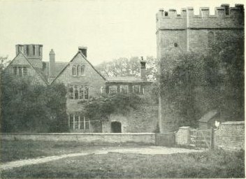
Astwell Castle

Astwell Castle is a manor house in Northamptonshire, England about 1.5 miles (2.4 km) south-west of Wappenham. It is a Grade II listed building and part...

Nearby Amenities

Located within 500m of 52.102338,-1.084206
Source: bing 15.Jan.2012
Lat/Long: 52.0998626/-1.0820384
Source: bing 15.Jan.2012
Lat/Long: 52.0998227/-1.0818654
Source: bing 15.Jan.2012
Lat/Long: 52.0999535/-1.0817613
Source: bing 15.Jan.2012
Lat/Long: 52.1000631/-1.0809563
Source: bing 15.Jan.2012
Lat/Long: 52.1002881/-1.0812752
Source: bing 15.Jan.2012
Lat/Long: 52.1000843/-1.0815929
Source: bing 15.Jan.2012
Lat/Long: 52.1001365/-1.0808912
Source: bing 15.Jan.2012
Lat/Long: 52.1002748/-1.0813059
Source: bing 15.Jan.2012
Lat/Long: 52.1002654/-1.081082
Source: bing 15.Jan.2012
Lat/Long: 52.100295/-1.0812405
Source: bing 15.Jan.2012
Lat/Long: 52.1003412/-1.0811998
Source: bing 15.Jan.2012
Lat/Long: 52.1002948/-1.0812024
Source: bing 15.Jan.2012
Lat/Long: 52.1002887/-1.0811643
Source: bing 15.Jan.2012
Lat/Long: 52.1002813/-1.0811316
Source: bing 15.Jan.2012
Lat/Long: 52.100247/-1.0810384
Source: bing 15.Jan.2012
Lat/Long: 52.1001939/-1.080933
Source: bing 15.Jan.2012
Lat/Long: 52.1000877/-1.0809201
Source: bing 15.Jan.2012
Lat/Long: 52.1001123/-1.0808988
Source: bing 15.Jan.2012
Lat/Long: 52.1001709/-1.0809053
Source: bing 15.Jan.2012
Lat/Long: 52.1005201/-1.0807858
Source: bing 15.Jan.2012
Lat/Long: 52.100458/-1.0809621
Source: bing 15.Jan.2012
Lat/Long: 52.1003945/-1.0811071
Source: bing 15.Jan.2012
Lat/Long: 52.1006453/-1.0801813
Source: bing 15.Jan.2012
Lat/Long: 52.1006131/-1.0804466
Source: bing 15.Jan.2012
Lat/Long: 52.1005835/-1.0805754
Source: bing 15.Jan.2012
Lat/Long: 52.100632/-1.0803212
Source: bing 15.Jan.2012
Lat/Long: 52.1006635/-1.0797116
Barrier: stile
Steps: 2
Lat/Long: 52.1039627/-1.0790323
Barrier: stile
Note: was 2..ones broken
Steps: 1
Lat/Long: 52.1048756/-1.0801166
Barrier: stile
Steps: 2
Lat/Long: 52.1054042/-1.0799802
Source: bing 15.Jan.2012
Lat/Long: 52.100648/-1.0800755
Barrier: kissing_gate
Foot: yes
Lat/Long: 52.1062983/-1.0837987
Barrier: footgate
Bicycle: yes
Foot: yes
Horse: yes
Lat/Long: 52.1007695/-1.0862801
Barrier: kissing_gate
Foot: yes
Lat/Long: 52.105554/-1.0861408
Barrier: footgate
Bicycle: yes
Foot: yes
Horse: yes
Note: check
Lat/Long: 52.105129/-1.0865199
Barrier: kissing_gate
Foot: yes
Lat/Long: 52.1046333/-1.0851134
Barrier: footgate
Bicycle: yes
Foot: yes
Horse: yes
Lat/Long: 52.1057872/-1.0882197
Barrier: kissing_gate
Foot: yes
Lat/Long: 52.1045834/-1.0895638
Power: pole
Lat/Long: 52.1063611/-1.0836522
Post Box
Brand: Royal Mail
Brand Wikidata: Q638098
Brand Wikipedia: en:Royal Mail
Operator: Royal Mail
Operator Wikidata: Q638098
Ref: NN12 263
Lat/Long: 52.1064739/-1.0861906
Barrier: kissing_gate
Foot: yes
Lat/Long: 52.105126/-1.0895105
Place Of Worship
Slapton & Wappenham Independent Evangelical Church
Denomination: evangelical
Religion: christian
Lat/Long: 52.106554/-1.0863923
Source: bing 15.Jan.2012
Lat/Long: 52.1006657/-1.0788702
Barrier: stile
Lat/Long: 52.1036293/-1.0867527
Direction: S
Generator Method: photovoltaic
Generator Output Electricity: yes
Generator Solar Modules: 16
Generator Source: solar
Generator Type: solar_photovoltaic_panel
Location: roof
Power: generator
Lat/Long: 52.1062117/-1.0865825
Direction: 190
Generator Method: photovoltaic
Generator Output Electricity: yes
Generator Solar Modules: 9
Generator Source: solar
Generator Type: solar_photovoltaic_panel
Location: roof
Power: generator
Lat/Long: 52.1064689/-1.0843114
Direction: 190
Generator Method: photovoltaic
Generator Output Electricity: yes
Generator Solar Modules: 3
Generator Source: solar
Generator Type: solar_photovoltaic_panel
Location: roof
Power: generator
Lat/Long: 52.1064672/-1.084243
Direction: 125
Generator Method: photovoltaic
Generator Output Electricity: yes
Generator Solar Modules: 16
Generator Source: solar
Generator Type: solar_photovoltaic_panel
Location: roof
Power: generator
Lat/Long: 52.1058067/-1.0808286
The data included in this document is from www.openstreetmap.org. The data is made available under ODbL.

Have you been to Wappenham?

Leave your review of Wappenham below (or comments, questions and feedback).