Waltham St. Lawrence

Civil Parish in Berkshire

England

Waltham St. Lawrence

Heading east on the M4 where the power lines change direction
Heading east on the M4 where the power lines change direction Credit: Rob Purvis

Waltham St. Lawrence is a civil parish located in the county of Berkshire, England. Situated approximately 5 miles southeast of Maidenhead, it covers an area of around 7 square miles. The parish is part of the Royal Borough of Windsor and Maidenhead.

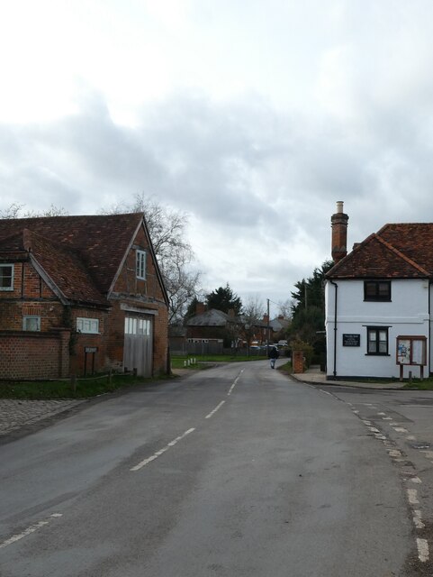
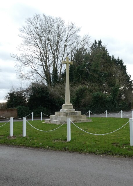
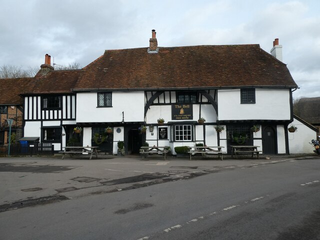
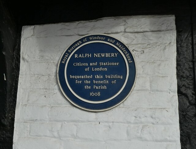
The village of Waltham St. Lawrence is the main settlement within the parish, surrounded by picturesque countryside and farmland. It is known for its charming rural character and traditional English village atmosphere. The village features a mix of historic and modern buildings, with some properties dating back to the 17th century.

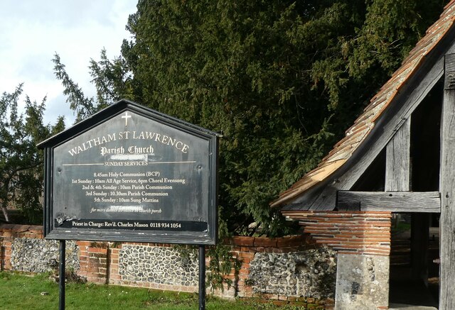
The centerpiece of Waltham St. Lawrence is the parish church, St. Lawrence's Church, which dates back to the 12th century. The church is renowned for its beautiful architecture and hosts regular worship services, as well as special events and concerts throughout the year.

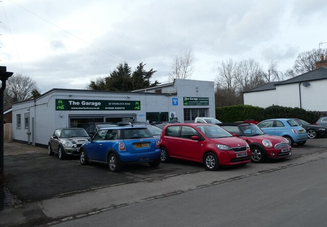
The community in Waltham St. Lawrence is close-knit and vibrant, with various amenities and services available for residents and visitors. These include a village hall, a primary school, a local pub, a cricket club, and well-maintained recreational spaces.

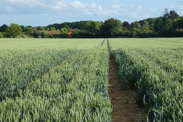
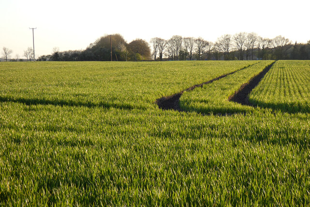
The parish is surrounded by stunning natural landscapes, making it a popular spot for outdoor activities such as walking, cycling, and horse riding. The nearby countryside offers lovely trails and scenic views, providing ample opportunities to enjoy the great outdoors.

Overall, Waltham St. Lawrence is a picturesque rural parish that offers a peaceful and idyllic setting for its residents, while still being within easy reach of nearby towns and amenities.

If you have any feedback on the listing, please let us know in the comments section below.

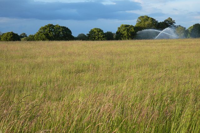
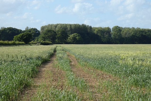
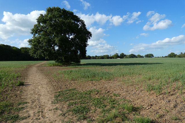
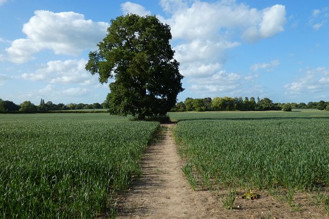
Waltham St. Lawrence Images

Images are sourced within 2km of 51.469617/-0.807211 or Grid Reference SU8275. Thanks to Geograph Open Source API. All images are credited.

Heading east on the M4 where the power lines change direction
Rush hour in Waltham St Lawrence
Waltham Cross War Memorial: early February 2022
The Garage@Shurlock Row: early February 2022 (taken in The Street)
The Garage@Shurlock Row: early February 2022
(taken in The Street)
Splendid old Moggy Van in The Street The post-WWII version of the Morris Minor was a popular British motor car built between 1948 and 1971. Designed by Alec Issigonis (later to be famed for designing the Mini), the original Minor MM was launched at the Earls Court motor show in 1948.

There were three-generations of the car, the MM, the Series II and the 1000.

1.36 million were produced, in five main guises; saloon (2-door & 4-door), tourer (convertible), traveller (estate), van and pick-up. From 1967 the van's were also rebadged as Austins (Morris' sister company as part of the BMC group). Read more at wikipedia <span class="nowrap"><a title="http://en.wikipedia.org/wiki/Morris_Minor" rel="nofollow ugc noopener" href="http://en.wikipedia.org/wiki/Morris_Minor">Link</a><img style="margin-left:2px;" alt="External link" title="External link - shift click to open in new window" src="https://s1.geograph.org.uk/img/external.png" width="10" height="10"/></span>
Splendid old Moggy Van in The Street
The post-WWII version of the Morris Minor was a popular British motor car built between 1948 and 1971. Designed by Alec Issigonis (later to be famed for designing the Mini), the original Minor MM was launched at the Earls Court motor show in 1948. There were three-generations of the car, the MM, the Series II and the 1000. 1.36 million were produced, in five main guises; saloon (2-door & 4-door), tourer (convertible), traveller (estate), van and pick-up. From 1967 the van's were also rebadged as Austins (Morris' sister company as part of the BMC group). Read more at wikipedia LinkExternal link
The Bell, Waltham St Lawrence: early February 2022
Blue plaque on The Bell Also see <span class="nowrap"><a title="http://www.berkshirehistory.com/bios/rnewbery.html" rel="nofollow ugc noopener" href="http://www.berkshirehistory.com/bios/rnewbery.html">Link</a><img style="margin-left:2px;" alt="External link" title="External link - shift click to open in new window" src="https://s1.geograph.org.uk/img/external.png" width="10" height="10"/></span>
Blue plaque on The Bell
Also see LinkExternal link
Waltham St Lawrence: noticeboard
Farmland, Waltham St Lawrence A large field of wheat with the buildings of Halls Farm amongst the trees.
Farmland, Waltham St Lawrence
A large field of wheat with the buildings of Halls Farm amongst the trees.
Farmland, Shottesbrooke Spring barley to the west of Smewins Road.
Farmland, Shottesbrooke
Spring barley to the west of Smewins Road.
Grassland, Waltham St Lawrence Beyond the long grass a polo pitch is being irrigated with water being pumped from a nearby pond.
Grassland, Waltham St Lawrence
Beyond the long grass a polo pitch is being irrigated with water being pumped from a nearby pond.
Farmland, Ruscombe The western side of a large field of wheat beside the bridleway between West End and Ruscombe.
Farmland, Ruscombe
The western side of a large field of wheat beside the bridleway between West End and Ruscombe.
Farmland, Waltham St Lawrence The more westerly of two footpaths across fields between Hungerford and West End.
Farmland, Waltham St Lawrence
The more westerly of two footpaths across fields between Hungerford and West End.
Farmland, Waltham St Lawrence The more easterly of two footpaths across fields between Hungerford and West End.
Farmland, Waltham St Lawrence
The more easterly of two footpaths across fields between Hungerford and West End.
Farmland, Waltham St Lawrence A large arable field to the south of Shurlock Row.
Farmland, Waltham St Lawrence
A large arable field to the south of Shurlock Row.
Track and farmland, Waltham St Lawrence Viewed from the motorway bridge, the footpath from Billingbear to Shurlock Row passes between fields of peas and beans.
Track and farmland, Waltham St Lawrence
Viewed from the motorway bridge, the footpath from Billingbear to Shurlock Row passes between fields of peas and beans.
Footbridge, M4 The M4 is 190 miles long and runs from London to South Wales. Major centres close to the motorway include Reading, Swindon, Bristol, Newport, Cardiff and Swansea. The motorway was constructed between 1961 and 1996. The M4 originally crossed the first Severn Road Bridge. It has now been diverted to use the Second Severn Crossing and the motorway over the older bridge has been renumbered as M48.
Wikipedia: <span class="nowrap"><a title="http://en.wikipedia.org/wiki/M4_motorway" rel="nofollow ugc noopener" href="http://en.wikipedia.org/wiki/M4_motorway">Link</a><img style="margin-left:2px;" alt="External link" title="External link - shift click to open in new window" src="https://s1.geograph.org.uk/img/external.png" width="10" height="10"/></span>
Footbridge, M4
The M4 is 190 miles long and runs from London to South Wales. Major centres close to the motorway include Reading, Swindon, Bristol, Newport, Cardiff and Swansea. The motorway was constructed between 1961 and 1996. The M4 originally crossed the first Severn Road Bridge. It has now been diverted to use the Second Severn Crossing and the motorway over the older bridge has been renumbered as M48. Wikipedia: LinkExternal link
B3018 Bridge, M4 The M4 is 190 miles long and runs from London to South Wales. Major centres close to the motorway include Reading, Swindon, Bristol, Newport, Cardiff and Swansea. The motorway was constructed between 1961 and 1996. The M4 originally crossed the first Severn Road Bridge. It has now been diverted to use the Second Severn Crossing and the motorway over the older bridge has been renumbered as M48.
Wikipedia: <span class="nowrap"><a title="http://en.wikipedia.org/wiki/M4_motorway" rel="nofollow ugc noopener" href="http://en.wikipedia.org/wiki/M4_motorway">Link</a><img style="margin-left:2px;" alt="External link" title="External link - shift click to open in new window" src="https://s1.geograph.org.uk/img/external.png" width="10" height="10"/></span>
B3018 Bridge, M4
The M4 is 190 miles long and runs from London to South Wales. Major centres close to the motorway include Reading, Swindon, Bristol, Newport, Cardiff and Swansea. The motorway was constructed between 1961 and 1996. The M4 originally crossed the first Severn Road Bridge. It has now been diverted to use the Second Severn Crossing and the motorway over the older bridge has been renumbered as M48. Wikipedia: LinkExternal link
Show me another place!

Waltham St. Lawrence is located at Grid Ref: SU8275 (Lat: 51.469617, Lng: -0.807211)

Unitary Authority: Windsor and Maidenhead

Police Authority: Thames Valley

What 3 Words

///remarking.annoys.pays. Near White Waltham, Berkshire

Related Wikis

Shurlock Row

Shurlock Row is a village in the Royal Borough of Windsor and Maidenhead in Berkshire, England. It is located in the heart of the Thames Valley, around...

Waltham St Lawrence

Waltham St Lawrence is a village and civil parish in the English county of Berkshire. == Toponymy == The name 'Waltham' is believed to be derived from...

Shottesbrooke

Shottesbrooke is a hamlet and civil parish administered by the unitary authority of the Royal Borough of Windsor and Maidenhead in the English county...

Shottesbrooke Park

Shottesbrooke Park is a Grade II* listed country house and park in Shottesbrooke, Berkshire, England, southwest of Maidenhead. The house is a Tudor mansion...

Have you been to Waltham St. Lawrence?

Leave your review of Waltham St. Lawrence below (or comments, questions and feedback).