Walford

Civil Parish in Herefordshire

England

Walford

Track and footpath Track and footpath at Kiln Green above the Wye valley.
Track and footpath Credit: Philip Halling

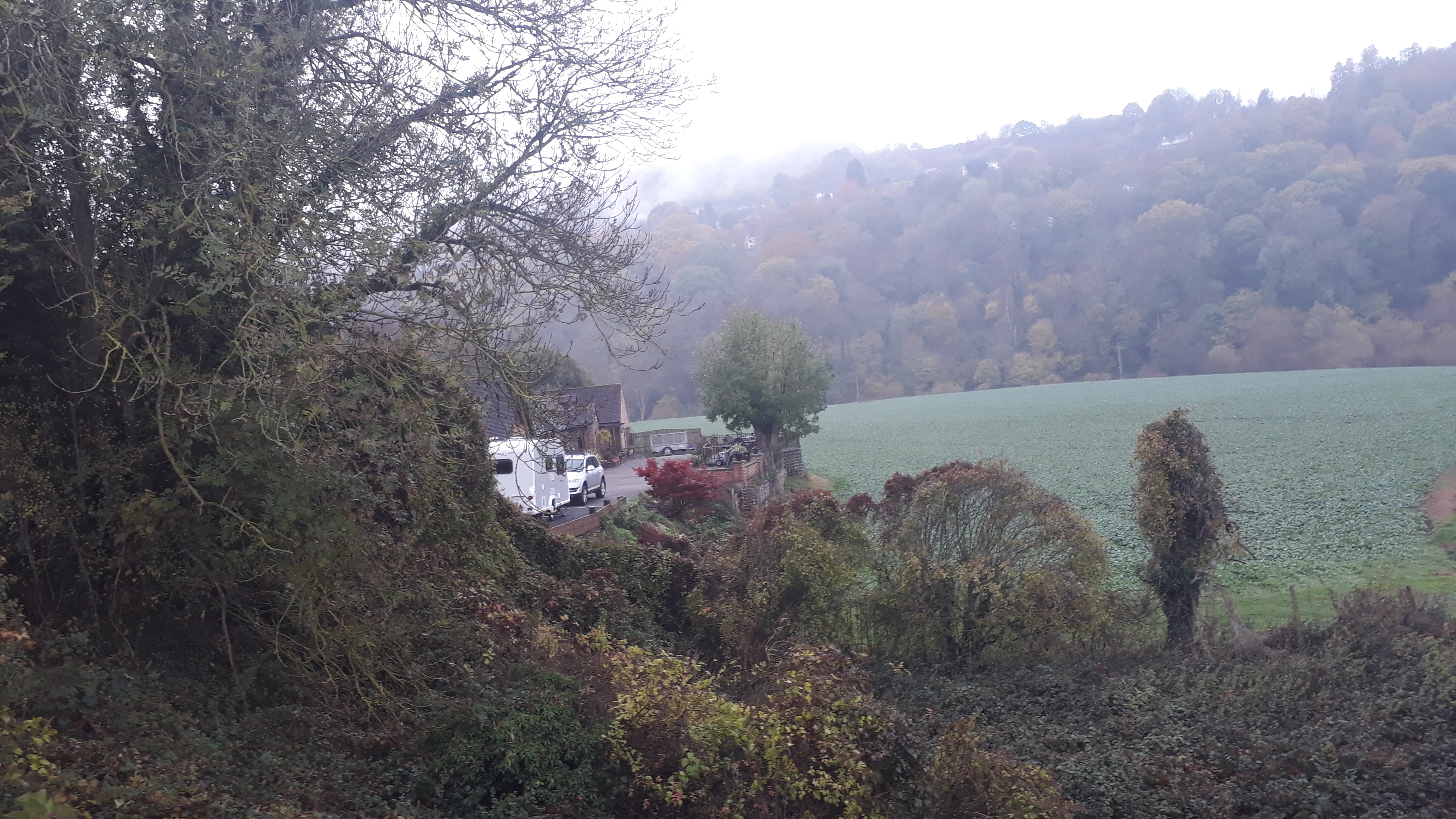
Walford is a small civil parish located in the county of Herefordshire, England. It is situated along the River Wye, approximately 4 miles southwest of the town of Ross-on-Wye. The parish covers an area of about 6 square miles and has a population of around 500 residents.

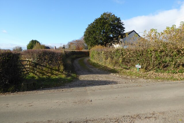
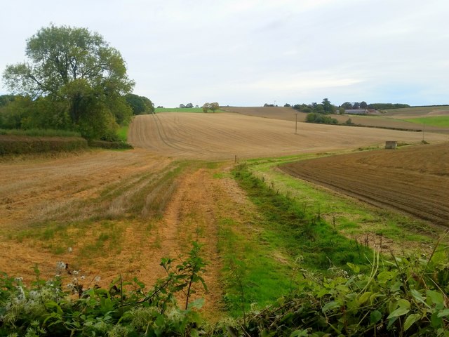
Walford is known for its picturesque countryside and tranquil atmosphere. The landscape is predominantly rural, characterized by rolling hills, meadows, and woodlands. The River Wye, which forms the eastern boundary of the parish, is a popular spot for fishing, boating, and leisurely walks along its scenic banks.

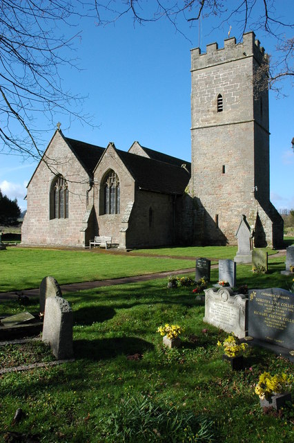
The village of Walford itself is a charming settlement, with a mix of traditional stone cottages and more modern houses. It has a small primary school, a village hall, and a church, St. Michael and All Angels, which dates back to the 12th century and boasts beautiful stained glass windows.

The parish is surrounded by several notable landmarks and attractions. Just to the north lies the historic Goodrich Castle, a well-preserved medieval fortress that offers stunning views of the surrounding countryside. The nearby market town of Ross-on-Wye provides amenities such as shops, restaurants, and leisure facilities.

Walford is also a popular destination for outdoor enthusiasts, with numerous walking and cycling trails crisscrossing the area. The parish offers an idyllic setting for those seeking a peaceful retreat in the heart of the Herefordshire countryside, away from the hustle and bustle of larger towns and cities.

If you have any feedback on the listing, please let us know in the comments section below.

Walford Images

Images are sourced within 2km of 51.883044/-2.587956 or Grid Reference SO5920. Thanks to Geograph Open Source API. All images are credited.

Track and footpath Track and footpath at Kiln Green above the Wye valley.
Track and footpath
Track and footpath at Kiln Green above the Wye valley.
South Herefordshire countryside Arable land near Kiln Green. A dry seasonal watercourse in the foreground.
South Herefordshire countryside
Arable land near Kiln Green. A dry seasonal watercourse in the foreground.
Kiln Green Rolling countryside viewed from near Great Howle farm on a cold crisp morning.
In the distance are The Skirrid and Sugarloaf, well over 20km distant.
Kiln Green
Rolling countryside viewed from near Great Howle farm on a cold crisp morning. In the distance are The Skirrid and Sugarloaf, well over 20km distant.
Arable field above Bishopswood The crop is fodder beet.
Arable field above Bishopswood
The crop is fodder beet.
Oak trees above Suff Wood Cottages and houses of Kiln Green can be seen beyond the oaks.
Oak trees above Suff Wood
Cottages and houses of Kiln Green can be seen beyond the oaks.
Atlas Farm and The Dam An early morning view across late summer fields and woodland on the edge of Herefordshire and the Forest of Dean.
Atlas Farm and The Dam
An early morning view across late summer fields and woodland on the edge of Herefordshire and the Forest of Dean.
Rolling stubble land near Kiln Green The house centre right is The Dam.
Rolling stubble land near Kiln Green
The house centre right is The Dam.
Crop of rape near Howle Hill Commencing flowering in April 2020.
Crop of rape near Howle Hill
Commencing flowering in April 2020.
Crop of rape near Howle Hill, July 2020 Follow-on photo from <a href="https://www.geograph.org.uk/photo/6444811">SO6119 : Crop of rape near Howle Hill</a>.
The three trees were starting to leaf up in April, now dark green in July four months later.
The crop is approaching harvest.
Crop of rape near Howle Hill, July 2020
Follow-on photo from SO6119 : Crop of rape near Howle Hill. The three trees were starting to leaf up in April, now dark green in July four months later. The crop is approaching harvest.
Welcome to Ross-on-Wye!
Frost protection near Walford Goodrich Castle can be seen in the background on the far side of the River Wye.
Frost protection near Walford
Goodrich Castle can be seen in the background on the far side of the River Wye.
Walford church from lower Coppet Hill
Turning for Howie Hill
Approach to Walford
Approach to Walford
Wye valley floor Viewed from the rear of The Mill Race. Walford Sawmills yard can be seen.
Wye valley floor
Viewed from the rear of The Mill Race. Walford Sawmills yard can be seen.
Ross Parish milepost Ross-on-Wye Located alongside Walford Road near the southern boundary of Ross-on-Wye.
Since this <a title="https://www.geograph.org.uk/photo/523258" href="https://www.geograph.org.uk/photo/523258">Link</a> view taken in 2007, the milepost has been repainted or perhaps replaced.
Ross Parish milepost Ross-on-Wye
Located alongside Walford Road near the southern boundary of Ross-on-Wye. Since this Link view taken in 2007, the milepost has been repainted or perhaps replaced.
5 miles to Lydbrook from Ross-on-Wye The milepost <a title="https://www.geograph.org.uk/photo/3566912" href="https://www.geograph.org.uk/photo/3566912">Link</a> is alongside the B4234 Walford Road at the southern edge of Ross-on-Wye. Lydbrook is in the NW corner of the Forest of Dean in Gloucestershire. The right turn is into Frome Valley Way.
5 miles to Lydbrook from Ross-on-Wye
The milepost Link is alongside the B4234 Walford Road at the southern edge of Ross-on-Wye. Lydbrook is in the NW corner of the Forest of Dean in Gloucestershire. The right turn is into Frome Valley Way.
Vine Tree Inn, Ross-On-Wye Viewed across Walford Road in Tudorville in the south of Ross-on-Wye.
Vine Tree Inn, Ross-On-Wye
Viewed across Walford Road in Tudorville in the south of Ross-on-Wye.
Show me another place!

Walford is located at Grid Ref: SO5920 (Lat: 51.883044, Lng: -2.587956)

Unitary Authority: County of Herefordshire

Police Authority: West Mercia

What 3 Words

///yarn.strikers.doormat. Near Walford, Herefordshire

Related Wikis

Walford, Ross-on-Wye

Walford is a village and civil parish in south Herefordshire, England, two miles south of the market town of Ross-on-Wye. It includes the settlements of...

Walford Halt railway station

Walford Halt railway station is a disused halt on the Ross and Monmouth Railway constructed near the Herefordshire village of Walford. It also served the...
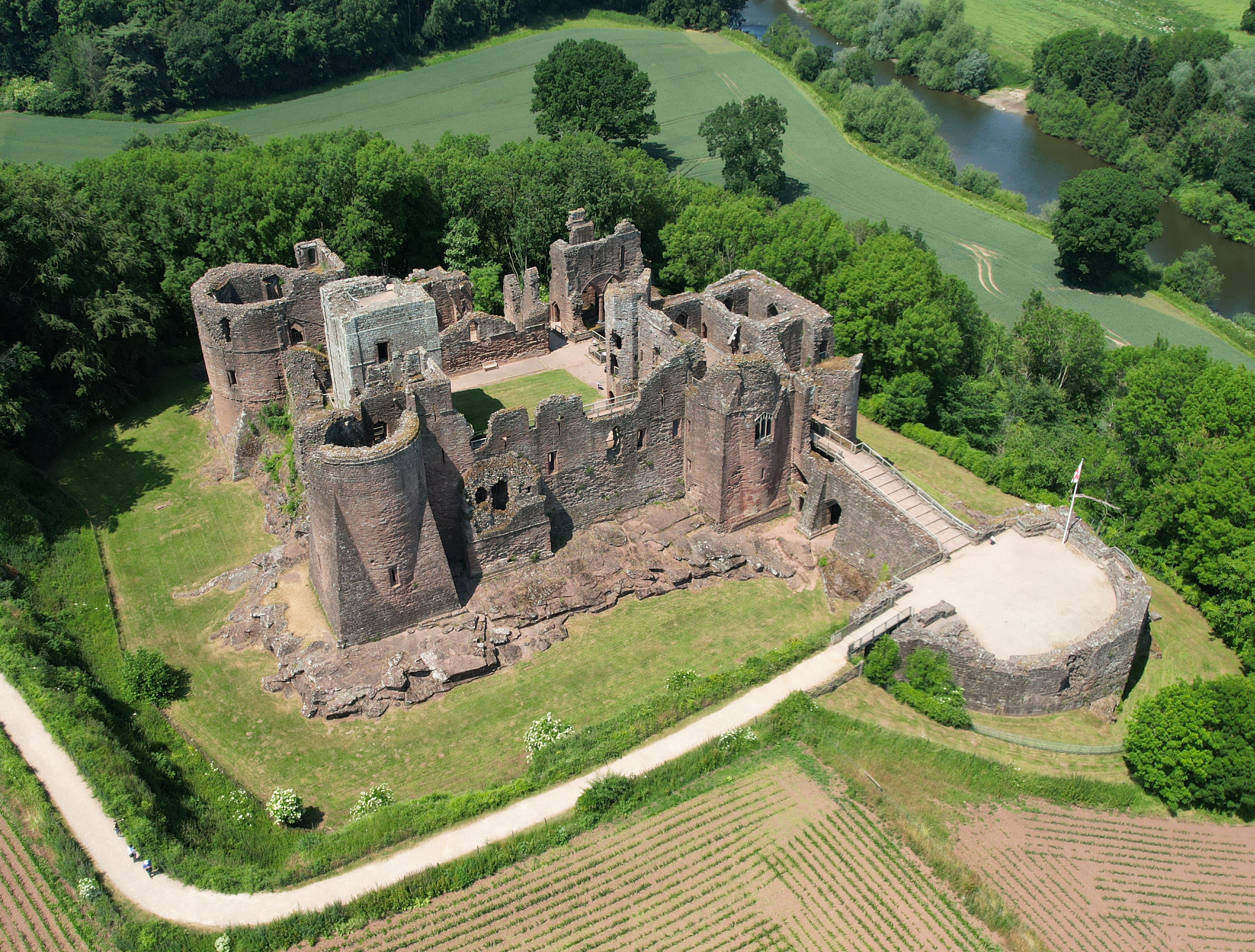
Goodrich Castle

Goodrich Castle is a Norman medieval castle ruin north of the village of Goodrich in Herefordshire, England, controlling a key location between Monmouth...

Flanesford Priory

Flanesford Priory was an Augustinian priory in Herefordshire, England. Sir Richard Talbot, then owner of nearby Goodrich Castle, founded the priory in...

Kerne Bridge railway station

Kerne Bridge railway station is a disused railway station on the Ross and Monmouth Railway constructed in the Herefordshire hamlet of Kerne Bridge which...

Kerne Bridge

Kerne Bridge is a hamlet in south Herefordshire, England, about 3.5 miles (6 km) south of the market town of Ross-on-Wye on the B4234 Ross-on-Wye to Coleford...

Kerne Bridge (River Wye crossing)

Kerne Bridge was built over the River Wye in the County of Herefordshire, England in 1825–28, on the site of an ancient ford crossing known as Flanesford...

Hill Court Manor

Hill Court Manor (grid reference SO574216) is a country house built in 1700 at Hom Green, Walford near Ross-on-Wye in Herefordshire. The house is a Grade...

Nearby Amenities

Located within 500m of 51.883044,-2.587956
Barrier: stile
Foot: designated
Source: survey
Lat/Long: 51.8810754/-2.5874565
Barrier: stile
Foot: designated
Source: survey
Lat/Long: 51.8817/-2.5862502
Crossing
Crossing: uncontrolled
Lat/Long: 51.8827026/-2.5848769
Ford: yes
Lat/Long: 51.8861806/-2.5908182
Barrier: stile
Foot: designated
Source: survey
Lat/Long: 51.8825081/-2.5807755
Barrier: stile
Foot: designated
Source: survey
Lat/Long: 51.8811346/-2.5869443
Barrier: yes
Foot: designated
Source: survey
Lat/Long: 51.8810366/-2.5870911
Barrier: stile
Lat/Long: 51.8834772/-2.5914792
Barrier: stile
Lat/Long: 51.8842254/-2.5855586
The data included in this document is from www.openstreetmap.org. The data is made available under ODbL.

Have you been to Walford?

Leave your review of Walford below (or comments, questions and feedback).