Bull's Hill

Settlement in Herefordshire

England

Bull's Hill

Wheat field near Great Howle Farm A fine distant view to the Black Mountains.
Wheat field near Great Howle Farm Credit: Jonathan Billinger

Bull's Hill is a small village located in the county of Herefordshire, England. Situated in the rural countryside, it lies approximately 12 miles southwest of the city of Hereford. The village is nestled among rolling hills and picturesque landscapes, offering residents and visitors a tranquil and idyllic setting.

With a population of around 300 people, Bull's Hill has a close-knit community that prides itself on its strong sense of community spirit. The village is renowned for its friendly and welcoming atmosphere, making it a desirable place to live or visit.

The village is home to a handful of amenities, including a local pub, a village hall, and a small convenience store. These facilities provide essential services to the community, fostering a sense of self-sufficiency and ensuring that residents have access to their basic needs.

The surrounding countryside offers ample opportunities for outdoor enthusiasts, with numerous walking and cycling routes crisscrossing the area. The lush green fields and meadows are dotted with charming farmhouses and traditional cottages, adding to the village's rustic charm.

Bull's Hill is also conveniently located near several notable attractions. The historic market town of Hay-on-Wye, famous for its annual literary festival, is just a short drive away. Additionally, the stunning landscapes of the Brecon Beacons National Park are within easy reach, providing opportunities for hiking, wildlife spotting, and breathtaking scenery.

Overall, Bull's Hill offers a peaceful and picturesque retreat from the hustle and bustle of city life, providing residents and visitors with a quintessential English countryside experience.

If you have any feedback on the listing, please let us know in the comments section below.
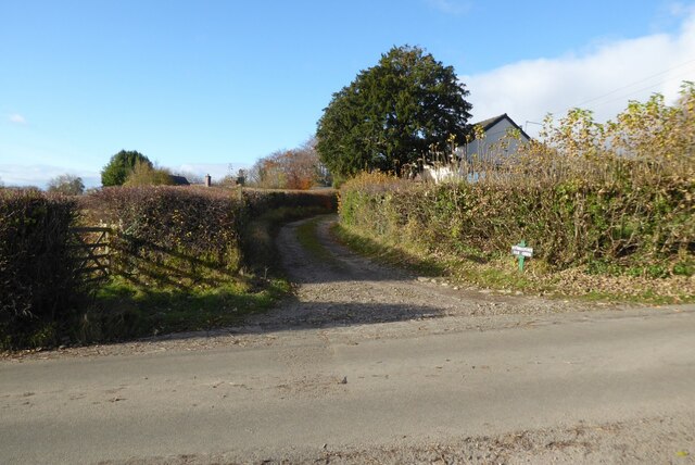
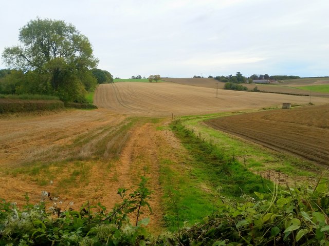
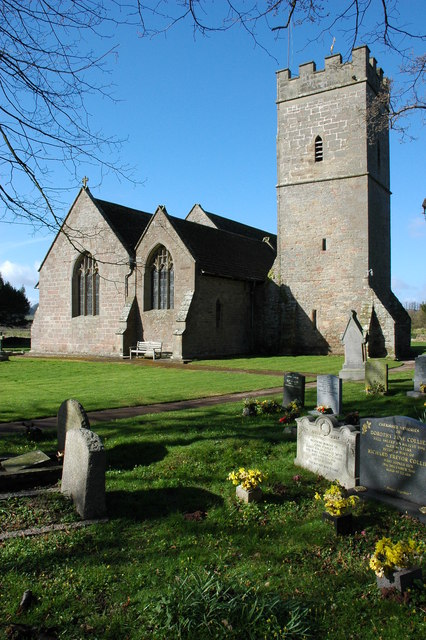
Bull's Hill Images

Images are sourced within 2km of 51.880556/-2.5882454 or Grid Reference SO5920. Thanks to Geograph Open Source API. All images are credited.

Wheat field near Great Howle Farm A fine distant view to the Black Mountains.
Wheat field near Great Howle Farm
A fine distant view to the Black Mountains.
Track and footpath Track and footpath at Kiln Green above the Wye valley.
Track and footpath
Track and footpath at Kiln Green above the Wye valley.
South Herefordshire countryside Arable land near Kiln Green. A dry seasonal watercourse in the foreground.
South Herefordshire countryside
Arable land near Kiln Green. A dry seasonal watercourse in the foreground.
Kiln Green Rolling countryside viewed from near Great Howle farm on a cold crisp morning.
In the distance are The Skirrid and Sugarloaf, well over 20km distant.
Kiln Green
Rolling countryside viewed from near Great Howle farm on a cold crisp morning. In the distance are The Skirrid and Sugarloaf, well over 20km distant.
Arable field above Bishopswood The crop is fodder beet.
Arable field above Bishopswood
The crop is fodder beet.
Oak trees above Suff Wood Cottages and houses of Kiln Green can be seen beyond the oaks.
Oak trees above Suff Wood
Cottages and houses of Kiln Green can be seen beyond the oaks.
Atlas Farm and The Dam An early morning view across late summer fields and woodland on the edge of Herefordshire and the Forest of Dean.
Atlas Farm and The Dam
An early morning view across late summer fields and woodland on the edge of Herefordshire and the Forest of Dean.
Rolling stubble land near Kiln Green The house centre right is The Dam.
Rolling stubble land near Kiln Green
The house centre right is The Dam.
Crop of rape near Howle Hill Commencing flowering in April 2020.
Crop of rape near Howle Hill
Commencing flowering in April 2020.
Crop of rape near Howle Hill, July 2020 Follow-on photo from <a href="https://www.geograph.org.uk/photo/6444811">SO6119 : Crop of rape near Howle Hill</a>.
The three trees were starting to leaf up in April, now dark green in July four months later.
The crop is approaching harvest.
Crop of rape near Howle Hill, July 2020
Follow-on photo from SO6119 : Crop of rape near Howle Hill. The three trees were starting to leaf up in April, now dark green in July four months later. The crop is approaching harvest.
Copse in a barren field Howle Green Farm is beyond.
Copse in a barren field
Howle Green Farm is beyond.
Frost protection near Walford Goodrich Castle can be seen in the background on the far side of the River Wye.
Frost protection near Walford
Goodrich Castle can be seen in the background on the far side of the River Wye.
Walford church from lower Coppet Hill
Turning for Howie Hill
Approach to Walford
Approach to Walford
Outer Ward of Goodrich Castle The Outer Ward on the northern side of Goodrich Castle.
Outer Ward of Goodrich Castle
The Outer Ward on the northern side of Goodrich Castle.
Wye valley floor Viewed from the rear of The Mill Race. Walford Sawmills yard can be seen.
Wye valley floor
Viewed from the rear of The Mill Race. Walford Sawmills yard can be seen.
Footprints in the snow Outside the north wall of Goodrich Castle
Footprints in the snow
Outside the north wall of Goodrich Castle
Show me another place!

Bull's Hill is located at Grid Ref: SO5920 (Lat: 51.880556, Lng: -2.5882454)

Unitary Authority: County of Herefordshire

Police Authority: West Mercia

What 3 Words

///emerald.searcher.outsiders. Near Walford, Herefordshire

Related Wikis

Walford, Ross-on-Wye

Walford is a village and civil parish in south Herefordshire, England, two miles south of the market town of Ross-on-Wye. It includes the settlements of...

Walford Halt railway station

Walford Halt railway station is a disused halt on the Ross and Monmouth Railway constructed near the Herefordshire village of Walford. It also served the...
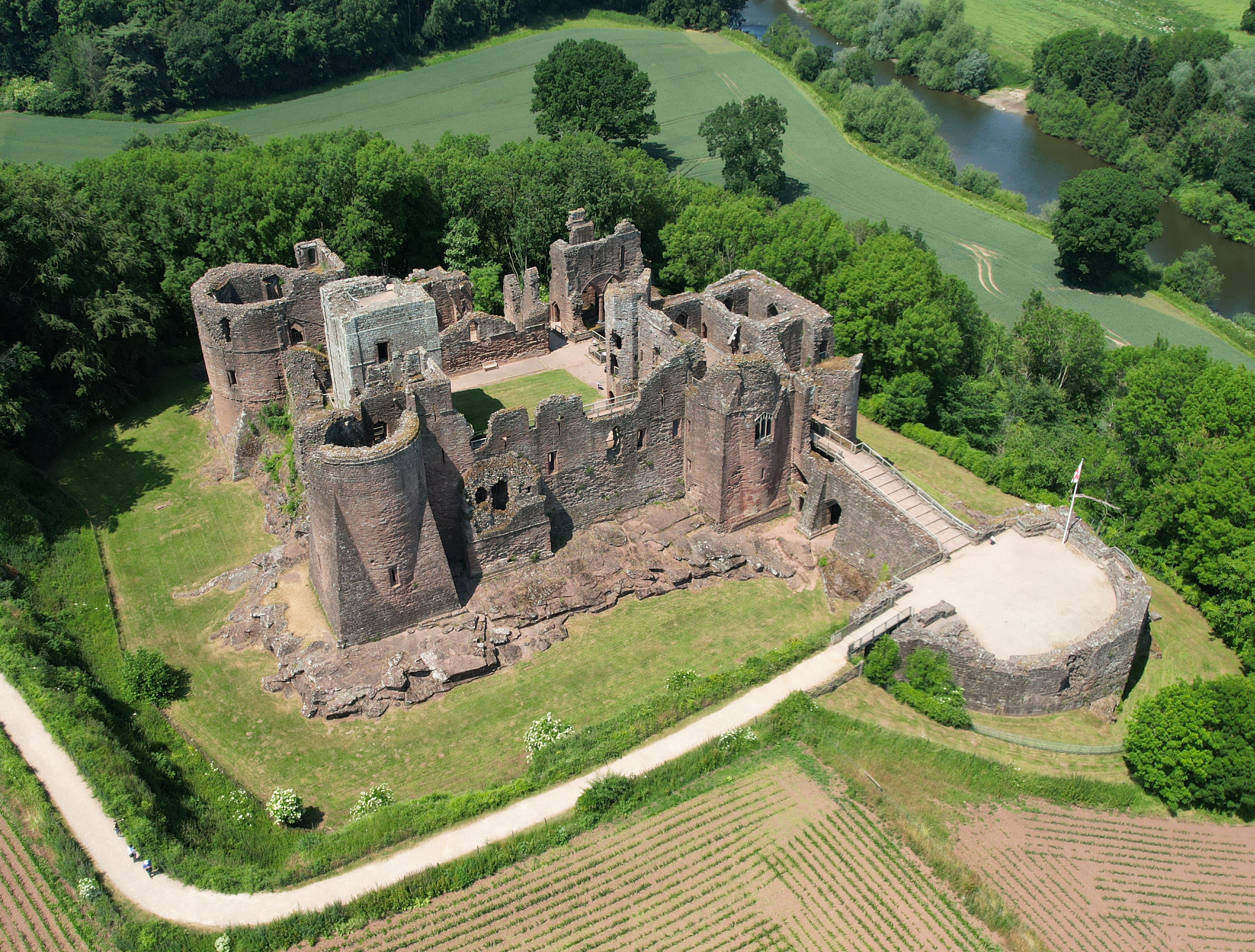
Goodrich Castle

Goodrich Castle is a Norman medieval castle ruin north of the village of Goodrich in Herefordshire, England, controlling a key location between Monmouth...

Kerne Bridge

Kerne Bridge is a hamlet in south Herefordshire, England, about 3.5 miles (6 km) south of the market town of Ross-on-Wye on the B4234 Ross-on-Wye to Coleford...

Nearby Amenities

Located within 500m of 51.880556,-2.5882454
Barrier: stile
Foot: designated
Source: survey
Lat/Long: 51.8810754/-2.5874565
Barrier: stile
Foot: designated
Source: survey
Lat/Long: 51.8817/-2.5862502
Crossing
Crossing: uncontrolled
Lat/Long: 51.8827026/-2.5848769
Barrier: stile
Foot: designated
Source: survey
Lat/Long: 51.8811346/-2.5869443
Barrier: yes
Foot: designated
Source: survey
Lat/Long: 51.8810366/-2.5870911
Barrier: stile
Lat/Long: 51.8834772/-2.5914792
Barrier: stile
Lat/Long: 51.8842254/-2.5855586
The data included in this document is from www.openstreetmap.org. The data is made available under ODbL.

Have you been to Bull's Hill?

Leave your review of Bull's Hill below (or comments, questions and feedback).