Ventnor

Civil Parish in Hampshire

England

Ventnor

The Ventnor Gas & Water Co. building The former pumping station carries a plaque dating it from 1883.
The Ventnor Gas & Water Co. building Credit: John Lucas

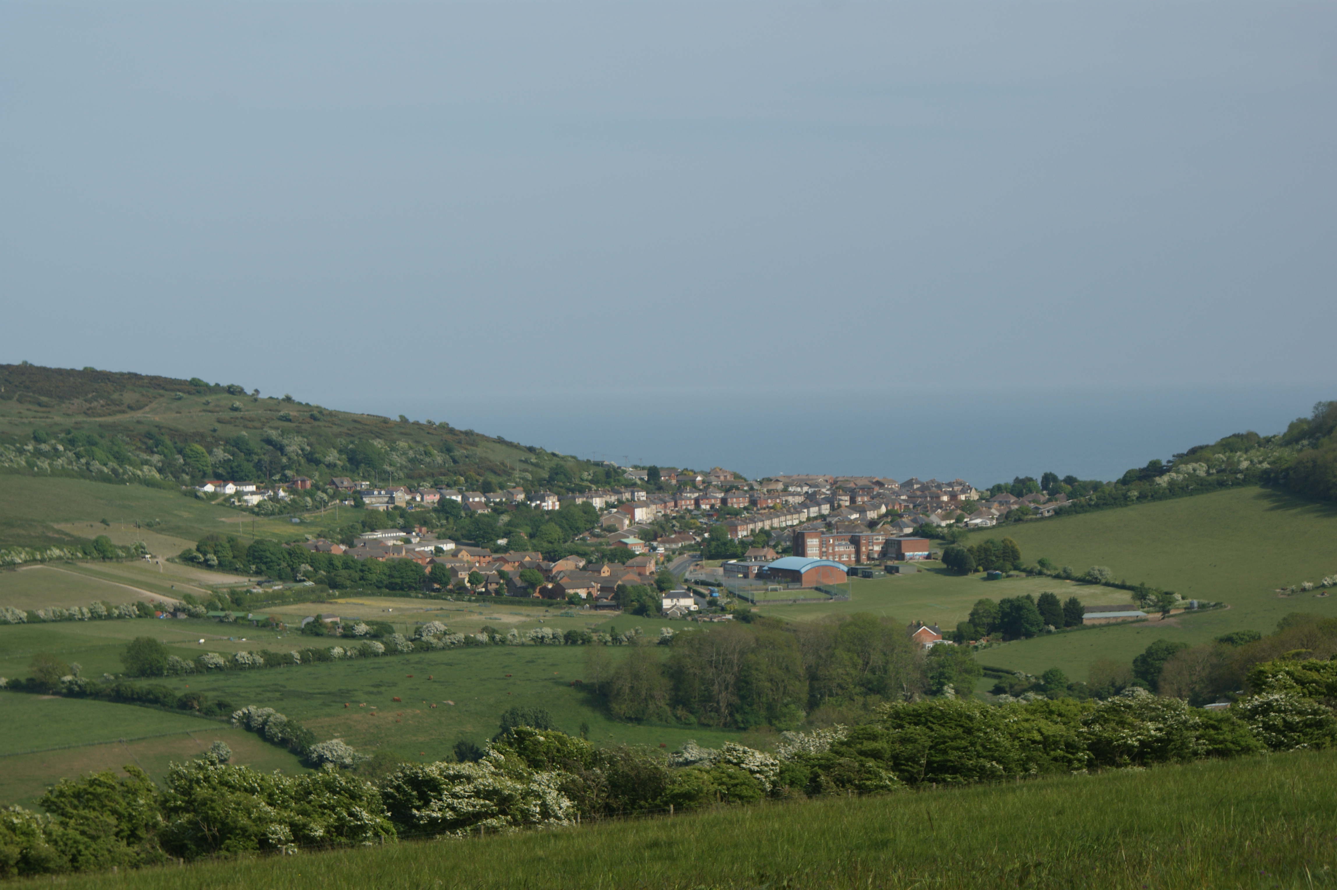
Ventnor is a civil parish located in Hampshire, England. Situated on the southern coast of the Isle of Wight, it is part of the administrative district of the Isle of Wight Council. The parish covers an area of approximately 12 square kilometers and has a population of around 6,000 residents.

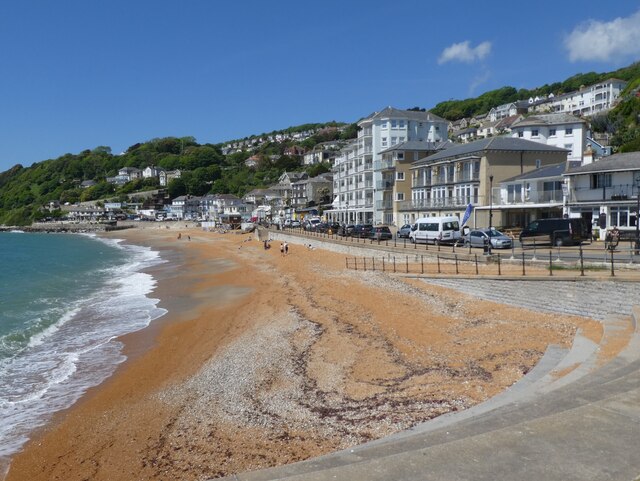
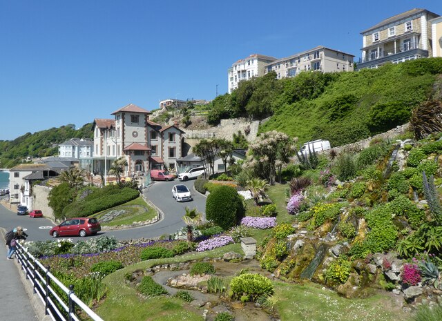
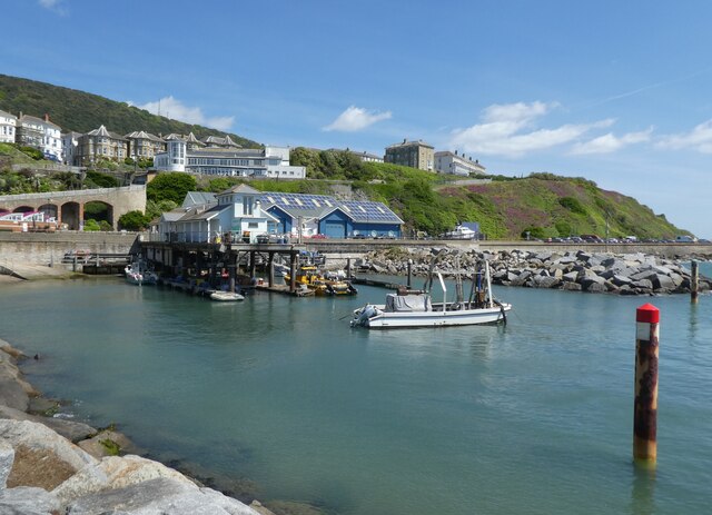
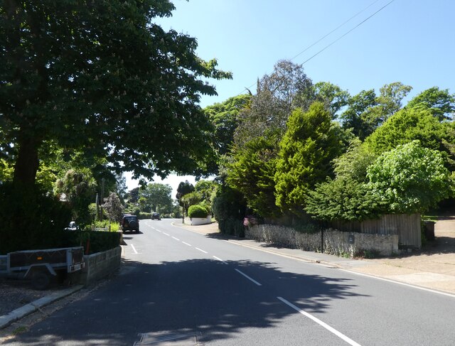
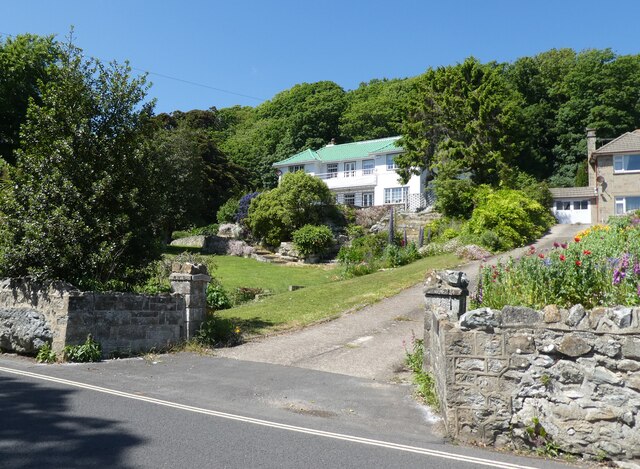
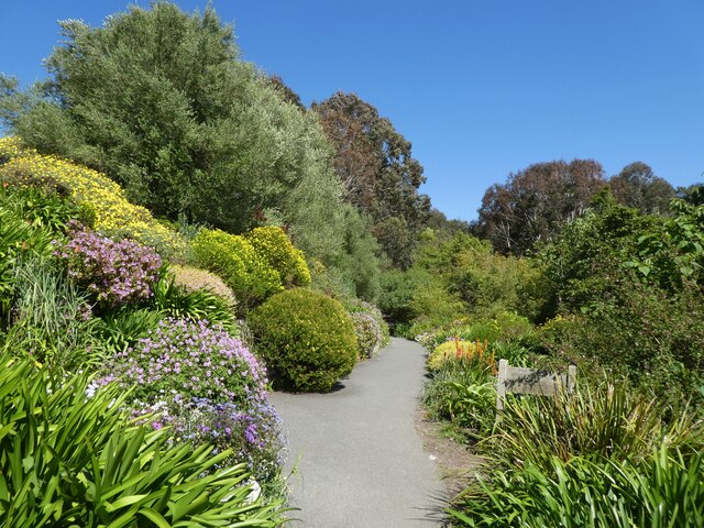
Ventnor is known for its stunning natural beauty, with its picturesque landscape consisting of cliffs, beaches, and lush greenery. It is a popular destination for tourists, offering a range of attractions and activities. The sandy beaches provide opportunities for sunbathing, swimming, and water sports, while the surrounding cliffs offer breathtaking views and scenic walks.

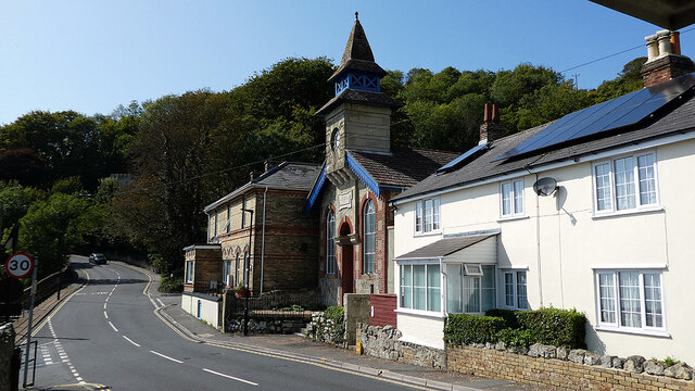
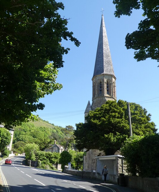
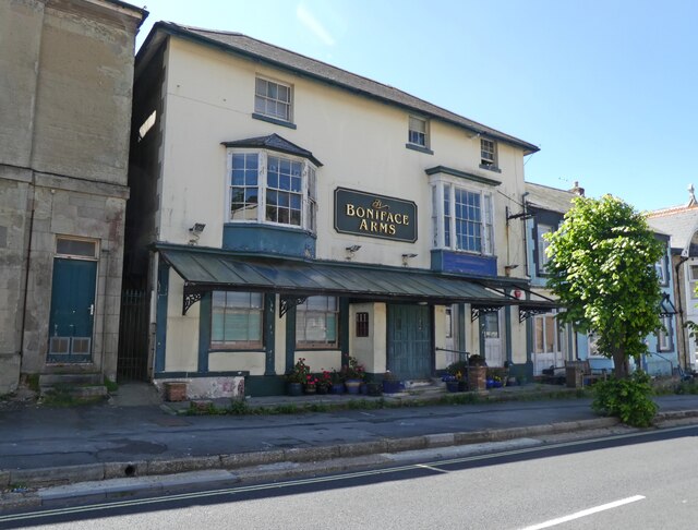
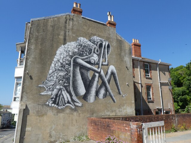
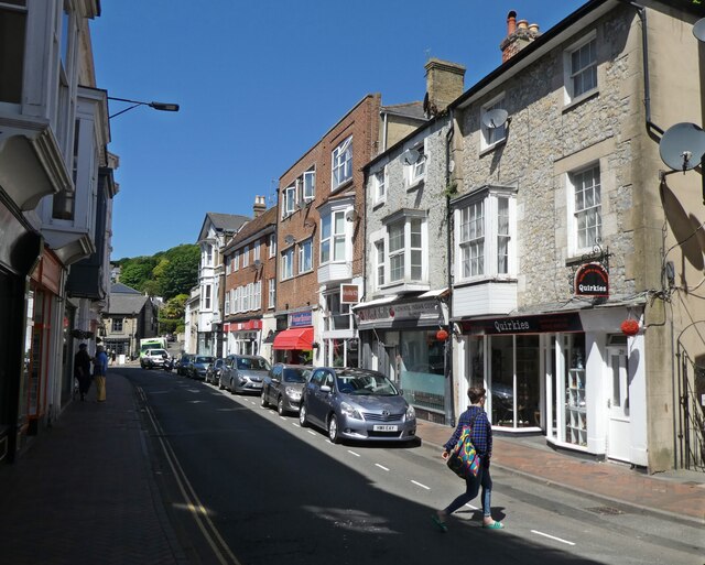
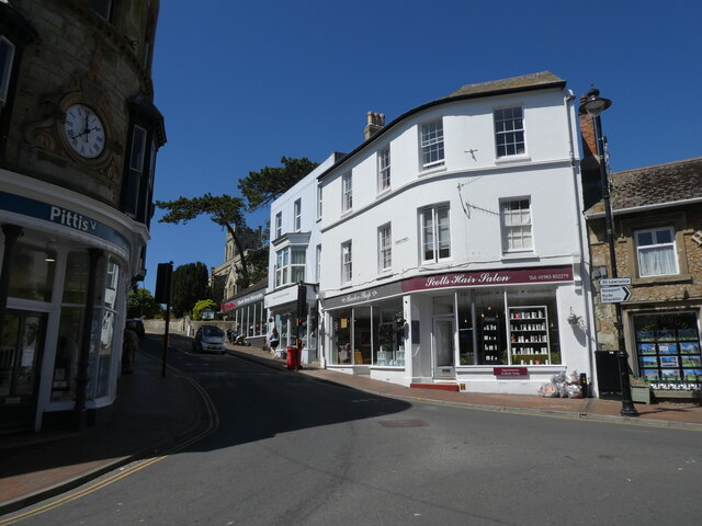
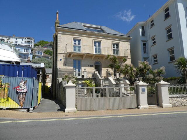
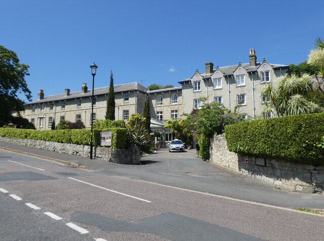
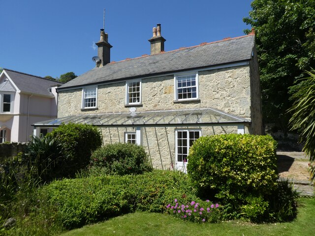
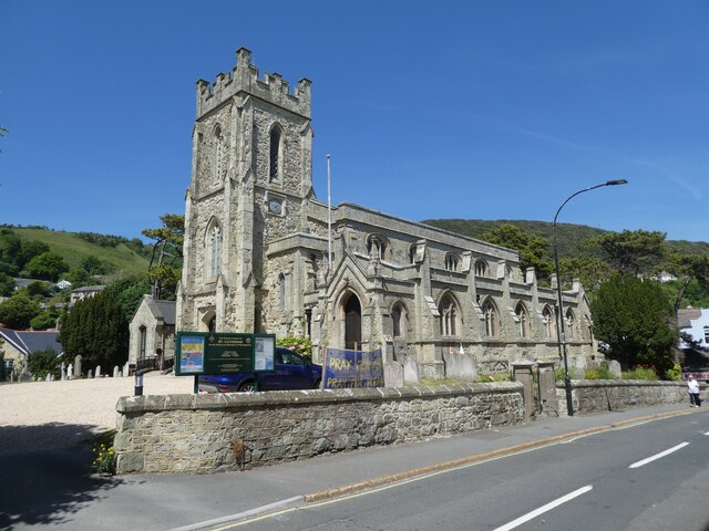
The town of Ventnor itself has a charming and traditional feel, with its Victorian architecture and quaint streets. It offers a range of amenities, including shops, restaurants, and cafes, catering to both locals and visitors. The town also has a strong artistic community, with several galleries and theaters showcasing the work of local artists.

Ventnor is well-connected to other parts of the Isle of Wight, as well as the mainland, with regular ferry services and transport links. It is also home to several historical landmarks, such as the Ventnor Botanic Garden and the Ventnor Heritage Museum, providing insights into the area's rich history and heritage.

Overall, Ventnor is a vibrant and picturesque civil parish that offers a mix of natural beauty, cultural attractions, and a sense of community, making it a popular destination for both residents and tourists alike.

If you have any feedback on the listing, please let us know in the comments section below.

Ventnor Images

Images are sourced within 2km of 50.595369/-1.22346 or Grid Reference SZ5577. Thanks to Geograph Open Source API. All images are credited.

The Ventnor Gas & Water Co. building The former pumping station carries a plaque dating it from 1883.
The Ventnor Gas & Water Co. building
The former pumping station carries a plaque dating it from 1883.
The beach at Ventnor
Trinity Church, Ventnor
St Wilfred's Catholic Church, Ventnor
The Boniface Arms
The Boniface Arms
Mural at 99 High Street
High Street, Ventnor
Church Street
Church Street
Cascade Gardens, Ventnor
Ventnor Haven
Ventnor Haven
Villa Amanti
Villa Amanti
The Royal Hotel, Ventnor
Cove Cottage
Cove Cottage
St Catherine's Church, Ventnor
Steephill Road
Steephill Road
Broadview House
Broadview House
Botanic Gardens, Ventnor
Ventnor Cricket Club
Show me another place!

Ventnor is located at Grid Ref: SZ5577 (Lat: 50.595369, Lng: -1.22346)

Unitary Authority: Isle of Wight

Police Authority: Hampshire

What 3 Words

///splash.jeep.vintages. Near Ventnor, Isle of Wight

Related Wikis

Rew Down

Rew Down is a 23.5-hectare biological Site of Special Scientific Interest and Local Nature Reserve located on the south-east edge of the Isle of Wight...

Ventnor West railway station

Ventnor West railway station was in operation from 1900 to 1952 in Ventnor, Isle of Wight. == History == The station was opened on 1 June 1900 as the final...
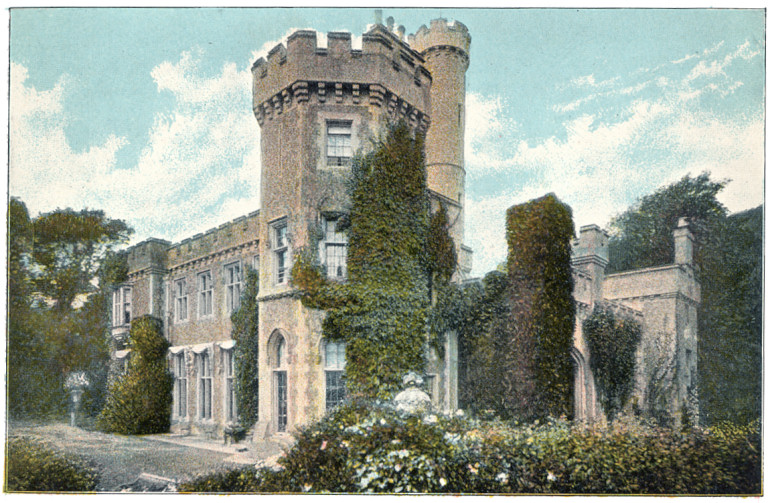
Steephill

Steephill is a hamlet near Ventnor, Isle of Wight, England, previously the location of a Victorian country estate with a castle-style mansion, Steephill...

Ventnor Botanic Garden

Ventnor Botanic Garden is a botanic garden located in Ventnor, Isle of Wight. It was founded in 1970, by Sir Harold Hillier, and donated to the Isle of...

Nearby Amenities

Located within 500m of 50.595369,-1.22346
Source: Bing
Lat/Long: 50.5940199/-1.220607
Source: Bing
Lat/Long: 50.595457/-1.2228025
Source: Bing
Lat/Long: 50.5954948/-1.2231371
Source: Bing
Lat/Long: 50.5959665/-1.2264051
Post Box
Check Date Collection Times: 2018-06-03
Check Date Ref: 2018-06-03
Collection Plate: CP7D
Collection Times: Mo-Fr 09:00; Sa 07:00; Su off
Operator: Royal Mail
Operator Wikidata: Q638098
Post Box Type: lamp
Ref: PO38 263D
Ref GB Uprn: 10015469528
Royal Cypher: EIIR
Royal Cypher Wikidata: Q33102113
Website: https://www.royalmail.com/services-near-you/postbox/castle-court-po38-1aa/000PO38263
Lat/Long: 50.5915365/-1.2263495
Bus Stop
Pine Point
Bus: yes
Contact Website: https://www.islandbuses.info/stops/230000004750
Naptan AtcoCode: 230000004750
Naptan Bearing: W
Naptan CommonName: Pine Point
Naptan Indicator: towards Blackgang
Naptan NaptanCode: iowdmga
Naptan Street: Whitwell Road
Public Transport: platform
Ref GB Uprn: 10025577182
Shelter: yes
Lat/Long: 50.5936855/-1.2211919
Bus Stop
Pine Point
Bus: yes
Contact Website: https://www.islandbuses.info/stops/230000004760
Naptan AtcoCode: 230000004760
Naptan Bearing: E
Naptan CommonName: Pine Point
Naptan Indicator: towards Ventnor
Naptan NaptanCode: iowdmgd
Naptan Street: Whitwell Road
Public Transport: platform
Shelter: no
Lat/Long: 50.5935464/-1.2224796
Bus Stop
Foxhills
Bus: yes
Contact Website: https://www.islandbuses.info/stops/230000000903
Naptan AtcoCode: 230000000903
Naptan NaptanCode: iowmwtd
Public Transport: platform
Shelter: no
Survey Date: 2019-04-01
Lat/Long: 50.5925536/-1.2288552
Bus Stop
Castle Court
Bus: yes
Naptan AtcoCode: 230000003010
Naptan Bearing: E
Naptan CommonName: Castle Court
Naptan Indicator: Adj
Naptan NaptanCode: iowawpg
Naptan Street: Castle Close
Public Transport: platform
Shelter: no
Lat/Long: 50.5915197/-1.2266493
Bus Stop
Ventnor West Station
Bus: yes
Naptan AtcoCode: 230000004650
Naptan Bearing: E
Naptan CommonName: Ventnor West Station
Naptan Indicator: Adj
Naptan NaptanCode: iowdmap
Naptan Street: Castle Close
Public Transport: platform
Shelter: no
Lat/Long: 50.5924024/-1.2193193
Source: Bing
Lat/Long: 50.5915067/-1.2266918
Bus Stop
Lower Gills Cliff Road
Bus: yes
Contact Website: https://www.islandbuses.info/stops/230000004620
Naptan AtcoCode: 230000004620
Naptan Bearing: NW
Naptan CommonName: Lower Gills Cliff Road
Naptan Indicator: towards Blackgang
Naptan NaptanCode: iowdmag
Naptan Street: Lower Gill's Cliff Road
Public Transport: platform
Shelter: no
Lat/Long: 50.593833/-1.2178898
Bus Stop
Glyn's View
Bench: no
Bus: yes
Naptan AtcoCode: 230000119
Naptan NaptanCode: iowmpwg
Public Transport: platform
Shelter: no
Survey Date: 2021-02-26
Tactile Paving: no
Lat/Long: 50.5941871/-1.2202668
Bus Stop
Ventnor, Foxhills
Bus: yes
Contact Website: https://www.islandbuses.info/stops/230000005090
Naptan AtcoCode: 230000005090
Naptan Bearing: W
Naptan CommonName: La Manche
Naptan Indicator: towards Blackgang
Naptan NaptanCode: iowdmwt
Public Transport: platform
Shelter: no
Short Name: Foxhills
Lat/Long: 50.5926714/-1.2276427
Bus Stop
Lower Gills Cliff Road
Bus: yes
Contact Website: https://www.islandbuses.info/stops/2300170
Naptan AtcoCode: 2300170
Naptan Bearing: E
Naptan BusStopType: CUS
Naptan CommonName: Lower Gills Cliff Road
Naptan Indicator: towards Ventnor
Naptan NaptanCode: iowmdwa
Naptan Street: Lower Gill's Cliff Road
Public Transport: platform
Shelter: no
Lat/Long: 50.5939986/-1.2176104
Source: Bing
Lat/Long: 50.5972977/-1.2297008
Post Box
Check Date Collection Times: 2021-03-31
Collection Times: Mo-Fr 16:15; Sa 11:30; Su off
Operator: Royal Mail
Operator Wikidata: Q638098
Post Box Type: wall
Ref: PO38 248
Ref GB Uprn: 10015317324
Royal Cypher: VR
Royal Cypher Wikidata: Q33102356
Website: https://www.royalmail.com/services-near-you/postbox/gills-cliff-road-po38-1aa/000PO38248
Lat/Long: 50.5940279/-1.2207087
Bus Stop
Glyn's View
Bench: no
Bus: yes
Naptan AtcoCode: 230000004660
Naptan NaptanCode: iowdmat
Public Transport: platform
Shelter: no
Tactile Paving: no
Lat/Long: 50.5942539/-1.2191248
Source: Bing
Lat/Long: 50.595658/-1.2169415
Source: Bing
Lat/Long: 50.5954461/-1.2177001
Source: Bing
Lat/Long: 50.5959772/-1.2269349
Source: Bing
Lat/Long: 50.5959296/-1.227569
Source: Bing
Lat/Long: 50.5941004/-1.2204002
Source: Bing
Lat/Long: 50.5915219/-1.226995
Barrier: kissing_gate
Lat/Long: 50.5936919/-1.224517
Barrier: kissing_gate
Lat/Long: 50.5939655/-1.2249067
Barrier: kissing_gate
Lat/Long: 50.5941856/-1.222754
Barrier: stile
Lat/Long: 50.5950292/-1.2271939
Barrier: stile
Lat/Long: 50.595046/-1.2267203
Barrier: stile
Lat/Long: 50.5950576/-1.2182809
Barrier: stile
Lat/Long: 50.5955169/-1.2274404
Bench
Lat/Long: 50.594701/-1.2274052
Source: Bing
Lat/Long: 50.5964132/-1.2177403
Cafe
Ventnor Golf Club Cafe
Addr City: Ventnor
Addr Country: GB
Addr Postcode: PO38 1BP
Addr Street: Steephill Down Road
Fhrs Id: 541714
Mobile: +44 7711 475233
Source Addr: FHRS Open Data
Website: https://www.ventnorgolfclub.co.uk/index.html
Lat/Long: 50.5963664/-1.2251654
Ventnor West
End Date: 1952-09-15
Historic Railway: station
Old Name: Ventnor Town
Railway: site
Start Date: 1900-06-01
Wikidata: Q16902595
Lat/Long: 50.5923965/-1.2190815
Power: substation
Ref GB Uprn: 10024901447
Lat/Long: 50.5958449/-1.2165485
Power: substation
Ref GB Uprn: 10024895387
Lat/Long: 50.5919014/-1.2263737
Generator Solar Modules: 10
Generator Source: solar
Location: roof
Power: generator
Lat/Long: 50.5943198/-1.2173326
The data included in this document is from www.openstreetmap.org. The data is made available under ODbL.

Have you been to Ventnor?

Leave your review of Ventnor below (or comments, questions and feedback).