Southstoke

Civil Parish in Somerset

England

Southstoke

Waiting for the cyclists! Work is gradually progressing on converting the old Somerset & Dorset Railway south of Midford into a cycle path. In May 2005 this was the next stretch awaiting the Sustrans treatment.
Waiting for the cyclists! Credit: Ron Strutt

Southstoke is a civil parish located in the county of Somerset, England. Situated about 5 miles south of Bath, it falls within the Bath and North East Somerset unitary authority. The parish covers an area of approximately 2.5 square miles and has a population of around 400 residents.

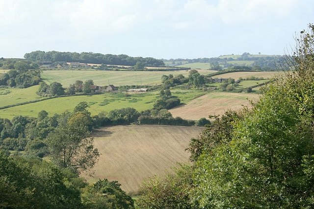
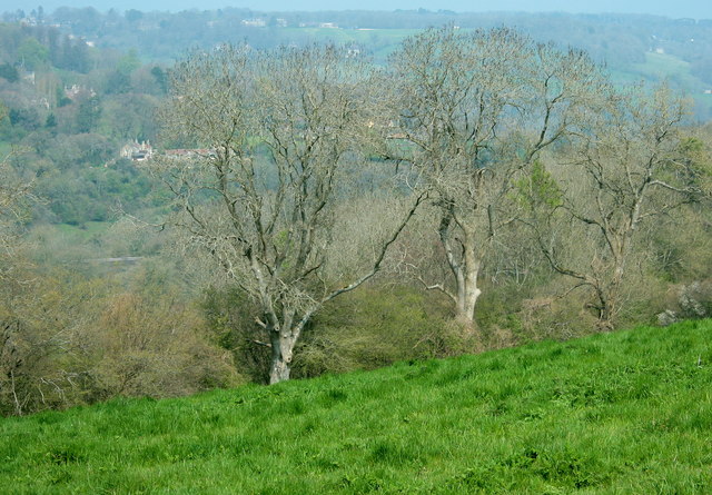
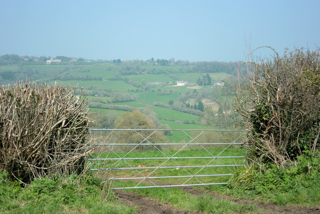
Southstoke is a picturesque village set in the scenic countryside of Somerset. It is known for its charming rural character and beautiful natural surroundings. The village is nestled on the southern slope of the Limpley Stoke Valley, offering breathtaking views of the surrounding hills and valleys.

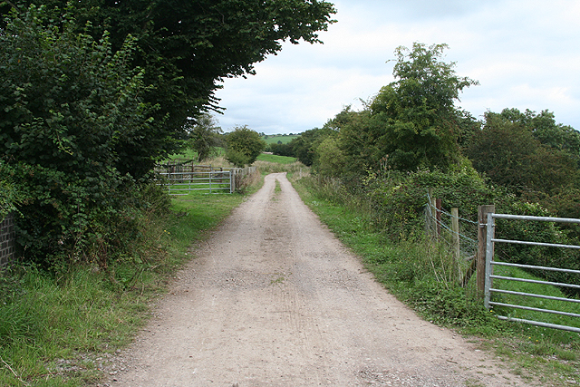
The heart of Southstoke consists of a cluster of traditional stone-built houses, many of which date back to the 18th and 19th centuries. These historic buildings add to the village's timeless appeal and give it a sense of heritage. The parish also includes farmland and open fields, contributing to the area's agricultural character.

Despite its small size, Southstoke has a vibrant community spirit. The village is home to a local church, St. James Church, which serves as a gathering place for religious services and community events. Additionally, there is a village hall that hosts various activities and social gatherings throughout the year.

Southstoke offers a tranquil and idyllic setting, making it a desirable place to live for those seeking a peaceful rural lifestyle. With its close proximity to the city of Bath, residents can also enjoy easy access to urban amenities and cultural attractions.

If you have any feedback on the listing, please let us know in the comments section below.
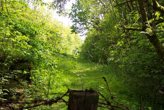
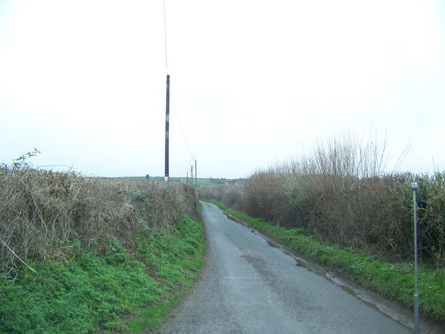
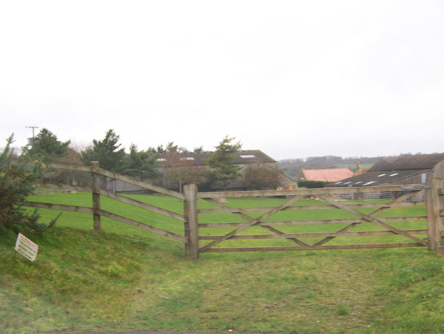
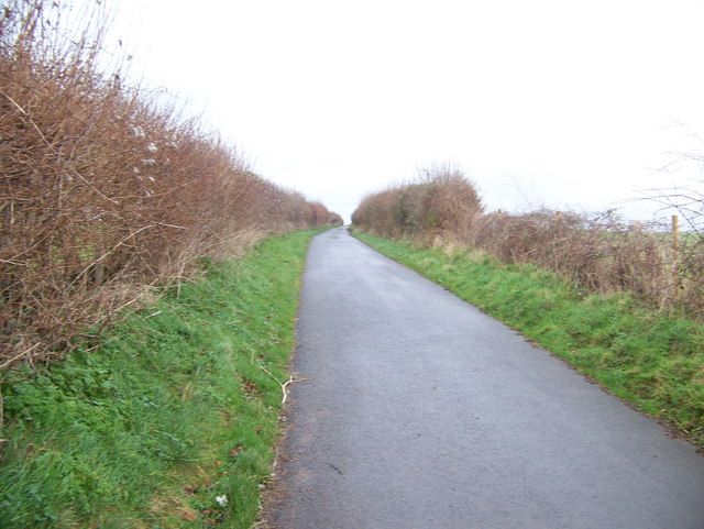
Southstoke Images

Images are sourced within 2km of 51.348719/-2.358742 or Grid Reference ST7561. Thanks to Geograph Open Source API. All images are credited.

Waiting for the cyclists! Work is gradually progressing on converting the old Somerset & Dorset Railway south of Midford into a cycle path. In May 2005 this was the next stretch awaiting the Sustrans treatment.
Waiting for the cyclists!
Work is gradually progressing on converting the old Somerset & Dorset Railway south of Midford into a cycle path. In May 2005 this was the next stretch awaiting the Sustrans treatment.
Between Twinhoe & Midford
Twinhoe
Twinhoe
Between Wellow & Twinhoe
View from Midford Hill Looking down a valley from a sharp bend on Midford Hill. The Wellow Brook runs across the end.
Lower Twinhoe Farm is on the hill beyond.
Don't dally here, the sharp bend can be very dangerous for pedestrians.
View from Midford Hill
Looking down a valley from a sharp bend on Midford Hill. The Wellow Brook runs across the end. Lower Twinhoe Farm is on the hill beyond. Don't dally here, the sharp bend can be very dangerous for pedestrians.
2008 : Pasture near Twinhoe Taken from the lane between Midford and Twinhoe.
The Cam Brook runs through the valley behind the trees, Southstoke is on the other side of the valley and Midford is to the right.
2008 : Pasture near Twinhoe
Taken from the lane between Midford and Twinhoe. The Cam Brook runs through the valley behind the trees, Southstoke is on the other side of the valley and Midford is to the right.
2008 : Middle Twinhoe Farm There were three farms. Upper Twinhoe Farm, Middle Twinhoe Farm and Lower Twinhoe Farm. Goldilocks found Middle Twinhoe Farm was just right.
2008 : Middle Twinhoe Farm
There were three farms. Upper Twinhoe Farm, Middle Twinhoe Farm and Lower Twinhoe Farm. Goldilocks found Middle Twinhoe Farm was just right.
2008 : Lower Twinhoe Farm Taken from the lane between Midford and Twinhoe. Wellow Brook runs through the valley beyond the farm.
2008 : Lower Twinhoe Farm
Taken from the lane between Midford and Twinhoe. Wellow Brook runs through the valley beyond the farm.
2008 : Field gate on Twinhoe Lane The driveway to Lower Twinhoe Farm is behind us.
Upper Twinhoe with its farms is located on the eastern end of a ridge starting near Midford and running west to Peasedown St.John and beyond.
The two arms of the Somerset Coal Canal were built on either side of the ridge. The canal proper, which went as far as Radford Basin near Timsbury, went through the valley before us. The southern arm, which was part tramway and part canal, went along the valley behind as far as Radstock.
2008 : Field gate on Twinhoe Lane
The driveway to Lower Twinhoe Farm is behind us. Upper Twinhoe with its farms is located on the eastern end of a ridge starting near Midford and running west to Peasedown St.John and beyond. The two arms of the Somerset Coal Canal were built on either side of the ridge. The canal proper, which went as far as Radford Basin near Timsbury, went through the valley before us. The southern arm, which was part tramway and part canal, went along the valley behind as far as Radstock.
2008 : Cottages at Twinhoe The field between and the barn on the left hand edge belong to Upper Twinhoe Farm.
Southstoke is in the distance, with Combe Down on the southern edge of Bath out of sight beyond the skyline.
2008 : Cottages at Twinhoe
The field between and the barn on the left hand edge belong to Upper Twinhoe Farm. Southstoke is in the distance, with Combe Down on the southern edge of Bath out of sight beyond the skyline.
Disused Railway Bridge A double vaulted bridge on the  Somerset and Dorset Joint Railway (S&DJR).
Disused Railway Bridge
A double vaulted bridge on the Somerset and Dorset Joint Railway (S&DJR).
Wellow: near Rainbow Wood On the formation of the Somerset and Dorset Railway, below Twinhoe. The track is now a cyclepath provided by Sustrans but is also used by local farmers for field access
Wellow: near Rainbow Wood
On the formation of the Somerset and Dorset Railway, below Twinhoe. The track is now a cyclepath provided by Sustrans but is also used by local farmers for field access
Wellow: the Wellow valley Looking towards Midford Hill – the road linking Midford and Hinton Charterhouse. Seen from the formation of the Somerset and Dorset Railway, now a Sustrans cycleway. In the first field, under a tree by the Wellow Brook, is a World War II pillbox – see <a href="https://www.geograph.org.uk/photo/1190425">ST7559 : Pill Box at Wellow Brook</a>
Wellow: the Wellow valley
Looking towards Midford Hill – the road linking Midford and Hinton Charterhouse. Seen from the formation of the Somerset and Dorset Railway, now a Sustrans cycleway. In the first field, under a tree by the Wellow Brook, is a World War II pillbox – see ST7559 : Pill Box at Wellow Brook
Bridleway, Combe Hay The bridleway takes riders and walkers from Combe Hay, through woodland to Upper Twinhoe Farm.
Bridleway, Combe Hay
The bridleway takes riders and walkers from Combe Hay, through woodland to Upper Twinhoe Farm.
Byway hill up to the railway bridge The byway skirts the edge of a field and is quite narrow as it ascends a steep hill up from the Wellow Brook valley to the disused railway line.
Byway hill up to the railway bridge
The byway skirts the edge of a field and is quite narrow as it ascends a steep hill up from the Wellow Brook valley to the disused railway line.
The Byway goes under the railway line Looking uphill at the south side of the railway bridge where the byway crosses underneath the disused railway.
The Byway goes under the railway line
Looking uphill at the south side of the railway bridge where the byway crosses underneath the disused railway.
Bridge over the Byway The north side of the railway bridge over the Byway that runs between Lower Twinhoe Farm and Ford Road, east of Wellow.
Bridge over the Byway
The north side of the railway bridge over the Byway that runs between Lower Twinhoe Farm and Ford Road, east of Wellow.
Upper Twinhoe Attractive stone buildings on a small side lane. At the end, left centre, is the listed C17 Upper Twinhoe Farmhouse <span class="nowrap"><a title="https://www.historicengland.org.uk/listing/the-list/list-entry/1115349" rel="nofollow ugc noopener" href="https://www.historicengland.org.uk/listing/the-list/list-entry/1115349">Link</a><img style="margin-left:2px;" alt="External link" title="External link - shift click to open in new window" src="https://s1.geograph.org.uk/img/external.png" width="10" height="10"/></span> , more clearly shown in <a href="https://www.geograph.org.uk/photo/4899042">ST7459 : Upper Twinhoe Farm</a>.
Upper Twinhoe
Attractive stone buildings on a small side lane. At the end, left centre, is the listed C17 Upper Twinhoe Farmhouse LinkExternal link , more clearly shown in ST7459 : Upper Twinhoe Farm.
Show me another place!

Southstoke is located at Grid Ref: ST7561 (Lat: 51.348719, Lng: -2.358742)

Unitary Authority: Bath and North East Somerset

Police Authority: Avon and Somerset

What 3 Words

///breed.banks.butter. Near Wellow, Somerset

Related Wikis

South Stoke, Somerset

South Stoke or Southstoke is a small village and civil parish in north east Somerset, England. It is 2 miles (3 km) south of the city of Bath, on the River...

Packhorse Inn

The Packhorse Inn in Southstoke within the English county of Somerset is a Grade II listed building which was largely rebuilt in 1674. It was changed from...

Church of St James, Southstoke

The Church of St James is an Anglican parish church in Southstoke, Somerset, England. It was built in the 12th century and has been designated as a Grade...
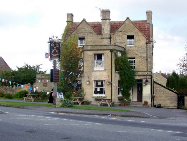
Cross Keys Inn

The Cross Keys Inn is a pub-restaurant and former coaching inn, trading since before 1750, on a corner of Midford Road in Odd Down, Bath, Somerset, England...

Nearby Amenities

Located within 500m of 51.348719,-2.358742
Barrier: kissing_gate
Lat/Long: 51.3512566/-2.35889
Barrier: stile
Lat/Long: 51.3486399/-2.3605904
Barrier: stile
Lat/Long: 51.3479704/-2.3578934
Barrier: stile
Lat/Long: 51.3476473/-2.3575429
Post Box
Lat/Long: 51.3500491/-2.364465
Entrance: yes
Lat/Long: 51.349673/-2.3521971
Barrier: kissing_gate
Lat/Long: 51.3487008/-2.3518069
Barrier: kissing_gate
Lat/Long: 51.3484056/-2.3530315
Barrier: kissing_gate
Lat/Long: 51.3464449/-2.3536454
Barrier: kissing_gate
Lat/Long: 51.3524818/-2.3568376
Southstoke
Place: village
Wikidata: Q2707590
Wikipedia: en:South Stoke, Somerset
Lat/Long: 51.3494721/-2.3613846
Barrier: stile
Lat/Long: 51.3477146/-2.3605438
Barrier: entrance
Lat/Long: 51.3482663/-2.3635843
Defibrillator
Booth: K6
Colour: red
Covered: booth
Defibrillator Location: inside old red phone box, Old School Hill, Southstoke
Disused Amenity: telephone
Emergency: defibrillator
Installation: British red telephone box
Listed Status: Grade II
Man Made: telephone_box
Ref: CHT-14-1387
Lat/Long: 51.3500982/-2.3650075
Barrier: kissing_gate
Lat/Long: 51.3527384/-2.3577633
Bus Stop
Southstoke Village
Bus: yes
Naptan AtcoCode: 0180BAC30130
Naptan Bearing: SW
Naptan CommonName: Southstoke Village
Naptan Crossing: Southstoke Lane
Naptan NaptanCode: bthjmdm
Naptan Street: Pack Horse Lane
Naptan Verified: no
Public Transport: platform
Source: naptan_import
Lat/Long: 51.3501791/-2.3649048
Barrier: stile
Lat/Long: 51.3450374/-2.3572956
Barrier: stile
Lat/Long: 51.3450334/-2.3572825
Hodshill
Natural: peak
Lat/Long: 51.3468585/-2.3644659
Power: pole
Lat/Long: 51.3459539/-2.3534608
Power: pole
Lat/Long: 51.3463935/-2.3527024
Power: pole
Lat/Long: 51.346391/-2.3536116
Barrier: bollard
Lat/Long: 51.3503488/-2.3644633
Entrance: yes
Lat/Long: 51.3496139/-2.365428
Bench
Lat/Long: 51.3502461/-2.3646842
Barrier: stile
Lat/Long: 51.34746/-2.3561064
Barrier: kissing_gate
Lat/Long: 51.3486883/-2.3641508
The data included in this document is from www.openstreetmap.org. The data is made available under ODbL.

Have you been to Southstoke?

Leave your review of Southstoke below (or comments, questions and feedback).