South Cockerington

Civil Parish in Lincolnshire East Lindsey

England

South Cockerington

Settlement of North Cockerington: aerial 2021 The settlement of North Cockerington (also known as Cockerington St Mary) is first documented in the Domesday Book, and therefore probably has its origins in the Anglo-Saxon period. See: <span class="nowrap"><a title="https://www.heritagegateway.org.uk/Gateway/Results_Single.aspx?uid=MLI83365&resourceID=1006" rel="nofollow ugc noopener" href="https://www.heritagegateway.org.uk/Gateway/Results_Single.aspx?uid=MLI83365&resourceID=1006">Link</a><img style="margin-left:2px;" alt="External link" title="External link - shift click to open in new window" src="https://s1.geograph.org.uk/img/external.png" width="10" height="10"/></span>

Included is the moated site of North Cockerington Hall, top left: <span class="nowrap"><a title="https://www.heritagegateway.org.uk/Gateway/Results_Single.aspx?uid=836a927c-5934-4ece-8686-5cfd98bd67fe&resourceID=19191" rel="nofollow ugc noopener" href="https://www.heritagegateway.org.uk/Gateway/Results_Single.aspx?uid=836a927c-5934-4ece-8686-5cfd98bd67fe&resourceID=19191">Link</a><img style="margin-left:2px;" alt="External link" title="External link - shift click to open in new window" src="https://s1.geograph.org.uk/img/external.png" width="10" height="10"/></span>

Very unfortunately, the brown field to the right do the moated site used also to contain earthworks, but these have now been completely ploughed out.
Settlement of North Cockerington: aerial 2021 Credit: Simon Tomson

South Cockerington is a civil parish located in the ceremonial county of Lincolnshire, England. Situated about 6 miles east of Louth, it covers an area of approximately 5.5 square miles. The parish is named after the Cockerington Beck, a small stream that runs through the village.

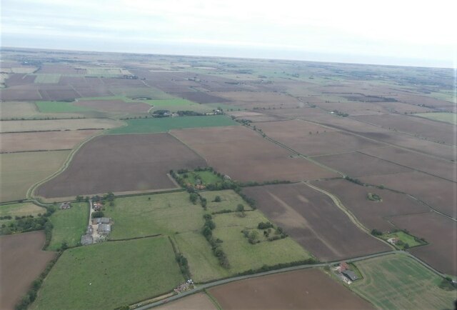
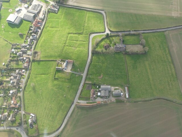
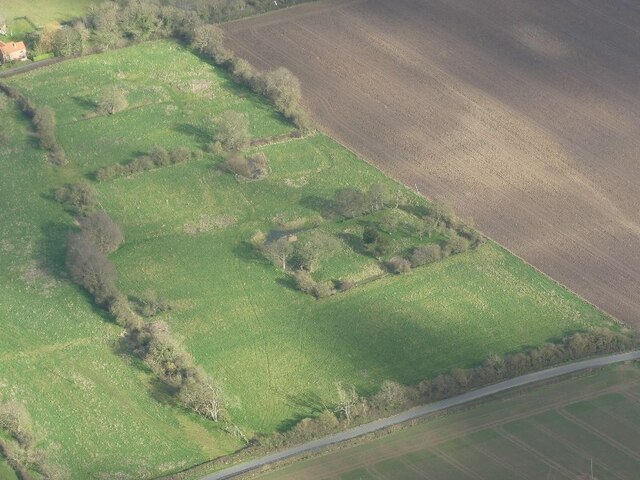
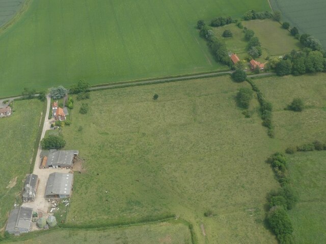
The village of South Cockerington is predominantly rural, with a population of around 300 people. It is known for its picturesque countryside, characterized by rolling hills and agricultural fields. The landscape is dotted with traditional farmhouses and cottages, giving it a charming and timeless quality.

Historically, South Cockerington has been an agricultural community, with farming being the main industry. The fertile soil and favorable climate make it ideal for growing crops and rearing livestock. The village has a close-knit community, and agriculture continues to be an integral part of its identity.

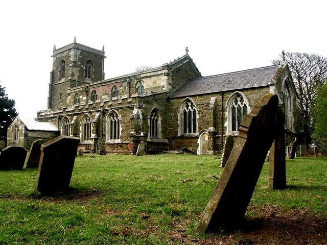
South Cockerington is also home to the 13th-century St. Leonard's Church, a Grade II listed building. The church features a Norman font and stained glass windows, adding to its historical significance. The village has a primary school and a village hall, providing essential amenities for its residents.

Overall, South Cockerington offers a tranquil and idyllic setting for those seeking a rural lifestyle. With its rich agricultural heritage and natural beauty, it is a place where residents can enjoy the peace and tranquility of the Lincolnshire countryside.

If you have any feedback on the listing, please let us know in the comments section below.

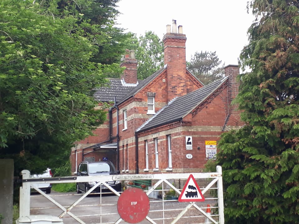
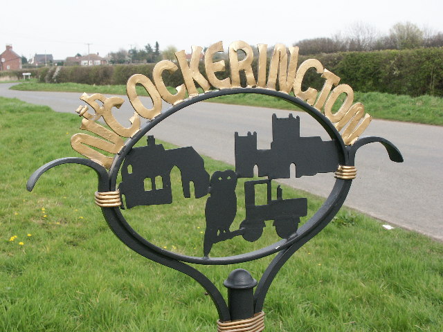
South Cockerington Images

Images are sourced within 2km of 53.381471/0.07416 or Grid Reference TF3889. Thanks to Geograph Open Source API. All images are credited.

Settlement of North Cockerington: aerial 2021 The settlement of North Cockerington (also known as Cockerington St Mary) is first documented in the Domesday Book, and therefore probably has its origins in the Anglo-Saxon period. See: <span class="nowrap"><a title="https://www.heritagegateway.org.uk/Gateway/Results_Single.aspx?uid=MLI83365&resourceID=1006" rel="nofollow ugc noopener" href="https://www.heritagegateway.org.uk/Gateway/Results_Single.aspx?uid=MLI83365&resourceID=1006">Link</a><img style="margin-left:2px;" alt="External link" title="External link - shift click to open in new window" src="https://s1.geograph.org.uk/img/external.png" width="10" height="10"/></span>

Included is the moated site of North Cockerington Hall, top left: <span class="nowrap"><a title="https://www.heritagegateway.org.uk/Gateway/Results_Single.aspx?uid=836a927c-5934-4ece-8686-5cfd98bd67fe&resourceID=19191" rel="nofollow ugc noopener" href="https://www.heritagegateway.org.uk/Gateway/Results_Single.aspx?uid=836a927c-5934-4ece-8686-5cfd98bd67fe&resourceID=19191">Link</a><img style="margin-left:2px;" alt="External link" title="External link - shift click to open in new window" src="https://s1.geograph.org.uk/img/external.png" width="10" height="10"/></span>

Very unfortunately, the brown field to the right do the moated site used also to contain earthworks, but these have now been completely ploughed out.
Settlement of North Cockerington: aerial 2021
The settlement of North Cockerington (also known as Cockerington St Mary) is first documented in the Domesday Book, and therefore probably has its origins in the Anglo-Saxon period. See: LinkExternal link Included is the moated site of North Cockerington Hall, top left: LinkExternal link Very unfortunately, the brown field to the right do the moated site used also to contain earthworks, but these have now been completely ploughed out.
Soil- and cropmark remains of South Cockerington Medieval Settlement: aerial 2022
Settlement of South Cockerington: aerial 2022 (1)
Moated site and boundary ditches, North Cockerington: aerial 2022
Settlement of Grimoldby: aerial 2022 See: <span class="nowrap"><a title="https://www.heritagegateway.org.uk/Gateway/Results_Single.aspx?uid=MLI88070&resourceID=1006" rel="nofollow ugc noopener" href="https://www.heritagegateway.org.uk/Gateway/Results_Single.aspx?uid=MLI88070&resourceID=1006">Link</a><img style="margin-left:2px;" alt="External link" title="External link - shift click to open in new window" src="https://s1.geograph.org.uk/img/external.png" width="10" height="10"/></span>
Settlement of Grimoldby: aerial 2022
See: LinkExternal link
Settlement of South Cockerington: aerial 2022 (2) See: <a href="https://www.geograph.org.uk/photo/7144768">TF3789 : Settlement of South Cockerington: aerial 2022 (1)</a> and <span class="nowrap"><a title="https://www.heritagegateway.org.uk/Gateway/Results_Single.aspx?uid=MLI43243&resourceID=1006" rel="nofollow ugc noopener" href="https://www.heritagegateway.org.uk/Gateway/Results_Single.aspx?uid=MLI43243&resourceID=1006">Link</a><img style="margin-left:2px;" alt="External link" title="External link - shift click to open in new window" src="https://s1.geograph.org.uk/img/external.png" width="10" height="10"/></span>
Settlement of South Cockerington: aerial 2022 (2)
Grimoldby: aerial 2022
North Cockerington: aerial 2022
Track off Middlesykes Lane, Grimoldby
Old Mill Lane, Grimoldby
Old Mill Lane near The Griff, Grimoldby
Field of ripening barley near Grimoldby
Wheat field off Marsh Lane
Footpath to North Coclerington Alongside a rather overgrown Green Dike.
Footpath to North Coclerington
Alongside a rather overgrown Green Dike.
Settlement of South Cockerington: aerial 2022 (3)
Earthworks at Grimoldby: aerial 2022 (1)
Earthworks at Grimoldby: aerial 2022 (2)
Settlement of South Cockerington: aerial 2022 (4)
Show me another place!

South Cockerington is located at Grid Ref: TF3889 (Lat: 53.381471, Lng: 0.07416)

Administrative County: Lincolnshire

District: East Lindsey

Police Authority: Lincolnshire

What 3 Words

///armed.ghosts.eradicate. Near Manby, Lincolnshire

Related Wikis

South Cockerington

South Cockerington is a village and civil parish in the East Lindsey district of Lincolnshire, England. It is situated approximately 4 miles (6 km) east...

Grimoldby railway station

Grimoldy railway station was a station in Grimoldby, Lincolnshire; opened in 1877 by the Louth and East Coast Railway; and closed in 1960. == References ==

Grimoldby

Grimoldby is a village and civil parish in the East Lindsey district of Lincolnshire, England. It is situated 4 miles (6 km) east from Louth. Grimoldby...

North Cockerington

North Cockerington is a small village and civil parish in the East Lindsey district of Lincolnshire, England. It is situated approximately 3 miles (5 km...

Nearby Amenities

Located within 500m of 53.381471,0.07416
South Cockerington
Is In: Lincolnshire, England, UK
Place: village
Source: npe
Lat/Long: 53.3800101/0.0739265
Bus Stop
Marsh Lane
Naptan AtcoCode: 2700LSCB1728
Naptan Bearing: SW
Naptan CommonName: Marsh Lane
Naptan Indicator: adj
Naptan Landmark: Marsh Lane
Naptan NaptanCode: linamjpd
Naptan Street: Mill Hill Way
Naptan Verified: no
Source: naptan_import
Lat/Long: 53.3818563/0.0758825
Bus Stop
Chapel Lane
Naptan AtcoCode: 2700LSCC1729
Naptan Bearing: NE
Naptan CommonName: Chapel Lane
Naptan Indicator: adj
Naptan Landmark: Chapel Lane
Naptan NaptanCode: linamjpg
Naptan Street: Mill Hill Way
Naptan Verified: no
Source: naptan_import
Lat/Long: 53.3816638/0.0755952
Power: pole
Lat/Long: 53.3834327/0.0680314
Power: pole
Lat/Long: 53.3838362/0.0703016
Power: pole
Lat/Long: 53.3842413/0.0725131
Power: pole
Lat/Long: 53.3845906/0.0749193
Power: pole
Lat/Long: 53.3849028/0.077002
South View Farm
Place: farm
Source: Bing
Lat/Long: 53.3788046/0.0710353
West View Farm
Place: farm
Source: Bing
Lat/Long: 53.379481/0.0762544
Generator Method: photovoltaic
Generator Output Electricity: yes
Generator Source: solar
Generator Type: solar_photovoltaic_panel
Location: roof
Power: generator
Lat/Long: 53.3805832/0.0724538
Generator Method: photovoltaic
Generator Output Electricity: yes
Generator Source: solar
Generator Type: solar_photovoltaic_panel
Location: roof
Power: generator
Lat/Long: 53.3790489/0.0742428
Generator Method: photovoltaic
Generator Output Electricity: yes
Generator Source: solar
Generator Type: solar_photovoltaic_panel
Location: roof
Power: generator
Lat/Long: 53.3789913/0.0740711
Generator Method: photovoltaic
Generator Output Electricity: yes
Generator Source: solar
Generator Type: solar_photovoltaic_panel
Location: roof
Power: generator
Lat/Long: 53.3793272/0.0753371
West View Bed & Breakfast
Addr City: Louth
Addr Country: GB
Addr Housename: West View Farm
Addr Postcode: LN11 7ED
Addr Street: South View Lane
Addr Village: South Cockerington
Fhrs Authority: East Lindsey
Fhrs Id: 637970
Fhrs Local Authority Id: EHFDI/18145/13
Tourism: guest_house
Lat/Long: 53.3795222/0.0752494
Post Box
Collection Times: Mo-Fr 09:00; Sa 07:00
Operator: Royal Mail
Operator Wikidata: Q638098
Post Box Mounting: brick_pillar
Post Box Type: wall
Ref: LN11 23
Royal Cypher: GR
Royal Cypher Wikidata: Q33102273
Lat/Long: 53.3808949/0.0732995
The data included in this document is from www.openstreetmap.org. The data is made available under ODbL.

Have you been to South Cockerington?

Leave your review of South Cockerington below (or comments, questions and feedback).