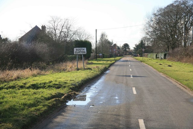
South Clifton

Civil Parish in Nottinghamshire Newark and Sherwood

England

South Clifton

Fledborough Viaduct: under the bridge
Fledborough Viaduct: under the bridge Credit: Simon Tomson

South Clifton is a civil parish located in the county of Nottinghamshire, England. It is situated in the district of Newark and Sherwood, approximately 16 miles north-east of the city of Nottingham. The parish covers an area of around 8 square kilometers and has a population of approximately 400 residents.

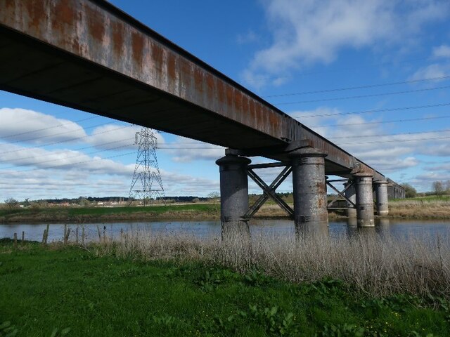
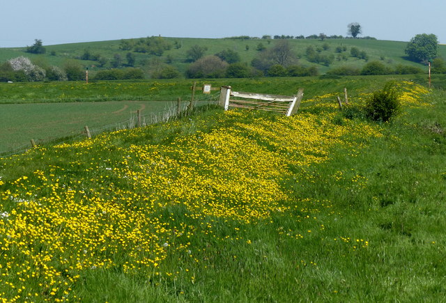
The village of South Clifton is situated on the eastern bank of the River Trent, and it is surrounded by picturesque countryside and farmland. The landscape is characterized by rolling hills, lush green fields, and meandering waterways. The area is known for its natural beauty and offers plenty of opportunities for outdoor activities such as walking, cycling, and fishing.

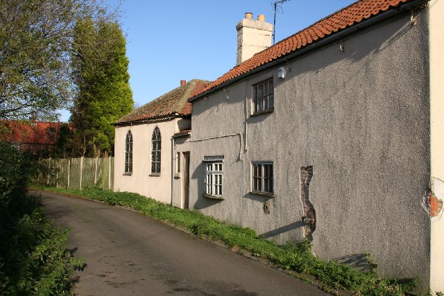
The village itself is small and charming, with a mix of traditional stone cottages and more modern houses. It has a close-knit community and a friendly atmosphere. The parish church, St. George's, is a notable landmark in the village, with its striking architecture and historical significance.

Despite its rural location, South Clifton benefits from good transport links. The A57 road runs nearby, providing easy access to the nearby towns of Newark-on-Trent and Gainsborough. The village also has a bus service that connects it to surrounding areas.

Overall, South Clifton is a peaceful and picturesque village in Nottinghamshire, offering a tranquil escape from the hustle and bustle of urban life. Its natural beauty, friendly community, and convenient location make it an attractive place to live or visit.

If you have any feedback on the listing, please let us know in the comments section below.

South Clifton Images

Images are sourced within 2km of 53.223714/-0.759742 or Grid Reference SK8270. Thanks to Geograph Open Source API. All images are credited.

Fledborough Viaduct: under the bridge
Fingerpost in North Clifton A guidepost with wooden arms and ends shaped like fingers in the centre of North Clifton.  The larger arm points to destinations reached by the nearby A1133.

Milestone Society National ID: NT_SK8272
Fingerpost in North Clifton
A guidepost with wooden arms and ends shaped like fingers in the centre of North Clifton. The larger arm points to destinations reached by the nearby A1133. Milestone Society National ID: NT_SK8272
Trig point on Clifton Hill Looking over old course of River Trent and lakes formed from old gravel pits.
Trig point on Clifton Hill
Looking over old course of River Trent and lakes formed from old gravel pits.
Muddy Trent Valley Way
Trent Valley Way
Trent Valley Way
Cow bar Or just another piped in bath in a field.
Cow bar
Or just another piped in bath in a field.
Rabbithill Lane, Spalford
What a pig sty! In a corner of wartime RAF Wigsley is this pile of old pig sties. Beyond is a controversial wind turbine, opposed by nearby residents but now built. Out of sight is a vast open area of the former airfield now devoted to pigs.
What a pig sty!
In a corner of wartime RAF Wigsley is this pile of old pig sties. Beyond is a controversial wind turbine, opposed by nearby residents but now built. Out of sight is a vast open area of the former airfield now devoted to pigs.
Heading for Wigsley Wood
Buttercups on the River Trent floodbank With the backdrop of Clifton Hill.
Buttercups on the River Trent floodbank
With the backdrop of Clifton Hill.
Clapper gates along the River Trent Clapper Gates are self-closing double gates, unique to the navigable reaches of the River Trent.
Clapper gates along the River Trent
Clapper Gates are self-closing double gates, unique to the navigable reaches of the River Trent.
The River Trent near South Clifton
Marshgate Farmhouse next to the River Trent
Clapper gates along the River Trent Clapper Gates are self-closing double gates, unique to the navigable reaches of the River Trent.
Clapper gates along the River Trent
Clapper Gates are self-closing double gates, unique to the navigable reaches of the River Trent.
A waterskier on the River Trent
The driveway to Field Farm
Clifton Hill trig point Overlooking the Old River Trent
Clifton Hill trig point
Overlooking the Old River Trent
Eagle Road, Spalford
Show me another place!

South Clifton is located at Grid Ref: SK8270 (Lat: 53.223714, Lng: -0.759742)

Administrative County: Nottinghamshire

District: Newark and Sherwood

Police Authority: Nottinghamshire

What 3 Words

///boating.dislodge.wildfires. Near Sutton on Trent, Nottinghamshire

Related Wikis

South Clifton

South Clifton is a village and civil parish in the Newark and Sherwood district of Nottinghamshire, England. It is 11 miles north of Newark-on-Trent. In...

Clifton-on-Trent railway station

Clifton-on-Trent railway station is a former railway station between North Clifton and South Clifton in eastern Nottinghamshire, England. == Context... ==

St George the Martyr's Church, North & South Clifton

St George the Martyr's Church, North and South Clifton is a Grade II* listed parish church in the Church of England in North Clifton, Nottinghamshire....

Spalford

Spalford is a hamlet and civil parish in the Newark and Sherwood district of Nottinghamshire, England. Spalford was listed in the Domesday Book (1086)...

Nearby Amenities

Located within 500m of 53.223714,-0.759742
Barrier: kissing_gate
Lat/Long: 53.2193298/-0.7613435
The Chase
Place: isolated_dwelling
Lat/Long: 53.2261018/-0.7599008
The Old Police House
Place: isolated_dwelling
Lat/Long: 53.2225281/-0.7594803
The Paddocks
Place: isolated_dwelling
Lat/Long: 53.225652/-0.7632119
Direction: SW
Generator Method: photovoltaic
Generator Output Electricity: yes
Generator Solar Modules: 20
Generator Source: solar
Generator Type: solar_photovoltaic_panel
Location: roof
Power: generator
Lat/Long: 53.2217529/-0.7663114
The data included in this document is from www.openstreetmap.org. The data is made available under ODbL.

Have you been to South Clifton?

Leave your review of South Clifton below (or comments, questions and feedback).