South Clifton
Settlement in Nottinghamshire Newark and Sherwood
England
South Clifton
South Clifton is a small village located in the Bassetlaw district of Nottinghamshire, England. Situated on the banks of the River Trent, it lies approximately 14 miles north of the city of Nottingham. With a population of around 300 people, it is a close-knit community that embodies the traditional English countryside charm.
The village is characterized by its picturesque surroundings, with rolling farmlands and scenic landscapes. It is surrounded by green fields and is known for its tranquil atmosphere, making it an ideal place for those seeking a peaceful and rural lifestyle.
South Clifton is home to St. Mary's Church, a beautiful 12th-century building that serves as a place of worship and a historical landmark. The village also boasts a village hall, which serves as a hub for community events and gatherings.
While it may be small, South Clifton offers a range of amenities for its residents. It has a primary school, providing education for children within the village and the surrounding areas. The village also has a pub, which serves as a social hub for locals and visitors alike.
The River Trent, which runs along the village, provides opportunities for recreational activities such as fishing and boating. Additionally, there are several walking and cycling paths in the area, allowing residents to explore the natural beauty of the surrounding countryside.
Overall, South Clifton is a charming and idyllic village, offering a peaceful and close-knit community for its residents. Its stunning countryside setting and range of amenities make it an attractive place to live for those seeking a rural lifestyle.
If you have any feedback on the listing, please let us know in the comments section below.
South Clifton Images
Images are sourced within 2km of 53.224457/-0.769922 or Grid Reference SK8270. Thanks to Geograph Open Source API. All images are credited.


South Clifton is located at Grid Ref: SK8270 (Lat: 53.224457, Lng: -0.769922)
Administrative County: Nottinghamshire
District: Newark and Sherwood
Police Authority: Nottinghamshire
What 3 Words
///decorator.obviously.standing. Near Sutton on Trent, Nottinghamshire
Nearby Locations
Related Wikis
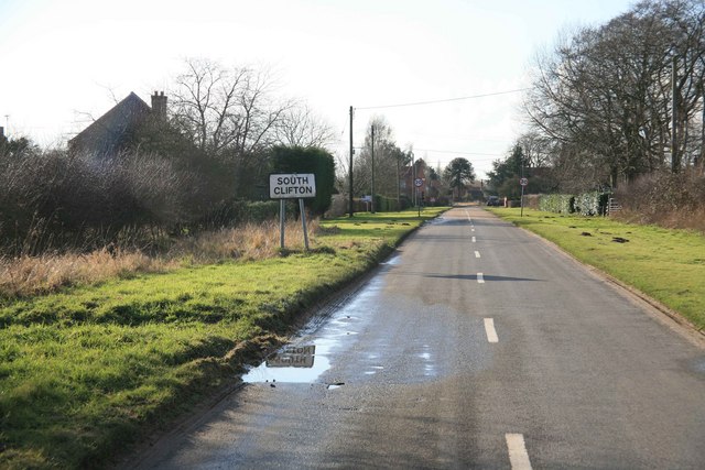
South Clifton
South Clifton is a village and civil parish in the Newark and Sherwood district of Nottinghamshire, England. It is 11 miles north of Newark-on-Trent. In...

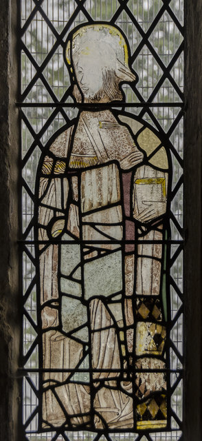
St George the Martyr's Church, North & South Clifton
St George the Martyr's Church, North and South Clifton is a Grade II* listed parish church in the Church of England in North Clifton, Nottinghamshire....

Clifton-on-Trent railway station
Clifton-on-Trent railway station is a former railway station between North Clifton and South Clifton in eastern Nottinghamshire, England. == Context... ==
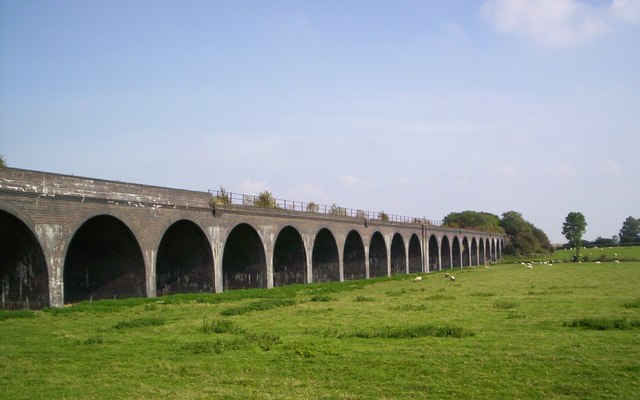
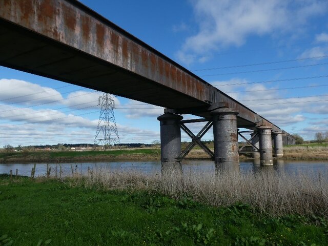
Fledborough Viaduct
Fledborough Viaduct is a former railway viaduct near Fledborough, Nottinghamshire which is now part of the national cycle network. == History == The viaduct...
Nearby Amenities
Located within 500m of 53.224457,-0.769922Have you been to South Clifton?
Leave your review of South Clifton below (or comments, questions and feedback).