Shanklin

Civil Parish in Hampshire

England

Shanklin

Luccombe Down looking towards Shanklin and Sandown Luccombe Down, Isle of Wight.  Looking towards Shanklin and Sandown, with the Pier at Sandown in the distance.
Luccombe Down looking towards Shanklin and Sandown Credit: Christine Matthews

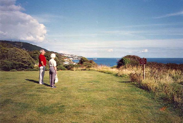
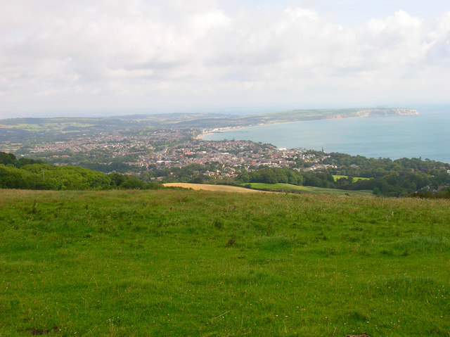
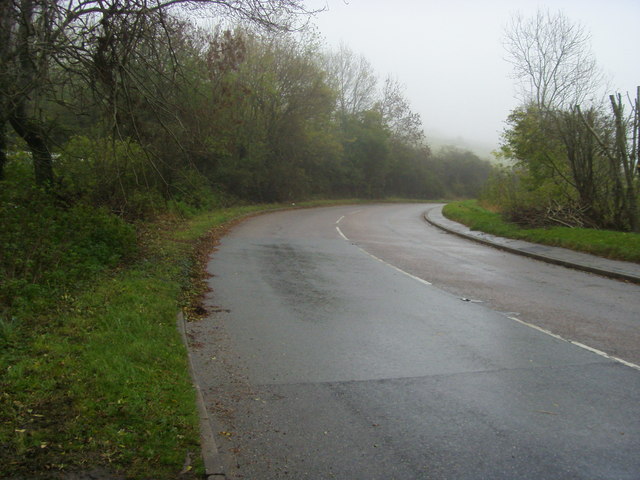
Shanklin is a civil parish located on the Isle of Wight, in the county of Hampshire, England. It is situated on the southern coast of the island, approximately 2 miles south of the town of Sandown. Shanklin is a popular tourist destination, known for its stunning sandy beaches, picturesque Old Village, and beautiful countryside.

The town has a population of around 9,500 people, which swells during the summer months due to the influx of tourists. Shanklin has a rich history, with evidence of human habitation dating back to the Bronze Age. The area was subsequently inhabited by the Romans, who left behind several archaeological remains.

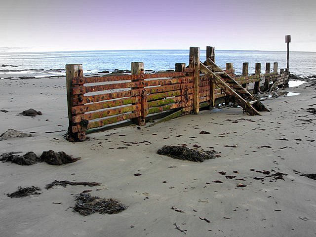
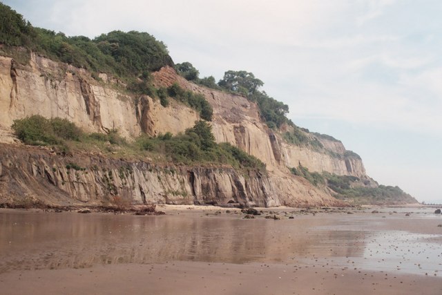
Shanklin's main attraction is its beautiful beach, which stretches for approximately a mile and offers a range of amenities, including beach huts, cafes, and water sports facilities. The town's esplanade is lined with hotels, restaurants, and shops, catering to the needs of visitors.

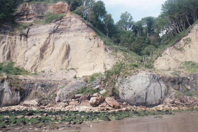
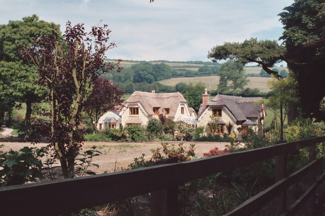
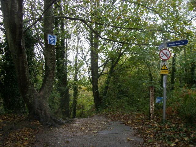
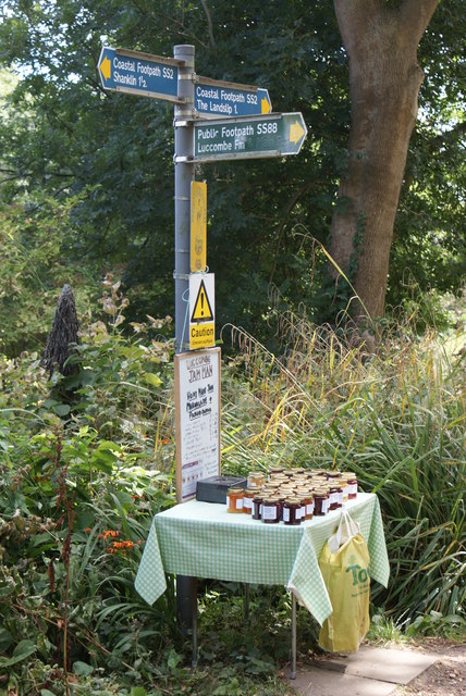
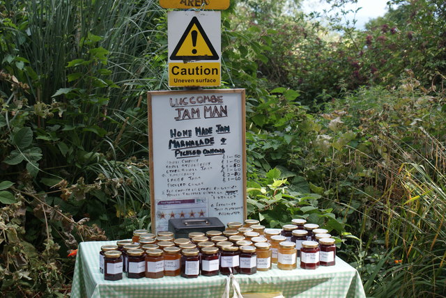
The Old Village of Shanklin is a charming area with thatched cottages, tea rooms, and traditional pubs. It is a popular spot for tourists to wander through the narrow streets and soak up the village's historical atmosphere. Shanklin Chine, a deep gorge with waterfalls and lush vegetation, is also a popular tourist attraction.

In addition to its natural beauty, Shanklin offers a range of activities and attractions for visitors. These include the Shanklin Theatre, which hosts a variety of performances throughout the year, and the Shanklin Seafront Complex, which offers indoor and outdoor entertainment options for all ages.

Overall, Shanklin is a picturesque coastal town with a rich history, beautiful beaches, and a wide range of amenities and attractions, making it a popular destination for tourists wishing to explore the Isle of Wight.

If you have any feedback on the listing, please let us know in the comments section below.
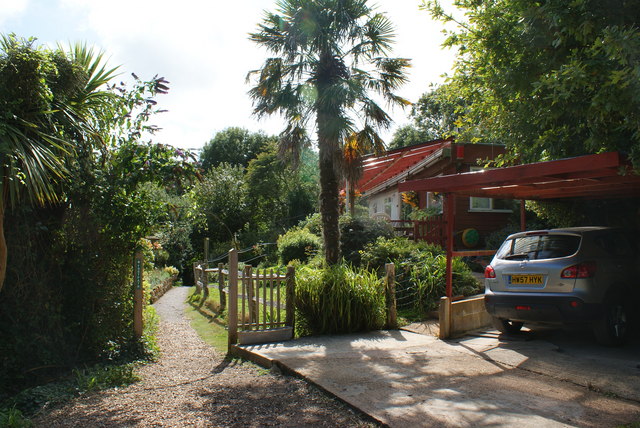
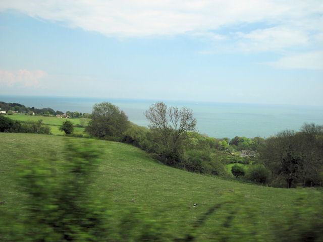
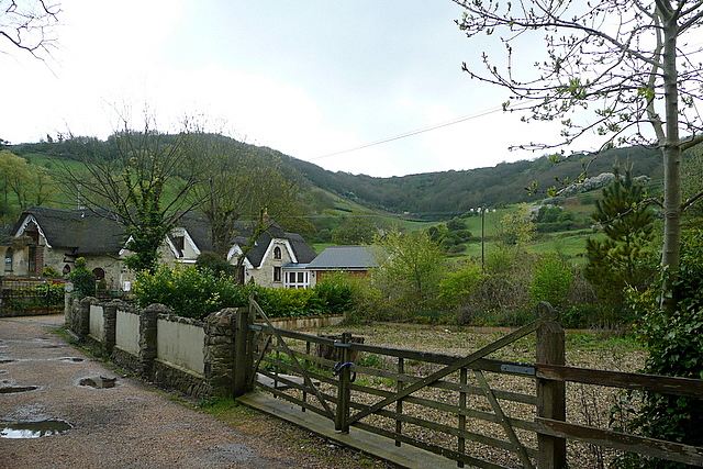
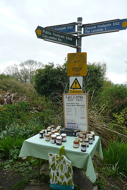
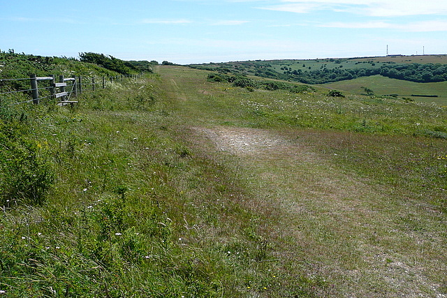
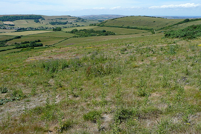
Shanklin Images

Images are sourced within 2km of 50.626316/-1.1868 or Grid Reference SZ5781. Thanks to Geograph Open Source API. All images are credited.

Luccombe Down looking towards Shanklin and Sandown Luccombe Down, Isle of Wight.  Looking towards Shanklin and Sandown, with the Pier at Sandown in the distance.
Luccombe Down looking towards Shanklin and Sandown
Luccombe Down, Isle of Wight. Looking towards Shanklin and Sandown, with the Pier at Sandown in the distance.
Old Breakwater Old breakwater on the beach beneath the cliffs at Luccombe. Culver Down just visible in the background across Sandown Bay.
Old Breakwater
Old breakwater on the beach beneath the cliffs at Luccombe. Culver Down just visible in the background across Sandown Bay.
Luccombe Down On the circular footpath from and to Wroxall, most of which is on a horseshoe of downland. The horses, however, appeared to be shoeless! In the distance on the right can be seen two of the disused circular coastal radar buildings.
Luccombe Down
On the circular footpath from and to Wroxall, most of which is on a horseshoe of downland. The horses, however, appeared to be shoeless! In the distance on the right can be seen two of the disused circular coastal radar buildings.
Luccombe Chine The steps have been replaced for access to Luccombe village
Luccombe Chine
The steps have been replaced for access to Luccombe village
The cliffs from Luccombe chine to Yellow Ledge
Shanklin Downs over the thatched cottages Taken from the start of the Landslip walk
Shanklin Downs over the thatched cottages
Taken from the start of the Landslip walk
Sandown Bay As viewed from Shanklin Down. Shanklin is in the foreground, Sandown in the centre near the pier and Culver Cliff bringing up the furthest point of the cliffs.
Sandown Bay
As viewed from Shanklin Down. Shanklin is in the foreground, Sandown in the centre near the pier and Culver Cliff bringing up the furthest point of the cliffs.
Shanklin Down Looking up the combe from the bridleway that links Shanklin Down with Middle Barn,
Shanklin Down
Looking up the combe from the bridleway that links Shanklin Down with Middle Barn,
A3055 heading to Shanklin A3055 by Luccombe Farm heading to Shanklin
A3055 heading to Shanklin
A3055 by Luccombe Farm heading to Shanklin
Coastal path Coastal path heading down to Luccombe village
Coastal path
Coastal path heading down to Luccombe village
Parting of the Ways The Coastal Footpath continues along the top of the cliffs, generally well wooded, whilst the path to the right goes to Luccombe Farm.
Parting of the Ways
The Coastal Footpath continues along the top of the cliffs, generally well wooded, whilst the path to the right goes to Luccombe Farm.
Luccombe Jam Man I presume that this display is as much for local customers as passing trade.  I was travelling light, so could not be tempted.
Luccombe Jam Man
I presume that this display is as much for local customers as passing trade. I was travelling light, so could not be tempted.
Footpath Near Luccombe This is the Coastal Footpath, and it runs straight across the garden of this house!
Footpath Near Luccombe
This is the Coastal Footpath, and it runs straight across the garden of this house!
View across fields from A3055 north of Nansen Hill
Luccombe Chine This is the view inland from the coastal path.  The house is at the bottom of a steep lane, which climbs up towards the Ventnor to Shanklin road that winds its way around the head of the chine just below the tree line.  Behind us the chine gets narrower and steeper as it drops quickly to the sea.
Luccombe Chine
This is the view inland from the coastal path. The house is at the bottom of a steep lane, which climbs up towards the Ventnor to Shanklin road that winds its way around the head of the chine just below the tree line. Behind us the chine gets narrower and steeper as it drops quickly to the sea.
Luccombe Jam Man This table has become a well-known stopping point on the coastal path between Ventnor and Shanklin, as people buy a memento of their visit.  Just in case you think he is being very trusting, the money box is welded to the table, which is chained to the footpath signpost.
Luccombe Jam Man
This table has become a well-known stopping point on the coastal path between Ventnor and Shanklin, as people buy a memento of their visit. Just in case you think he is being very trusting, the money box is welded to the table, which is chained to the footpath signpost.
Shanklin Down This is a good bridleway on broad downland towards the radar and radio masts at St. Boniface Down <a href="https://www.geograph.org.uk/gridref/SZ5678">SZ5678</a>.  It is usually much more popular with walkers.
Shanklin Down
This is a good bridleway on broad downland towards the radar and radio masts at St. Boniface Down SZ5678. It is usually much more popular with walkers.
From Shanklin Down Looking north-west from the wide downland with St. Martin's Down <a href="https://www.geograph.org.uk/gridref/SZ5680">SZ5680</a> to the right and Wroxall <a href="https://www.geograph.org.uk/gridref/SZ5579">SZ5579</a> in the valley to the left.
From Shanklin Down
Looking north-west from the wide downland with St. Martin's Down SZ5680 to the right and Wroxall SZ5579 in the valley to the left.
Show me another place!

Shanklin is located at Grid Ref: SZ5781 (Lat: 50.626316, Lng: -1.1868)

Unitary Authority: Isle of Wight

Police Authority: Hampshire

What 3 Words

///mailboxes.safe.succumbs. Near Shanklin, Isle of Wight

Related Wikis

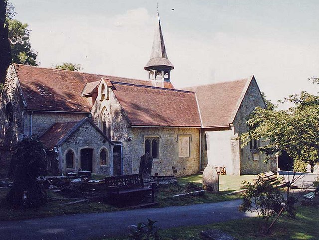
St Blasius Church, Shanklin

St. Blasius Church, Shanklin is a parish church in the Church of England located in Shanklin, Isle of Wight. The church is medieval but was largely rebuilt...

Shanklin Chine

Shanklin Chine is a geological feature and tourist attraction in the town of Shanklin, on the Isle of Wight, England. A wooded coastal ravine, it contains...

Church of St Saviour-on-the-Cliff, Shanklin

The Church of St. Saviour-on-the-Cliff, Shanklin is a Grade II Listed parish church in the Church of England located in Shanklin, Isle of Wight. ��2�...

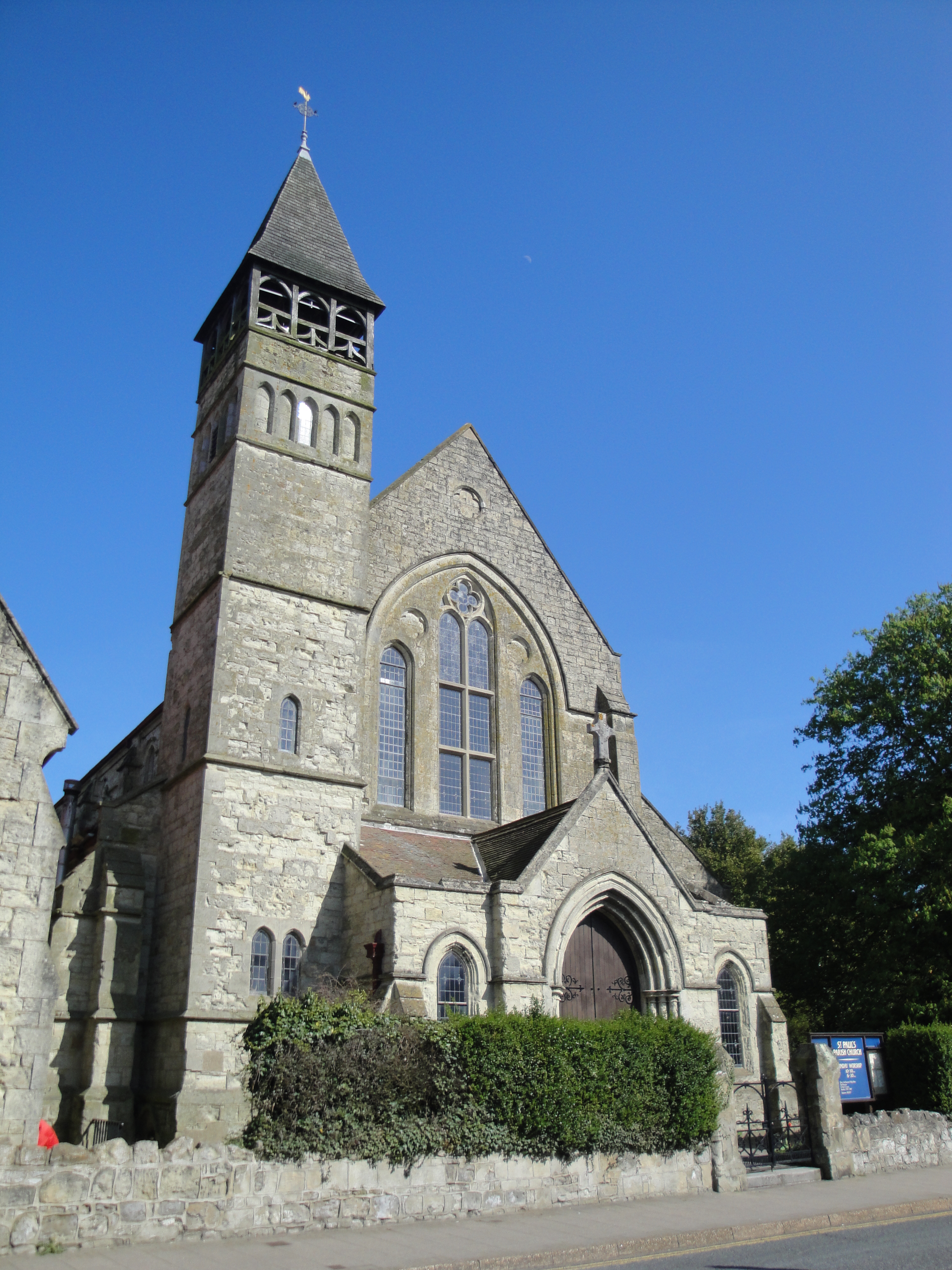
St Paul's Church, Gatten, Shanklin

St. Paul's Church, Gatten, Shanklin is a parish church in the Church of England located in Shanklin, Isle of Wight. == History == It is an ecclesiastical...

Shanklin railway station

Shanklin railway station is a Grade II listed railway station serving Shanklin on the Isle of Wight. It is the present terminus of the Island Line from...

Shanklin Pier

Shanklin Pier was a pleasure pier in the town of Shanklin on the Isle of Wight, England. Opened in August 1890 at a length of 1,200 feet (370 m), the pier...

Shanklin

Shanklin () is a seaside resort town and civil parish on the Isle of Wight, England, located on Sandown Bay. Shanklin is the southernmost of three settlements...

America Wood

America Wood (grid reference SZ567820) is a 21.4 hectare biological Site of Special Scientific Interest on the Isle of Wight, notified in 1986. Legend...

Nearby Amenities

Located within 500m of 50.626316,-1.1868
Turning Circle
Lat/Long: 50.6282502/-1.1853512
Turning Circle
Lat/Long: 50.6271294/-1.1933467
Chatsworth Avenue
Source: GPS waypoint
Lat/Long: 50.627298/-1.18831
Source: Bing
Lat/Long: 50.6256237/-1.1930349
Bus Stop
Shanklin Library
Bench: yes
Bin: no
Bus: yes
Contact Website: https://www.islandbuses.info/stops/230000003140
Naptan AtcoCode: 230000003140
Naptan Bearing: NW
Naptan CommonName: Library
Naptan Indicator: opp
Naptan NaptanCode: iowdadg
Naptan Street: Victoria Avenue
Public Transport: platform
Ref GB Uprn: 10025705547
Shelter: yes
Source: naptan_import
Survey Date: 2020-01-25
Tactile Paving: no
Lat/Long: 50.6274807/-1.1803401
Bus Stop
Shanklin Library
Bench: no
Bin: no
Bus: yes
Contact Website: https://www.islandbuses.info/stops/230000003150
Naptan AtcoCode: 230000003150
Naptan Bearing: SE
Naptan CommonName: Library
Naptan Indicator: adj
Naptan NaptanCode: iowdadj
Naptan Street: Victoria Avenue
Public Transport: platform
Shelter: no
Source: naptan_import
Survey Date: 2020-01-25
Tactile Paving: no
Lat/Long: 50.6277642/-1.1806199
Bus Stop
Tile House
Bench: yes
Bin: no
Bus: yes
Contact Website: https://www.islandbuses.info/stops/230000003410
Naptan AtcoCode: 230000003410
Naptan Bearing: NW
Naptan CommonName: Tile House
Naptan Indicator: adj
Naptan NaptanCode: iowdapa
Naptan Street: Victoria Avenue
Public Transport: platform
Ref GB Uprn: 10025734985
Shelter: yes
Source: naptan_import
Survey Date: 2020-01-25
Tactile Paving: no
Lat/Long: 50.6272343/-1.186041
Bus Stop
Westhill Road
Bench: yes
Bin: no
Bus: yes
Contact Website: https://www.islandbuses.info/stops/230000003480
Naptan AtcoCode: 230000003480
Naptan Bearing: NW
Naptan CommonName: Westhill Road
Naptan Indicator: adj
Naptan NaptanCode: iowdata
Naptan Street: Victoria Avenue
Public Transport: platform
Ref GB Uprn: 10025670767
Shelter: yes
Source: naptan_import
Survey Date: 2020-01-25
Tactile Paving: no
Lat/Long: 50.6272172/-1.1893232
Bus Stop
Westhill Road
Bench: yes
Bin: no
Bus: yes
Contact Website: https://www.islandbuses.info/stops/230000003650
Naptan AtcoCode: 230000003650
Naptan Bearing: SE
Naptan CommonName: Westhill Road
Naptan Indicator: opp
Naptan NaptanCode: iowdgam
Naptan Street: Victoria Avenue
Public Transport: platform
Shelter: yes
Source: naptan_import
Survey Date: 2020-01-25
Tactile Paving: no
Lat/Long: 50.6273115/-1.1882081
Bus Stop
Silver Trees East
Bench: no
Bin: no
Bus: yes
Contact Website: https://www.islandbuses.info/stops/230000003730
Naptan AtcoCode: 230000003730
Naptan Bearing: S
Naptan CommonName: Silver Trees layby
Naptan Indicator: Adj
Naptan NaptanCode: iowdgdp
Naptan Street: Silver Trees
Public Transport: platform
Shelter: yes
Source: naptan_import
Tactile Paving: no
Lat/Long: 50.6295648/-1.1912284
Bus Stop
Silver Trees West
Bench: no
Bin: no
Bus: yes
Contact Website: https://www.islandbuses.info/stops/230000003750
Naptan AtcoCode: 230000003750
Naptan Bearing: N
Naptan CommonName: Silver Trees
Naptan Indicator: outside number 74
Naptan NaptanCode: iowdgdw
Naptan Street: Silver Trees
Public Transport: platform
Shelter: no
Source: naptan_import
Tactile Paving: no
Lat/Long: 50.6290587/-1.1921842
Post Box
Check Date Collection Times: 2020-07-22
Collection Times: Mo-Fr 16:30; Sa 11:15; Su off
Operator: Royal Mail
Operator Wikidata: Q638098
Ref: PO37 61
Ref GB Uprn: 10015439148
Royal Cypher: GVIR
Royal Cypher Wikidata: Q33102169
Website: https://www.royalmail.com/services-near-you/postbox/victoria-avenue-po38-3es/0000PO3761
Lat/Long: 50.6273834/-1.1862934
Barrier: kissing_gate
Foot: yes
Lat/Long: 50.6296634/-1.186629
Barrier: stile
Foot: yes
Lat/Long: 50.6293193/-1.1886719
Barrier: stile
Foot: yes
Lat/Long: 50.6259784/-1.1879743
Barrier: kerb
Kerb: raised
Tactile Paving: no
Lat/Long: 50.6273505/-1.1926895
Barrier: kerb
Kerb: lowered
Tactile Paving: no
Lat/Long: 50.6273288/-1.1888238
Crossing
Crossing: unmarked
Crossing Island: no
Crossing Markings: no
Kerb: lowered
Tactile Paving: no
Lat/Long: 50.6273486/-1.1887418
Crossing
Check Date Crossing: 2021-03-15
Crossing: unmarked
Crossing Island: no
Tactile Paving: no
Lat/Long: 50.6273583/-1.192722
Crossing
Crossing Island: no
Lat/Long: 50.6264139/-1.1905015
Turning Circle
Lat/Long: 50.6286972/-1.1919555
Crossing
Crossing: unmarked
Crossing Island: no
Crossing Markings: no
Tactile Paving: no
Lat/Long: 50.6279855/-1.1810063
Sibden Hill
Ele: 80
Natural: peak
Lat/Long: 50.6288721/-1.1900267
Bench
Lat/Long: 50.6294949/-1.1900117
Noexit: yes
Lat/Long: 50.6272326/-1.1858214
Noexit: yes
Lat/Long: 50.6272836/-1.1854204
Noexit: yes
Lat/Long: 50.6272845/-1.1851978
Noexit: yes
Lat/Long: 50.6283384/-1.1809479
Noexit: yes
Lat/Long: 50.6284897/-1.1809608
Highmead
Addr City: Shanklin
Addr Country: GB
Addr Housenumber: 3
Addr Street: Highfield Road
Operator: Isle of Wight Council
Lat/Long: 50.6268849/-1.1830176
Social Facility
The Laurels
Addr City: Shanklin
Addr Country: GB
Addr Housenumber: 3
Addr Postcode: PO37 6PR
Addr Street: Highfield Road
Fhrs Id: 540503
Operator: Isle of Wight Council
Social Facility: assisted_living
Lat/Long: 50.6270344/-1.1831116
Addr City: Shanklin
Addr Country: GB
Addr Housenumber: 12
Addr Street: Florence Road
Entrance: home
Lat/Long: 50.6268942/-1.1811103
Addr City: Shanklin
Addr Country: GB
Addr Housename: The Wight House
Addr Housenumber: 11
Addr Street: Pomona Road
Entrance: home
Ref GB Uprn: 100062437713
Lat/Long: 50.6265897/-1.1803948
Addr City: Shanklin
Addr Country: GB
Addr Housenumber: 2A
Addr Street: Paddock Road
Entrance: home
Lat/Long: 50.6269448/-1.1809456
Addr City: Shanklin
Addr Country: GB
Addr Housenumber: 14
Addr Street: Florence Road
Entrance: home
Lat/Long: 50.6268459/-1.1810807
Addr City: Shanklin
Addr Country: GB
Addr Housename: Larch Cottage
Addr Street: Pomona Road
Entrance: home
Ref GB Uprn: 100062437885
Lat/Long: 50.6264883/-1.1804596
Bus Stop
Tile House
Bench: no
Bin: no
Bus: yes
Contact Website: https://www.islandbuses.info/stops/230000000801
Naptan AtcoCode: 230000000801
Public Transport: platform
Shelter: no
Survey Date: 2020-01-25
Tactile Paving: no
Lat/Long: 50.6273763/-1.1859039
Entrance: home
Lat/Long: 50.6292445/-1.1818925
Entrance: home
Lat/Long: 50.6292453/-1.1817993
Power: substation
Ref GB Uprn: 10025278677
Lat/Long: 50.6277615/-1.1830835
Orchardleigh Road
Operator: Scottish and Southern Electricity Networks
Operator Wikidata: Q43080530
Power: substation
Ref GB Uprn: 10024892346
Lat/Long: 50.6284165/-1.1805515
Old Shanklin Guest House
Addr City: Shanklin
Addr Country: GB
Addr Housenumber: 20
Addr Postcode: PO37 6NN
Addr Street: Grange Road
Contact Email: info@old-shanklin-guest-house.co.uk
Contact Phone: +44 1983 867796
Contact Website: https://www.old-shanklin-guest-house.co.uk/
Fhrs Id: 540853
Tourism: guest_house
Lat/Long: 50.6257265/-1.1798474
Hartlands
Addr City: Shanklin
Addr Country: GB
Addr Housenumber: 41
Addr Street: Victoria Avenue
Alt Name: Spectrum Breaks
Contact Email: support@spectrumbreaks.co.uk
Contact Facebook: https://www.facebook.com/spectrumbreaks/
Contact Phone: +44 1983 864 885
Contact Twitter: @spectrumbreaks
Contact Website: https://spectrumbreaks.co.uk/
Number Of Apartments: 4
Tourism: apartment
Wheelchair: yes
Lat/Long: 50.6276445/-1.1856772
Power: substation
Lat/Long: 50.6271222/-1.1903503
Entrance: main
Lat/Long: 50.6292353/-1.1836998
Defibrillator
Defibrillator Location: On outside wall of Shanklin Rifle and Pistol Club
Emergency: defibrillator
Indoor: no
Level: 0
Opening Hours: 24/7
Wheelchair: no
Lat/Long: 50.6292394/-1.1837023
Noexit: yes
Lat/Long: 50.6292118/-1.1838215
Shanklin Rifle and Pistol Club
Addr City: Shanklin
Addr Country: GB
Addr Street: Sibden Road
Club: sport
Sport: shooting
Lat/Long: 50.6292532/-1.1836595
Rectory Road
Operator: Scottish and Southern Electricity Networks
Operator Wikidata: Q43080530
Power: substation
Ref: 3514441
Ref GB Uprn: 10024888139
Lat/Long: 50.6251194/-1.1808063
Ref GB Uprn: 10024893379
Was Amenity: telephone
Lat/Long: 50.6275454/-1.1801679
Waste Basket
Waste: dog_excrement
Lat/Long: 50.6252203/-1.1808376
Westhill Road
Operator: Scottish and Southern Electricity Networks
Operator Wikidata: Q43080530
Power: substation
Ref: 3516076
Ref GB Uprn: 10024890231
Lat/Long: 50.6250656/-1.1864915
Defibrillator
Covered: yes
Defibrillator Location: In a passage way through the building at Shanklin Cricket Club
Emergency: defibrillator
Indoor: no
Level: 0
Opening Hours: 24/7
Ref GB The Circuit: 4D40CF24-726E-4FBD-8090-AF8D01009138
Lat/Long: 50.62409/-1.1854606
Community Centre
Shanklin Performing Arts
Addr City: Shanklin
Addr Country: GB
Addr Street: Victoria Avenue
Opening Hours Signed: no
Lat/Long: 50.6275998/-1.1802605
Playground: slide
Lat/Long: 50.6243852/-1.1825518
Playground: structure
Lat/Long: 50.6243763/-1.1825497
Baby: yes
Playground: swing
Lat/Long: 50.624469/-1.1825632
Bench
Lat/Long: 50.6244473/-1.1822916
Playground: yes
Lat/Long: 50.624566/-1.1824559
Playground: seesaw
Lat/Long: 50.6245132/-1.1824324
Playground: swing
Lat/Long: 50.6244384/-1.182417
Barrier: kissing_gate
Lat/Long: 50.6300626/-1.1835711
Playground: rotator
Lat/Long: 50.6301345/-1.1838428
Playground: rotator
Lat/Long: 50.6301515/-1.1837683
Waste Basket
Waste: trash
Lat/Long: 50.6300963/-1.1835695
Bench
Backrest: yes
Lat/Long: 50.6300959/-1.1835526
Waste Basket
Waste: trash
Lat/Long: 50.6302286/-1.1833002
Bench
Backrest: yes
Lat/Long: 50.6302174/-1.1832806
Playground: structure
Lat/Long: 50.6301327/-1.1837886
Playground: climbingframe
Lat/Long: 50.6301164/-1.1835929
Playground: springy
Playground Theme: skateboard
Lat/Long: 50.6301262/-1.1834368
Playground: climbingframe
Lat/Long: 50.6301724/-1.1833357
Playground: tireswing
Lat/Long: 50.6301862/-1.1835212
Playground: climbingframe
Lat/Long: 50.6302227/-1.1836735
Capacity: 2
Capacity Baby: 0
Playground: swing
Lat/Long: 50.6302268/-1.1838283
Capacity: 2
Capacity Baby: 2
Playground: swing
Lat/Long: 50.6301903/-1.1839076
Generator Solar Modules: 6
Generator Source: solar
Location: roof
Power: generator
Lat/Long: 50.630389/-1.1870143
Generator Solar Modules: 5
Generator Source: solar
Location: roof
Power: generator
Lat/Long: 50.6253016/-1.1854866
Generator Solar Modules: 10
Generator Source: solar
Location: roof
Power: generator
Lat/Long: 50.6260264/-1.1932337
Information: board
Tourism: information
Lat/Long: 50.6239143/-1.1859414
Bench
Backrest: yes
Lat/Long: 50.6288113/-1.1859924
Barrier: kerb
Kerb: lowered
Tactile Paving: yes
Lat/Long: 50.6286686/-1.1809559
Barrier: kerb
Kerb: lowered
Tactile Paving: yes
Lat/Long: 50.6286999/-1.180953
Barrier: kerb
Kerb: raised
Tactile Paving: no
Lat/Long: 50.627994/-1.1810424
Barrier: kerb
Kerb: raised
Tactile Paving: no
Lat/Long: 50.6279779/-1.1809738
Give Way
Lat/Long: 50.6279326/-1.1810487
Give Way
Lat/Long: 50.6285863/-1.1810252
Crossing
Crossing: unmarked
Crossing Markings: no
Tactile Paving: yes
Lat/Long: 50.628686/-1.1809543
Give Way
Lat/Long: 50.6286884/-1.1810449
Crossing
Crossing: unmarked
Crossing Markings: no
Tactile Paving: no
Lat/Long: 50.6285868/-1.1810421
Barrier: kerb
Kerb: no
Tactile Paving: no
Lat/Long: 50.6285586/-1.1810405
Fixme: continue
Lat/Long: 50.6279112/-1.180927
Barrier: kerb
Kerb: no
Tactile Paving: no
Lat/Long: 50.6286182/-1.1810438
Power: substation
Lat/Long: 50.6266917/-1.1881428
Bicycle Rental
Westhill Road
Bicycle Rental: dropoff_point
Brand: Beryl
Brand Wikidata: Q106575365
Capacity: 5
Email: support@beryl.cc
Fee: yes
Name Signed: no
Network: Beryl
Network Wikidata: Q106575365
Official Name: Westhill Road
Operator: Beryl
Operator Wikidata: Q106575369
Payment App: yes
Payment App Android: cc.beryl.basis
Payment App Ios: 1386768364
Payment Cash: no
Payment Credit Cards: no
Payment Cryptocurrencies: no
Payment Debit Cards: no
Payment Electronic Purses: no
Phone: +44 20 3003 5044
Ref Gbfs: beryl_isle_of_wight:2867
Rental: ebike;escooter
Website: https://beryl.cc/scheme/isle-wight
Lat/Long: 50.6271019/-1.188472
Addr City: Shanklin
Addr Country: GB
Addr Housenumber: 8B
Addr Street: Victoria Avenue
Entrance: home
Lat/Long: 50.6276558/-1.1806639
Addr City: Shanklin
Addr Country: GB
Addr Housenumber: 8A
Addr Street: Victoria Avenue
Entrance: home
Lat/Long: 50.6276484/-1.1807615
Fixme: continue
Lat/Long: 50.6291297/-1.1838748
Fixme: continue
Lat/Long: 50.6290673/-1.1838573
Fixme: continue
Lat/Long: 50.627901/-1.1831117
Addr City: Shanklin
Addr Country: GB
Addr Housenumber: 9A
Addr Street: Furze Hill Road
Entrance: home
Lat/Long: 50.628791/-1.1833434
Barrier: bollard
Lat/Long: 50.622975/-1.1841671
Bench
Lat/Long: 50.6229418/-1.1834543
Bench
Lat/Long: 50.6229886/-1.1835314
Bench
Lat/Long: 50.6230469/-1.1836045
Waste Basket
Waste: trash
Lat/Long: 50.6243773/-1.1822882
Bench
Lat/Long: 50.6243078/-1.1809277
Bench
Lat/Long: 50.6244065/-1.1810712
Bench
Lat/Long: 50.6230192/-1.1825699
Bench
Lat/Long: 50.6230116/-1.1824894
Bench
Lat/Long: 50.6230711/-1.1825725
Crossing
Lat/Long: 50.627219/-1.1885556
Crossing
Crossing Island: no
Lat/Long: 50.6271577/-1.1905271
Crossing
Crossing Island: no
Lat/Long: 50.6271984/-1.1904751
Generator Source: solar
Location: roof
Power: generator
Lat/Long: 50.6267576/-1.190756
Brand: Mer
Brand Wikidata: Q100821564
Capacity: 2
Man Made: charge_point
Lat/Long: 50.6282864/-1.1808191
Brand: Mer
Brand Wikidata: Q100821564
Capacity: 2
Man Made: charge_point
Lat/Long: 50.6282808/-1.1809082
Bench
Lat/Long: 50.6225793/-1.1833839
Waste Basket
Check Date: 2023-02-19
Lat/Long: 50.6232124/-1.1817867
Bench
Lat/Long: 50.6231758/-1.1818457
Bench
Lat/Long: 50.6231868/-1.181902
Bench
Lat/Long: 50.6231554/-1.1819141
Waste Basket
Check Date: 2023-02-19
Waste: dog_excrement
Lat/Long: 50.6251377/-1.1818537
Charging Station
Brand: Mer
Brand Wikidata: Q100821564
Capacity: 4
Lat/Long: 50.6282974/-1.1808787
The data included in this document is from www.openstreetmap.org. The data is made available under ODbL.

Have you been to Shanklin?

Leave your review of Shanklin below (or comments, questions and feedback).