Parlington

Civil Parish in Yorkshire Leeds

England

Parlington

Old milestone At the southern end of Aberford on the route of the Great North Road/A1, now unclassified, is this West Riding CC milestone.  It is near the entrance to St Wilfrid's Priory on the east side of the road.  This is another metal attachment with deteriorating paintwork even though it is so near the village centre and is Grade II listed, 1200719
Old milestone Credit: Chris Minto

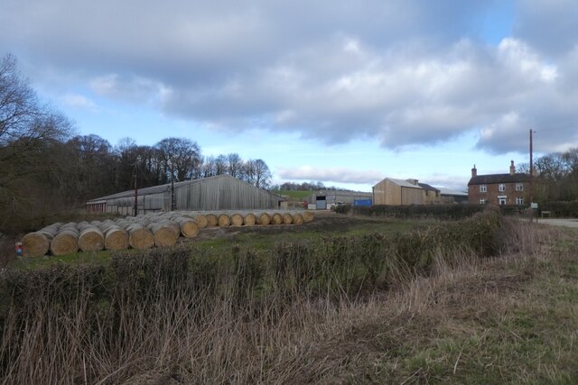
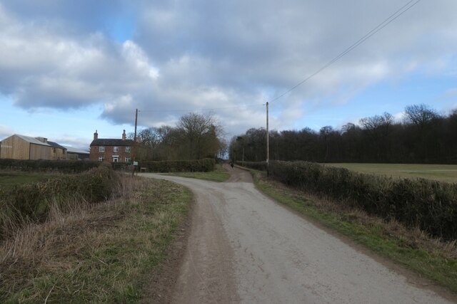
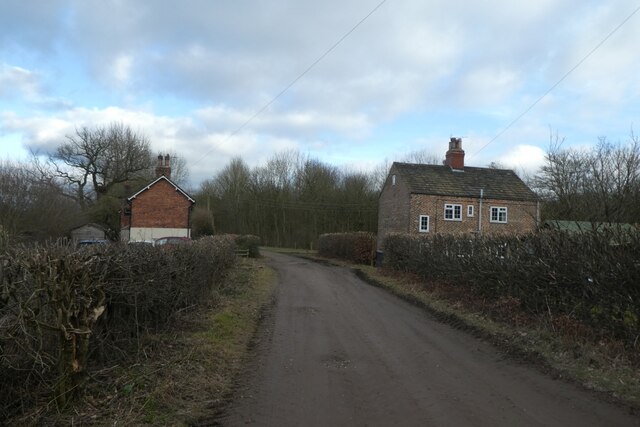
Parlington is a civil parish located in the county of Yorkshire, England. Situated approximately 15 miles east of Leeds, it encompasses an area of about 2,000 acres. The parish is made up of a small cluster of farms and residential properties, surrounded by picturesque countryside and farmland.

The history of Parlington can be traced back to the Domesday Book, where it is mentioned as part of the estate of Ilbert de Lacy. Over the centuries, the area remained predominantly rural, with farming being the main occupation of its inhabitants.

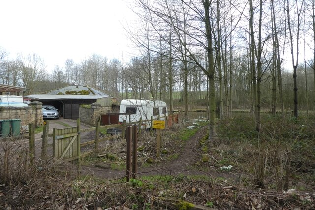
One notable feature of Parlington is Parlington Hall, a grand country mansion that was built in the late 18th century. The hall, designed in the classical style, is set within stunning landscaped gardens and parkland. Although the hall itself is privately owned and not accessible to the public, the surrounding grounds provide a popular spot for leisurely walks and picnics.

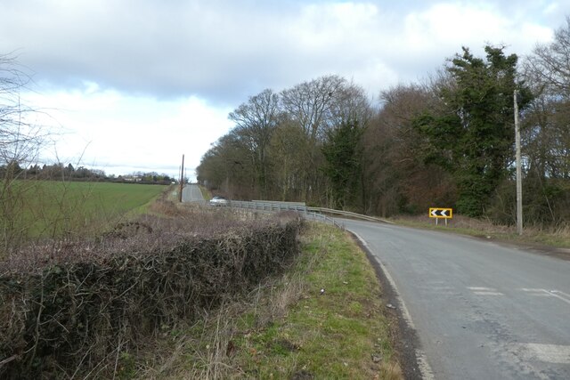
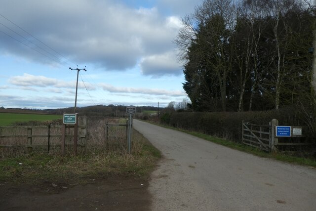
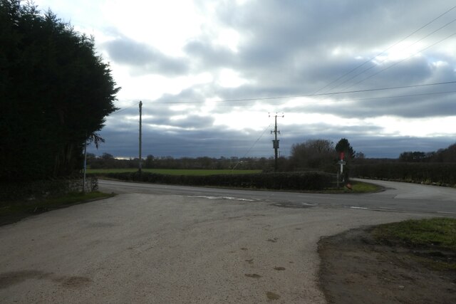
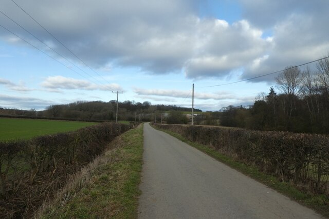
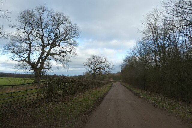
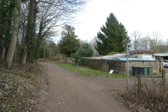
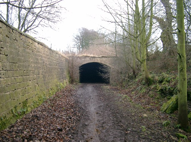
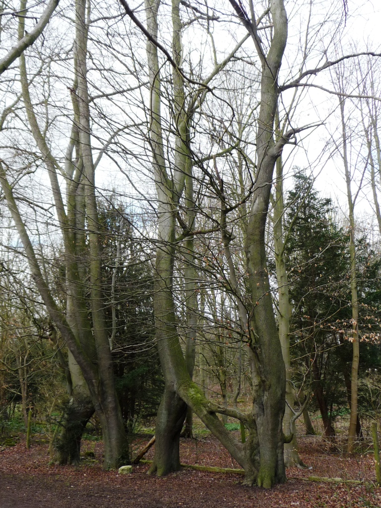
The parish also boasts a number of footpaths and bridleways, making it an attractive destination for outdoor enthusiasts. These paths meander through rolling hills, fields, and woodlands, offering visitors the opportunity to explore the natural beauty of the area.

Today, Parlington remains a quiet and idyllic parish, known for its tranquility and scenic charm. Its rural setting and close proximity to Leeds make it an attractive location for those seeking a peaceful countryside lifestyle while still having access to urban amenities.

If you have any feedback on the listing, please let us know in the comments section below.
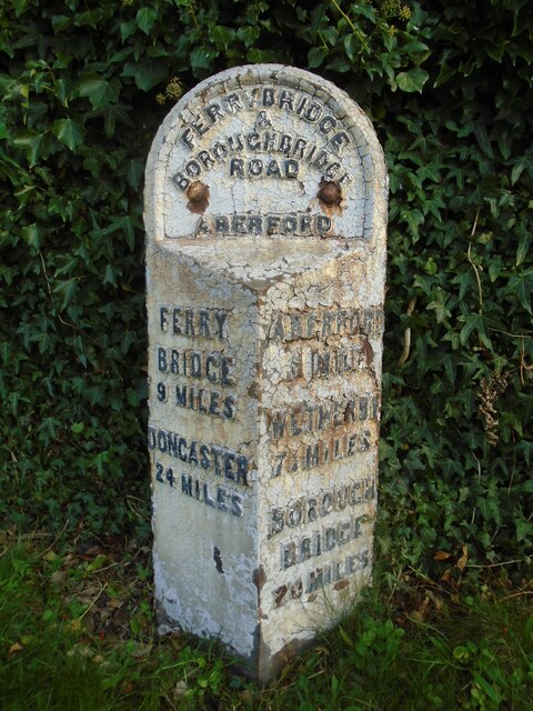
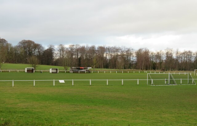
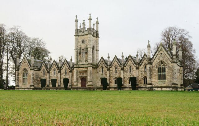
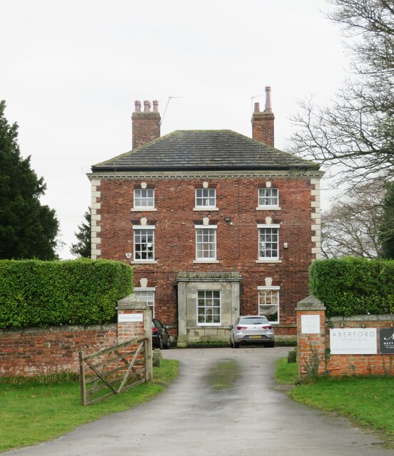
Parlington Images

Images are sourced within 2km of 53.818702/-1.365023 or Grid Reference SE4136. Thanks to Geograph Open Source API. All images are credited.

Old milestone At the southern end of Aberford on the route of the Great North Road/A1, now unclassified, is this West Riding CC milestone.  It is near the entrance to St Wilfrid's Priory on the east side of the road.  This is another metal attachment with deteriorating paintwork even though it is so near the village centre and is Grade II listed, 1200719
Old milestone
At the southern end of Aberford on the route of the Great North Road/A1, now unclassified, is this West Riding CC milestone. It is near the entrance to St Wilfrid's Priory on the east side of the road. This is another metal attachment with deteriorating paintwork even though it is so near the village centre and is Grade II listed, 1200719
Football ground, Aberford The ground is in a field to the west side of the old A1. It looks as though the main stand could accommodate at least 10 spectators.
Football ground, Aberford
The ground is in a field to the west side of the old A1. It looks as though the main stand could accommodate at least 10 spectators.
Former Catholic chapel, Aberford Now part of a private residence, this simple building was a very early [1793] Catholic place of worship, following the Catholic Relief Act of 1791.
Former Catholic chapel, Aberford
Now part of a private residence, this simple building was a very early [1793] Catholic place of worship, following the Catholic Relief Act of 1791.
The Gascoigne Almshouses A prominent feature on the southern approach to Aberford, this rather splendid building dates from c1844 and is now offices.
The Gascoigne Almshouses
A prominent feature on the southern approach to Aberford, this rather splendid building dates from c1844 and is now offices.
Hicklam House A rather fine mid 18th century house on the southern fringe of Aberford village.
Hicklam House
A rather fine mid 18th century house on the southern fringe of Aberford village.
Almost at the end of M1 Looking north east along the last few hundred metres of the M1 heading towards Junction 48 at Hook Moor, where it joins A1(M) which has reached J43. The overbridge in the middle distance is carrying the northbound carriageway of A1(M). These roads date from major upgrades and alterations in 1999.
Almost at the end of M1
Looking north east along the last few hundred metres of the M1 heading towards Junction 48 at Hook Moor, where it joins A1(M) which has reached J43. The overbridge in the middle distance is carrying the northbound carriageway of A1(M). These roads date from major upgrades and alterations in 1999.
M1 heading south west from Hook Moor The beginnings of M1 at its northern end where is cuts through a shallow cutting where the Roman Road once crossed. Signs in the distance herald the approach in 1 mile to J47.
M1 heading south west from Hook Moor
The beginnings of M1 at its northern end where is cuts through a shallow cutting where the Roman Road once crossed. Signs in the distance herald the approach in 1 mile to J47.
M1 Northbound from Parlington Interchange, near Garforth Leeds Image of the M1 northbound heading towards its junction with the A1M. Image taken, after a snowfall, from the Parlington Interchange which is the junction of the B1217 Aberford Road with the M1.
M1 Northbound from Parlington Interchange, near Garforth Leeds
Image of the M1 northbound heading towards its junction with the A1M. Image taken, after a snowfall, from the Parlington Interchange which is the junction of the B1217 Aberford Road with the M1.
Barwick Road crossing Cock Beck The bridge carries the road and NCN66 over Cock Beck.
Barwick Road crossing Cock Beck
The bridge carries the road and NCN66 over Cock Beck.
Parlington Lane from Barwick Road A bridleway runs along Parlington Road between Barwick Road and Aberford. This path forms part of National Cycle Network route 66, with this section connecting Leeds and York.
Parlington Lane from Barwick Road
A bridleway runs along Parlington Road between Barwick Road and Aberford. This path forms part of National Cycle Network route 66, with this section connecting Leeds and York.
Junction with Barwick Road A bridleway runs along Parlington Road between Barwick Road and Aberford. This path forms part of National Cycle Network route 66, with this section connecting Leeds and York.
Junction with Barwick Road
A bridleway runs along Parlington Road between Barwick Road and Aberford. This path forms part of National Cycle Network route 66, with this section connecting Leeds and York.
Along Parlington Road A bridleway runs along Parlington Road between Barwick Road and Aberford. This path forms part of National Cycle Network route 66, with this section connecting Leeds and York.
Along Parlington Road
A bridleway runs along Parlington Road between Barwick Road and Aberford. This path forms part of National Cycle Network route 66, with this section connecting Leeds and York.
Throstle Nest Farm Located along Parlington Lane.
Throstle Nest Farm
Located along Parlington Lane.
Parlington Lane near Throstle Nest Farm A bridleway runs along Parlington Road between Barwick Road and Aberford. This path forms part of National Cycle Network route 66, with this section connecting Leeds and York.
Parlington Lane near Throstle Nest Farm
A bridleway runs along Parlington Road between Barwick Road and Aberford. This path forms part of National Cycle Network route 66, with this section connecting Leeds and York.
Parlington Lane east of Throstle Nest Farm A bridleway runs along Parlington Road between Barwick Road and Aberford. This path forms part of National Cycle Network route 66, with this section connecting Leeds and York.
Parlington Lane east of Throstle Nest Farm
A bridleway runs along Parlington Road between Barwick Road and Aberford. This path forms part of National Cycle Network route 66, with this section connecting Leeds and York.
Parlington Lane passing Staith Cottage A bridleway runs along Parlington Road between Barwick Road and Aberford. This path forms part of National Cycle Network route 66, with this section connecting Leeds and York.
Parlington Lane passing Staith Cottage
A bridleway runs along Parlington Road between Barwick Road and Aberford. This path forms part of National Cycle Network route 66, with this section connecting Leeds and York.
Fishing pool near Gamekeepers Cottage Looking towards a fishing pool beside Parlington Lane.
Fishing pool near Gamekeepers Cottage
Looking towards a fishing pool beside Parlington Lane.
Parlington Lane near Gamekeepers Cottage A bridleway runs along Parlington Road between Barwick Road and Aberford. This path forms part of National Cycle Network route 66, with this section connecting Leeds and York.
Parlington Lane near Gamekeepers Cottage
A bridleway runs along Parlington Road between Barwick Road and Aberford. This path forms part of National Cycle Network route 66, with this section connecting Leeds and York.
Show me another place!

Parlington is located at Grid Ref: SE4136 (Lat: 53.818702, Lng: -1.365023)

Division: West Riding

Administrative County: West Yorkshire

District: Leeds

Police Authority: West Yorkshire

What 3 Words

///estuaries.believer.pizza. Near Aberford, West Yorkshire

Related Wikis

Parlington

Parlington is a civil parish that includes part of Aberford, in the City of Leeds in West Yorkshire, England. In 2001 the parish had a population of 87...
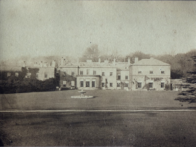
Parlington Hall

Parlington Hall was the seat of the Gascoigne family, Aberford near Leeds in West Yorkshire, England. == History == The Parlington estate was acquired...

Nellie's Tree

Nellie's Tree (also known as the Love Tree) near Aberford, West Yorkshire is a group of three beech trees that have been grafted together in the shape...

Aberford railway station

Aberford railway station served the village of Aberford, West Yorkshire, England, from 1837 to 1924 on the Aberford Railway. == History == The station...

Nearby Amenities

Located within 500m of 53.818702,-1.365023
Bathingwell Platation
Natural: wood
Lat/Long: 53.8150266/-1.3667977
Noexit: yes
Lat/Long: 53.8220593/-1.3663767
Noexit: yes
Lat/Long: 53.8217786/-1.366487
Noexit: yes
Lat/Long: 53.8206465/-1.3604736
The data included in this document is from www.openstreetmap.org. The data is made available under ODbL.

Have you been to Parlington?

Leave your review of Parlington below (or comments, questions and feedback).