Parracombe

Civil Parish in Devon North Devon

England

Parracombe

Parracombe: course of Lynton & Barnstaple Railway In the gardens at Fair View in 1993 the railway walk was open to paying visitors on summer Saturdays and Sundays
Parracombe: course of Lynton & Barnstaple Railway Credit: Martin Bodman

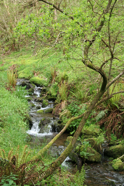
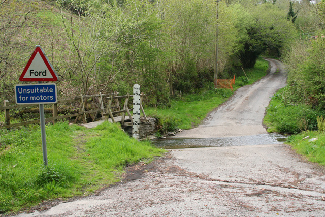
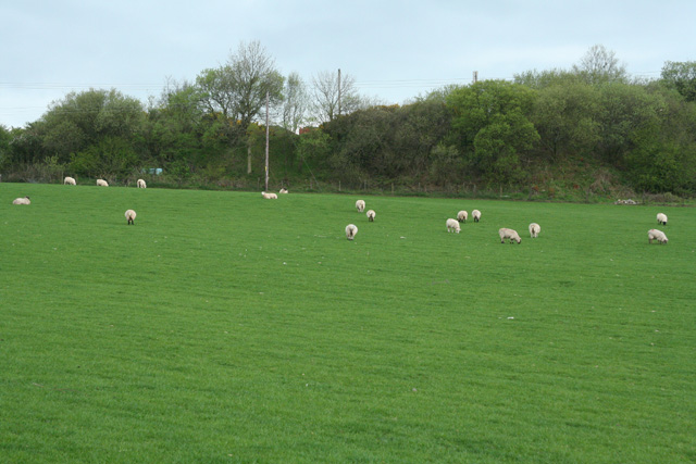
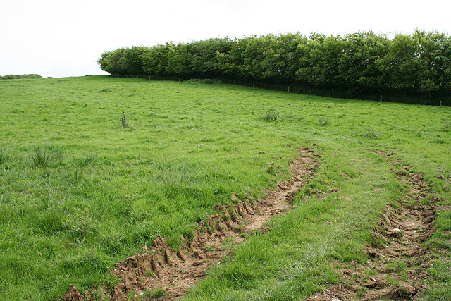
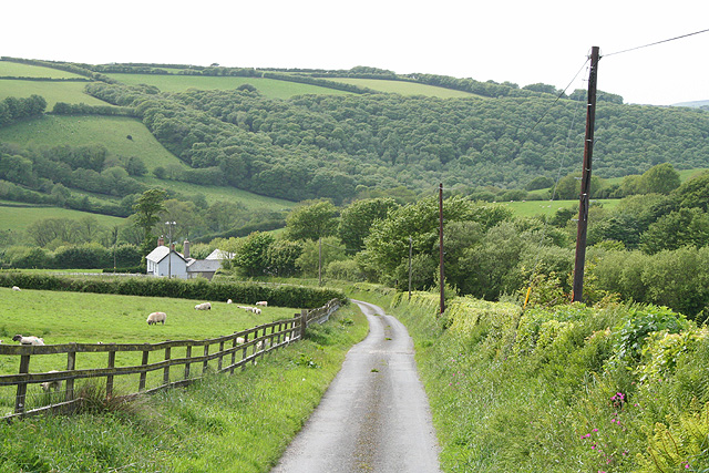
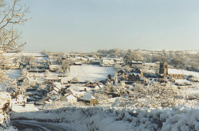
Parracombe is a civil parish located in the county of Devon, England. Situated on the edge of Exmoor National Park, it covers an area of approximately 17 square kilometers. The village itself is nestled in a picturesque valley, surrounded by rolling hills and woodlands.

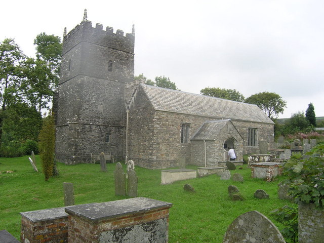
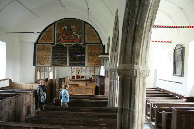
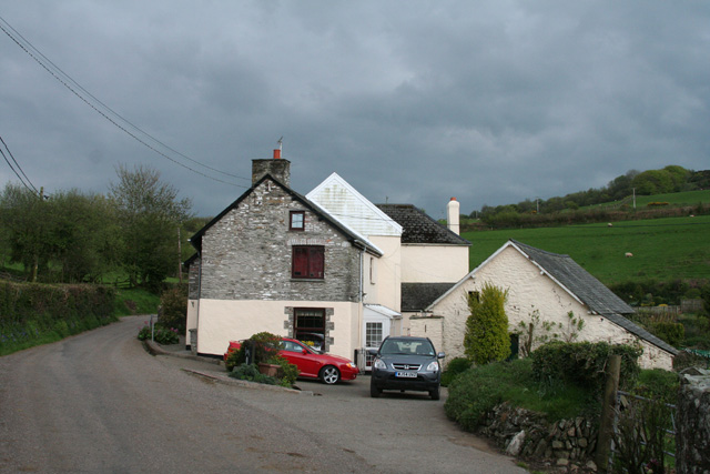
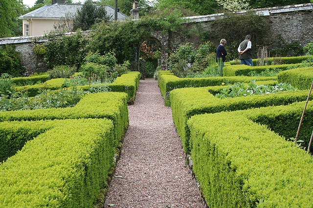
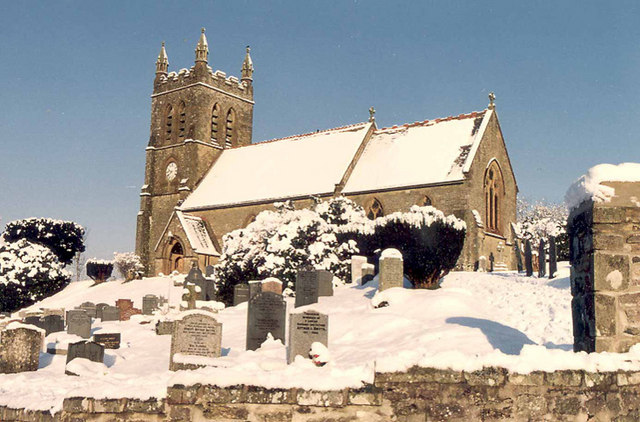
With a population of around 400 residents, Parracombe has a close-knit community atmosphere. The village is known for its charming thatched cottages, traditional stone buildings, and a 13th-century church dedicated to St. Petrock. The church is a focal point of the village and is often visited by tourists for its beautiful architecture and historical significance.

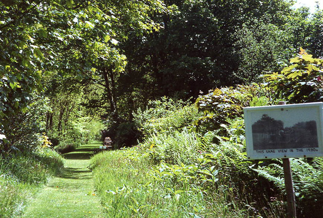
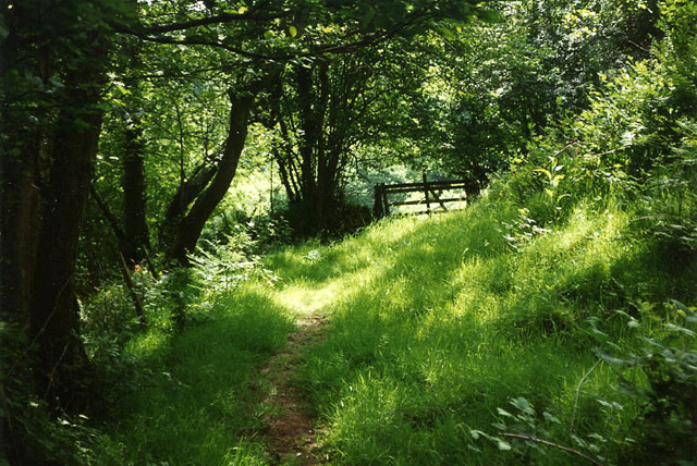
The surrounding landscape offers stunning natural beauty, making Parracombe a popular destination for outdoor enthusiasts. The nearby Exmoor National Park provides ample opportunities for hiking, cycling, and horseback riding through its scenic trails. The village is also located close to the North Devon coast, offering easy access to sandy beaches and picturesque coastal walks.

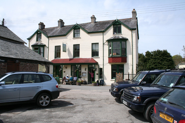
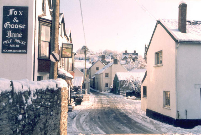
Parracombe is well-served by local amenities, including a village shop, a post office, and a primary school. The village also has a pub, the Fox and Goose, which is a popular spot for locals and visitors alike to enjoy a drink or a meal.

Overall, Parracombe offers a tranquil and idyllic setting for those seeking a peaceful rural lifestyle or a retreat in the heart of Devon's natural beauty.

If you have any feedback on the listing, please let us know in the comments section below.
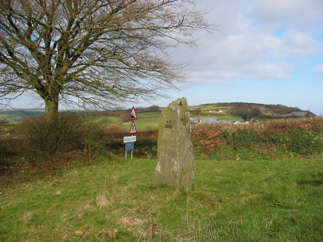
Parracombe Images

Images are sourced within 2km of 51.188517/-3.911243 or Grid Reference SS6644. Thanks to Geograph Open Source API. All images are credited.

Parracombe: course of Lynton & Barnstaple Railway In the gardens at Fair View in 1993 the railway walk was open to paying visitors on summer Saturdays and Sundays
Parracombe: course of Lynton & Barnstaple Railway
In the gardens at Fair View in 1993 the railway walk was open to paying visitors on summer Saturdays and Sundays
Parracombe: near Bumsley Mill Footpath in the Heddon valley
Parracombe: near Bumsley Mill
Footpath in the Heddon valley
Parracombe Old church of St Petrock is now in the care of the Churches Conservation Trust - full of C18 fittings and in a time-warp, thanks to the new church being built in the village.
Parracombe Old church of St Petrock
is now in the care of the Churches Conservation Trust - full of C18 fittings and in a time-warp, thanks to the new church being built in the village.
Parracombe: The Fox & Goose Inn A pub with an entry in the Good Pub Guide 2005. Looking north west from the car park across the street
Parracombe: The Fox & Goose Inn
A pub with an entry in the Good Pub Guide 2005. Looking north west from the car park across the street
Parracombe: St Petrock’s church Or Parracombe old church, saved from destruction in the 1870s by John Ruskin and others. It retains its Georgian box pews and pulpit. A new church was erected nearer the village centre in 1878
Parracombe: St Petrock’s church
Or Parracombe old church, saved from destruction in the 1870s by John Ruskin and others. It retains its Georgian box pews and pulpit. A new church was erected nearer the village centre in 1878
Martinhoe: stream near Kittitoe Looking east-south-east by the road from Hunters Inn to Killington Cross and the A39.
Martinhoe: stream near Kittitoe
Looking east-south-east by the road from Hunters Inn to Killington Cross and the A39.
Martinhoe: ford near Kittitoe Looking north on a lane to Kemacott
Martinhoe: ford near Kittitoe
Looking north on a lane to Kemacott
Martinhoe: house at Killington Looking south east by the road from Hunters Inn to Killington Cross and the A39.
Martinhoe: house at Killington
Looking south east by the road from Hunters Inn to Killington Cross and the A39.
Martinhoe: towards Higher Bodley Beyond the field boundary lie old quarry workings. Looking south-south-west
Martinhoe: towards Higher Bodley
Beyond the field boundary lie old quarry workings. Looking south-south-west
Martinhoe: towards Killington Looking west-north-west from the A39 road. Towards the foreground, by the tree, the narrow-gauge Lynton & Barnstaple Railway now runs from Woody Bay Station to Killington Lane, outside Parracombe (summer 2006). In the distance are Trentishoe Down, 324m high, and Holdstone Hill at 349m
Martinhoe: towards Killington
Looking west-north-west from the A39 road. Towards the foreground, by the tree, the narrow-gauge Lynton & Barnstaple Railway now runs from Woody Bay Station to Killington Lane, outside Parracombe (summer 2006). In the distance are Trentishoe Down, 324m high, and Holdstone Hill at 349m
Parracombe: Heddon Hall The walled garden seen here was designed by Penelope Hobhouse. Looking west-south-west. See also <span class="nowrap"><a title="http://www.heddonhallgardens.co.uk" rel="nofollow ugc noopener" href="http://www.heddonhallgardens.co.uk">Link</a><img style="margin-left:2px;" alt="External link" title="External link - shift click to open in new window" src="https://s1.geograph.org.uk/img/external.png" width="10" height="10"/></span> - the gardens are now only open to groups of 10 or more. In Parracombe parish
Parracombe: Heddon Hall
The walled garden seen here was designed by Penelope Hobhouse. Looking west-south-west. See also LinkExternal link - the gardens are now only open to groups of 10 or more. In Parracombe parish
Parracombe: below Rowley Down On the bridleway to Brockenbarrow. Looking south
Parracombe: below Rowley Down
On the bridleway to Brockenbarrow. Looking south
Parracombe: at Rowley Gate The access lane to Rowley Barton. Looking west-north-west
Parracombe: at Rowley Gate
The access lane to Rowley Barton. Looking west-north-west
Christ Church, Parracombe The new Church built in 1878 when St.Petrocks Churchtown was abandoned.
Christ Church, Parracombe
The new Church built in 1878 when St.Petrocks Churchtown was abandoned.
The Centre of Parracombe in winter Very occasionally snow prevented vehicles getting up the 1:4 and 1:5 hills out of the village.
The Centre of Parracombe in winter
Very occasionally snow prevented vehicles getting up the 1:4 and 1:5 hills out of the village.
A Winter landscape of Parracombe A delightful village on the River Heddon. Population in the village around 110 and in the Parish around 310.
A Winter landscape of Parracombe
A delightful village on the River Heddon. Population in the village around 110 and in the Parish around 310.
Dick Smythe One time Exmoor shepherd, a Parracombe postman, an innumerable odd jobs man and a great raconteur - that is if you could understand the local dialect. R.I.P
Dick Smythe
One time Exmoor shepherd, a Parracombe postman, an innumerable odd jobs man and a great raconteur - that is if you could understand the local dialect. R.I.P
Millennium standing stone Views over the village of Parracombe.
Millennium standing stone
Views over the village of Parracombe.
Show me another place!

Parracombe is located at Grid Ref: SS6644 (Lat: 51.188517, Lng: -3.911243)

Administrative County: Devon

District: North Devon

Police Authority: Devon & Cornwall

What 3 Words

///walnuts.parent.petrified. Near Lynton, Devon

Related Wikis

Parracombe

Parracombe is a rural settlement 4 miles (6 km) south-west of Lynton, in Devon, England. It is situated in the Heddon Valley, on Exmoor. The population...

Parracombe railway station

Parracombe railway station was a halt on the Lynton & Barnstaple Railway, a narrow gauge line that ran through Exmoor from Barnstaple to Lynton and Lynmouth...

St Petrock's Church, Parracombe

St Petrock's Church in Parracombe, Devon, England was built in the 13th century. It is recorded in the National Heritage List for England as a designated...

Killington Lane railway station

Killington Lane is a temporary terminus about one mile (1.6 km) southwest of Woody Bay on the Lynton and Barnstaple Railway (L&B), the narrow gauge line...

Nearby Amenities

Located within 500m of 51.188517,-3.911243
Parracombe
Place: village
Lat/Long: 51.1872003/-3.9074471
Pub
Fox And Goose
Addr City: Barnstaple
Addr Housename: Fox And Goose
Addr Postcode: EX31 4PE
Addr Suburb: Parracombe
Phone: +44 1598 763239
Tourism: guest_house
Website: https://www.foxandgooseinnexmoor.co.uk/
Wikidata: Q79837884
Lat/Long: 51.1869125/-3.9081047
Telephone
Lat/Long: 51.1871799/-3.9069525
Bus Stop
Bus: yes
Public Transport: platform
Lat/Long: 51.1868956/-3.908023
Bodley Cross
Place: locality
Lat/Long: 51.1883848/-3.9050819
Generator Method: photovoltaic
Generator Output Electricity: yes
Generator Source: solar
Generator Type: solar_photovoltaic_panel
Location: roof
Power: generator
Lat/Long: 51.1868955/-3.9081393
Generator Method: photovoltaic
Generator Output Electricity: yes
Generator Source: solar
Generator Type: solar_photovoltaic_panel
Location: roof
Power: generator
Lat/Long: 51.1869233/-3.9080548
Generator Method: photovoltaic
Generator Output Electricity: yes
Generator Source: solar
Generator Type: solar_photovoltaic_panel
Location: roof
Power: generator
Lat/Long: 51.186895/-3.9107263
Generator Method: photovoltaic
Generator Output Electricity: yes
Generator Source: solar
Generator Type: solar_photovoltaic_panel
Location: roof
Power: generator
Lat/Long: 51.1903801/-3.9099217
Power: pole
Lat/Long: 51.1917621/-3.9158562
Power: pole
Lat/Long: 51.1917049/-3.9137131
Power: pole
Lat/Long: 51.1920243/-3.911275
Power: pole
Lat/Long: 51.1924244/-3.9082092
The data included in this document is from www.openstreetmap.org. The data is made available under ODbL.

Have you been to Parracombe?

Leave your review of Parracombe below (or comments, questions and feedback).