Orton

Civil Parish in Westmorland Eden

England

Orton

Crookdale Crag At 1404ft, Crookdale Crag is in the Eastern Fells
Crookdale Crag Credit: Eirian Evans

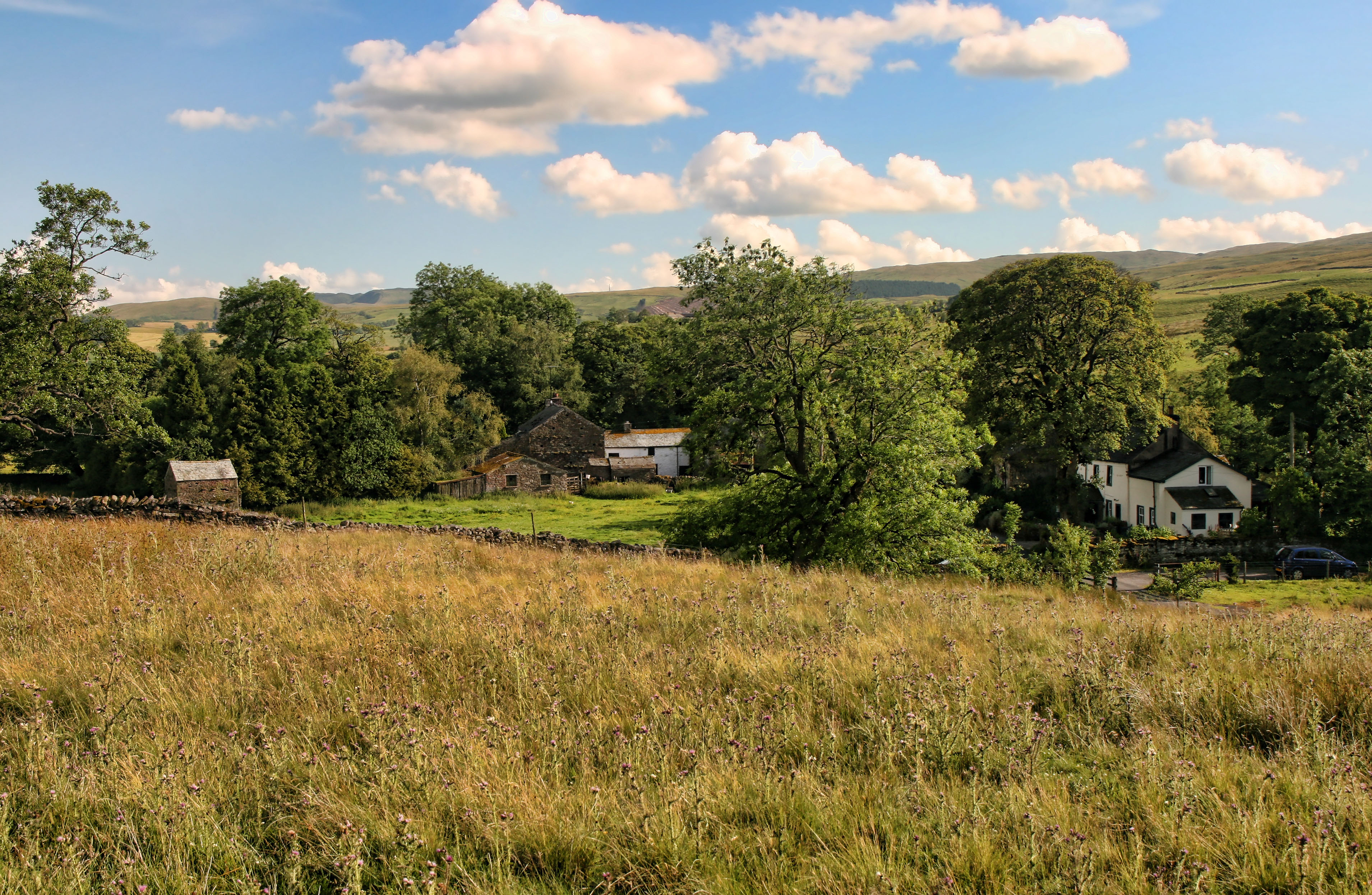
Orton is a civil parish located in the county of Cumbria, in the North West of England. Situated on the eastern edge of the Lake District National Park, Orton is surrounded by stunning natural landscapes and offers a peaceful and picturesque setting.

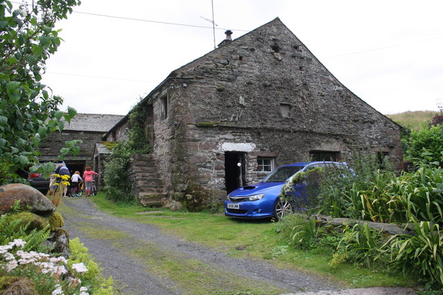
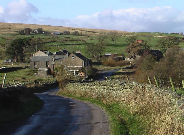
The village of Orton itself is quaint and charming, with a population of around 400 residents. It features a mix of traditional stone-built houses and cottages, giving it a distinctive character. The village is known for its well-preserved historical buildings, including the 12th-century St. Michael's Church, which is a popular attraction for visitors.

Orton is also famous for its annual Appleby Horse Fair, the largest gathering of Gypsies and Travellers in Europe. This event attracts thousands of people each year who come to witness the horse trading and enjoy the vibrant atmosphere. The fair has a long history, dating back to 1775, and is a significant cultural event for the local community.

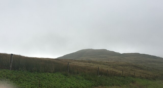
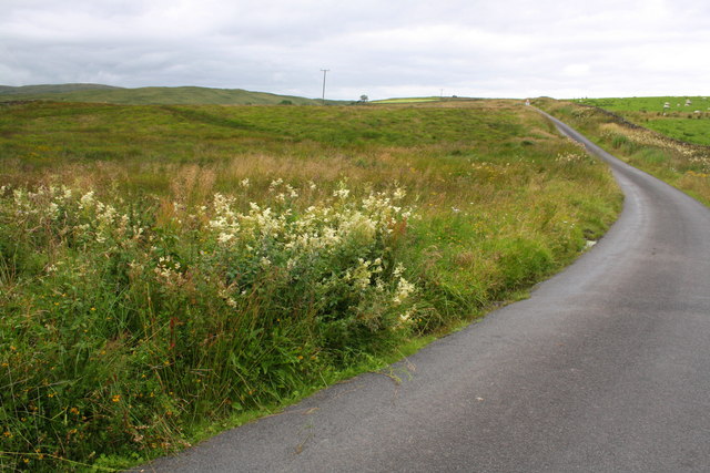
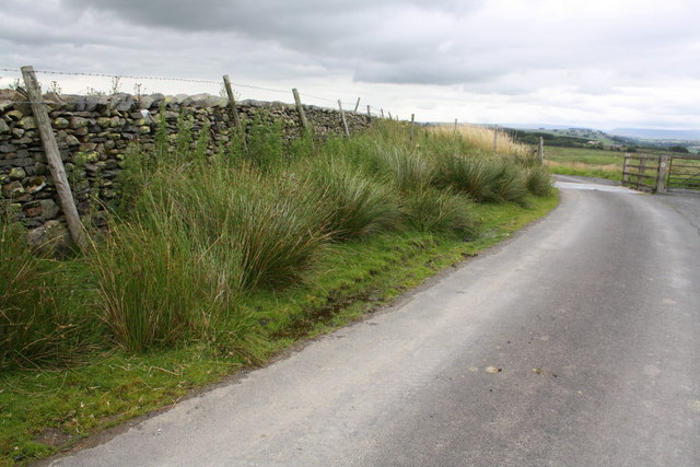
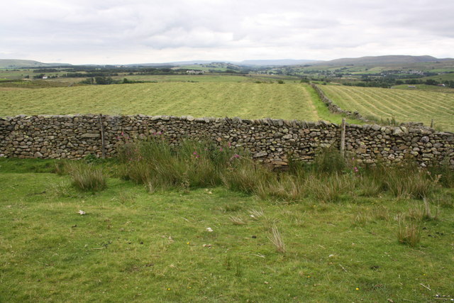
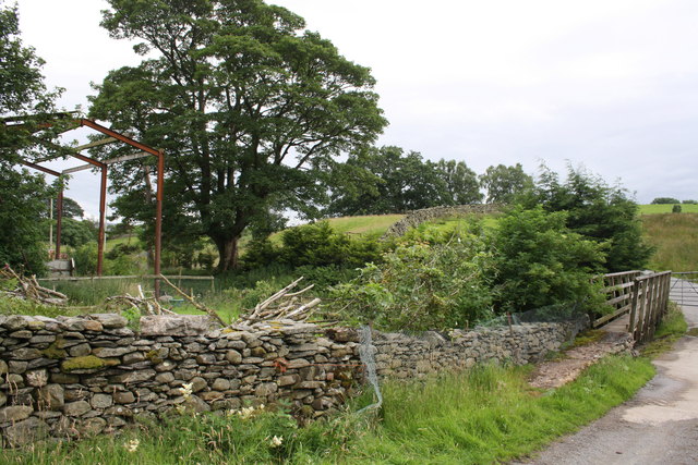
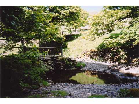
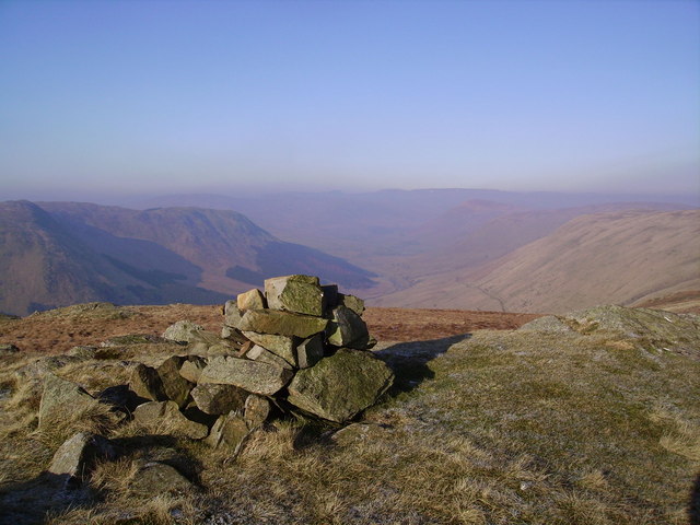
The surrounding countryside of Orton offers numerous opportunities for outdoor activities and exploration. The Orton Scar, a limestone hill, provides stunning panoramic views of the surrounding area. There are also several walking and cycling routes, allowing visitors to immerse themselves in the natural beauty of the region.

In terms of amenities, Orton has a village shop, a primary school, and a community hall, which hosts various events throughout the year. The village is well-connected to other towns and cities in the area, with good transport links and easy access to the M6 motorway.

Overall, Orton is a delightful civil parish that combines natural beauty with a rich cultural heritage, making it an attractive destination for both residents and visitors alike.

If you have any feedback on the listing, please let us know in the comments section below.

Orton Images

Images are sourced within 2km of 54.447855/-2.655523 or Grid Reference NY5706. Thanks to Geograph Open Source API. All images are credited.

Crookdale Crag At 1404ft, Crookdale Crag is in the Eastern Fells
Crookdale Crag
At 1404ft, Crookdale Crag is in the Eastern Fells
Minor road SW of Brackenhill A small stream passes under the road here - hidden well by the vegetation
Minor road SW of Brackenhill
A small stream passes under the road here - hidden well by the vegetation
Benchmark on stone in wall south of Brackenhill Ordnance Survey rivet benchmark described on the Bench Mark Database at <span class="nowrap"><a title="http://www.bench-marks.org.uk/bm69617" rel="nofollow ugc noopener" href="http://www.bench-marks.org.uk/bm69617">Link</a><img style="margin-left:2px;" alt="External link" title="External link - shift click to open in new window" src="https://s1.geograph.org.uk/img/external.png" width="10" height="10"/></span>
Benchmark on stone in wall south of Brackenhill
Ordnance Survey rivet benchmark described on the Bench Mark Database at LinkExternal link
Minor road at cattle grid south of Brackenhill There is an OS benchmark <a href="https://www.geograph.org.uk/photo/4646856">NY5906 : Benchmark on stone in wall south of Brackenhill</a> on a stone at the base of the wall left of the fence post at the left hand side of the image
Minor road at cattle grid south of Brackenhill
There is an OS benchmark NY5906 : Benchmark on stone in wall south of Brackenhill on a stone at the base of the wall left of the fence post at the left hand side of the image
Dry stone wall beside minor road at Ewelock Bank
Benchmark on 'Scalegill' Ordnance Survey rivet benchmark described on the Bench Mark Database at <span class="nowrap"><a title="http://www.bench-marks.org.uk/bm69618" rel="nofollow ugc noopener" href="http://www.bench-marks.org.uk/bm69618">Link</a><img style="margin-left:2px;" alt="External link" title="External link - shift click to open in new window" src="https://s1.geograph.org.uk/img/external.png" width="10" height="10"/></span>
Benchmark on 'Scalegill'
Ordnance Survey rivet benchmark described on the Bench Mark Database at LinkExternal link
'Scalegill' There is an OS benchmark <a href="https://www.geograph.org.uk/photo/4646906">NY5805 : Benchmark on 'Scalegill'</a> on the left hand side of the house at the front crner
'Scalegill'
There is an OS benchmark NY5805 : Benchmark on 'Scalegill' on the left hand side of the house at the front crner
Benchmark on stone at base of wall near Eskew Beck House Ordnance Survey rivet benchmark described on the Bench Mark Database at <span class="nowrap"><a title="http://www.bench-marks.org.uk/bm69619" rel="nofollow ugc noopener" href="http://www.bench-marks.org.uk/bm69619">Link</a><img style="margin-left:2px;" alt="External link" title="External link - shift click to open in new window" src="https://s1.geograph.org.uk/img/external.png" width="10" height="10"/></span>
Benchmark on stone at base of wall near Eskew Beck House
Ordnance Survey rivet benchmark described on the Bench Mark Database at LinkExternal link
Footbridge and ford on minor road for Eskew Beck There is an OS benchmark <a href="https://www.geograph.org.uk/photo/4646930">NY5805 : Benchmark on stone at base of wall near Eskew Beck House</a> on a stone at the base of the wall on the left hand side of the image
Footbridge and ford on minor road for Eskew Beck
There is an OS benchmark NY5805 : Benchmark on stone at base of wall near Eskew Beck House on a stone at the base of the wall on the left hand side of the image
Damaged culvert top beside road south of Eskew Beck House
Benchmark on stone in wall north of High Whinhowe Ordnance Survey benchmark described on the Bench Mark Database at <span class="nowrap"><a title="http://www.bench-marks.org.uk/bm69620" rel="nofollow ugc noopener" href="http://www.bench-marks.org.uk/bm69620">Link</a><img style="margin-left:2px;" alt="External link" title="External link - shift click to open in new window" src="https://s1.geograph.org.uk/img/external.png" width="10" height="10"/></span>
Benchmark on stone in wall north of High Whinhowe
Ordnance Survey benchmark described on the Bench Mark Database at LinkExternal link
Dry stone wall beside minor road north of High Whinhowe There is an OS benchmark <a href="https://www.geograph.org.uk/photo/4646987">NY5805 : Benchmark on stone in wall north of High Whinhowe</a> on a stone in front of the wall near the right hand side of the image
Dry stone wall beside minor road north of High Whinhowe
There is an OS benchmark NY5805 : Benchmark on stone in wall north of High Whinhowe on a stone in front of the wall near the right hand side of the image
Ruined farm buildings at High Whinhowe
Benchmark on gatepost between High Whinhowe and Low Whinhowe Ordnance Survey cut mark benchmark described on the Bench Mark Database at <span class="nowrap"><a title="http://www.bench-marks.org.uk/bm69780" rel="nofollow ugc noopener" href="http://www.bench-marks.org.uk/bm69780">Link</a><img style="margin-left:2px;" alt="External link" title="External link - shift click to open in new window" src="https://s1.geograph.org.uk/img/external.png" width="10" height="10"/></span>
Benchmark on gatepost between High Whinhowe and Low Whinhowe
Ordnance Survey cut mark benchmark described on the Bench Mark Database at LinkExternal link
Gateway on path from High Whinhowe to Low Whinhowe There is an OS benchmark <a href="https://www.geograph.org.uk/photo/4647035">NY5905 : Benchmark on gatepost between High Whinhowe and Low Whinhowe</a> on the stone gatepost
Gateway on path from High Whinhowe to Low Whinhowe
There is an OS benchmark NY5905 : Benchmark on gatepost between High Whinhowe and Low Whinhowe on the stone gatepost
Benchmark on building at Low Whinhowe Ordnance Survey cut mark benchmark described on the Bench Mark Database at <span class="nowrap"><a title="http://www.bench-marks.org.uk/bm69781" rel="nofollow ugc noopener" href="http://www.bench-marks.org.uk/bm69781">Link</a><img style="margin-left:2px;" alt="External link" title="External link - shift click to open in new window" src="https://s1.geograph.org.uk/img/external.png" width="10" height="10"/></span>
Benchmark on building at Low Whinhowe
Ordnance Survey cut mark benchmark described on the Bench Mark Database at LinkExternal link
Farm building at Low Whinhowe There is an OS benchmark <a href="https://www.geograph.org.uk/photo/4647173">NY5905 : Benchmark on building at Low Whinhowe</a> on the near corner of the building right hand face, on the quoin covered with white lichen
Farm building at Low Whinhowe
There is an OS benchmark NY5905 : Benchmark on building at Low Whinhowe on the near corner of the building right hand face, on the quoin covered with white lichen
Ruined stone hut and old farm equipment at Low Whinhowe
Show me another place!

Orton is located at Grid Ref: NY5706 (Lat: 54.447855, Lng: -2.655523)

Administrative County: Cumbria

District: Eden

Police Authority: Cumbria

What 3 Words

///gathers.haggis.seatbelt. Near Shap, Cumbria

Related Wikis

Birkbeck Fells

Birkbeck Fells is a township located in part of the parishes of Crosby Ravensworth, Orton and Shap in the historic county of Westmorland. It is a large...

Bretherdale Head

Bretherdale Head is a hamlet in Cumbria, England. Meaning "Valley of the Brother", it was referred to as Britherdal in the 12th century. == References ==

Greenholme

Greenholme is a hamlet in Cumbria, England.The Greenholme Gala and Agricultural Show is held there annually.Greenholme Bridge crosses the Birk Beck in...

Scout Green

Scout Green is a hamlet and small area of farm land near the village of Tebay in Cumbria, England. == History == It is best known among railway enthusiasts...

Tebay Services

Tebay Services are motorway service stations on the M6 motorway in the Westmorland and Furness district of Cumbria, England. The northbound opened in 1972...

Borrowdale, Westmorland

Borrowdale is a valley in the English Lake District. It is located in the county of Westmorland, and is sometimes referred to as Westmorland Borrowdale...

Winterscleugh

Winterscleugh is a hill of 464 metres (1,522 ft) in Cumbria, England, to the east of the Lake District. It is in the far east of the Lake District National...

Wasdale Horseshoe

The Wasdale Horseshoe is a group of hills on the eastern fringe of the English Lake District, to the west of the A6, south of Shap, Cumbria. They surround...

Nearby Amenities

Located within 500m of 54.447855,-2.655523
Thorny Bank
Ele: 372.2
Natural: peak
Source: OS 1:25k
Lat/Long: 54.4463234/-2.6553284
High Crag
Place: locality
Lat/Long: 54.4463066/-2.648563
Eskew Head
Place: locality
Lat/Long: 54.4490611/-2.6511667
Ford: yes
Lat/Long: 54.4478805/-2.6482871
The data included in this document is from www.openstreetmap.org. The data is made available under ODbL.

Have you been to Orton?

Leave your review of Orton below (or comments, questions and feedback).