Coldwell Hill

Hill, Mountain in Westmorland Eden

England

Coldwell Hill

Moorland by Wasdale Beck From the A6 as it descends from Shap
Moorland by Wasdale Beck Credit: Eirian Evans

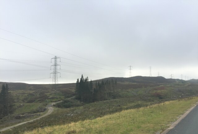
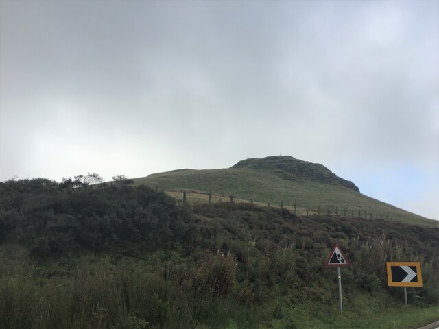
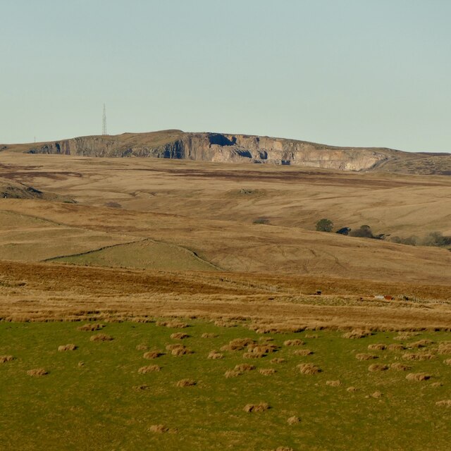
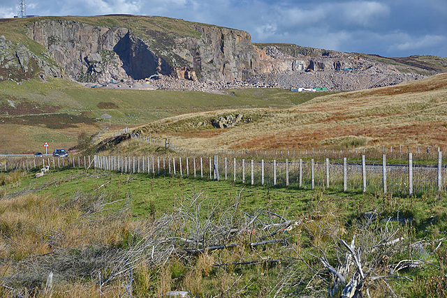
Coldwell Hill is a prominent geological formation located in the Westmorland region of England. Rising to an elevation of approximately 1,000 feet, it is classified as both a hill and a mountain, depending on the definition used. Situated in the Lake District National Park, Coldwell Hill offers breathtaking panoramic views of the surrounding countryside, making it a popular destination for hikers and nature enthusiasts alike.

The hill is composed of sedimentary rocks, primarily consisting of sandstone and limestone, which were formed millions of years ago during the Paleozoic era. These rocks exhibit unique geological features, including exposed layers and distinctive striations, providing valuable insights into the region's geological history.

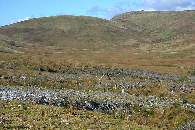
Coldwell Hill is home to a diverse array of flora and fauna, with its sloping sides supporting a variety of plant species adapted to its specific microclimate. The hillside is covered in blankets of heather, interspersed with patches of bracken and scattered wildflowers, creating a vibrant and colorful landscape during the summer months.

Birdwatchers are often rewarded with sightings of various avian species, including peregrine falcons, kestrels, and buzzards, which soar above the hill's crags and cliffs. Mammals such as red deer and rabbits can also be spotted in the surrounding areas.

Accessible by footpaths and trails, Coldwell Hill provides ample opportunities for outdoor activities such as hiking, climbing, and picnicking. Its close proximity to nearby villages and towns makes it a popular destination for day trips, attracting visitors from both the local area and further afield.

Overall, Coldwell Hill is a captivating natural landmark, showcasing the beauty and diversity of Westmorland's landscape while offering a range of recreational pursuits for all to enjoy.

If you have any feedback on the listing, please let us know in the comments section below.

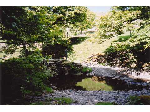
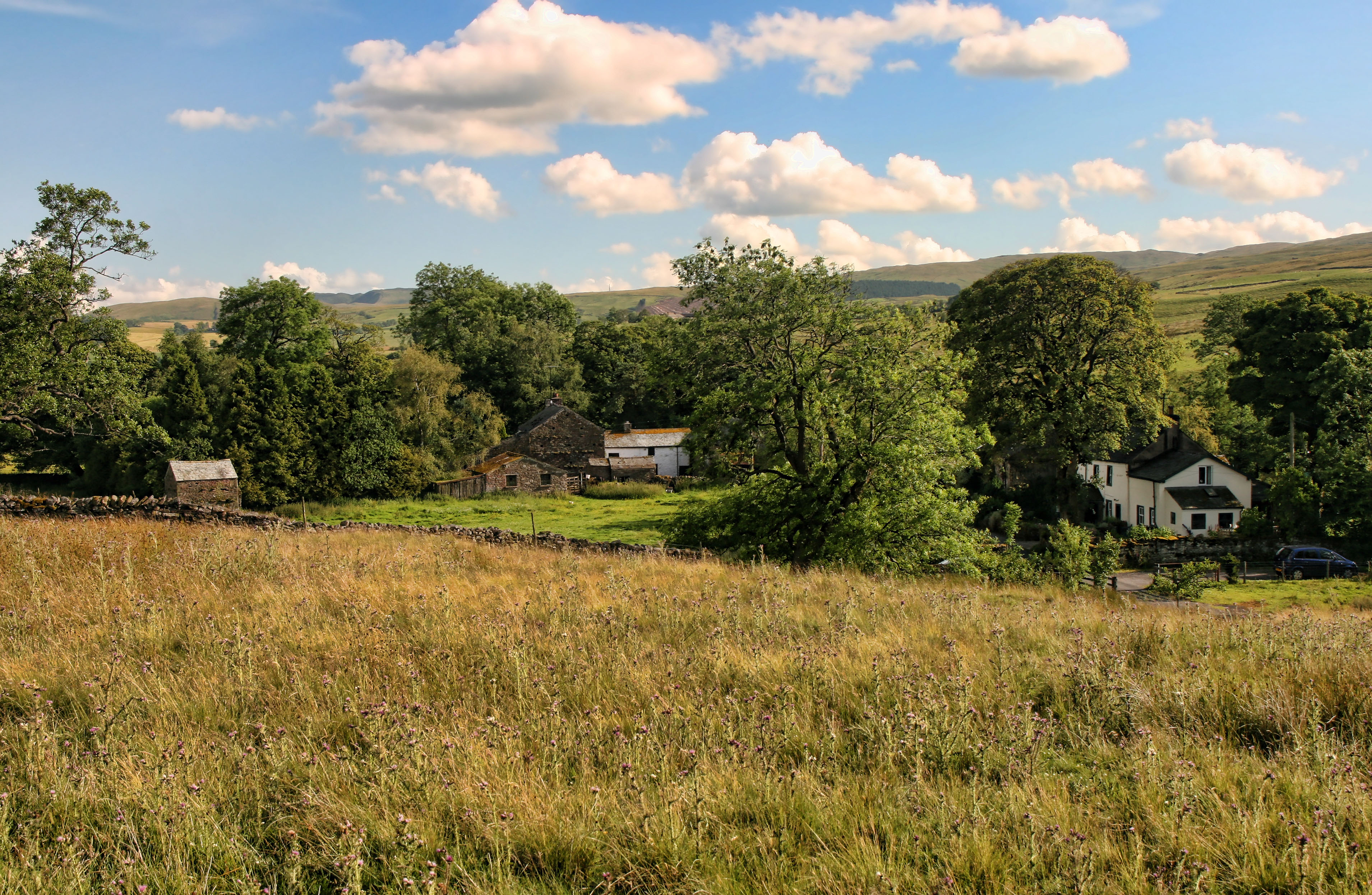
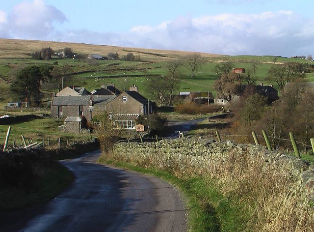
Coldwell Hill Images

Images are sourced within 2km of 54.45649/-2.6633144 or Grid Reference NY5706. Thanks to Geograph Open Source API. All images are credited.

Moorland by Wasdale Beck From the A6 as it descends from Shap
Moorland by Wasdale Beck
From the A6 as it descends from Shap
Packhorse Hill On a drover's route from Salterworth to Shap
Packhorse Hill
On a drover's route from Salterworth to Shap
Shap Pink Quarry Granite quarry above the M6.
Shap Pink Quarry
Granite quarry above the M6.
Forestry clearfell and Wasdale This is the eastern Wasdale, not to be compared with the western one.
Forestry clearfell and Wasdale
This is the eastern Wasdale, not to be compared with the western one.
View towards Shap Pink Quarry With the A6 in the foreground.
View towards Shap Pink Quarry
With the A6 in the foreground.
Bridleway off the A6 The A6 is one of the main historic north south roads in England. At 299 miles long it is the fourth longest road in the country. It currently runs from Luton in Bedfordshire to Carlisle in Cumbria, although it formerly started at a junction with the A1 at Barnet.
Wikipedia: <span class="nowrap"><a title="http://en.wikipedia.org/wiki/A6_road_(England)" rel="nofollow ugc noopener" href="http://en.wikipedia.org/wiki/A6_road_(England)">Link</a><img style="margin-left:2px;" alt="External link" title="External link - shift click to open in new window" src="https://s1.geograph.org.uk/img/external.png" width="10" height="10"/></span> 
See also <span class="nowrap"><a title="http://www.sabre-roads.org.uk/wiki/index.php?title=A6" rel="nofollow ugc noopener" href="http://www.sabre-roads.org.uk/wiki/index.php?title=A6">Link</a><img style="margin-left:2px;" alt="External link" title="External link - shift click to open in new window" src="https://s1.geograph.org.uk/img/external.png" width="10" height="10"/></span> for more route detail.
Bridleway off the A6
The A6 is one of the main historic north south roads in England. At 299 miles long it is the fourth longest road in the country. It currently runs from Luton in Bedfordshire to Carlisle in Cumbria, although it formerly started at a junction with the A1 at Barnet. Wikipedia: LinkExternal link See also LinkExternal link for more route detail.
Uphill towards Shap Heading north on the A6.
Uphill towards Shap
Heading north on the A6.
Moorland, Demings Moss East of the A6.
Moorland, Demings Moss
East of the A6.
Former telephone trunk repeater station beside the A6 See <a href="https://www.geograph.org.uk/photo/114286">NY5506 : Former Telecom Substation at Shap Summit</a> for a closer view.
Former telephone trunk repeater station beside the A6
A6 looking north Towards Shap.
A6 looking north
Towards Shap.
Moorland beside the A6 The A6 is one of the main historic north south roads in England. At 299 miles long it is the fourth longest road in the country. It currently runs from Luton in Bedfordshire to Carlisle in Cumbria, although it formerly started at a junction with the A1 at Barnet.
Wikipedia: <span class="nowrap"><a title="http://en.wikipedia.org/wiki/A6_road_(England)" rel="nofollow ugc noopener" href="http://en.wikipedia.org/wiki/A6_road_(England)">Link</a><img style="margin-left:2px;" alt="External link" title="External link - shift click to open in new window" src="https://s1.geograph.org.uk/img/external.png" width="10" height="10"/></span> 
See also <span class="nowrap"><a title="http://www.sabre-roads.org.uk/wiki/index.php?title=A6" rel="nofollow ugc noopener" href="http://www.sabre-roads.org.uk/wiki/index.php?title=A6">Link</a><img style="margin-left:2px;" alt="External link" title="External link - shift click to open in new window" src="https://s1.geograph.org.uk/img/external.png" width="10" height="10"/></span> for more route detail.
Moorland beside the A6
The A6 is one of the main historic north south roads in England. At 299 miles long it is the fourth longest road in the country. It currently runs from Luton in Bedfordshire to Carlisle in Cumbria, although it formerly started at a junction with the A1 at Barnet. Wikipedia: LinkExternal link See also LinkExternal link for more route detail.
A6 towards Shap Looking north east.
A6 towards Shap
Looking north east.
Wasdale View towards Shap Pink Quarry.
Wasdale
View towards Shap Pink Quarry.
Bend in the A6, Packhorse Hill Heading north east towards Shap.
Bend in the A6, Packhorse Hill
Heading north east towards Shap.
Woodland beside the A6 The A6 is one of the main historic north south roads in England. At 299 miles long it is the fourth longest road in the country. It currently runs from Luton in Bedfordshire to Carlisle in Cumbria, although it formerly started at a junction with the A1 at Barnet.
Wikipedia: <span class="nowrap"><a title="http://en.wikipedia.org/wiki/A6_road_(England)" rel="nofollow ugc noopener" href="http://en.wikipedia.org/wiki/A6_road_(England)">Link</a><img style="margin-left:2px;" alt="External link" title="External link - shift click to open in new window" src="https://s1.geograph.org.uk/img/external.png" width="10" height="10"/></span> 
See also <span class="nowrap"><a title="http://www.sabre-roads.org.uk/wiki/index.php?title=A6" rel="nofollow ugc noopener" href="http://www.sabre-roads.org.uk/wiki/index.php?title=A6">Link</a><img style="margin-left:2px;" alt="External link" title="External link - shift click to open in new window" src="https://s1.geograph.org.uk/img/external.png" width="10" height="10"/></span> for more route detail.
Woodland beside the A6
The A6 is one of the main historic north south roads in England. At 299 miles long it is the fourth longest road in the country. It currently runs from Luton in Bedfordshire to Carlisle in Cumbria, although it formerly started at a junction with the A1 at Barnet. Wikipedia: LinkExternal link See also LinkExternal link for more route detail.
View across Wasdale Towards Shap Pink Quarry.
View across Wasdale
Towards Shap Pink Quarry.
Shap Pink Quarry View across Wasdale.
Shap Pink Quarry
View across Wasdale.
Former woodland off the A6 The A6 is one of the main historic north south roads in England. At 299 miles long it is the fourth longest road in the country. It currently runs from Luton in Bedfordshire to Carlisle in Cumbria, although it formerly started at a junction with the A1 at Barnet.
Wikipedia: <span class="nowrap"><a title="http://en.wikipedia.org/wiki/A6_road_(England)" rel="nofollow ugc noopener" href="http://en.wikipedia.org/wiki/A6_road_(England)">Link</a><img style="margin-left:2px;" alt="External link" title="External link - shift click to open in new window" src="https://s1.geograph.org.uk/img/external.png" width="10" height="10"/></span> 
See also <span class="nowrap"><a title="http://www.sabre-roads.org.uk/wiki/index.php?title=A6" rel="nofollow ugc noopener" href="http://www.sabre-roads.org.uk/wiki/index.php?title=A6">Link</a><img style="margin-left:2px;" alt="External link" title="External link - shift click to open in new window" src="https://s1.geograph.org.uk/img/external.png" width="10" height="10"/></span> for more route detail.
Former woodland off the A6
The A6 is one of the main historic north south roads in England. At 299 miles long it is the fourth longest road in the country. It currently runs from Luton in Bedfordshire to Carlisle in Cumbria, although it formerly started at a junction with the A1 at Barnet. Wikipedia: LinkExternal link See also LinkExternal link for more route detail.
Show me another place!

Coldwell Hill is located at Grid Ref: NY5706 (Lat: 54.45649, Lng: -2.6633144)

Administrative County: Cumbria

District: Eden

Police Authority: Cumbria

What 3 Words

///lakeside.frantic.social. Near Shap, Cumbria

Related Wikis

Birkbeck Fells

Birkbeck Fells is a township located in part of the parishes of Crosby Ravensworth, Orton and Shap in the historic county of Westmorland. It is a large...

Bretherdale Head

Bretherdale Head is a hamlet in Cumbria, England. Meaning "Valley of the Brother", it was referred to as Britherdal in the 12th century. == References ==

Scout Green

Scout Green is a hamlet and small area of farm land near the village of Tebay in Cumbria, England. == History == It is best known among railway enthusiasts...

Wasdale Horseshoe

The Wasdale Horseshoe is a group of hills on the eastern fringe of the English Lake District, to the west of the A6, south of Shap, Cumbria. They surround...

Greenholme

Greenholme is a hamlet in Cumbria, England.The Greenholme Gala and Agricultural Show is held there annually.Greenholme Bridge crosses the Birk Beck in...

Tebay Services

Tebay Services are motorway service stations on the M6 motorway in the Westmorland and Furness district of Cumbria, England. The northbound opened in 1972...

Crookdale Horseshoe

The Crookdale Horseshoe is a group of hills on the eastern edge of the English Lake District, in Cumbria, west of the A6 road. They are the subject of...

Borrowdale, Westmorland

Borrowdale is a valley in the English Lake District. It is located in the county of Westmorland, and is sometimes referred to as Westmorland Borrowdale...

Nearby Amenities

Located within 500m of 54.45649,-2.6633144
Ele: 401.4
Is In Country Code: GB
Man Made: cairn
Natural: peak
Source: NPE
Lat/Long: 54.4542777/-2.6683348
The data included in this document is from www.openstreetmap.org. The data is made available under ODbL.

Have you been to Coldwell Hill?

Leave your review of Coldwell Hill below (or comments, questions and feedback).