Knott Moss

Downs, Moorland in Westmorland Eden

England

Knott Moss

Packhorse Hill On a drover's route from Salterworth to Shap
Packhorse Hill Credit: Eirian Evans

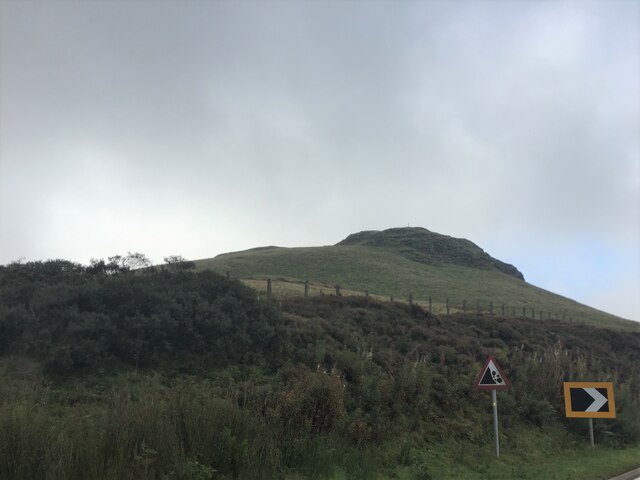
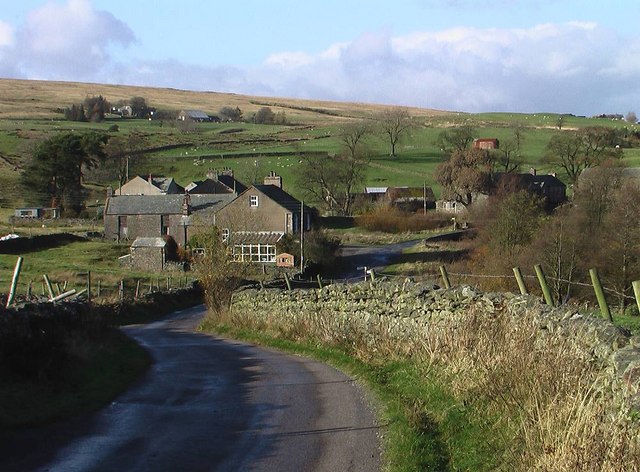
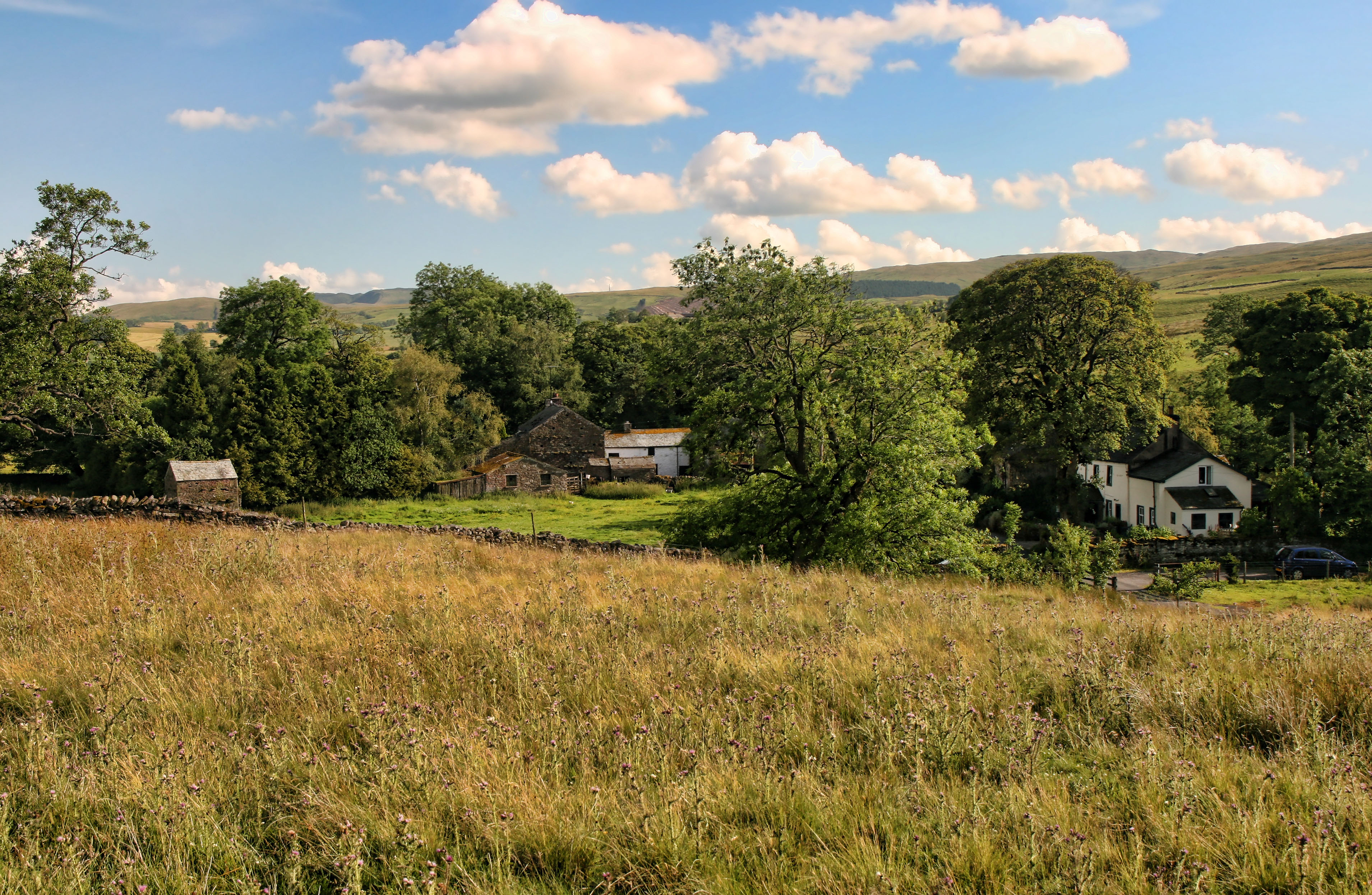
Knott Moss, located in Westmorland, is a picturesque area encompassing both downs and moorland. It is a region of outstanding natural beauty, characterized by its rolling hills, expansive meadows, and diverse flora and fauna.

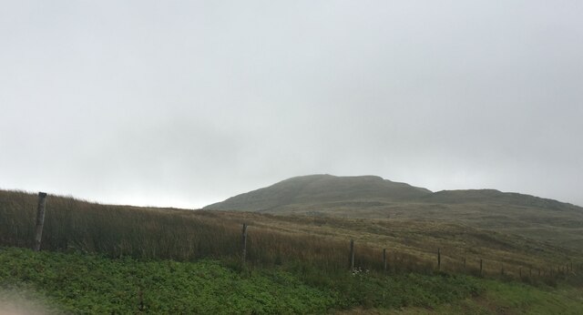
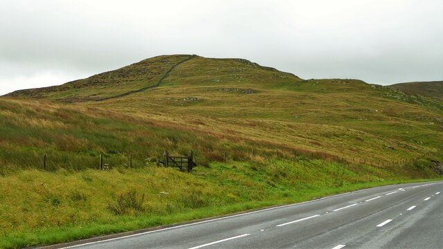
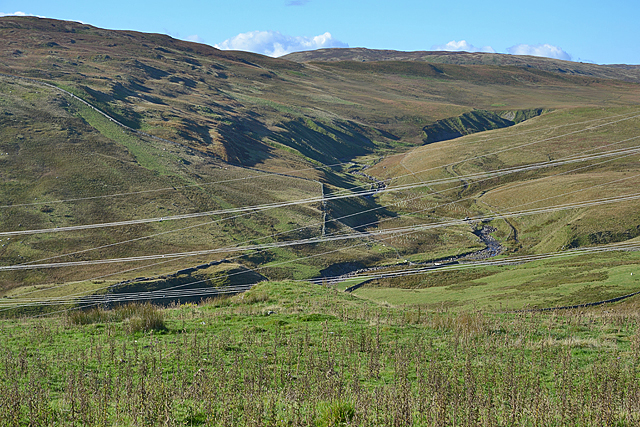
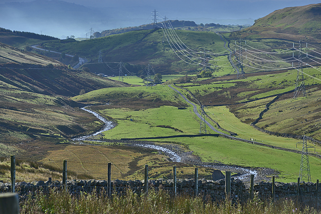
The downs of Knott Moss are gently sloping hills covered in lush green grass, providing idyllic grazing grounds for livestock. These open spaces offer breathtaking panoramic views of the surrounding countryside, making it a popular spot for hikers and nature lovers. The downs are also dotted with charming villages and hamlets, adding to the quaint and peaceful ambiance of the area.

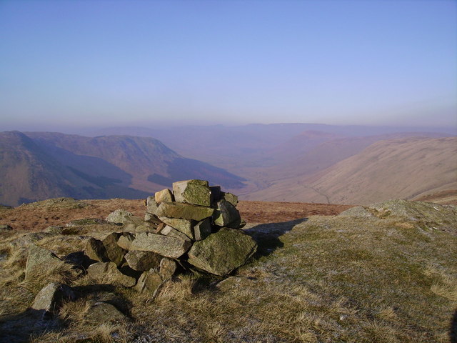
In contrast, the moorland of Knott Moss is a wild and rugged landscape, characterized by heather, gorse, and moss-covered terrain. This unique habitat supports a variety of wildlife, including birds of prey, such as kestrels and peregrine falcons, as well as smaller mammals like rabbits and hedgehogs. The moorland is a haven for avid birdwatchers and nature enthusiasts seeking to explore its untamed beauty.

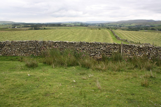
Knott Moss is also home to several nature reserves and protected areas, ensuring the preservation of its natural heritage. These reserves provide opportunities for educational activities, such as guided walks and nature trails, enabling visitors to learn about the rich biodiversity and ecological importance of the region.

Overall, Knott Moss in Westmorland offers a captivating blend of downs and moorland, providing a haven for both wildlife and outdoor enthusiasts seeking solace in the beauty of nature.

If you have any feedback on the listing, please let us know in the comments section below.
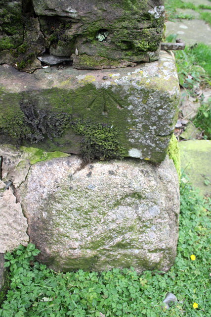
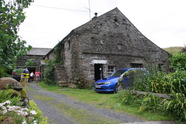
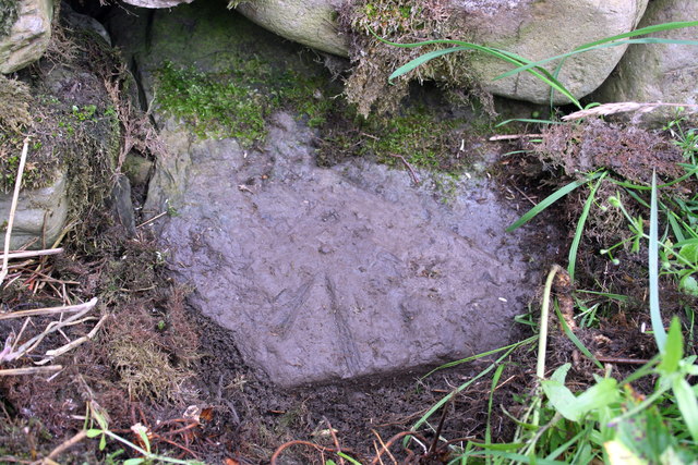
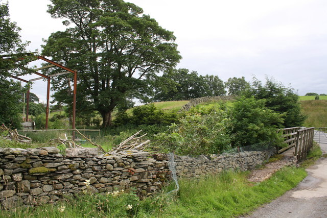
Knott Moss Images

Images are sourced within 2km of 54.448748/-2.6624489 or Grid Reference NY5706. Thanks to Geograph Open Source API. All images are credited.

Packhorse Hill On a drover's route from Salterworth to Shap
Packhorse Hill
On a drover's route from Salterworth to Shap
Crookdale Crag At 1404ft, Crookdale Crag is in the Eastern Fells
Crookdale Crag
At 1404ft, Crookdale Crag is in the Eastern Fells
Crookdale Crag Towering above the A6 road
Crookdale Crag
Towering above the A6 road
Dry stone wall beside minor road at Ewelock Bank
Benchmark on 'Scalegill' Ordnance Survey rivet benchmark described on the Bench Mark Database at <span class="nowrap"><a title="http://www.bench-marks.org.uk/bm69618" rel="nofollow ugc noopener" href="http://www.bench-marks.org.uk/bm69618">Link</a><img style="margin-left:2px;" alt="External link" title="External link - shift click to open in new window" src="https://s1.geograph.org.uk/img/external.png" width="10" height="10"/></span>
Benchmark on 'Scalegill'
Ordnance Survey rivet benchmark described on the Bench Mark Database at LinkExternal link
'Scalegill' There is an OS benchmark <a href="https://www.geograph.org.uk/photo/4646906">NY5805 : Benchmark on 'Scalegill'</a> on the left hand side of the house at the front crner
'Scalegill'
There is an OS benchmark NY5805 : Benchmark on 'Scalegill' on the left hand side of the house at the front crner
Benchmark on stone at base of wall near Eskew Beck House Ordnance Survey rivet benchmark described on the Bench Mark Database at <span class="nowrap"><a title="http://www.bench-marks.org.uk/bm69619" rel="nofollow ugc noopener" href="http://www.bench-marks.org.uk/bm69619">Link</a><img style="margin-left:2px;" alt="External link" title="External link - shift click to open in new window" src="https://s1.geograph.org.uk/img/external.png" width="10" height="10"/></span>
Benchmark on stone at base of wall near Eskew Beck House
Ordnance Survey rivet benchmark described on the Bench Mark Database at LinkExternal link
Footbridge and ford on minor road for Eskew Beck There is an OS benchmark <a href="https://www.geograph.org.uk/photo/4646930">NY5805 : Benchmark on stone at base of wall near Eskew Beck House</a> on a stone at the base of the wall on the left hand side of the image
Footbridge and ford on minor road for Eskew Beck
There is an OS benchmark NY5805 : Benchmark on stone at base of wall near Eskew Beck House on a stone at the base of the wall on the left hand side of the image
Damaged culvert top beside road south of Eskew Beck House
Benchmark on stone in wall north of High Whinhowe Ordnance Survey benchmark described on the Bench Mark Database at <span class="nowrap"><a title="http://www.bench-marks.org.uk/bm69620" rel="nofollow ugc noopener" href="http://www.bench-marks.org.uk/bm69620">Link</a><img style="margin-left:2px;" alt="External link" title="External link - shift click to open in new window" src="https://s1.geograph.org.uk/img/external.png" width="10" height="10"/></span>
Benchmark on stone in wall north of High Whinhowe
Ordnance Survey benchmark described on the Bench Mark Database at LinkExternal link
Dry stone wall beside minor road north of High Whinhowe There is an OS benchmark <a href="https://www.geograph.org.uk/photo/4646987">NY5805 : Benchmark on stone in wall north of High Whinhowe</a> on a stone in front of the wall near the right hand side of the image
Dry stone wall beside minor road north of High Whinhowe
There is an OS benchmark NY5805 : Benchmark on stone in wall north of High Whinhowe on a stone in front of the wall near the right hand side of the image
Benchmark on rock beside road NE of Midwath Stead Ordnance Survey rivet benchmark described on the Bench Mark Database at <span class="nowrap"><a title="http://www.bench-marks.org.uk/bm69621" rel="nofollow ugc noopener" href="http://www.bench-marks.org.uk/bm69621">Link</a><img style="margin-left:2px;" alt="External link" title="External link - shift click to open in new window" src="https://s1.geograph.org.uk/img/external.png" width="10" height="10"/></span>
Benchmark on rock beside road NE of Midwath Stead
Ordnance Survey rivet benchmark described on the Bench Mark Database at LinkExternal link
View from minor road NE of Midwath Stead There is an OS benchmark <a href="https://www.geograph.org.uk/photo/4647313">NY5804 : Benchmark on rock beside road NE of Midwath Stead</a> on the rock in the foreground
View from minor road NE of Midwath Stead
There is an OS benchmark NY5804 : Benchmark on rock beside road NE of Midwath Stead on the rock in the foreground
Benchmark on barn at Midwath Stead Ordnance Survey pivot benchmark described on the Bench Mark Database at <span class="nowrap"><a title="http://www.bench-marks.org.uk/bm69623" rel="nofollow ugc noopener" href="http://www.bench-marks.org.uk/bm69623">Link</a><img style="margin-left:2px;" alt="External link" title="External link - shift click to open in new window" src="https://s1.geograph.org.uk/img/external.png" width="10" height="10"/></span>
Benchmark on barn at Midwath Stead
Ordnance Survey pivot benchmark described on the Bench Mark Database at LinkExternal link
Farm building at Midwath Stead There is an OS benchmark <a href="https://www.geograph.org.uk/photo/4647369">NY5804 : Benchmark on barn at Midwath Stead</a> on the right hand corner of the building where the cement cladding has broken away
Farm building at Midwath Stead
There is an OS benchmark NY5804 : Benchmark on barn at Midwath Stead on the right hand corner of the building where the cement cladding has broken away
View up Crookdale Somewhat ruined by the number of power lines.
View up Crookdale
Somewhat ruined by the number of power lines.
View down Crookdale On an improving morning as rain creeps away.
View down Crookdale
On an improving morning as rain creeps away.
Electricity transmission poles
Show me another place!

Knott Moss is located at Grid Ref: NY5706 (Lat: 54.448748, Lng: -2.6624489)

Administrative County: Cumbria

District: Eden

Police Authority: Cumbria

What 3 Words

///pixel.smashes.sling. Near Shap, Cumbria

Related Wikis

Bretherdale Head

Bretherdale Head is a hamlet in Cumbria, England. Meaning "Valley of the Brother", it was referred to as Britherdal in the 12th century. == References ==

Birkbeck Fells

Birkbeck Fells is a township located in part of the parishes of Crosby Ravensworth, Orton and Shap in the historic county of Westmorland. It is a large...

Greenholme

Greenholme is a hamlet in Cumbria, England.The Greenholme Gala and Agricultural Show is held there annually.Greenholme Bridge crosses the Birk Beck in...

Scout Green

Scout Green is a hamlet and small area of farm land near the village of Tebay in Cumbria, England. == History == It is best known among railway enthusiasts...

Wasdale Horseshoe

The Wasdale Horseshoe is a group of hills on the eastern fringe of the English Lake District, to the west of the A6, south of Shap, Cumbria. They surround...

Borrowdale, Westmorland

Borrowdale is a valley in the English Lake District. It is located in the county of Westmorland, and is sometimes referred to as Westmorland Borrowdale...

Winterscleugh

Winterscleugh is a hill of 464 metres (1,522 ft) in Cumbria, England, to the east of the Lake District. It is in the far east of the Lake District National...

Tebay Services

Tebay Services are motorway service stations on the M6 motorway in the Westmorland and Furness district of Cumbria, England. The northbound opened in 1972...

Have you been to Knott Moss?

Leave your review of Knott Moss below (or comments, questions and feedback).