Nether Haddon

Civil Parish in Derbyshire Derbyshire Dales

England

Nether Haddon

Broadmeadow Shaft Adjacent to the cottages here, which were once the offices of the Alport Mining Company, can be seen a large mound which marks the site of the Broadmeadow Shaft on the Alport mines. This company was an amalgamation of various separate mining concerns and operated the very rich lead mines of this area. They were classed as the most heavily watered mines in the country and suffered from inflows of more than 6000 gallons a minute. Consequently, heavy pumping was necessary, chiefly by water pressure engines which used a column of water to power them. The well known Cornish engineer, Richard Trevithick was consulted and he was responsible for the first of many such underground machines within this region. Water to power the engine in this shaft was taken from the River Lathkill and over Alport village in wooden launders and then by a tunnel to the shaft. All the pumped water, along with that used by the engines (of which there were upwards of seven scattered throughout the workings) was drained away by the deep Hillcarr Sough, a tunnel driven from the River Derwent near Darley Dale.
Broadmeadow Shaft Credit: Richard Bird

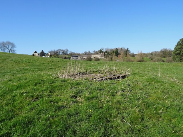
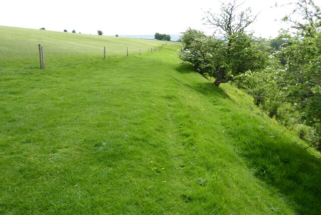
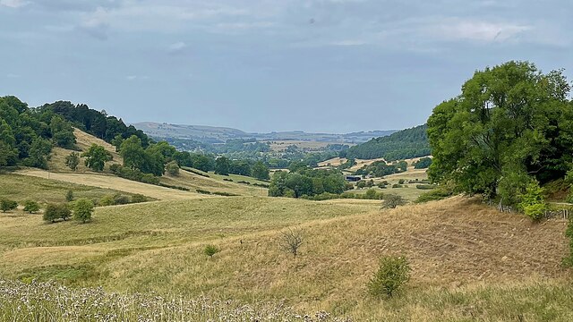
Nether Haddon is a civil parish located in the county of Derbyshire, England. It is situated in the district of North East Derbyshire, approximately 7 miles east of the town of Chesterfield. The parish covers an area of about 2.5 square miles and is predominantly rural, characterized by rolling hills, meadows, and farmland.

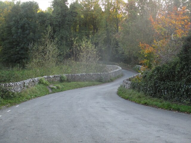
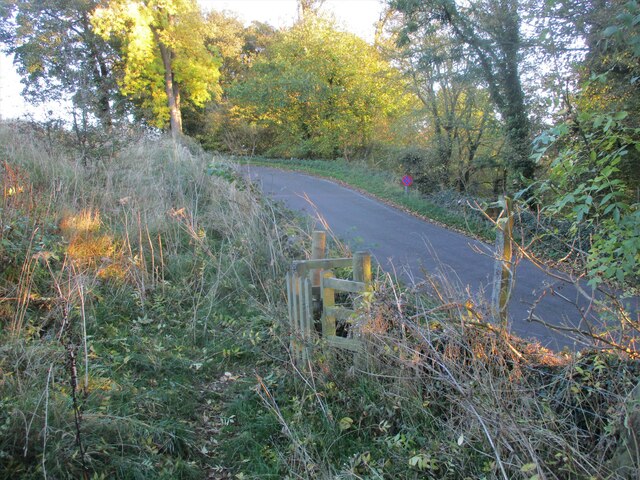
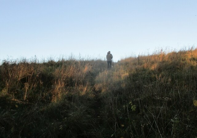
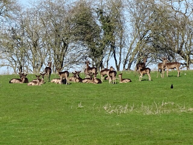
Nether Haddon is a small village with a population of around 200 residents. The settlement is scattered, with a handful of houses and farms dispersed throughout the area. The parish is surrounded by picturesque countryside, offering stunning views and ample opportunities for outdoor activities such as hiking and cycling.

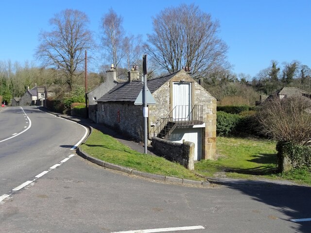
Historically, Nether Haddon was an agricultural community, with farming being the main occupation for its inhabitants. Although the village has seen some modern development, it has managed to retain its rural charm and tranquility. The local economy is now diverse, with residents engaged in a range of professions and industries.

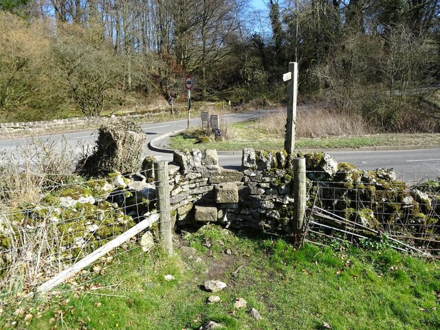
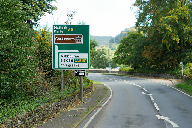
The parish is served by a local primary school, providing education to the village's children. There are also several churches in the area, catering to different denominations and serving as important community hubs. Additionally, Nether Haddon benefits from good transport links, with nearby roads connecting it to the surrounding towns and villages.

Overall, Nether Haddon is a small and peaceful civil parish, offering a rural lifestyle amidst beautiful countryside. Its close-knit community and scenic surroundings make it an attractive place to live for those seeking a quiet and picturesque setting.

If you have any feedback on the listing, please let us know in the comments section below.

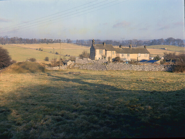
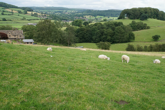
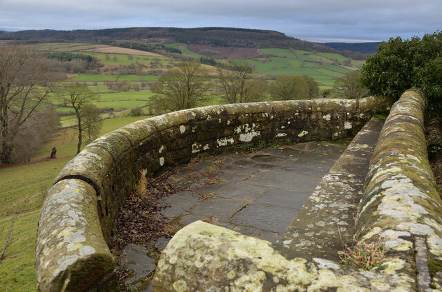
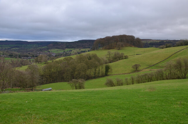
Nether Haddon Images

Images are sourced within 2km of 53.191656/-1.656009 or Grid Reference SK2366. Thanks to Geograph Open Source API. All images are credited.

Broadmeadow Shaft Adjacent to the cottages here, which were once the offices of the Alport Mining Company, can be seen a large mound which marks the site of the Broadmeadow Shaft on the Alport mines. This company was an amalgamation of various separate mining concerns and operated the very rich lead mines of this area. They were classed as the most heavily watered mines in the country and suffered from inflows of more than 6000 gallons a minute. Consequently, heavy pumping was necessary, chiefly by water pressure engines which used a column of water to power them. The well known Cornish engineer, Richard Trevithick was consulted and he was responsible for the first of many such underground machines within this region. Water to power the engine in this shaft was taken from the River Lathkill and over Alport village in wooden launders and then by a tunnel to the shaft. All the pumped water, along with that used by the engines (of which there were upwards of seven scattered throughout the workings) was drained away by the deep Hillcarr Sough, a tunnel driven from the River Derwent near Darley Dale.
Broadmeadow Shaft
Adjacent to the cottages here, which were once the offices of the Alport Mining Company, can be seen a large mound which marks the site of the Broadmeadow Shaft on the Alport mines. This company was an amalgamation of various separate mining concerns and operated the very rich lead mines of this area. They were classed as the most heavily watered mines in the country and suffered from inflows of more than 6000 gallons a minute. Consequently, heavy pumping was necessary, chiefly by water pressure engines which used a column of water to power them. The well known Cornish engineer, Richard Trevithick was consulted and he was responsible for the first of many such underground machines within this region. Water to power the engine in this shaft was taken from the River Lathkill and over Alport village in wooden launders and then by a tunnel to the shaft. All the pumped water, along with that used by the engines (of which there were upwards of seven scattered throughout the workings) was drained away by the deep Hillcarr Sough, a tunnel driven from the River Derwent near Darley Dale.
Cottages in Stanton in Peak Near the bottom of the long thin village.
Cottages in Stanton in Peak
Near the bottom of the long thin village.
Field at Stanton in Peak Right at the bottom of the village.
Field at Stanton in Peak
Right at the bottom of the village.
Stanton in Peak From the bottom of the village looking up. The spire of Holy Trinity Church is seen but the village continues quite a long way past that.
Stanton in Peak
From the bottom of the village looking up. The spire of Holy Trinity Church is seen but the village continues quite a long way past that.
Sheep above Congreave Looking towards Rowsley down the Wye valley.
Sheep above Congreave
Looking towards Rowsley down the Wye valley.
Viewpoint by Pilhough Lane, near Stanton, Derbyshire A viewing point over the lower valley of the River Wye in the Derbyshire Peak District.
Viewpoint by Pilhough Lane, near Stanton, Derbyshire
A viewing point over the lower valley of the River Wye in the Derbyshire Peak District.
Pastures at Congreave, near Rowsley, Derbyshire
Conksbury  Bridge  over  River  Lathkill In Lathkill Dale
Conksbury Bridge over River Lathkill
In Lathkill Dale
Footpath  coming  off  minor  road Takes you over fields to Over Haddon
Footpath coming off minor road
Takes you over fields to Over Haddon
Footpath  through  rough  pasture  out  of  Lathkill  Dale
Footpath through rough pasture out of Lathkill Dale
Old barn on the edge of Alport Not yet converted into a luxury residence.
Old barn on the edge of Alport
Not yet converted into a luxury residence.
A herd of deer
A herd of deer
Old lead shaft capped with concrete Harthill Hall is in the background
Old lead shaft capped with concrete
Harthill Hall is in the background
Step stile and fingerpost Off the B5056 at the junction with Birchover Road.
Step stile and fingerpost
Off the B5056 at the junction with Birchover Road.
Footpath above Lathkill Dale This footpath follows the shelf of land above the Lathkill Dale near Over Haddon.
Footpath above Lathkill Dale
This footpath follows the shelf of land above the Lathkill Dale near Over Haddon.
Looking over Coombs Valley To the east of Bakewell which can be seen in the distance.
Looking over Coombs Valley
To the east of Bakewell which can be seen in the distance.
Haddon Road (A6) The A6 is Britain's fourth longest road and one of the main historic north-south roads in England. It currently runs for 299 miles from Luton in Bedfordshire to Carlisle in Cumbria, although it formerly started at a junction with the A1 at Barnet.

Running north west from Luton, the road travels through Bedford, bypasses Rushden, Kettering and Market Harborough, continues through Leicester, Loughborough, Derby and Matlock before going through the Peak District to Bakewell, Buxton, Stockport, Manchester, Salford, Pendleton, Irlams o' th' Height, Pendlebury, Swinton, Walkden, Little Hulton, Bolton, Chorley, Preston, Lancaster, Kendal and Penrith before reaching Carlisle.

See <span class="nowrap"><a title="http://en.wikipedia.org/wiki/A6_road_(England)" rel="nofollow ugc noopener" href="http://en.wikipedia.org/wiki/A6_road_(England)">Link</a><img style="margin-left:2px;" alt="External link" title="External link - shift click to open in new window" src="https://s1.geograph.org.uk/img/external.png" width="10" height="10"/></span> (Wikipedia) and <span class="nowrap"><a title="http://www.sabre-roads.org.uk/wiki/index.php?title=A6" rel="nofollow ugc noopener" href="http://www.sabre-roads.org.uk/wiki/index.php?title=A6">Link</a><img style="margin-left:2px;" alt="External link" title="External link - shift click to open in new window" src="https://s1.geograph.org.uk/img/external.png" width="10" height="10"/></span> (SABRE) for more information.
Haddon Road (A6)
The A6 is Britain's fourth longest road and one of the main historic north-south roads in England. It currently runs for 299 miles from Luton in Bedfordshire to Carlisle in Cumbria, although it formerly started at a junction with the A1 at Barnet. Running north west from Luton, the road travels through Bedford, bypasses Rushden, Kettering and Market Harborough, continues through Leicester, Loughborough, Derby and Matlock before going through the Peak District to Bakewell, Buxton, Stockport, Manchester, Salford, Pendleton, Irlams o' th' Height, Pendlebury, Swinton, Walkden, Little Hulton, Bolton, Chorley, Preston, Lancaster, Kendal and Penrith before reaching Carlisle. See LinkExternal link (Wikipedia) and LinkExternal link (SABRE) for more information.
A6 near Haddon Hall
A6 near Haddon Hall
Show me another place!

Nether Haddon is located at Grid Ref: SK2366 (Lat: 53.191656, Lng: -1.656009)

Administrative County: Derbyshire

District: Derbyshire Dales

Police Authority: Derbyshire

What 3 Words

///nicknames.caveman.jelly. Near Bakewell, Derbyshire

Related Wikis

Nether Haddon

Nether Haddon is a sparsely populated village and civil parish in Derbyshire, England. It is immediately downstream along the River Wye from the small...

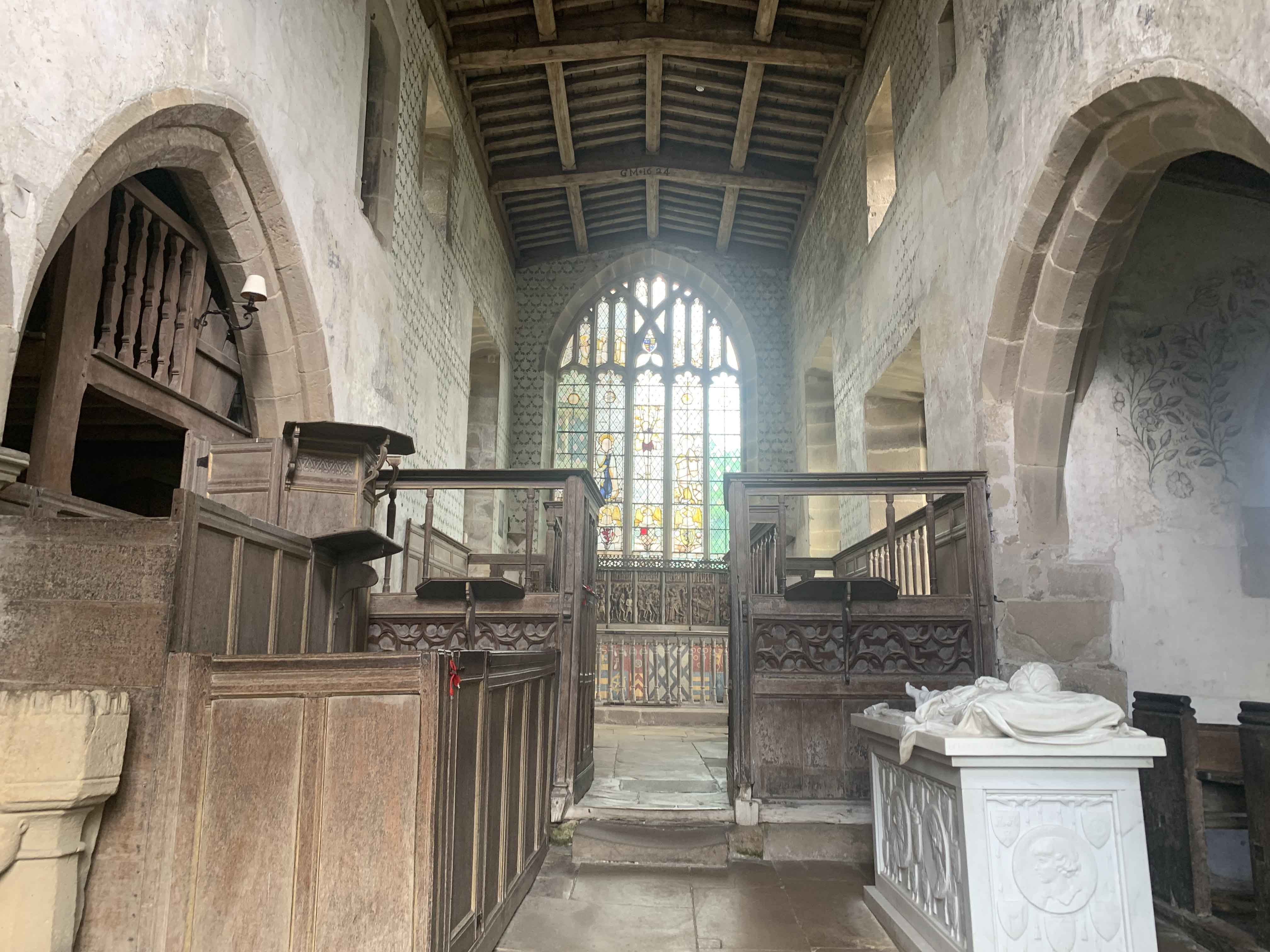
Chapel of St Nicholas, Haddon Hall

The Chapel St John Nicholas, Haddon Hall is a Grade I listed Church of England chapel in Haddon Hall, Derbyshire. The chapel's origins are Norman, with...
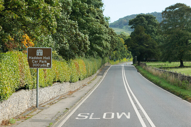
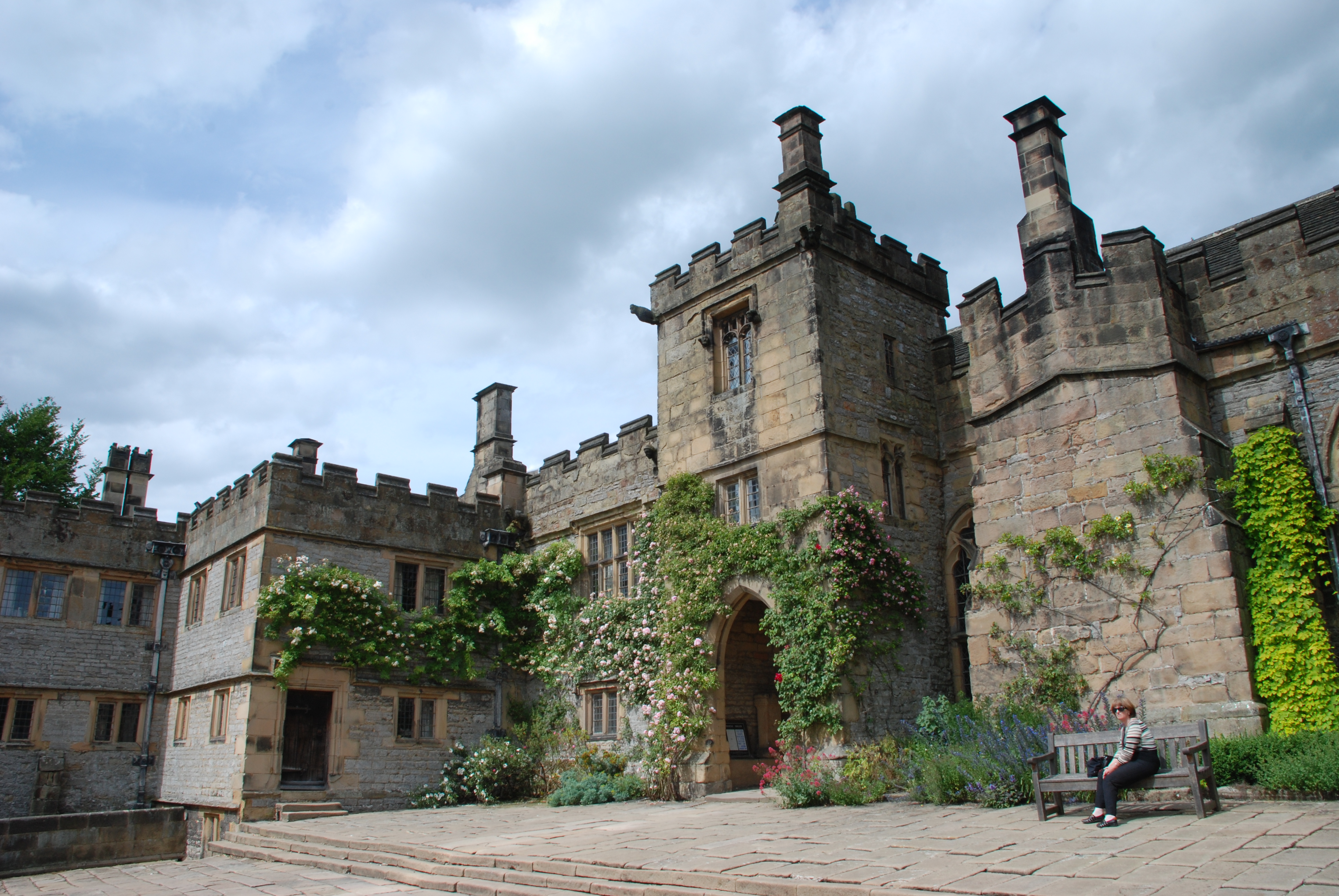
Haddon Hall

Haddon Hall is an English country house on the River Wye near Bakewell, Derbyshire, a former seat of the Dukes of Rutland. It is the home of Lord Edward...
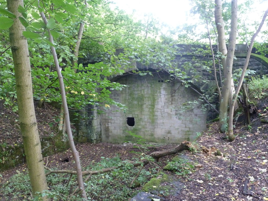
Haddon Tunnel

Haddon Tunnel was built by the Midland Railway in 1863 when extending the Manchester, Buxton, Matlock and Midlands Junction Railway from Rowsley to Buxton...
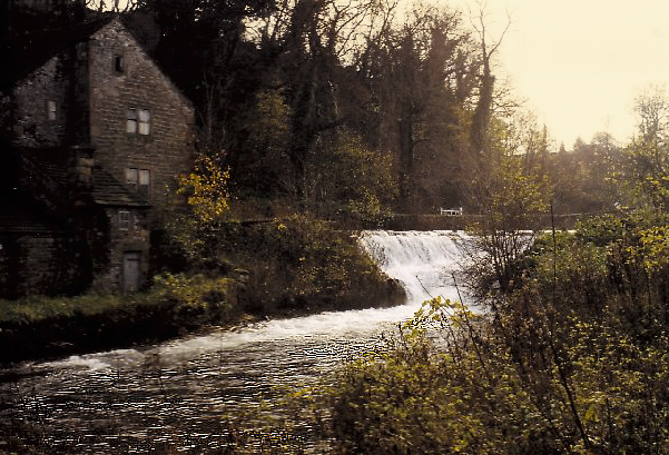
River Lathkill

The River Lathkill is a river in the Peak District National Park in Derbyshire, England. First recorded in 1280, the name "Lathkill" possibly has Scandinavian...

Harthill Hall

Harthill Hall was formerly the Manor House of a great 13th century Estate, and the hall is now a Grade II listed building within the civil parish of Harthill...

Alport

Alport is a hamlet in the White Peak area of Derbyshire, England. It lies east of Youlgreave, at the confluence of the River Bradford and the River Lathkill...

Burton Closes

Burton Closes is a 19th-century country house, now in use as a residential nursing home, situated at Haddon Road, Bakewell, Derbyshire. It is a Grade II...

Nearby Amenities

Located within 500m of 53.191656,-1.656009
Barrier: stile
Material: stone
Source: survey;gps
Stile: squeezer
Lat/Long: 53.1872278/-1.6547796
Barrier: stile
Material: stone
Source: survey;gps
Stile: squeezer
Lat/Long: 53.1939489/-1.6550014
Barrier: stile
Material: stone
Source: survey;gps
Stile: squeezer
Lat/Long: 53.1888916/-1.6549748
Post Box
Collection Times: Mo-Fr 09:00; Sa 07:00
Post Box Type: lamp
Ref: DE45 1275
Royal Cypher: EIIR
Lat/Long: 53.192429/-1.6519457
Haddon Hall
FIXME: Turn into an area; add opening hours
Tourism: attraction
Website: https://www.haddonhall.co.uk/
Wheelchair: no
Lat/Long: 53.1938295/-1.6509845
Entrance: yes
Lat/Long: 53.1935936/-1.6499093
Entrance: yes
Lat/Long: 53.1936205/-1.6497277
Entrance: yes
Lat/Long: 53.1937546/-1.649434
Entrance: main
Lat/Long: 53.1938117/-1.6498197
Toilets
Access: customers
Check Date: 2023-08-15
Wheelchair: no
Lat/Long: 53.1938607/-1.6500818
Entrance: main
Lat/Long: 53.1940631/-1.6505451
Entrance: yes
Lat/Long: 53.1940916/-1.6506811
Toilets
Access: customers
Check Date: 2023-08-15
Lat/Long: 53.1941094/-1.6506554
Bus Stop
Haddon Hall
Bench: no
Bin: no
Lit: no
Public Transport: platform
Shelter: no
Tactile Paving: no
Lat/Long: 53.1921865/-1.6520382
Bus Stop
Haddon Hall
Bench: no
Bin: no
Lit: no
Public Transport: platform
Shelter: no
Tactile Paving: no
Lat/Long: 53.1918916/-1.6512443
Waterway: weir
Lat/Long: 53.1944032/-1.6533161
The data included in this document is from www.openstreetmap.org. The data is made available under ODbL.

Have you been to Nether Haddon?

Leave your review of Nether Haddon below (or comments, questions and feedback).