Nesfield with Langbar
Civil Parish in Yorkshire Harrogate
England
Nesfield with Langbar
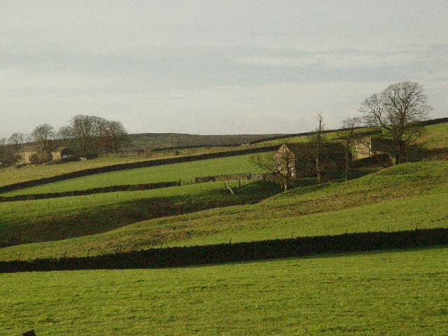
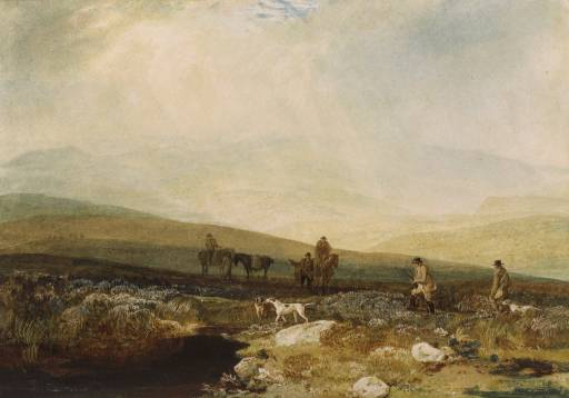
Nesfield with Langbar is a civil parish situated in the county of Yorkshire, England. It is located within the district of Bradford, in the Wharfedale region of the county. The parish consists of two small villages, Nesfield and Langbar, which are nestled in the beautiful landscape of the Yorkshire Dales.
Nesfield, the larger of the two villages, is a picturesque settlement with a charming rural character. It is known for its quaint stone cottages and traditional architecture, which adds to its overall appeal. The village is surrounded by rolling hills and lush green fields, offering stunning views of the surrounding countryside.
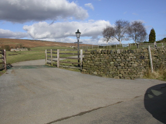
Langbar, on the other hand, is a smaller village that exudes a peaceful and tranquil atmosphere. It is famous for its scenic beauty and is a popular destination for nature lovers and hikers. The village is surrounded by woodlands and offers numerous walking trails that allow visitors to explore the stunning Yorkshire countryside.
Both villages offer a range of amenities and facilities for residents and visitors alike. These include local shops, pubs, and community centers, which contribute to the vibrant community spirit of the area. Additionally, the parish is well-connected to nearby towns and cities, making it an ideal location for those seeking a peaceful rural lifestyle while still having access to urban amenities.
Overall, Nesfield with Langbar is a charming civil parish in Yorkshire, offering a perfect blend of picturesque landscapes, rural beauty, and a close-knit community. It is a place where residents and visitors can enjoy the tranquility of the countryside while still being within reach of modern conveniences.
If you have any feedback on the listing, please let us know in the comments section below.
Nesfield with Langbar Images
Images are sourced within 2km of 53.975888/-1.849939 or Grid Reference SE0953. Thanks to Geograph Open Source API. All images are credited.
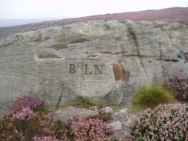
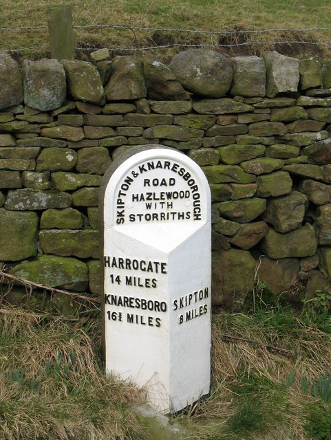
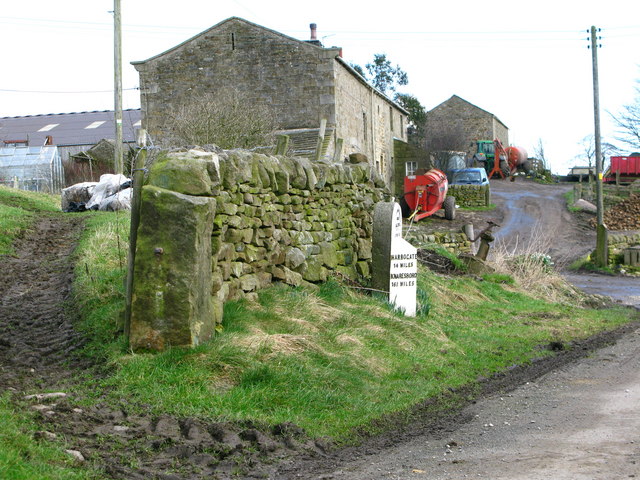
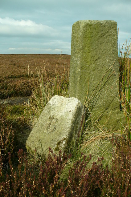
![Old Milestone Langbar Moor This old stone ['Skipton 6 1/2 mls'] stands at the junction of 2 paths on a damp moor above Addingham. Probably the route of an old pack horse track from Skipton to Knaresborough.](https://s2.geograph.org.uk/photos/13/81/138122_2584b42c.jpg)
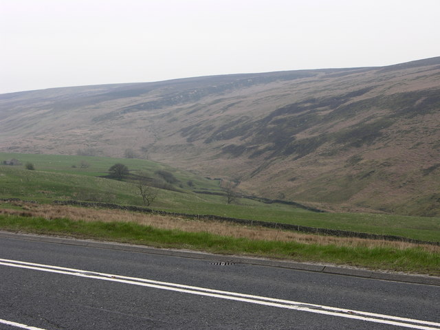
![Landslide by Kex Gill The swell of uneven ground part filling the valley bottom here is the result of a landslide or slope failure on the hillside behind. Note the line of low crags [High Combe] which define the edge of the landslip, which may have been caused by glacial meltwaters eroding the valley and destabilising the area above.](https://s0.geograph.org.uk/geophotos/01/17/72/1177228_a122f952.jpg)
![Old and new roads Looking downhill along the A59 [left], with the old road to the right. This section leading east from Bolton Bridge used to be a winding and tortuous ascent, but the road was re-engineered in the 1970's. Still a hazardous road with sections of three lane, whilst North Yorkshire Police are often here waiting for speeders.](https://s0.geograph.org.uk/geophotos/01/17/72/1177236_ef067388.jpg)
Nesfield with Langbar is located at Grid Ref: SE0953 (Lat: 53.975888, Lng: -1.849939)
Division: West Riding
Administrative County: North Yorkshire
District: Harrogate
Police Authority: North Yorkshire
What 3 Words
///surcharge.perfect.column. Near Addingham, West Yorkshire
Nearby Locations
Related Wikis

Hazlewood
Hazlewood is a hamlet in the English county of North Yorkshire. Hazlewood lies to the east of the town of Skipton by 7.5 miles (12.1 km) and is located...

Hazlewood with Storiths
Hazlewood with Storiths is a civil parish in the Craven district of North Yorkshire, England. The population of the civil parish as of the 2011 census...
Beamsley Hospital
Beamsley Hospital is an Almshouse building at Beamsley, near Skipton in North Yorkshire, and founded in 1593 by the Lady Margaret Russell, the Countess...
Beamsley
Beamsley is a village and civil parish in the Craven district of North Yorkshire, England. It is just within the boundary of the Yorkshire Dales National...

Bolton Abbey
Bolton Abbey in Wharfedale, North Yorkshire, England, takes its name from the ruins of the 12th-century Augustinian monastery now known as Bolton Priory...
Bolton Priory
Bolton Priory, whose full title is The Priory Church of St Mary and St Cuthbert, Bolton Abbey, is a Grade I listed parish church of the Church of England...

Cavendish memorial fountain
The Cavendish memorial fountain is a drinking fountain erected in 1886 at Bolton Abbey, North Yorkshire, England as a memorial to Lord Frederick Cavendish...

Bolton Abbey (village)
Bolton Abbey is a village and civil parish in the Craven district of North Yorkshire, England, 22 miles (35 km) north-west of Leeds. The village lies in...
Nearby Amenities
Located within 500m of 53.975888,-1.849939Have you been to Nesfield with Langbar?
Leave your review of Nesfield with Langbar below (or comments, questions and feedback).