Micklefield

Civil Parish in Yorkshire Leeds

England

Micklefield

Hook Moor Wind Farm
Hook Moor Wind Farm Credit: derek dye

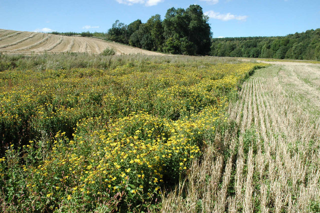
Micklefield is a civil parish and small village located in the county of Yorkshire, England. It is situated approximately 10 miles east of Leeds city centre and falls within the district of Leeds. The village is surrounded by picturesque countryside, offering a peaceful and rural setting for its residents.

Micklefield has a population of around 3,000 people and is known for its close-knit community spirit. The village boasts a range of amenities, including a primary school, a post office, a convenience store, and a few local shops and cafes. There are also several pubs in the area, providing social gathering spaces for locals and visitors alike.

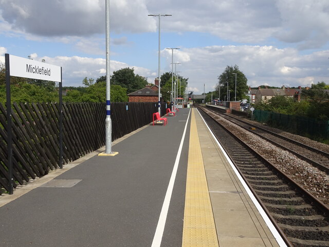
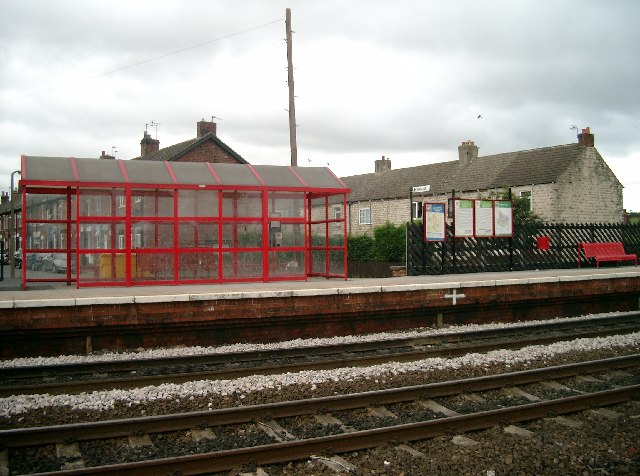
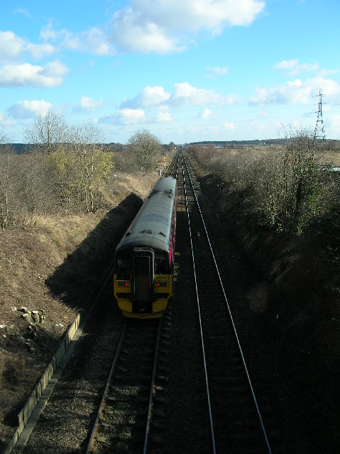
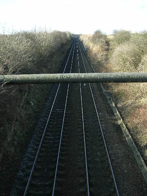
Transport links in Micklefield are well-developed, with a train station connecting the village to Leeds, York, and other major cities in the region. The A1(M) motorway is easily accessible, providing convenient road connections to nearby towns and cities.

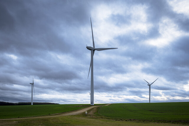
The village is surrounded by beautiful countryside, making it an ideal location for outdoor activities such as walking, cycling, and horse riding. The nearby Fairburn Ings Nature Reserve offers a haven for wildlife enthusiasts, with a variety of bird species and other animals to observe.

Overall, Micklefield combines the tranquility of a rural setting with the convenience of nearby amenities and excellent transport links. It is a charming village that attracts both families and individuals seeking a peaceful and friendly community to call home.

If you have any feedback on the listing, please let us know in the comments section below.
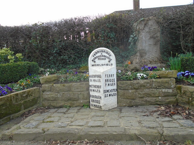
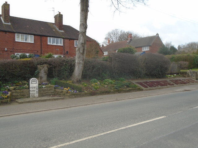
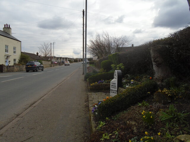
Micklefield Images

Images are sourced within 2km of 53.796014/-1.330129 or Grid Reference SE4433. Thanks to Geograph Open Source API. All images are credited.

Hook Moor Wind Farm
Hook Moor Wind Farm
Bragdale sway marker Hook Moor.
Almost at the end of M1 Looking north east along the last few hundred metres of the M1 heading towards Junction 48 at Hook Moor, where it joins A1(M) which has reached J43. The overbridge in the middle distance is carrying the northbound carriageway of A1(M). These roads date from major upgrades and alterations in 1999.
Almost at the end of M1
Looking north east along the last few hundred metres of the M1 heading towards Junction 48 at Hook Moor, where it joins A1(M) which has reached J43. The overbridge in the middle distance is carrying the northbound carriageway of A1(M). These roads date from major upgrades and alterations in 1999.
M1 heading south west from Hook Moor The beginnings of M1 at its northern end where is cuts through a shallow cutting where the Roman Road once crossed. Signs in the distance herald the approach in 1 mile to J47.
M1 heading south west from Hook Moor
The beginnings of M1 at its northern end where is cuts through a shallow cutting where the Roman Road once crossed. Signs in the distance herald the approach in 1 mile to J47.
Hook Moor Wind Farm View of wind generators from footpath looking from Lotherton towards Micklefield.
Hook Moor Wind Farm
View of wind generators from footpath looking from Lotherton towards Micklefield.
Hook Moor Wind Farm from footpath looking north Some of the Hook Moor Wind Farm Turbines. Image taken from footpath junction, looking north in the direction of Aberford.
Hook Moor Wind Farm from footpath looking north
Some of the Hook Moor Wind Farm Turbines. Image taken from footpath junction, looking north in the direction of Aberford.
M1 Northbound from Parlington Interchange, near Garforth Leeds Image of the M1 northbound heading towards its junction with the A1M. Image taken, after a snowfall, from the Parlington Interchange which is the junction of the B1217 Aberford Road with the M1.
M1 Northbound from Parlington Interchange, near Garforth Leeds
Image of the M1 northbound heading towards its junction with the A1M. Image taken, after a snowfall, from the Parlington Interchange which is the junction of the B1217 Aberford Road with the M1.
Old milestone Winter pansies in the little garden surrounding this West Riding County Council milestone on the old Great North Road.   615 of these milestones were erected all over the old West Riding in 1893/94.  9 of the posts on the 29 miles between Ferrybridge and Boroughbridge can still be found on now minor roads once the main road.
Old milestone
Winter pansies in the little garden surrounding this West Riding County Council milestone on the old Great North Road. 615 of these milestones were erected all over the old West Riding in 1893/94. 9 of the posts on the 29 miles between Ferrybridge and Boroughbridge can still be found on now minor roads once the main road.
Old milestone Either side of the milestone and its surrounding small garden are planted areas spelling out, at the southern side, 2000+ ANGLO SCOTTISH.   And to the north, seen here, TRADE ROUTE.
Old milestone
Either side of the milestone and its surrounding small garden are planted areas spelling out, at the southern side, 2000+ ANGLO SCOTTISH. And to the north, seen here, TRADE ROUTE.
Old milestone Facing southwards, three small areas can just be seen on the slope behind the two posts.  This is where 2000+, ANGLO, and SCOTTISH have been planted.
Old milestone
Facing southwards, three small areas can just be seen on the slope behind the two posts. This is where 2000+, ANGLO, and SCOTTISH have been planted.
Old milestone A photograph taken in 2018.   The metal attachment of this West Riding CC milestone dating from 1893/94, is looking dirtier than ever.   615 milestones were set up all over the old West Riding, over half are still by the roadside.
Old milestone
A photograph taken in 2018. The metal attachment of this West Riding CC milestone dating from 1893/94, is looking dirtier than ever. 615 milestones were set up all over the old West Riding, over half are still by the roadside.
Micklefield railway station, Yorkshire Opened in 1834 by the Leeds & Selby Railway, later part of the North Eastern Railway who rebuilt the original station in 1879.
View east towards South Milford and Selby (straight on), also Church Fenton and York (left). The 1835-built former warehouse can be seen on the left and just behind it, the 1873-built former station building, both now private residences. All the 1879 improvements including platform buildings and footbridge were removed some time after 1985. The current platform shelters replaced the ones shown in <a href="https://www.geograph.org.uk/photo/3253814">SE4432 : Micklefield railway station, Yorkshire, 2008</a>, taken from the opposite direction from the Leeds-bound platform.
Micklefield railway station, Yorkshire
Opened in 1834 by the Leeds & Selby Railway, later part of the North Eastern Railway who rebuilt the original station in 1879. View east towards South Milford and Selby (straight on), also Church Fenton and York (left). The 1835-built former warehouse can be seen on the left and just behind it, the 1873-built former station building, both now private residences. All the 1879 improvements including platform buildings and footbridge were removed some time after 1985. The current platform shelters replaced the ones shown in SE4432 : Micklefield railway station, Yorkshire, 2008, taken from the opposite direction from the Leeds-bound platform.
'Roman Road' Bridge, A1-M1 Link, Yorkshire This bridge takes a minor road over the M1 close to the line of the Roman Road [known as Roman Ridge], that ran northwards from Castleford [Lagentium] to Tadcaster [Calcaria]. Before construction of the motorway and bridge, the road kept to the line of the Roman Road and was formerly the A656 which joined A1 at Aberford.
'Roman Road' Bridge, A1-M1 Link, Yorkshire
This bridge takes a minor road over the M1 close to the line of the Roman Road [known as Roman Ridge], that ran northwards from Castleford [Lagentium] to Tadcaster [Calcaria]. Before construction of the motorway and bridge, the road kept to the line of the Roman Road and was formerly the A656 which joined A1 at Aberford.
Micklefield Station Micklefield Station is just before the line splits for York or Selby.
Micklefield Station
Micklefield Station is just before the line splits for York or Selby.
St Mary the Virgin, Micklefield The parish church of Micklefield.
St Mary the Virgin, Micklefield
The parish church of Micklefield.
Marsh near Hartly Wood Surrounded by cereal crops, an area of impeded drainage supports a small wildlife oasis with marsh plants including the bright yellow-flowered Common Fleabane.
Marsh near Hartly Wood
Surrounded by cereal crops, an area of impeded drainage supports a small wildlife oasis with marsh plants including the bright yellow-flowered Common Fleabane.
Garforth - Micklefield Railway from Ridge Bridge Taken next to Ridge Bridge Cottage on the A656.  Taken looking east towards Micklefield, as a train passes, travelling in that direction.
Garforth - Micklefield Railway from Ridge Bridge
Taken next to Ridge Bridge Cottage on the A656. Taken looking east towards Micklefield, as a train passes, travelling in that direction.
Micklefield - Garforth Railway from Ridge Bridge Reverse view of the railway <a href="https://www.geograph.org.uk/photo/125375">SE4332 : Garforth - Micklefield Railway from Ridge Bridge</a>, taken opposite Ridge Bridge Cottage on the A656. Taken looking west towards Garforth, with Stourton Grange on the right to the north-west.  Not sure what the monstrously carbunculous pipe is!
Micklefield - Garforth Railway from Ridge Bridge
Reverse view of the railway SE4332 : Garforth - Micklefield Railway from Ridge Bridge, taken opposite Ridge Bridge Cottage on the A656. Taken looking west towards Garforth, with Stourton Grange on the right to the north-west. Not sure what the monstrously carbunculous pipe is!
Show me another place!

Micklefield is located at Grid Ref: SE4433 (Lat: 53.796014, Lng: -1.330129)

Division: West Riding

Administrative County: West Yorkshire

District: Leeds

Police Authority: West Yorkshire

What 3 Words

///starlight.quench.servants. Near Garforth, West Yorkshire

Related Wikis

Micklefield

Micklefield is a village and civil parish in the City of Leeds in West Yorkshire, England. It neighbours Garforth, Aberford and Brotherton and is close...

Micklefield railway station

Micklefield railway station serves the village of Micklefield, near Garforth in West Yorkshire, England. It lies on the Selby and York Lines, operated...

Roman Road railway station (Yorkshire)

Roman Road railway station was a station on the Leeds and Selby Railway, near Micklefield, in West Yorkshire, England. The station was one of the shortest...

Sturton Grange

Sturton Grange is a civil parish in the City of Leeds in West Yorkshire, England. It has a population of 417, reducing to 403 at the 2011 Census.Most of...

Nearby Amenities

Located within 500m of 53.796014,-1.330129
Bus Stop
Great North Road Hicks Memorial School
Bus: yes
Local Ref: 45010136
Naptan AtcoCode: 450010136
Naptan Bearing: SE
Naptan CommonName: Great North Road Hicks Memorial School
Naptan Crossing: Churchville Drive
Naptan Indicator: Stop 45010136
Naptan Landmark: Hicks Memorial School
Naptan PlusbusZoneRef: LEEDS
Naptan ShortCommonName: Churchville Drive
Naptan Street: Great North Road
Naptan Verified: no
Public Transport: platform
Source: naptan_import
Lat/Long: 53.7955874/-1.3284488
Bus Stop
Great North Road Churchville Drive
Bus: yes
Local Ref: 45010137
Naptan AtcoCode: 450010137
Naptan Bearing: NW
Naptan CommonName: Great North Road Churchville Drive
Naptan Crossing: Churchville Drive
Naptan Indicator: Stop 45010137
Naptan PlusbusZoneRef: LEEDS
Naptan ShortCommonName: Churchville Drive
Naptan Street: Great North Road
Naptan Verified: no
Public Transport: platform
Source: naptan_import
Lat/Long: 53.7959047/-1.3289295
Bus Stop
Church Lane Hallfield Avenue
Bus: yes
Local Ref: 45010138
Naptan AtcoCode: 450010138
Naptan Bearing: SW
Naptan CommonName: Church Lane Hallfield Avenue
Naptan Crossing: Hallfield Avenue
Naptan Indicator: Stop 45010138
Naptan PlusbusZoneRef: LEEDS
Naptan ShortCommonName: Hallfield Avenue
Naptan Street: Church Lane
Naptan Verified: no
Public Transport: platform
Source: naptan_import
Lat/Long: 53.7956939/-1.3355438
Bus Stop
Church Lane Hallfield Avenue
Bus: yes
Local Ref: 45010139
Naptan AtcoCode: 450010139
Naptan Bearing: NE
Naptan CommonName: Church Lane Hallfield Avenue
Naptan Crossing: Hallfield Avenue
Naptan Indicator: Stop 45010139
Naptan PlusbusZoneRef: LEEDS
Naptan ShortCommonName: Hallfield Avenue
Naptan Street: Church Lane
Naptan Verified: no
Public Transport: platform
Source: naptan_import
Lat/Long: 53.7957642/-1.3356352
Bus Stop
Churchville Terrace Church Lane
Bus: yes
Local Ref: 45013321
Naptan AtcoCode: 450013321
Naptan Bearing: SE
Naptan CommonName: Churchville Terrace Church Lane
Naptan Crossing: Church Lane
Naptan Indicator: Stop 45013321
Naptan PlusbusZoneRef: LEEDS
Naptan ShortCommonName: Church Lane
Naptan Street: Churchville Terrace
Naptan Verified: no
Public Transport: platform
Source: naptan_import
Lat/Long: 53.7960828/-1.333466
Bus Stop
Micklefield Churchville PO
Bus: yes
Local Ref: 45013322
Naptan AtcoCode: 450013322
Naptan Bearing: NE
Naptan CommonName: Micklefield Churchville PO
Naptan Crossing: Churchville Terrace
Naptan Indicator: Stop 45013322
Naptan PlusbusZoneRef: LEEDS
Naptan ShortCommonName: Churchville Terrace
Naptan Street: Churchville Drive
Naptan Verified: no
Public Transport: platform
Source: naptan_import
Lat/Long: 53.7949697/-1.3321022
Bus Stop
Church Lane Great North Road
Bus: yes
Local Ref: 45013323
Naptan AtcoCode: 450013323
Naptan Bearing: SW
Naptan CommonName: Church Lane Great North Road
Naptan Crossing: Great North Road
Naptan Indicator: Stop 45013323
Naptan Notes: New L/C no 3C980
Naptan PlusbusZoneRef: LEEDS
Naptan ShortCommonName: Great North Road
Naptan Street: Church Lane
Naptan Verified: no
Public Transport: platform
Source: naptan_import
Lat/Long: 53.7969657/-1.3322223
Bus Stop
Churchville Terrace Church Lane
Bus: yes
Local Ref: 45050111
Naptan AtcoCode: 450050111
Naptan Bearing: NW
Naptan BusStopType: CUS
Naptan CommonName: Churchville Terrace Church Lane
Naptan Indicator: Stop 45050111
Naptan PlusbusZoneRef: LEEDS
Naptan ShortCommonName: Church Lane
Naptan Street: Churchville Terrace
Naptan Verified: no
Public Transport: platform
Source: naptan_import
Lat/Long: 53.7960033/-1.3337102
Bus Stop
Churchville PO
Bus: yes
Local Ref: 45050112
Naptan AtcoCode: 450050112
Naptan Bearing: SW
Naptan BusStopType: CUS
Naptan CommonName: Churchville PO
Naptan Indicator: Stop 45050112
Naptan PlusbusZoneRef: LEEDS
Naptan ShortCommonName: Churchville PO
Naptan Street: Churchville Drive
Naptan Verified: no
Public Transport: platform
Source: naptan_import
Lat/Long: 53.7949064/-1.3320425
Church Lane Great North Road
Local Ref: 45050113
Naptan AtcoCode: 450050113
Naptan Bearing: NE
Naptan BusStopType: CUS
Naptan CommonName: Church Lane Great North Road
Naptan Indicator: Stop 45050113
Naptan PlusbusZoneRef: LEEDS
Naptan ShortCommonName: Great North Road
Naptan Street: Church Lane
Naptan Verified: no
Source: naptan_import
Lat/Long: 53.7970293/-1.3323427
Micklefield
Place: village
Lat/Long: 53.7931381/-1.328374
Turning Circle
Lat/Long: 53.7939355/-1.3346318
Noexit: yes
Lat/Long: 53.7944883/-1.3284374
Noexit: yes
Lat/Long: 53.7960412/-1.3363122
Noexit: yes
Lat/Long: 53.7960783/-1.3322371
Noexit: yes
Lat/Long: 53.7961497/-1.33202
Noexit: yes
Lat/Long: 53.7961875/-1.3364342
Turning Circle
Turning Circle: circle
Lat/Long: 53.79696/-1.3350847
Turning Circle
Lat/Long: 53.797092/-1.3338627
Noexit: yes
Lat/Long: 53.7974235/-1.3332017
Traffic Calming: table
Lat/Long: 53.7989492/-1.3336702
Noexit: yes
Lat/Long: 53.7950823/-1.3289832
Noexit: yes
Lat/Long: 53.7950057/-1.3291783
Milestone
Historic: milestone
Lat/Long: 53.7964408/-1.3295936
Booth: KX420
Removed Amenity: telephone
Lat/Long: 53.7959512/-1.3290384
Bench
Lat/Long: 53.7960479/-1.3295453
D And P Churchville Village Store
Addr City: Leeds
Addr Housenumber: 22
Addr Postcode: LS25 4AR
Addr Street: Churchville Terrace
Addr Suburb: Micklefield
Fhrs Id: 321217
Shop: convenience
Lat/Long: 53.7948019/-1.3325509
Fast Food
Indigo Spice And Grill
Addr City: Leeds
Addr Housenumber: Adjacent Blands Arms
Addr Postcode: LS25 4AQ
Addr Street: Great North Road
Addr Suburb: Micklefield
Cuisine: indian
Fhrs Id: 1194686
Takeaway: yes
Lat/Long: 53.7944613/-1.3275111
Post Box
Operator: Royal Mail
Post Box Type: pillar
Ref: LS25 477
Lat/Long: 53.7948661/-1.3324906
Waste Basket
Collection Times: Th
Ref UK Leedscc Bin: 658
Lat/Long: 53.795424/-1.336515
Waste Basket
Collection Times: Th
Ref UK Leedscc Bin: 659
Lat/Long: 53.795457/-1.335914
Waste Basket
Collection Times: Th
Ref UK Leedscc Bin: 697
Lat/Long: 53.794797/-1.332429
Waste Basket
Collection Times: Th
Ref UK Leedscc Bin: 695
Lat/Long: 53.795042/-1.331682
Waste Basket
Collection Times: Th
Ref UK Leedscc Bin: 696
Lat/Long: 53.795939/-1.329804
Waste Basket
Collection Times: Th
Ref UK Leedscc Bin: 694
Lat/Long: 53.795992/-1.329277
Waste Basket
Collection Times: Th
Ref UK Leedscc Bin: 1147
Lat/Long: 53.79588/-1.328903
Waste Basket
Collection Times: Th
Ref UK Leedscc Bin: 1148
Lat/Long: 53.7956784/-1.3284569
Waste Basket
Collection Times: Th
Ref UK Leedscc Bin: 1145
Lat/Long: 53.794125/-1.327117
Noexit: yes
Lat/Long: 53.7943417/-1.3266545
Noexit: yes
Lat/Long: 53.7921214/-1.3272461
Noexit: yes
Lat/Long: 53.7926868/-1.3258148
Noexit: yes
Lat/Long: 53.7942355/-1.3255531
Noexit: yes
Lat/Long: 53.7942997/-1.3258642
Noexit: yes
Lat/Long: 53.7939384/-1.326111
Noexit: yes
Lat/Long: 53.794712/-1.325732
Noexit: yes
Lat/Long: 53.794577/-1.3257092
Noexit: yes
Lat/Long: 53.7957755/-1.3273045
Noexit: yes
Lat/Long: 53.7938283/-1.3272174
Noexit: yes
Lat/Long: 53.794215/-1.3344151
Noexit: yes
Lat/Long: 53.7941654/-1.3345868
Church Lane Hallfield Avenue
Bus: yes
Local Ref: 45010139
Public Transport: stop_position
Lat/Long: 53.7957357/-1.3355598
Church Lane Hallfield Avenue
Bus: yes
Local Ref: 45010138
Public Transport: stop_position
Lat/Long: 53.795714/-1.335611
Churchville Terrace Church Lane
Bus: yes
Local Ref: 45013321
Public Transport: stop_position
Lat/Long: 53.7960075/-1.3335433
Churchville Terrace Church Lane
Bus: yes
Local Ref: 45050111
Public Transport: stop_position
Lat/Long: 53.7960624/-1.3335996
Micklefield Churchville PO
Bus: yes
Local Ref: 45013322
Public Transport: stop_position
Lat/Long: 53.7949606/-1.3320115
Churchville PO
Bus: yes
Local Ref: 45050112
Public Transport: stop_position
Lat/Long: 53.7949206/-1.3321388
Great North Road Hicks Memorial School
Bus: yes
Local Ref: 45010136
Public Transport: stop_position
Lat/Long: 53.7955675/-1.3284436
Great North Road Churchville Drive
Bus: yes
Local Ref: 45010137
Public Transport: stop_position
Lat/Long: 53.7959742/-1.3288994
The data included in this document is from www.openstreetmap.org. The data is made available under ODbL.

Have you been to Micklefield?

Leave your review of Micklefield below (or comments, questions and feedback).