Meltham

Civil Parish in Yorkshire Kirklees

England

Meltham

The permissive path to West Nab Start of the short climb from the road.
The permissive path to West Nab Credit: steven ruffles

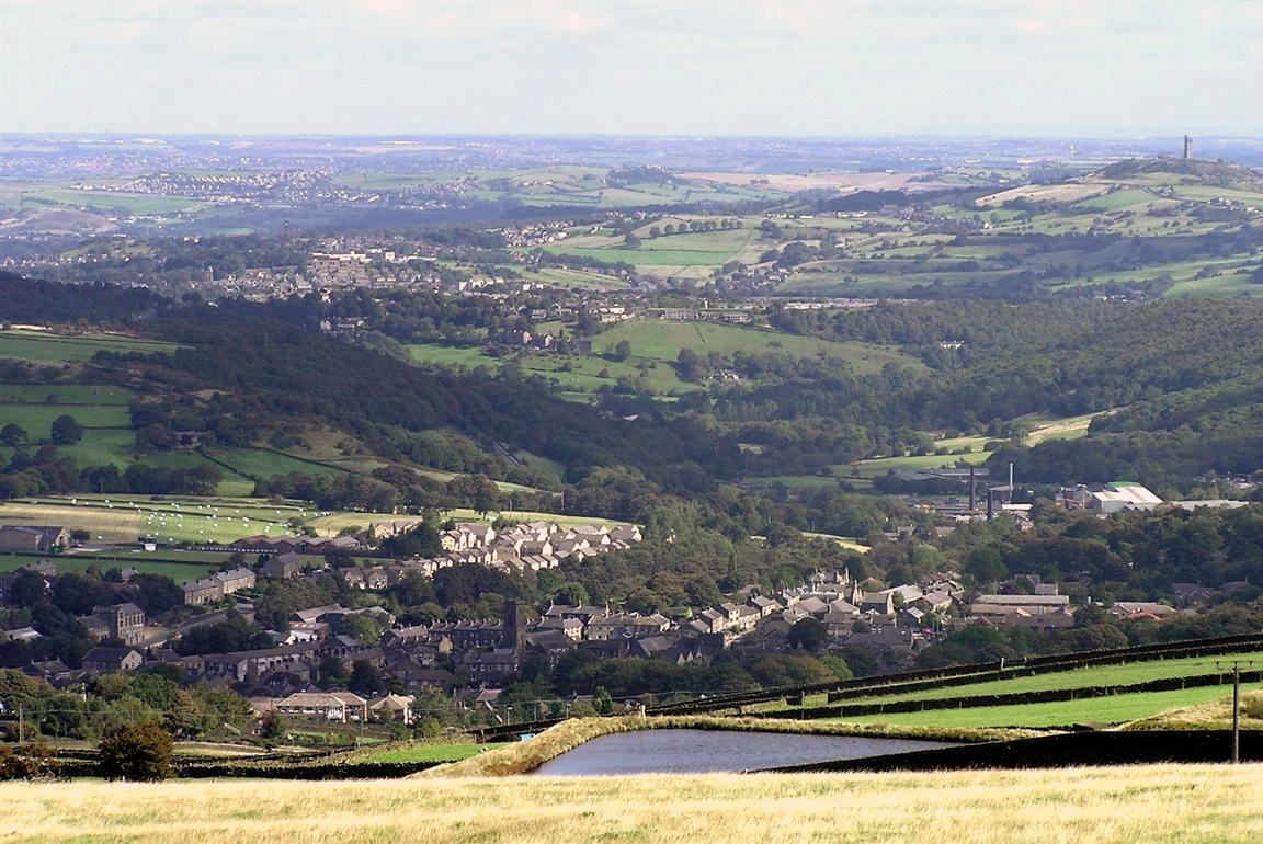
Meltham is a civil parish located in the metropolitan borough of Kirklees, West Yorkshire, England. Situated approximately 5 miles southwest of Huddersfield, it lies in the picturesque Holme Valley, surrounded by stunning countryside and rolling hills.

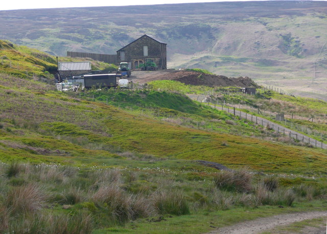
The history of Meltham dates back to the medieval period, and evidence of its industrial past can still be seen in the form of old mills and weavers' cottages. The village was once a thriving center for textile production, particularly woollen cloth, and remnants of this industry can be explored at the local Meltham Mills Heritage Centre.

With a population of around 8,000 people, Meltham is a close-knit community with a strong sense of identity. It offers a range of amenities and services to its residents, including primary and secondary schools, a library, shops, and local pubs. The village also boasts several sports facilities, including football and cricket pitches, as well as a golf course.

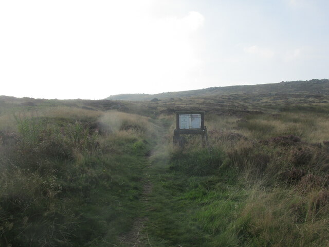
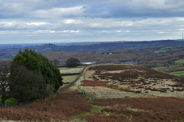
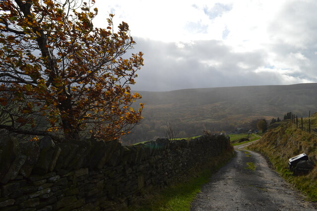
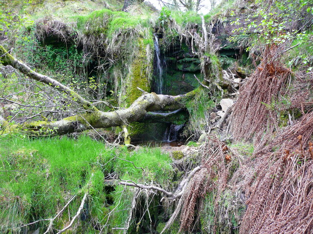
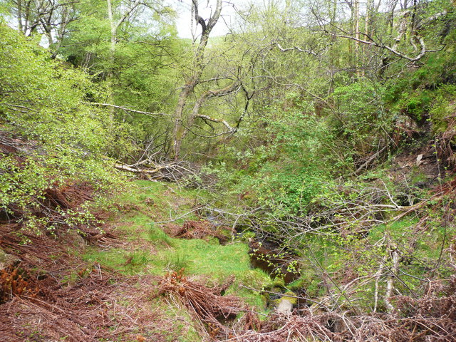
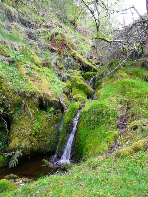
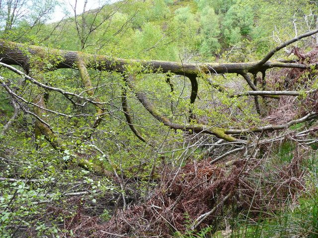
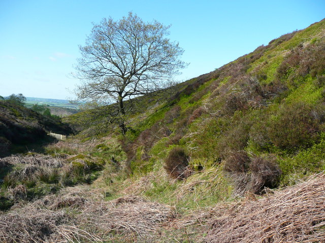
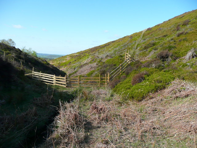
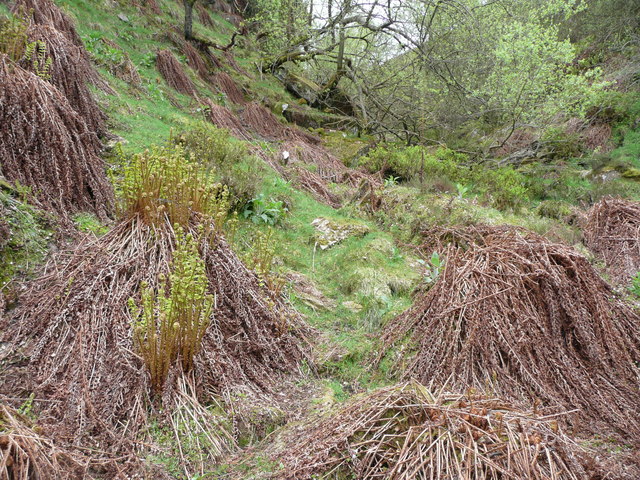
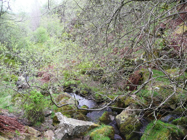
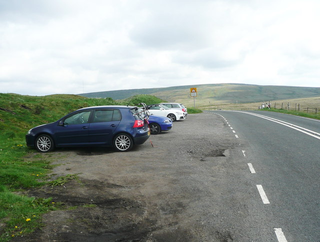
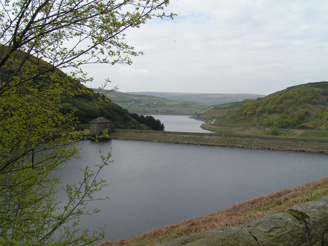
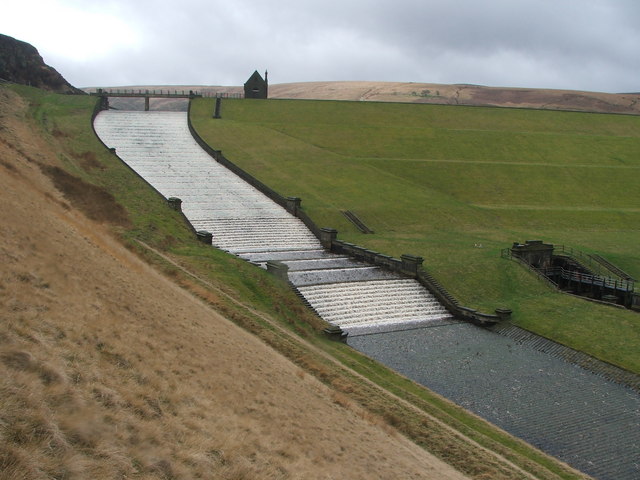
Nature lovers are drawn to Meltham for its stunning scenery and abundance of outdoor activities. The area is dotted with picturesque walking and cycling trails, such as the Meltham Way and the Kirklees Way, which offer breathtaking views of the surrounding countryside. Nearby, one can also find beautiful parks and reservoirs, like Blackmoorfoot Reservoir and Digley Reservoir, perfect for outdoor enthusiasts and families alike.

Overall, Meltham is a charming village that seamlessly blends its industrial heritage with natural beauty, providing its residents with a peaceful and idyllic place to live.

If you have any feedback on the listing, please let us know in the comments section below.
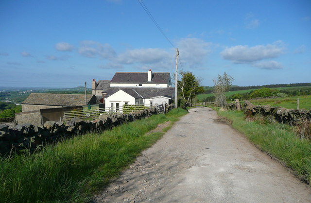
Meltham Images

Images are sourced within 2km of 53.581527/-1.877047 or Grid Reference SE0809. Thanks to Geograph Open Source API. All images are credited.

The permissive path to West Nab Start of the short climb from the road.
The permissive path to West Nab
Start of the short climb from the road.
West Nab Trig Point - View towards Huddersfield
Wessenden Head Road from West Nab
The Pennine Way near Wessenden Head Road
Meltham to West Nab Looking back along the footpath towards Meltham, in the distance can be seen Victoria Tower (known locally as Castle Hill) and opposite it on the far right, just in shot, is Emley Moor mast.
Meltham to West Nab
Looking back along the footpath towards Meltham, in the distance can be seen Victoria Tower (known locally as Castle Hill) and opposite it on the far right, just in shot, is Emley Moor mast.
Sun Royd farm Meltham The track leading down to Sun Royd farm from where the footpath leads off, this track to the farm, a footpath off to the right going towards West Nab.
Sun Royd farm Meltham
The track leading down to Sun Royd farm from where the footpath leads off, this track to the farm, a footpath off to the right going towards West Nab.
Waterfalls in Great Hey Sike Clough View from a contour path following a water pipe line that feeds Deer Hill Reservoir conduit
Waterfalls in Great Hey Sike Clough
View from a contour path following a water pipe line that feeds Deer Hill Reservoir conduit
Magdalen Road passing Royd Farm, Meltham Royd Farm is first shown on the 1906 1:2500 map. the house and bungalow were built later.
Magdalen Road passing Royd Farm, Meltham
Royd Farm is first shown on the 1906 1:2500 map. the house and bungalow were built later.
Waterfall in Middle Clough, Meltham This was taken a little further away than <a href="https://www.geograph.org.uk/photo/4475594">SE0908 : Middle Clough, Meltham, a big waterfall</a> to show the cliff face that has to be negotiated to continue further up the valley, or to come down. It is an awkward climb, and there are some loose stones on the way up.
Waterfall in Middle Clough, Meltham
This was taken a little further away than SE0908 : Middle Clough, Meltham, a big waterfall to show the cliff face that has to be negotiated to continue further up the valley, or to come down. It is an awkward climb, and there are some loose stones on the way up.
Middle Clough, below the tall waterfall, Meltham This is a wilderness. You have to pick your way carefully through the fallen trees and beware of slippery moss-covered boulders.
Middle Clough, below the tall waterfall, Meltham
This is a wilderness. You have to pick your way carefully through the fallen trees and beware of slippery moss-covered boulders.
Mossy waterfall, Middle Clough, Meltham
Fallen oak tree across Middle Clough, Meltham This is a difficult obstacle, but not impassable. Getting past it involves crossing the stream on branches of the tree, which is still alive despite being horizontal.
Fallen oak tree across Middle Clough, Meltham
This is a difficult obstacle, but not impassable. Getting past it involves crossing the stream on branches of the tree, which is still alive despite being horizontal.
Rams Clough at the Oak Tree, Meltham Spot the difference from <a href="https://www.geograph.org.uk/photo/4476782">SE0908 : Rams Clough at the oak tree, Meltham</a>. The tree hasn't grown much, however there is a new wooden fence across the valley floor in the distance.
Rams Clough at the Oak Tree, Meltham
Spot the difference from SE0908 : Rams Clough at the oak tree, Meltham. The tree hasn't grown much, however there is a new wooden fence across the valley floor in the distance.
New fence across Rams Clough This is presumably to stop sheep from going down the valley. It joins the stock-proof fence on each side. Perhaps it was considered that a more robust fence was needed across the valley floor.
New fence across Rams Clough
This is presumably to stop sheep from going down the valley. It joins the stock-proof fence on each side. Perhaps it was considered that a more robust fence was needed across the valley floor.
Ferns waking up in Rams Clough, Meltham See also <a href="https://www.geograph.org.uk/photo/4476758">SE0908 : Rams Clough, Meltham</a> and <a href="https://www.geograph.org.uk/photo/4033021">SE0908 : Ferns in Rams Clough</a>.
Ferns waking up in Rams Clough, Meltham
Tree in Rams Clough, Meltham This tree has long, slender branches that stretch out sideways close to the ground.
Tree in Rams Clough, Meltham
This tree has long, slender branches that stretch out sideways close to the ground.
West Nab Cottage, Meltham The 1841 Census lists 40-year-old James Haigh and his family residing at West Nab Cottage. His occupation is given as "coal agent" (coal was mined nearby). A gamekeeper lived here in 1851, and the building is said to have been used as a hunting lodge.

A builder has rescued it from a derelict state and hopes to open it as a base for outdoor pursuits.
West Nab Cottage, Meltham
The 1841 Census lists 40-year-old James Haigh and his family residing at West Nab Cottage. His occupation is given as "coal agent" (coal was mined nearby). A gamekeeper lived here in 1851, and the building is said to have been used as a hunting lodge. A builder has rescued it from a derelict state and hopes to open it as a base for outdoor pursuits.
Car park on Wessenden Head Road, Marsden This car park is useful for people walking in the Wessenden Valley.
Car park on Wessenden Head Road, Marsden
This car park is useful for people walking in the Wessenden Valley.
Show me another place!

Meltham is located at Grid Ref: SE0809 (Lat: 53.581527, Lng: -1.877047)

Division: West Riding

Administrative County: West Yorkshire

District: Kirklees

Police Authority: West Yorkshire

What 3 Words

///issue.artist.excavated. Near Meltham, West Yorkshire

Nearby Locations

High Moor Meltham

Related Wikis

Meltham

Meltham is a town and civil parish within the Metropolitan Borough of Kirklees, in West Yorkshire, England. It lies in the Holme Valley, below Wessenden...

Meltham railway station (England)

Meltham railway station was the terminus of the Meltham branch line from Lockwood (Huddersfield) to Meltham, in the West Riding of Yorkshire, England....

Meltham Town Hall

Meltham Town Hall is a municipal building in Carlile Street in Meltham, West Yorkshire, England. The building, which formerly operated as the offices of...

Helme, West Yorkshire

Helme is a small village in the Kirklees district, in the county of West Yorkshire, England. It is near the town of Meltham and Blackmoorfoot Reservoir...

Holmfirth floods

The Holmfirth floods were a number of instances when severe flooding had occurred in the Holme Valley, West Yorkshire, England affecting Holmfirth and...

Wessenden Valley

The Wessenden Valley is a moorland valley in the Dark Peak, immediately south of Marsden in West Yorkshire, England. The name Wessenden derives from Old...

Digley Reservoir

Digley Reservoir is a lake located downstream of Bilberry Reservoir, 2 miles (3.2 km) south west of Holmfirth, in West Yorkshire, England. The reservoir...

Butterley Reservoir, West Yorkshire

Butterley Reservoir is a reservoir located near Marsden, West Yorkshire, near the Peak District National Park boundary. It was completed in 1906. The reservoir...

Related Videos

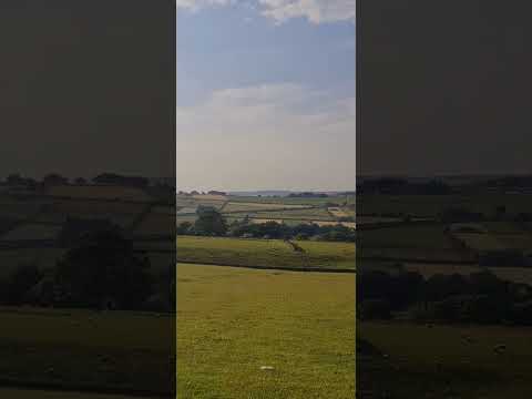
Beautiful views #pennines #yorkshire #rucking #hiking #shortsvideo #tabbing #fitover55

It's my #birthday today so I loaded up the #bergan as has become tradition to tab 5.6 km carrying 56lb up 1000 feet of local hill in ...

cock growing stone!!! #hiking #rucking #walking #funny #short #getoutside #goruck #gooutside

It's actually the Cock Crowing Stone The term "cock crowing stone" is usually given to standing stones with folklore attached.

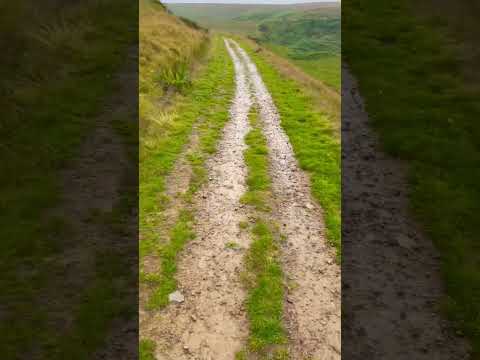
Post injury #rucking #walking #hiking #tabbing #paras10 #fandance #shorts #boots #fitness #keepfit

So… 8 weeks after sustaining a #stressfracture during training for the Fan Dance and 2 weeks after VW from the event itself I've ...

Nearby Amenities

Located within 500m of 53.581527,-1.877047
Barrier: cattle_grid
Source: Bing
Lat/Long: 53.5816411/-1.8757726
Power: pole
Lat/Long: 53.5835853/-1.8712963
Power: pole
Lat/Long: 53.5832318/-1.8721068
Power: pole
Lat/Long: 53.5812045/-1.8713904
Power: pole
Lat/Long: 53.5826595/-1.8710896
Power: pole
Lat/Long: 53.5817581/-1.8712701
Power: pole
Lat/Long: 53.5832268/-1.8710046
Power: pole
Lat/Long: 53.5815292/-1.8700641
Power: pole
Lat/Long: 53.581312/-1.8710113
Barrier: stile
Lat/Long: 53.5797198/-1.8746972
The data included in this document is from www.openstreetmap.org. The data is made available under ODbL.

Have you been to Meltham?

Leave your review of Meltham below (or comments, questions and feedback).