Melsonby

Civil Parish in Yorkshire Richmondshire

England

Melsonby

Location of OS Flush Bracket 2180: Melsonby <span class="nowrap"><a title="https://www.bench-marks.org.uk/bm10213" rel="nofollow ugc noopener" href="https://www.bench-marks.org.uk/bm10213">Link</a><img style="margin-left:2px;" alt="External link" title="External link - shift click to open in new window" src="https://s1.geograph.org.uk/img/external.png" width="10" height="10"/></span>
Location of OS Flush Bracket 2180: Melsonby Credit: thejackrustles

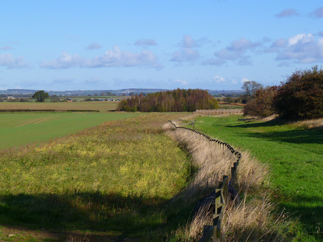
Melsonby is a small civil parish located in the district of Richmondshire, in the county of Yorkshire, England. Situated approximately 4 miles east of the market town of Richmond, it covers an area of about 1,500 acres. The village itself is nestled in a picturesque setting, surrounded by the rolling hills and stunning countryside that Yorkshire is renowned for.

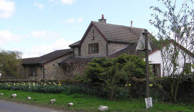
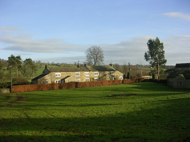
With a population of around 350 inhabitants, Melsonby retains its rural charm and tranquility. The village consists of a mixture of traditional stone-built houses, some of which date back to the 18th century, giving it a distinct character. The centerpiece of the village is the All Saints Church, a Grade I listed building, which adds to the historical appeal of Melsonby.

Melsonby benefits from a number of amenities to cater to the needs of its residents. These include a primary school, a village hall, a post office, a pub, and a small convenience store. The village also boasts a thriving community spirit, with various social groups and clubs, fostering a sense of togetherness among the residents.

The surrounding area offers plenty of opportunities for outdoor activities and exploration. Melsonby is surrounded by beautiful countryside, providing ample opportunities for walking, cycling, and hiking. The nearby River Swale offers opportunities for fishing, while the Yorkshire Dales National Park is within easy reach, offering stunning landscapes and picturesque villages to explore.

Overall, Melsonby is a charming and idyllic village, offering a peaceful and close-knit community, surrounded by natural beauty and with a rich historical heritage.

If you have any feedback on the listing, please let us know in the comments section below.

Melsonby Images

Images are sourced within 2km of 54.471722/-1.701 or Grid Reference NZ1908. Thanks to Geograph Open Source API. All images are credited.

Location of OS Flush Bracket 2180: Melsonby <span class="nowrap"><a title="https://www.bench-marks.org.uk/bm10213" rel="nofollow ugc noopener" href="https://www.bench-marks.org.uk/bm10213">Link</a><img style="margin-left:2px;" alt="External link" title="External link - shift click to open in new window" src="https://s1.geograph.org.uk/img/external.png" width="10" height="10"/></span>
Location of OS Flush Bracket 2180: Melsonby
OS Flush Bracket 2180: Melsonby Sadly the number is buried
This area has a very unusual concentration of 2GL Flush Brackets
<span class="nowrap"><a title="https://www.bench-marks.org.uk/help/flush" rel="nofollow ugc noopener" href="https://www.bench-marks.org.uk/help/flush">Link</a><img style="margin-left:2px;" alt="External link" title="External link - shift click to open in new window" src="https://s1.geograph.org.uk/img/external.png" width="10" height="10"/></span>
2GL Series
Flush brackets were first used during the 2nd Geodetic Levelling of England & Wales between 1912 and 1921. The 2GL series was numbered from OSBM 1 to OSBM 3000 and did not have a prefix letter. The vast majority of the flush brackets in the 2GL series were placed on walls and buildings, but a small number were used on triangulation pillars. There are 48 examples of these listed in the database, all in the range OSBM 2732 to OSBM 2999.

In addition to England and Wales, the survey also covered part of the southeast of Scotland, in roughly the area between Newcastleton, Dunbar, and Berwick upon Tweed.
OS Flush Bracket 2180: Melsonby
Sadly the number is buried This area has a very unusual concentration of 2GL Flush Brackets LinkExternal link 2GL Series Flush brackets were first used during the 2nd Geodetic Levelling of England & Wales between 1912 and 1921. The 2GL series was numbered from OSBM 1 to OSBM 3000 and did not have a prefix letter. The vast majority of the flush brackets in the 2GL series were placed on walls and buildings, but a small number were used on triangulation pillars. There are 48 examples of these listed in the database, all in the range OSBM 2732 to OSBM 2999. In addition to England and Wales, the survey also covered part of the southeast of Scotland, in roughly the area between Newcastleton, Dunbar, and Berwick upon Tweed.
OS Cut Mark - Melsonby, Church Row Junction <span class="nowrap"><a title="https://www.bench-marks.org.uk/bm174082" rel="nofollow ugc noopener" href="https://www.bench-marks.org.uk/bm174082">Link</a><img style="margin-left:2px;" alt="External link" title="External link - shift click to open in new window" src="https://s1.geograph.org.uk/img/external.png" width="10" height="10"/></span>
OS Cut Mark - Melsonby, Church Row Junction
Location of OS Cut Mark - Melsonby, Church Row Junction
OS Flush Bracket 2181 - Melsonby <span class="nowrap"><a title="https://www.bench-marks.org.uk/bm10214" rel="nofollow ugc noopener" href="https://www.bench-marks.org.uk/bm10214">Link</a><img style="margin-left:2px;" alt="External link" title="External link - shift click to open in new window" src="https://s1.geograph.org.uk/img/external.png" width="10" height="10"/></span>
This area has a very unusual concentration of 2GL Flush Brackets
<span class="nowrap"><a title="https://www.bench-marks.org.uk/help/flush" rel="nofollow ugc noopener" href="https://www.bench-marks.org.uk/help/flush">Link</a><img style="margin-left:2px;" alt="External link" title="External link - shift click to open in new window" src="https://s1.geograph.org.uk/img/external.png" width="10" height="10"/></span>
2GL Series
Flush brackets were first used during the 2nd Geodetic Levelling of England & Wales between 1912 and 1921. The 2GL series was numbered from OSBM 1 to OSBM 3000 and did not have a prefix letter. The vast majority of the flush brackets in the 2GL series were placed on walls and buildings, but a small number were used on triangulation pillars. There are 48 examples of these listed in the database, all in the range OSBM 2732 to OSBM 2999.

In addition to England and Wales, the survey also covered part of the southeast of Scotland, in roughly the area between Newcastleton, Dunbar, and Berwick upon Tweed.
OS Flush Bracket 2181 - Melsonby
LinkExternal link This area has a very unusual concentration of 2GL Flush Brackets LinkExternal link 2GL Series Flush brackets were first used during the 2nd Geodetic Levelling of England & Wales between 1912 and 1921. The 2GL series was numbered from OSBM 1 to OSBM 3000 and did not have a prefix letter. The vast majority of the flush brackets in the 2GL series were placed on walls and buildings, but a small number were used on triangulation pillars. There are 48 examples of these listed in the database, all in the range OSBM 2732 to OSBM 2999. In addition to England and Wales, the survey also covered part of the southeast of Scotland, in roughly the area between Newcastleton, Dunbar, and Berwick upon Tweed.
Location of OS Flush Bracket 2181 - Melsonby
East Road, Melsonby
East Road, Melsonby
St James The Great Church, Melsonby
OS Cut Mark - Melsonby, St James The Great Church <span class="nowrap"><a title="https://www.bench-marks.org.uk/bm59181" rel="nofollow ugc noopener" href="https://www.bench-marks.org.uk/bm59181">Link</a><img style="margin-left:2px;" alt="External link" title="External link - shift click to open in new window" src="https://s1.geograph.org.uk/img/external.png" width="10" height="10"/></span>
OS Cut Mark - Melsonby, St James The Great Church
Location of OS Cut Mark - Melsonby, St James The Great Church
St James the Great Church, Melsonby
Racehorse Gallops Near Middle Caves Farm.
Racehorse Gallops
Near Middle Caves Farm.
Kilton  House
Kilton House
Glebe Farm (Ruin) The ruin of Glebe Farm from the end of Dicky Dobbin Lane. With St.James the Great Church, Melsonby in the background.
Glebe Farm (Ruin)
The ruin of Glebe Farm from the end of Dicky Dobbin Lane. With St.James the Great Church, Melsonby in the background.
Centuries of wear Worn steps into the churchyard on Church Row, Melsonby. Church of St James in the background.
Centuries of wear
Worn steps into the churchyard on Church Row, Melsonby. Church of St James in the background.
Tower of St James The Great church, Melsonby
Farmland, Middleton Tyas A view towards the Cleveland Hills from the footpath between High and Low Merrybent.
Farmland, Middleton Tyas
A view towards the Cleveland Hills from the footpath between High and Low Merrybent.
Farmland and gallop, Aldbrough St John The public footpath follows this gallop as it descends towards a small plantation beside Appleby Lane.
Farmland and gallop, Aldbrough St John
The public footpath follows this gallop as it descends towards a small plantation beside Appleby Lane.
Show me another place!

Melsonby is located at Grid Ref: NZ1908 (Lat: 54.471722, Lng: -1.701)

Division: North Riding

Administrative County: North Yorkshire

District: Richmondshire

Police Authority: North Yorkshire

What 3 Words

///revolting.abundance.companies. Near High Coniscliffe, Co. Durham

Nearby Locations

Melsonby Melsonby

Related Wikis

Melsonby

Melsonby is a village and civil parish in the Richmondshire district of North Yorkshire, England. It lies a 1.2 miles (2 km) west of the A1(M) motorway...

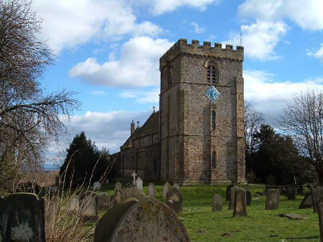
St James' Church, Melsonby

St James' Church is in the village of Melsonby, North Yorkshire, England. It is an Anglican parish church in the deanery of Richmond, the archdeaconry...

Carkin

Carkin is a civil parish in North Yorkshire, England. It was created from the separation of the parish of Forcett and Carkin into "Carkin" and "Forcett...

Scot's Dyke

Scot’s Dyke, also known as the Scots Dyke or the Scots Dike, is a linear earthwork in the district of Richmondshire in the county of North Yorkshire, England...

Aldbrough St John

Aldbrough St John is a village and civil parish (called just Aldbrough) in the Richmondshire district in North Yorkshire, England. The parish has a population...

Hartforth

Hartforth is a small village in the Richmondshire district of North Yorkshire, England. The village is situated approximately 9 miles (14 km) south-west...

Stanwick Park

Stanwick Park (also known as Stanwick Hall) was a Palladian country house at Stanwick St John in North Yorkshire, England. == History == It was re-built...

Middleton Lodge

Middleton Lodge is a Georgian Palladian mansion set within 200 acres (0.81 km2) of open countryside, on the outskirts of the village of Middleton Tyas...

Nearby Amenities

Located within 500m of 54.471722,-1.701
Melsonby
Is In: UK,England,Yorkshire,North Yorkshire
Place: village
Lat/Long: 54.4707095/-1.694995
Telephone
Booth: K6
Covered: booth
Man Made: telephone_box
Source: survey
Lat/Long: 54.4712534/-1.6949067
Post Box
Post Box Type: pillar
Royal Cypher: EIIR
Royal Cypher Wikidata: Q33102113
Source: survey
Lat/Long: 54.4710904/-1.6949417
Village Shop
Shop: convenience
Lat/Long: 54.4706027/-1.695091
Defibrillator
Defibrillator Location: attached to wall next to pillar box in Melsonby
Emergency: defibrillator
Indoor: no
Lat/Long: 54.4710605/-1.6949758
The data included in this document is from www.openstreetmap.org. The data is made available under ODbL.

Have you been to Melsonby?

Leave your review of Melsonby below (or comments, questions and feedback).